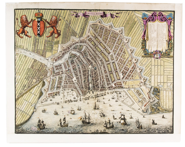
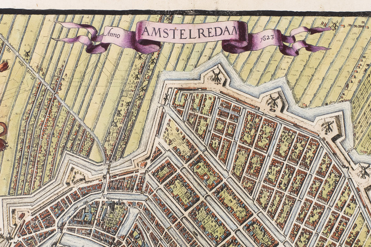
[MAP - NETHERLANDS - AMSTERDAM]. SWART, Dirck Cornelisse.
Amstelredam Anno 1623.
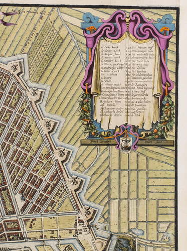
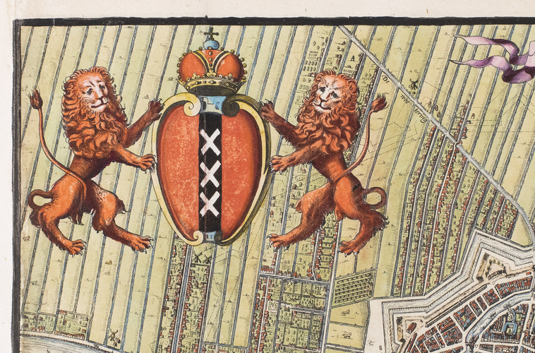
[Amsterdam, Dirck Cornelisse Swart?, 1623]. Leaf size ca. 50.5 x 63 cm, map size ca. 45 x 57.5 cm. Engraved map on a scale of about 1:7000 with north at the foot. With the title in a banderole above centre, the Amsterdam arms supported by lions above right, and a decorative cartouche with drapery and garlands above left with a key to 42 numbered features in the map, above the city seal and Swarts name. The whole is vividly hand-coloured in great detail, probably by a slightly later hand.
€ 15,000
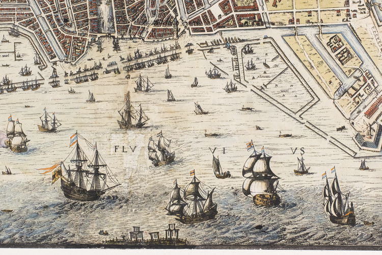
Extremely rare, vibrantly hand-coloured early map of the city of Amsterdam, apparently the first separately published map to give a detailed view of the great expansion of the city in the years 1610-1615. It shows each individual house and garden, as well as the larger buildings, windmills, fortifications, canals, bridges, shipyards, hundreds of boats and ships, polder land and settlements outside the city walls, and even bodies hanging from the gallows across the water from the city in the foreground. It depicts the projected wall and fortifications for the citys further expansion with a dotted line, though that expansion was not carried out until after 1660. The whole map is meticulously and artistically etched. We have traced only a very few other copies, at the Amsterdam Municipal Archives and the British Library, one at a Sothebys auction in 2012, and DAilly notes another (heavily trimmed) that was in private hands in 1934.
Little is known about Dirck Cornelisse Swarts life and work, except that he married in Amsterdam in 1622 and engraved maps for Cloppenburghs edition of Mercators Atlas Minor in the years 1630-1632. He apparently published the present map himself, for it bears no clue to its production or distribution beyond the statement "Dirck Cornelisse Swart fecit." A facsimile of the Amsterdam Archives copy was distributed to a small circle in 1989, but it cuts off about a half centimetre at the head and foot.
The map has been restored and the paper has been reinforced around the margins, the restoration has been done with great care, mainly showing on the back of the leaf and in a small part of the green fields left of the city and very slightly along some parts of the folding lines and the "flu" part of the name of the IJ water in the foreground. Overall a beautifully hand-coloured copy of an extremely rare Amsterdam map. DAilly 106; BMC Printed Maps XIII, col. 983; E. Taverne, In t Land van Belofte ... Stadsuitleg in de Republiek 1580-1680, Maarssen, 1987, pp. 163-164; Tooley, p. 606; Wurzbach II, p. 683; Karlsruher Virt. Kat. (1 copy); for Swart, see: Koeman II, pp. 530-548; Nordenskiöld II, pp. 62, 64; not in Hollstein; IKAR; NCC; WorldCat; for the city expansion: B.Bakker. "De stadsuitleg van 1610 ..." in: Jaarboek Amstelodamum 87 (1995), pp. 71-96.
Related Subjects: