BERTHELOT, François.
[Nautical atlas of the Mediterranean Sea].
Marseille, "se vend chez Benoît", 1720-1730. Large folio (40 x 55 cm). With 4 double-page engraved maps, with the first half of the first map as the front paste-down and the second half of the last map as the back paste-down. Contemporary vellum-backed boards, reinforced with light brown leather at the head and foot of the spine. 4 nautical maps on [8] pp.
€ 8,500
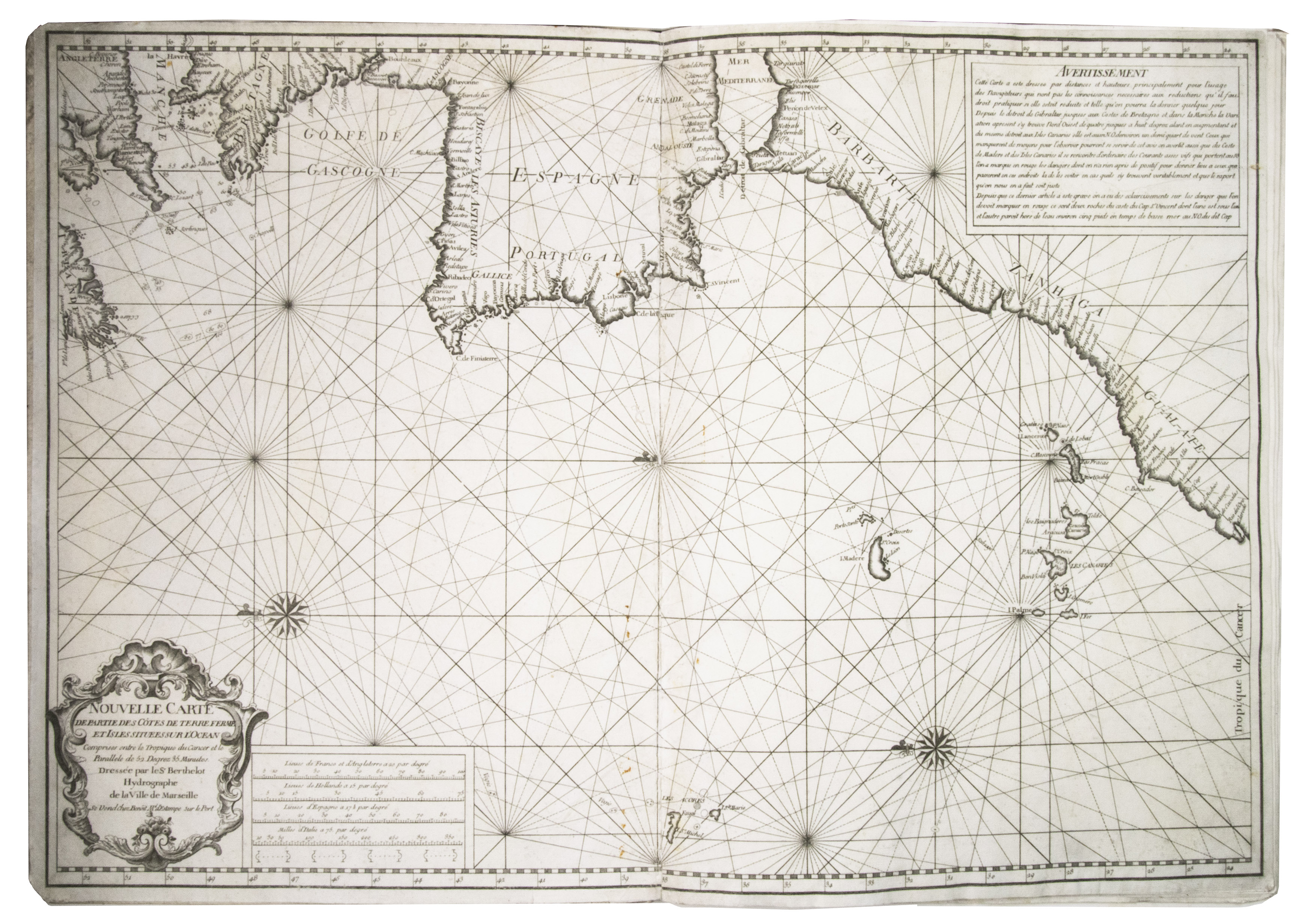
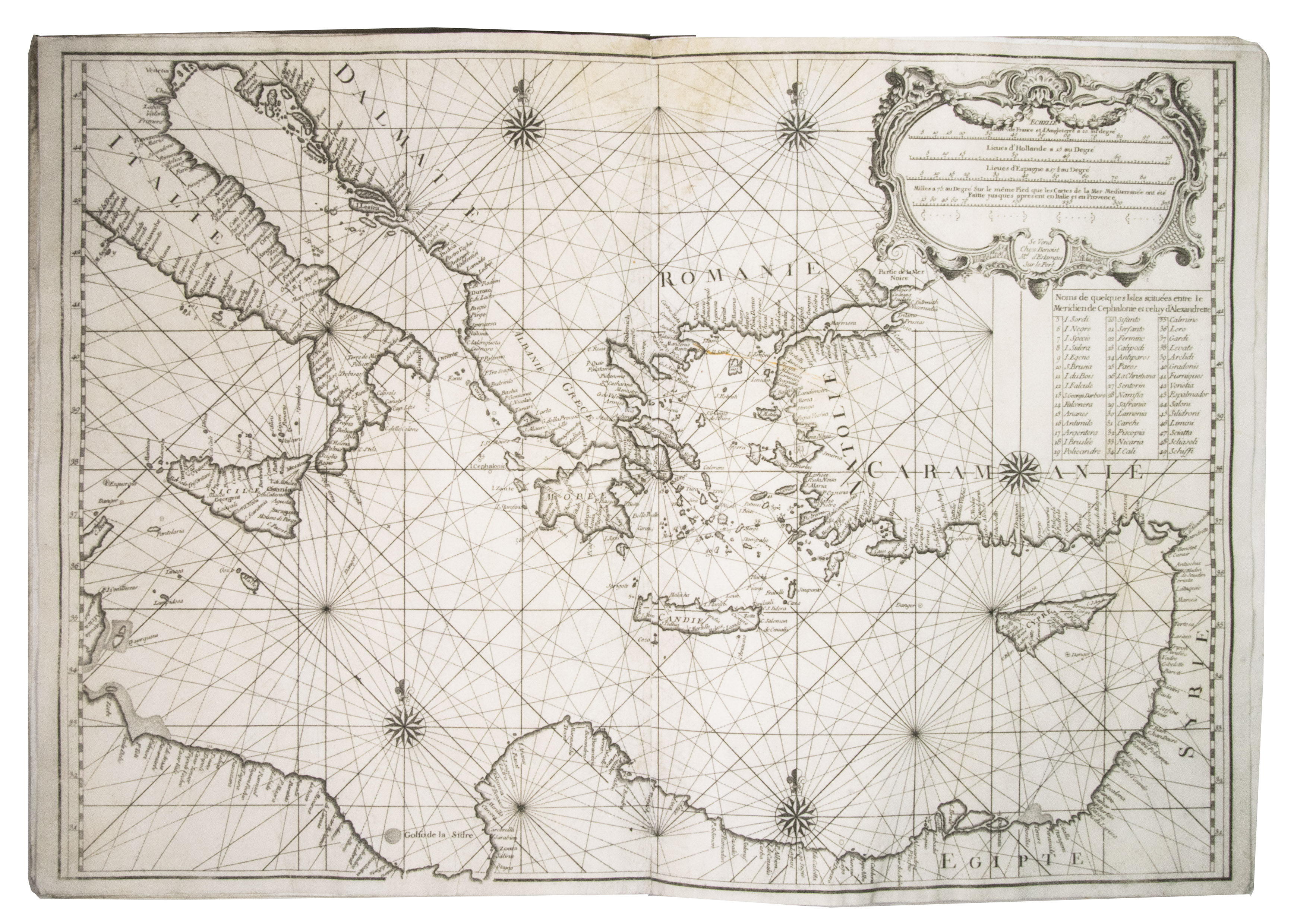
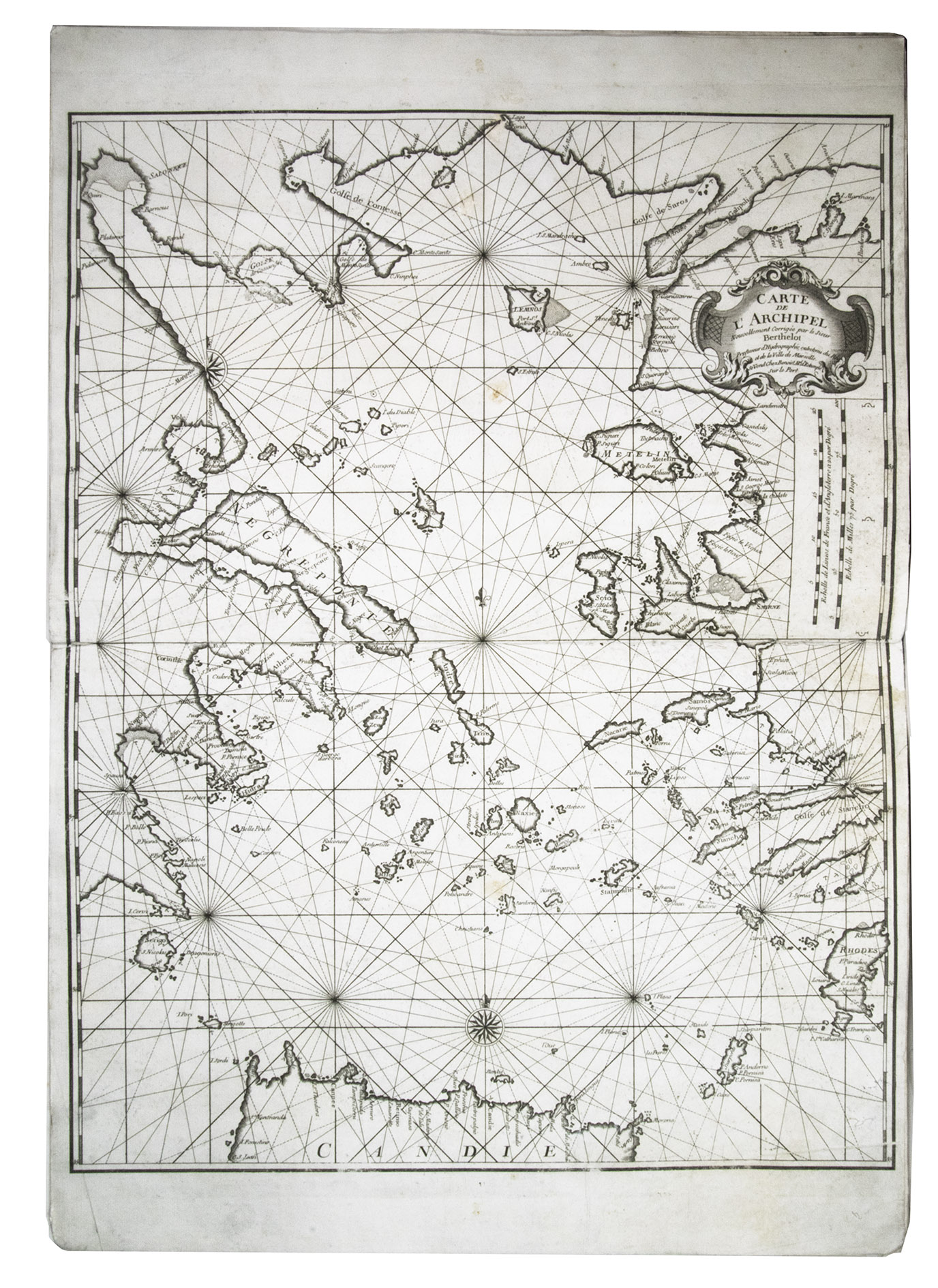
Fine example of this exceptionally rare nautical work depicting in detail the Mediterranean, which was a standard reference for French sailors in the region. The four charts are very crisp and clear, and together show every part of the Mediterranean Sea and the coasts of the countries that border it. Maps by François Berthelot (dates unknown) are very scarce, both on the market and in libraries, possibly due to the practical purpose they served. The present collection can only be found in the library of the University of California Berkeley.
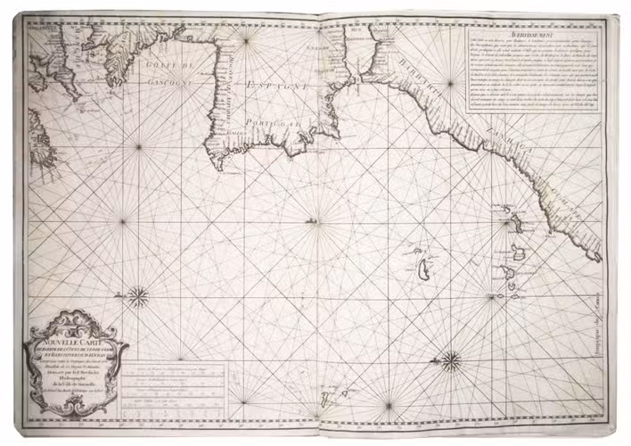
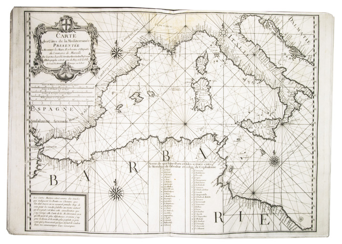
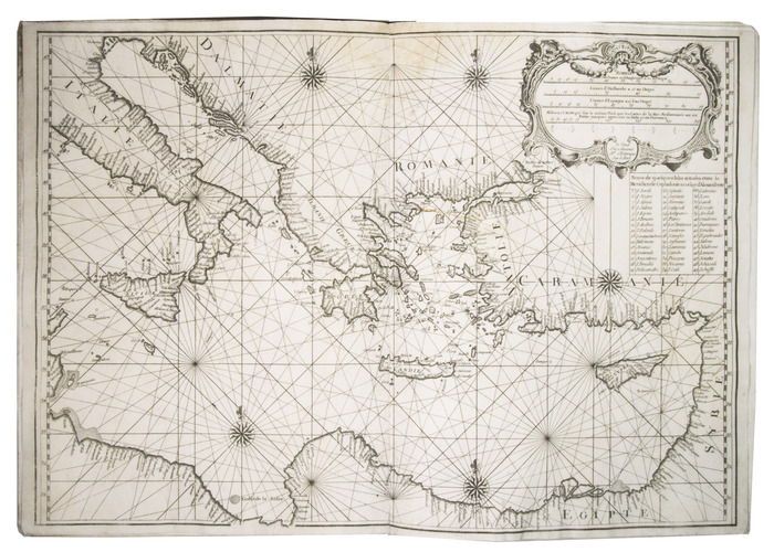
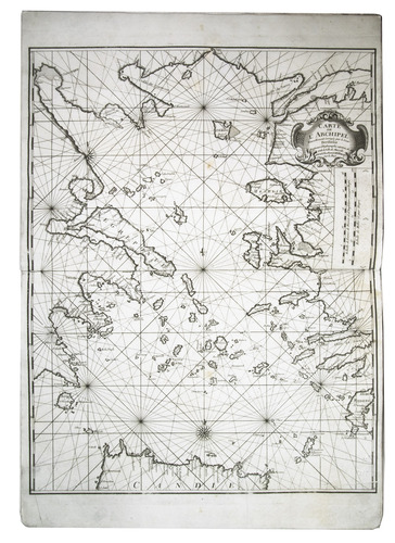
The first chart is called Nouvelle carte de partie des cotes de terre Ferme et isles situees sur l´ocean, and shows the entrance to the Mediterranean, with the coasts of Spain, Portugal, France, the United Kingdom, and the north-west coast of the African continent, with the Azores, Madeira, and the Canary Islands. The second and third chart together form one large chart, titled Carte des Cotes de la Mediterranée. They show the east and west side of the Mediterranean sea respectively. The final chart is called Carte de l'archipel and shows the Aegean Sea, the part of the Mediterranean between Greece and Turkey, and the numerous islands in that region, in more detail.
The collection of charts was first published in 1693, and continued to be updated and issued until the 1750s. Many of the editions are undated, but can be dated due to variations in the cartouche. The present collections was likely published in the 1720s.
Berthelot was a French cartographer, hydrographer, and professor, according to the cartouche of one of the charts. He was one of a group of cartographers who created accurate and reliable maps of the Mediterranean at the end of the 17th and beginning of the 18th century. Berthelot also published a book on sailing in 1691.
The corners of the boards are lightly scuffed. With a light brown stain at the top of the gutter in maps 2-4, slightly affecting the image, and small, brown stains around the gutter of map 1. Otherwise in very good condition. WorldCat 21023723 (1 copy); Zacharakis 215 and 216.
Related Subjects: