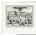
Famous Dutch voyages of discovery, with 2 maps, 1 plan and 61 plates
[VOC - WIC].
Nederlandsche reizen, tot bevordering van den koophandel, na de meest afgelegene gewesten des aardkloots. ... Met plaaten. Eerste[-veertiende of laatste] deel.
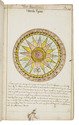
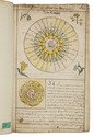
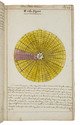
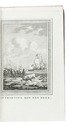
Amsterdam, Peterus Conradi; Harlingen, W. van der Plaats, 1784-1787. 14 volumes bound as 6. 8vo. With 2 engraved folding maps, 1 engraved folding city plan and 61 engraved plates (56 folding) including many topographic views. Uniform half tree calf (ca. 1820?), gold-tooled spines. Full description
€ 9,500
Amsterdam, Peterus Conradi; Harlingen, W. van der Plaats, 1784-1787. 14 volumes bound as 6. 8vo. With 2 engraved folding maps, 1 engraved folding city plan and 61 engraved plates (56 folding) including many topographic views. Uniform half tree calf (ca. 1820?), gold-tooled spines. Full description