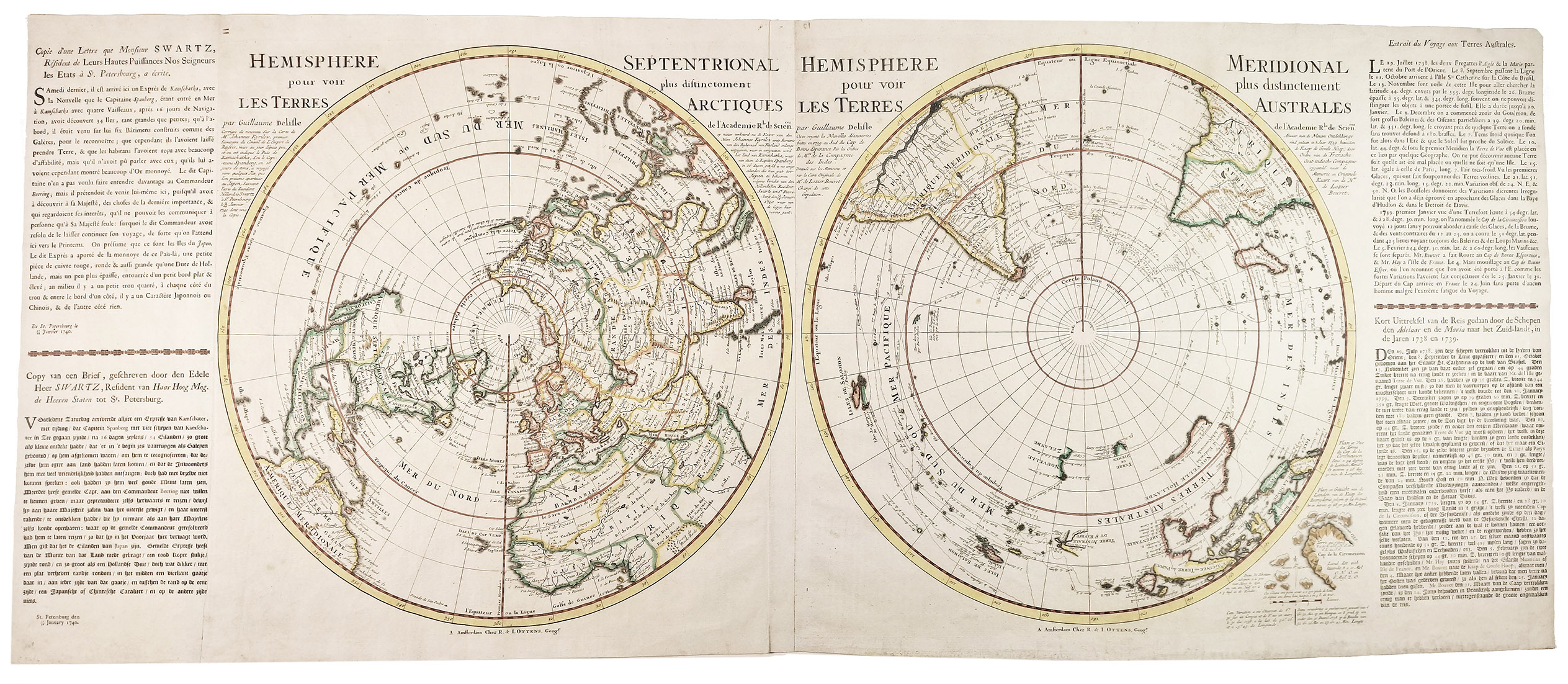
L'ISLE, Guillaume de.
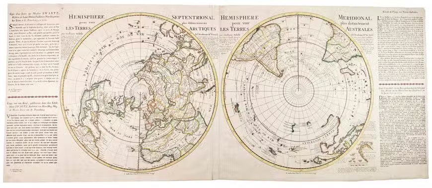
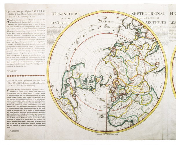
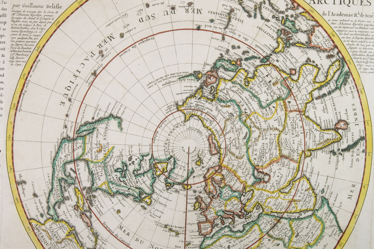
L'Hemisphere Septentrional pour voir plus distinctement les Terres Arctiques.
Amsterdam, Reinier and Josua Ottens, [ca. 1740 (after 1739)].
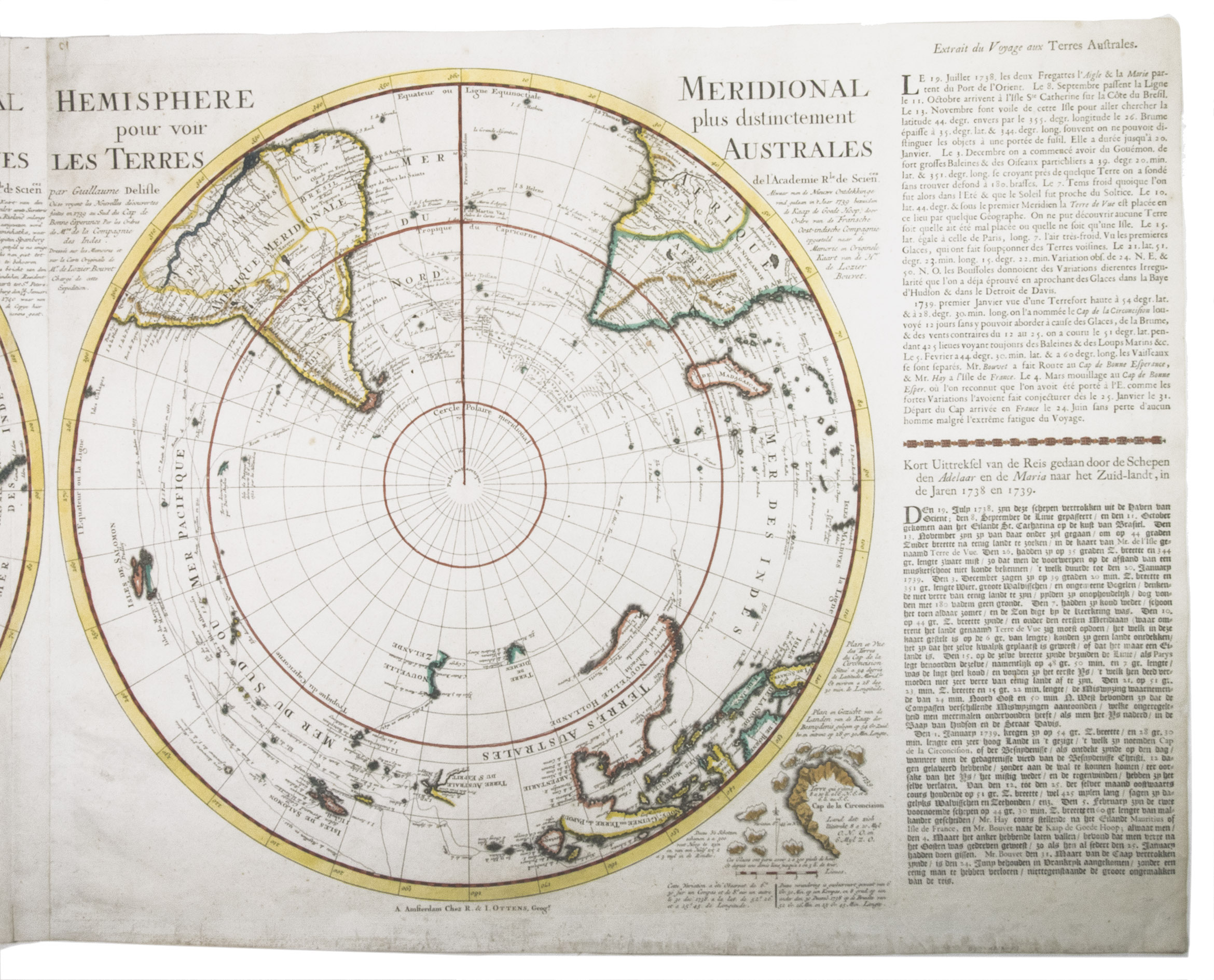
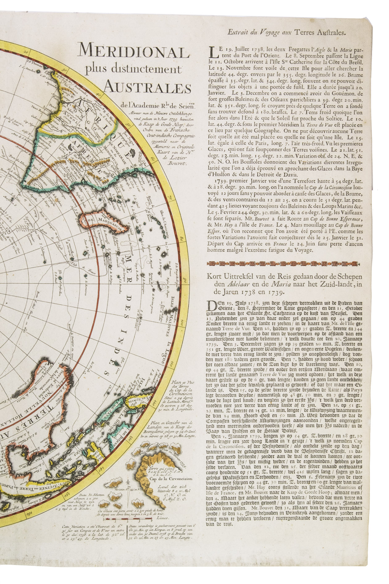
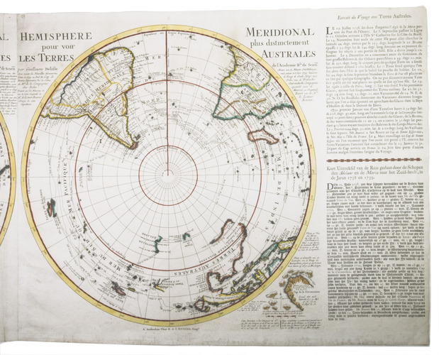
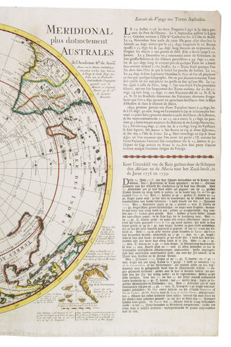
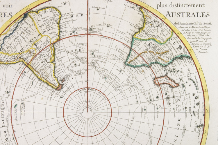
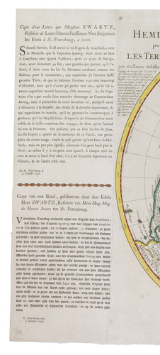
Together with: [IDEM]. L'Hemisphere Meridional pour voir plus distinctement les Terres Australes.
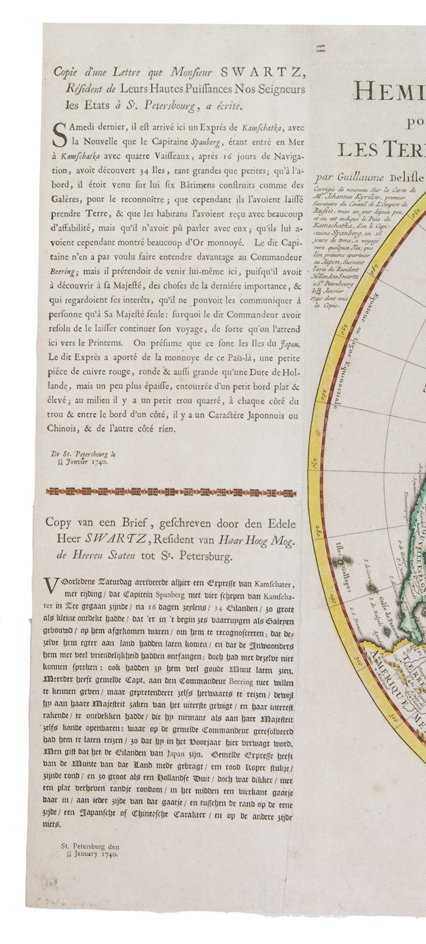
Amsterdam, Reinier and Josua Ottens, [after 1739]. 49.5 x 122 cm. Two large hemispherical maps (45 cm in diameter) on two sheets, joined together to make one large oblong world map, with the Dutch and French text of a letter written by a Mr. Swart in St. Petersburg on a separate (partial) sheet joined to the (left) outer edge of the map of the Northern Hemisphere. The map of the Southern Hemisphere includes the short description in Dutch and French of the journey undertaken by the ships Adelaar and Maria to the "Southland" or "Terres Australes" in 1738 and 1739. This description includes the discovery of the Cape Circoncision and a small map of that Cape is included in the bottom right corner of the map of the Southern Hemisphere. The maps are contemporary hand-coloured in outline.
€ 6,500
Beautiful examples of De L'Isle's updated hemispherical maps, contemporary hand-coloured in outline, here the two sheets are joined together forming a complete world map. The first editions of these maps were published in 1714, the present editions of the maps were published around 1740 by the Reinier and Josua Ottens in Amsterdam, and other editions of the maps were published by Covens & Mortier. These maps of the Northern and Southern hemispheres also appeared in composite atlases published by Ottens and Covens & Mortier during the 18th century.
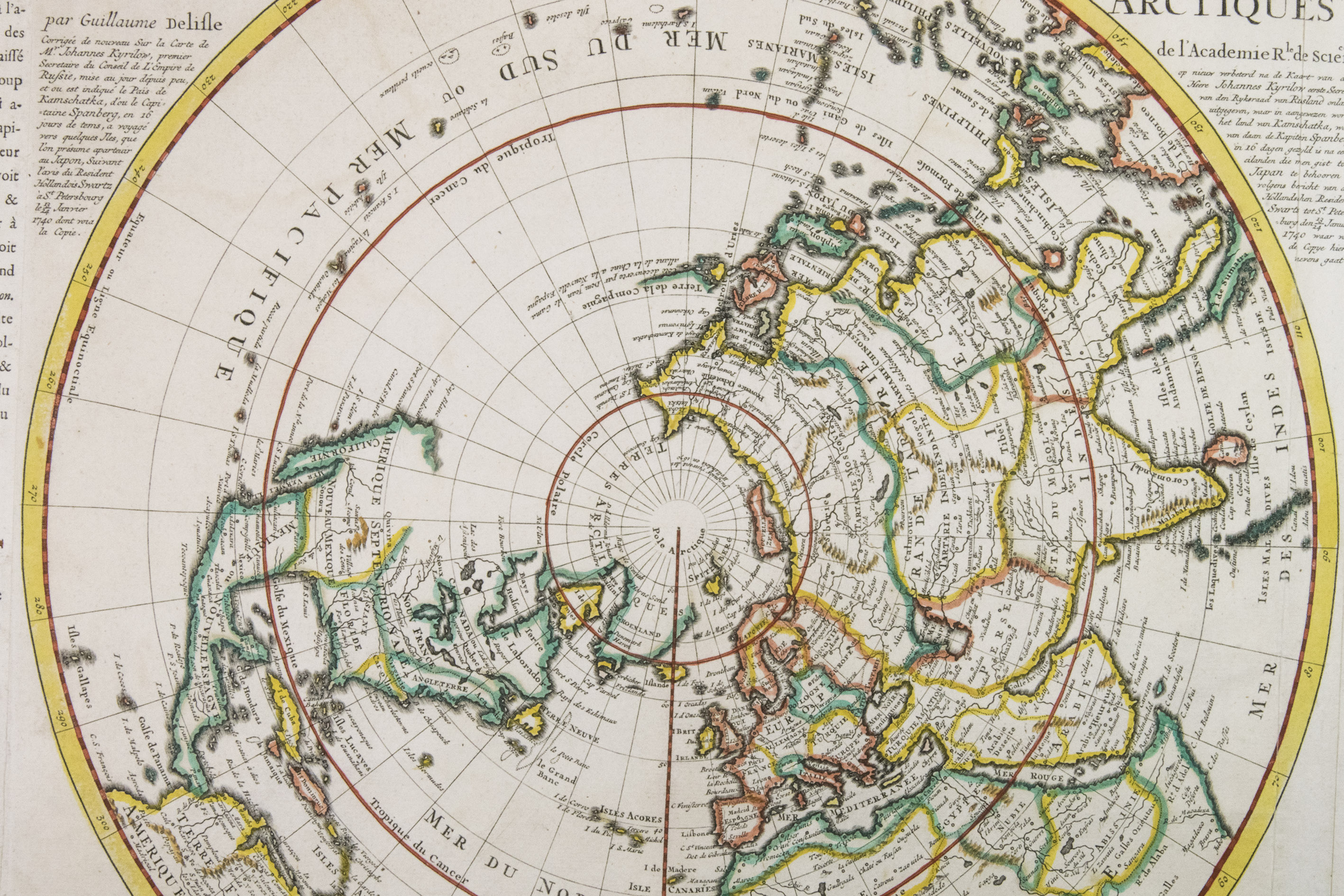
The detailed map of the Northern Hemisphere reflects Delisles trademark scientific precision. It was the first to accurately reposition the west coast of North America significantly eastward compared to earlier maps. California appears as a peninsula - a notable correction at a time when it was still often depicted as an island, even in some of Delisles own earlier works. However, a dotted line on the map still suggests the lingering belief in its insular form. Near northern Asia, "Terre de la Compagnie" is labelled, accompanied by a note crediting its discovery to Jean de Gama. Delisles portrayal of the North Pacific is informed by the 1709 voyage of Fondant. The version published by the Ottens firm features updates to northern Asia.
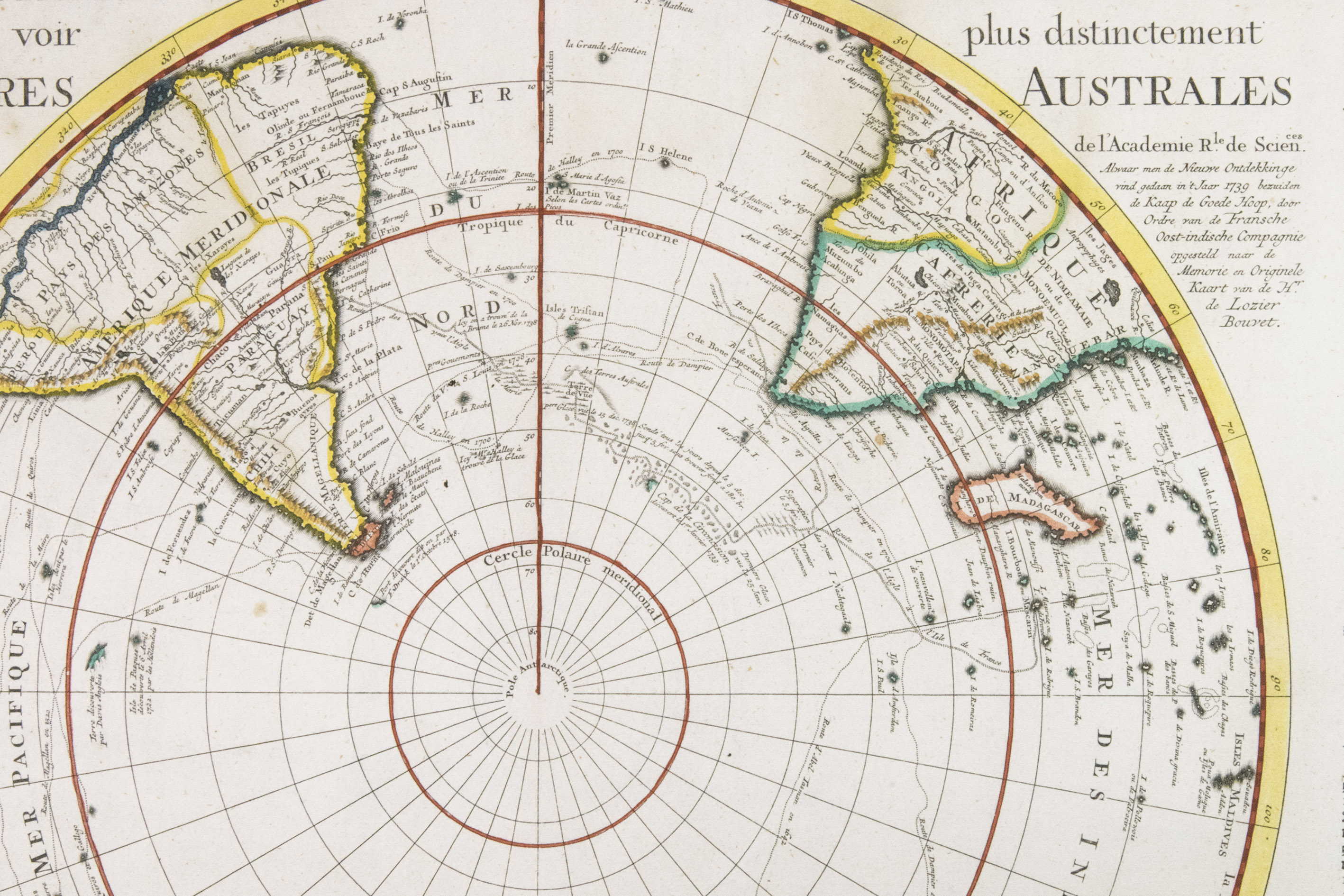
The Southern Hemisphere map traces the routes of notable explorers and circumnavigators in the southern oceans, including Magellan (1520), Abel Tasman (1642), and Edmund Halley (1698-1700). It offers detailed information, especially concerning exploration in the South Pacific. Australia, New Guinea, Tasmania, and New Zealand are partially outlined, with Australia and New Guinea shown nearly connected. This edition also incorporates updates based on the 1739 Antarctic voyage of Jean-Baptiste Charles Bouvet de Lozier.
De LIsle discards the outdated concept of "Terra Australis Incognita" and instead presents a more accurate depiction based on verified explorations. He includes several early Dutch discoveries in Australia, such as Dampiers sighting of Shark Bay (labelled "Scharks Bay") and his journeys in New Britain. Staying true to his scientific and precise approach to mapmaking, De LIsle marks two possible locations for the Solomon Islands: one placed northeast of New Zealand, based on information from Fernand Gallego (likely Hernando Gallego, Mendañas chief pilot), and another situated closer to South America, following the account of Robert Dudley.
Panels of text in both French and Dutch border the maps, describing recent expeditions in Kamchatka (left side) and the Cape of Circumcision area (right side), the latter accompanied by a small inset map.
The sheets are very slightly dust soiled, some contemporary inscriptions in brown ink in the upper outer corners of the two maps. Otherwise in very good condition. IKAR 001694812, 002143453 (1 copy Hemisphere Septentrional); IKAR 00169104X, 00214347X (2 copies Hemisphere Meridional); Cf. Koeman, Atl. Neer. (1969), Ottens Catalogue nos. 13 and 14 (p. 87); Phillips & Le Gear, 3490 (maps 1 and 122, Covens and Mortier eds. of the maps in an Ottens Atlas); Wagner 504 (first ed.).
Related Subjects: