LINSCHOTEN, Jan Huygen van.
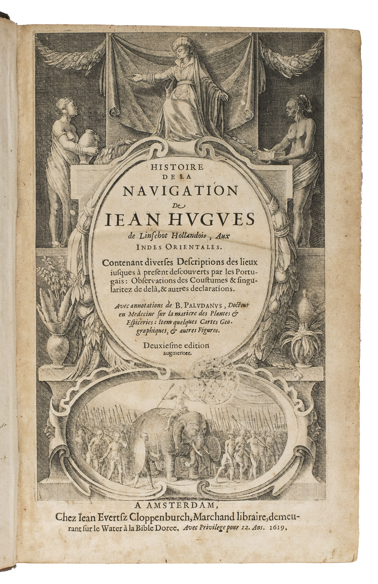
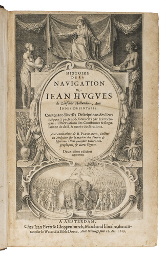
Histoire de la navigation... aux Indes Orientales. Contenant diverses descriptions des lieux jusques à present descouverts par les Portugais: observations de coustumes & singularitez de delà, & autres declarations. Deuxiesme edition augmentee.
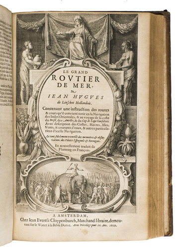
Amsterdam, Evert Cloppenburg, 1619. 3 works in 1 volume, the first in 2 parts. Folio (31 x 21 cm) With an engraved title page for each work, 42 engraved plates (31 double-page and 11 folding), including 6 maps, and a full-page portrait of the author within collation. Including: LINSCHOTEN, Jan Huyghen van. Le grand routier de mer, ...
[LINSCHOTEN, Jan Huygen van]. Description de lAmerique & des parties dicelle ...
Near-contemporary gold-tooled calf. [1], [1 blank], [6], "205" [= 206]; [1], [1 blank], [2], 181, [1 blank]; [1], [1 blank], "86" [= 80].
€ 65,000
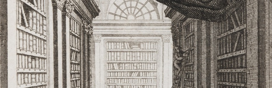
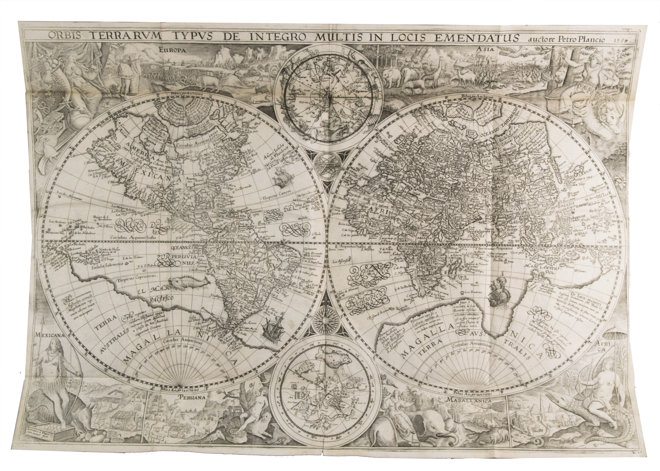
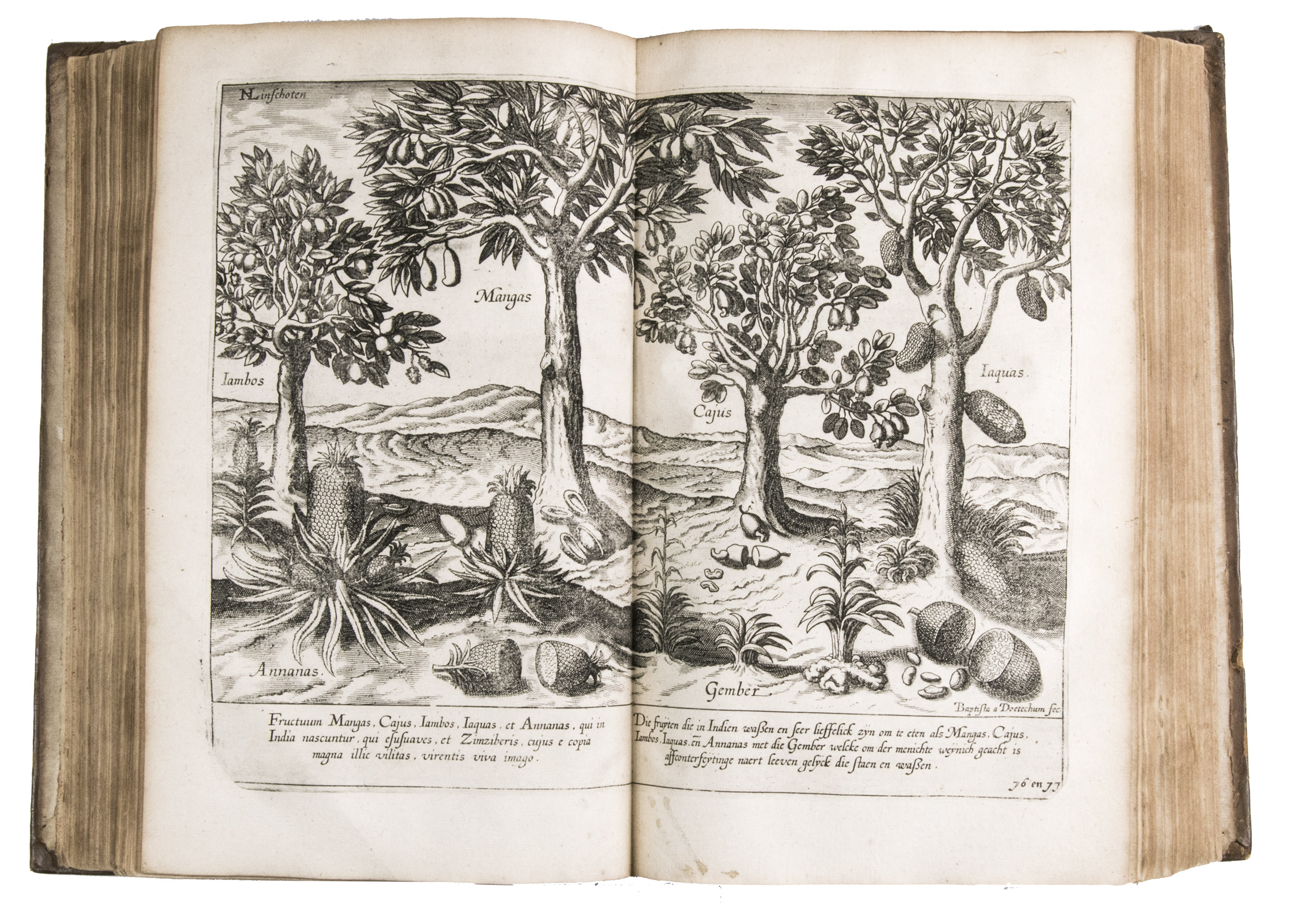
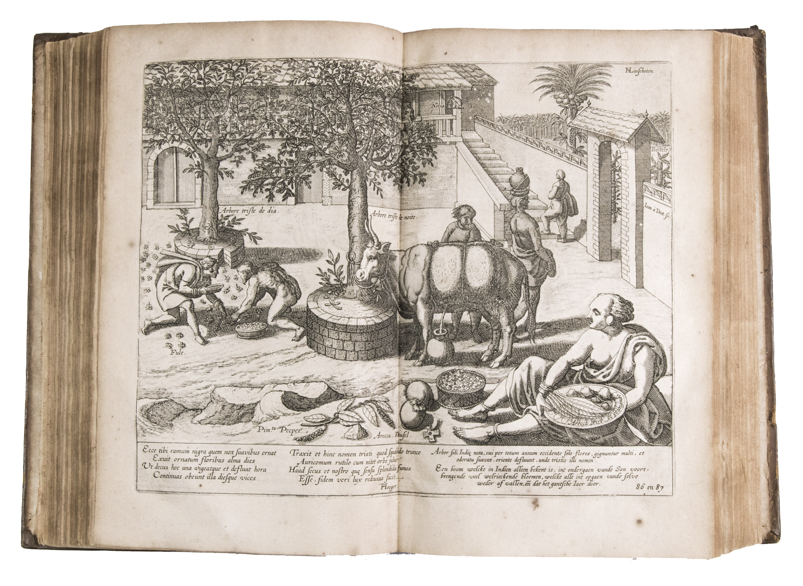
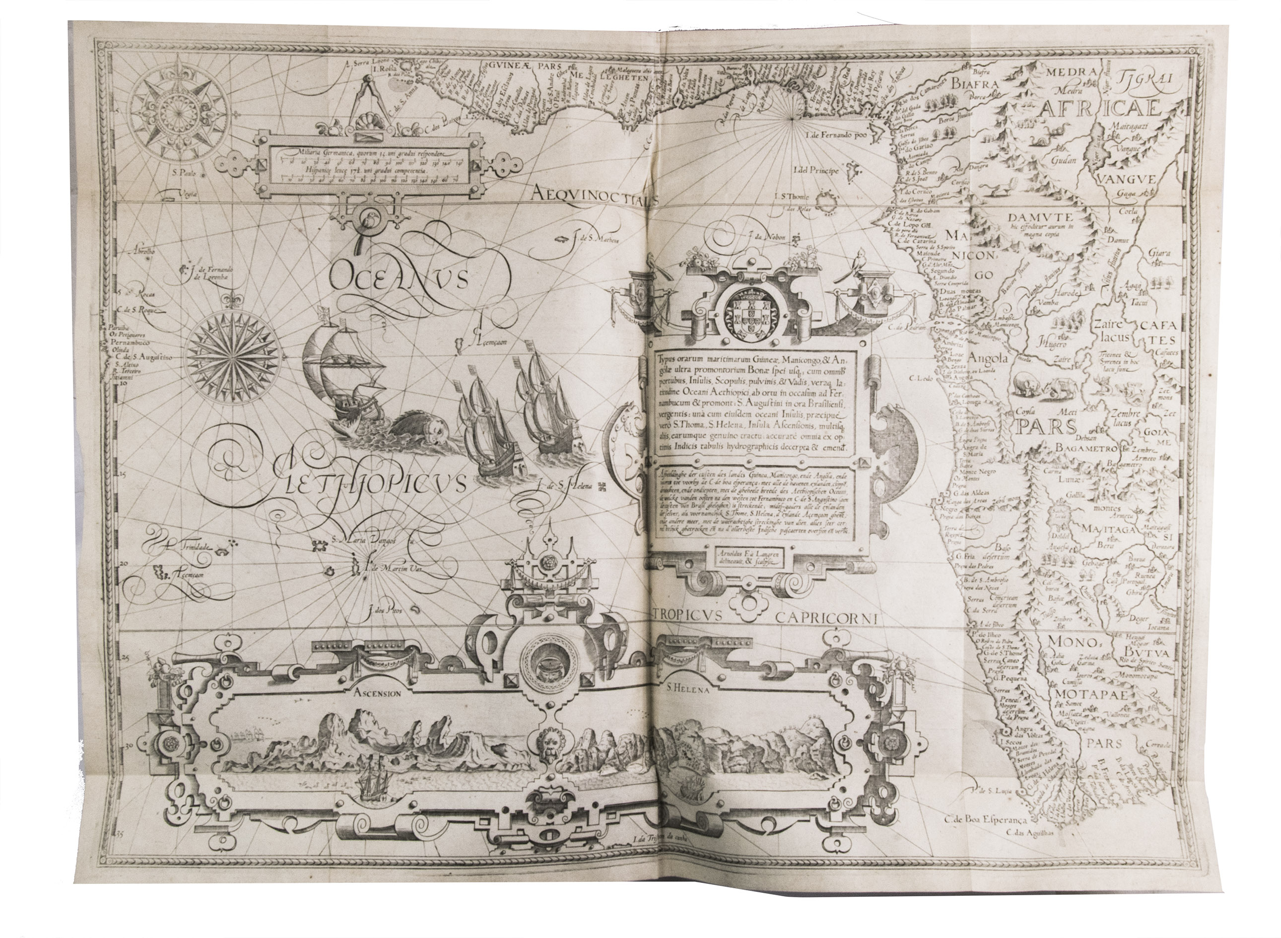
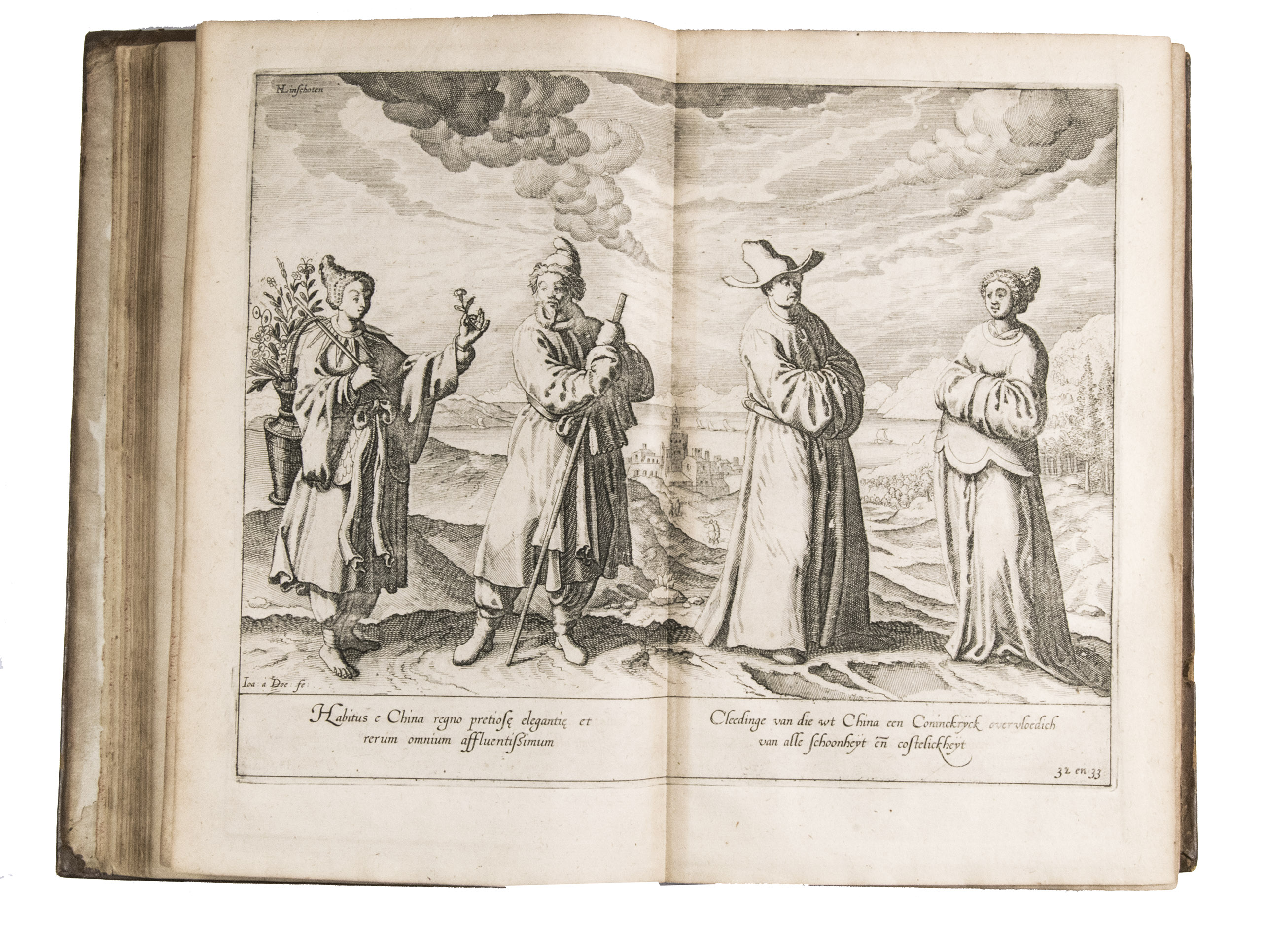
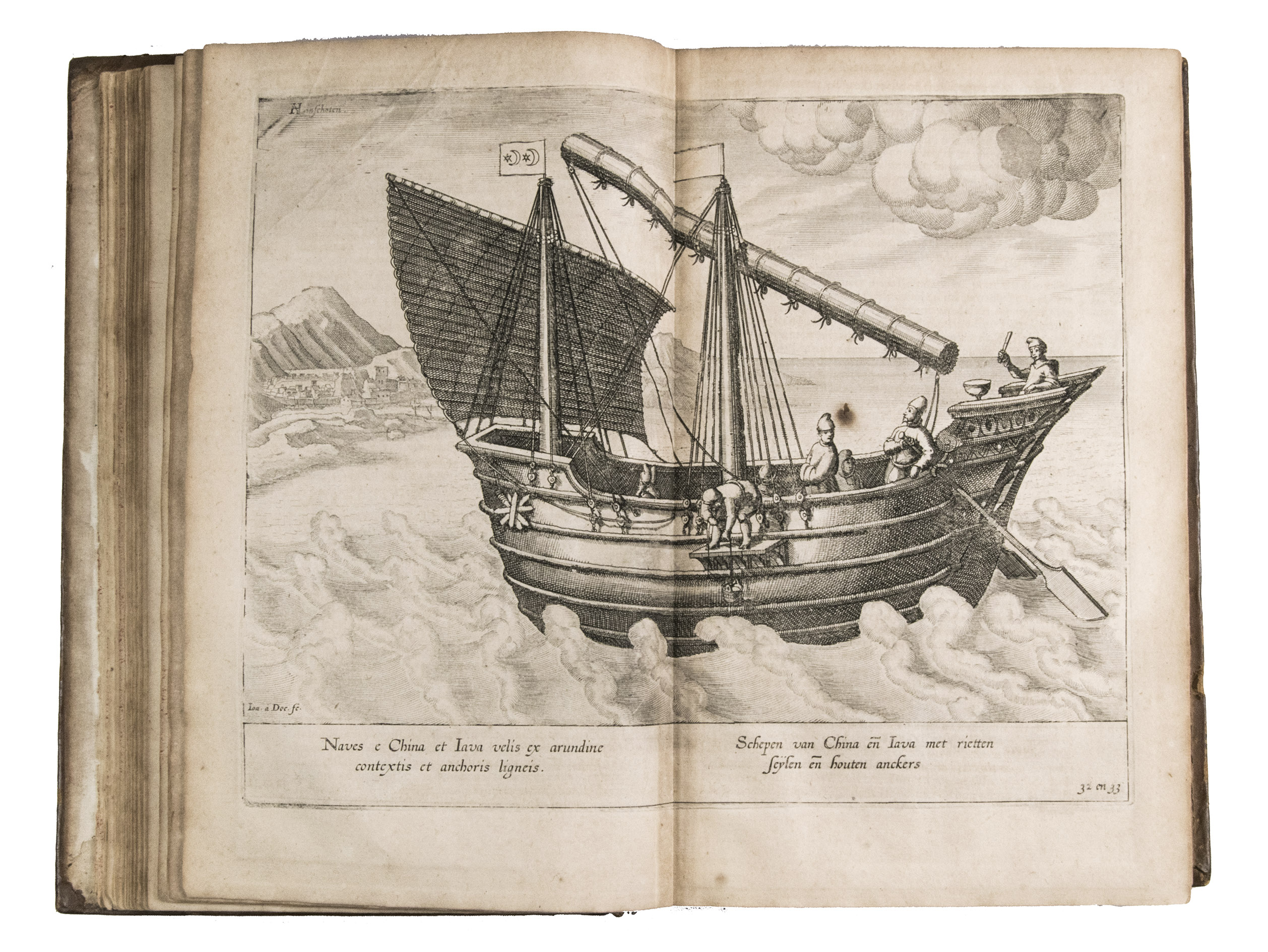
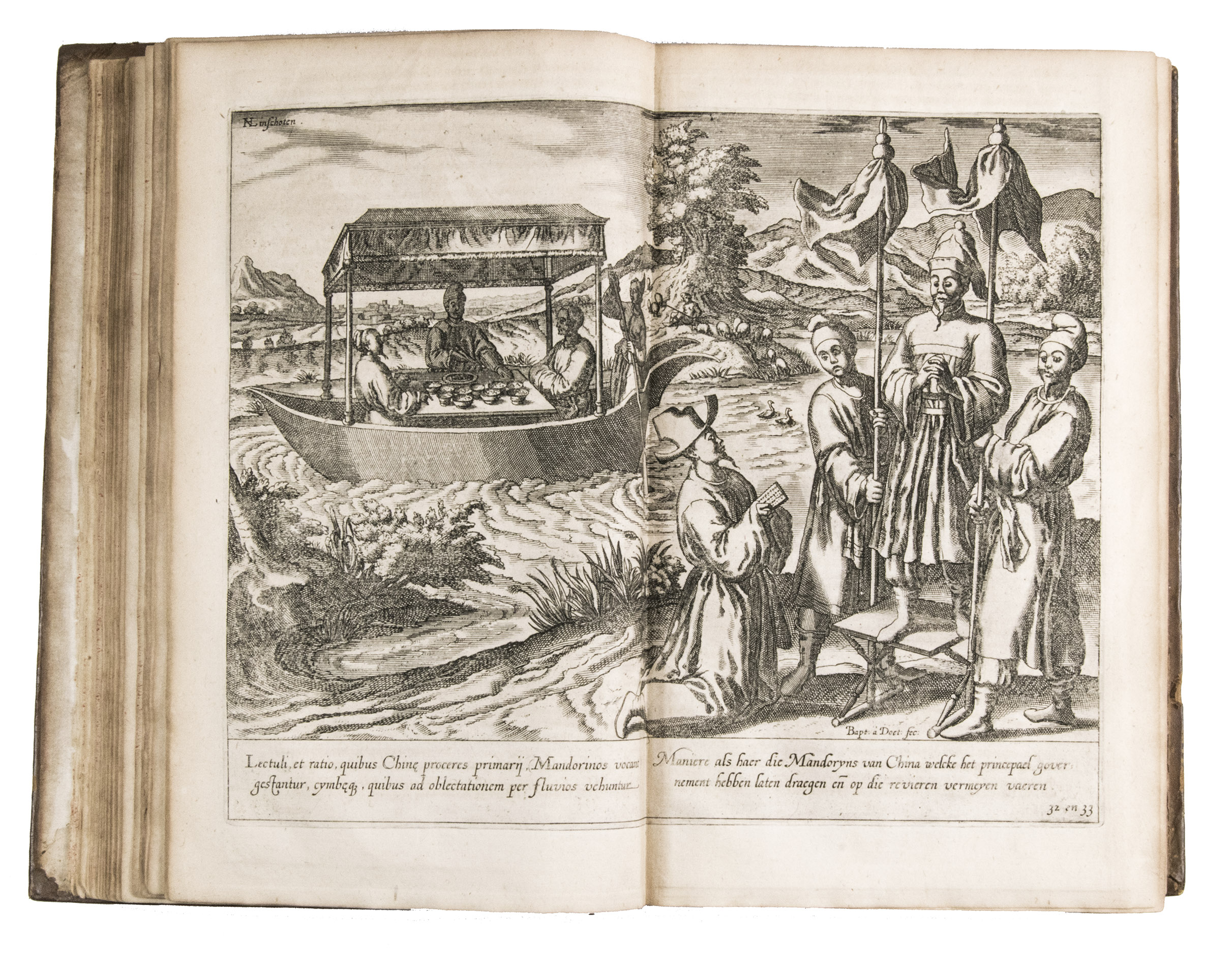
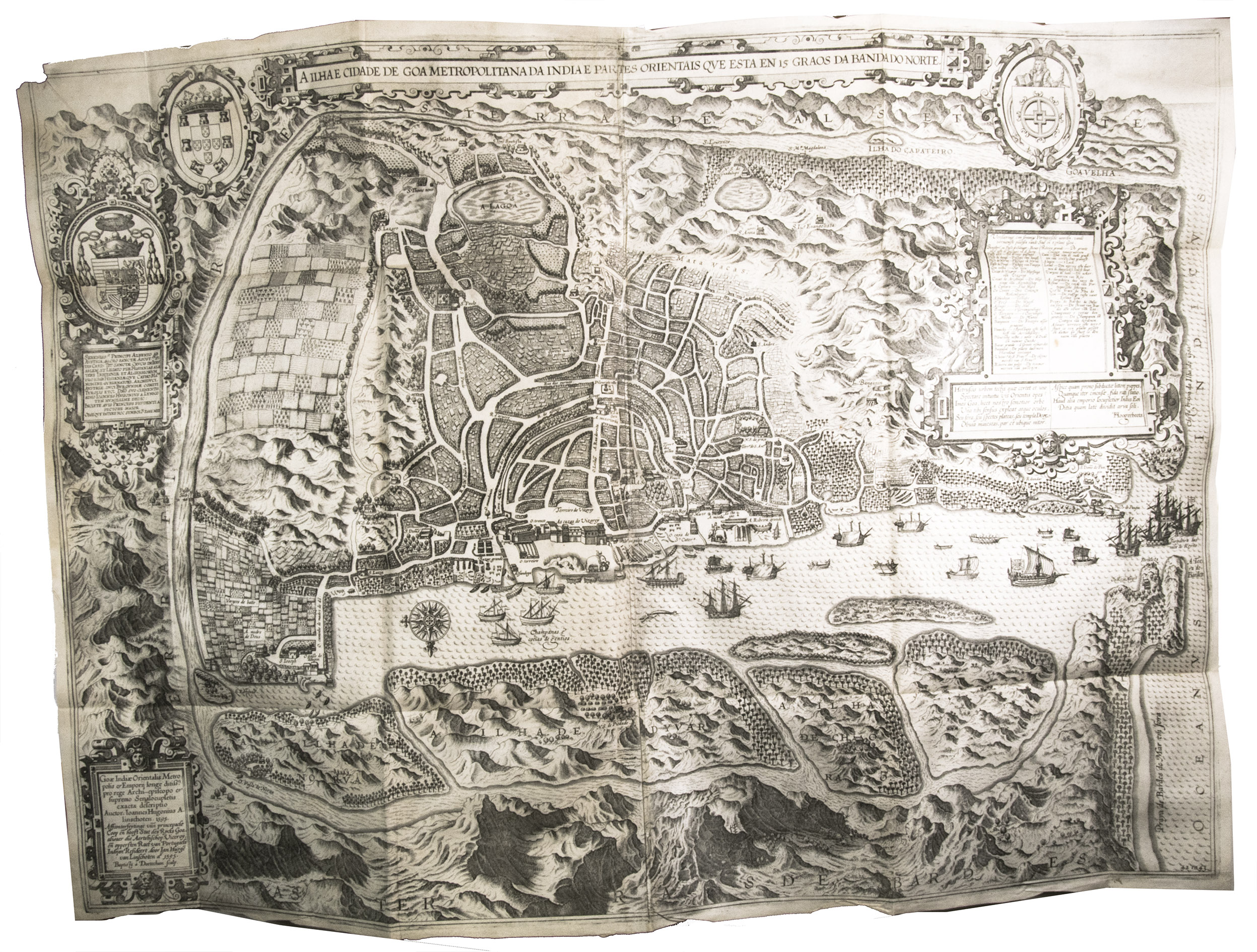
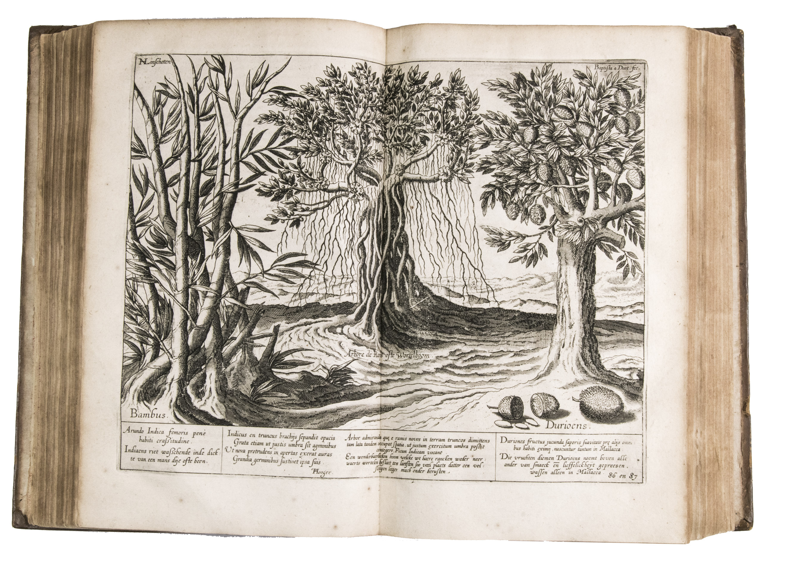
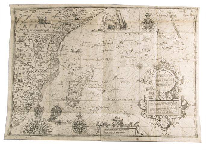
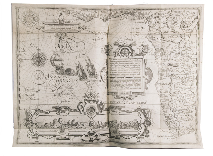
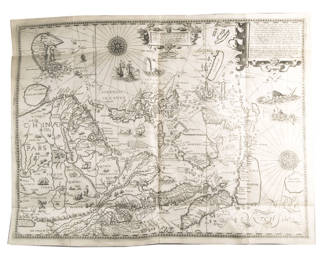
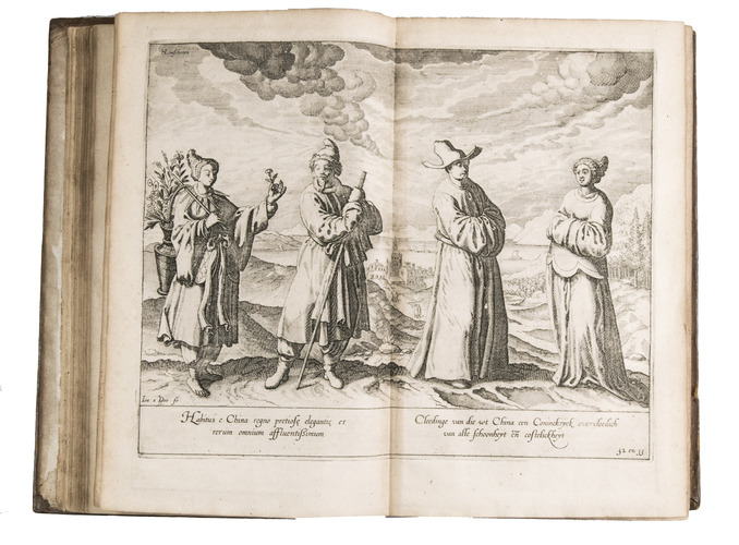
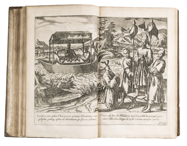
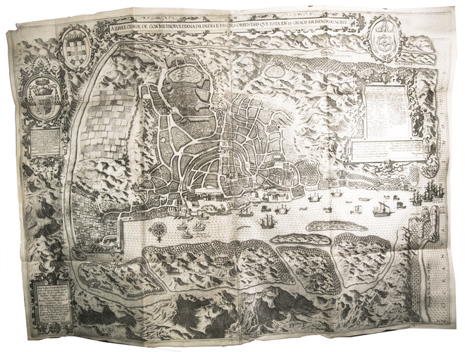
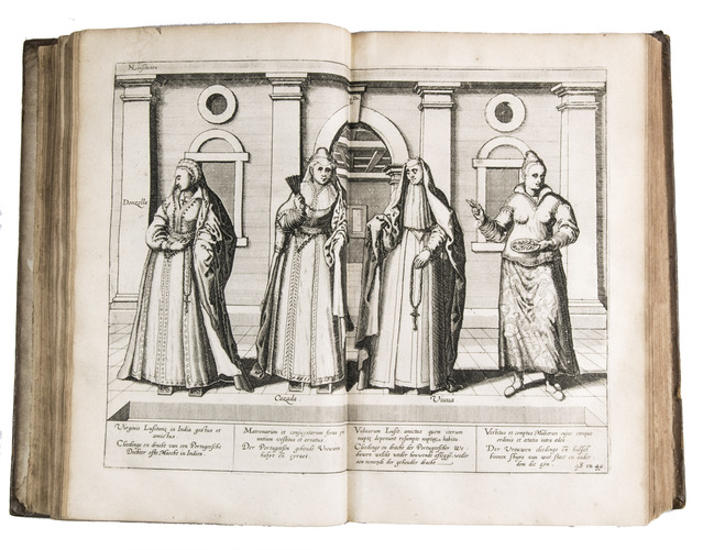
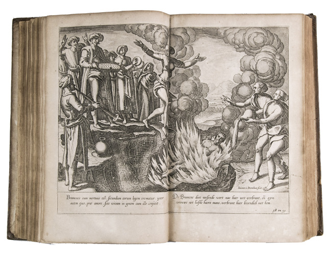
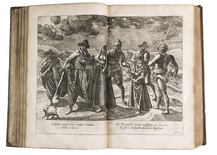
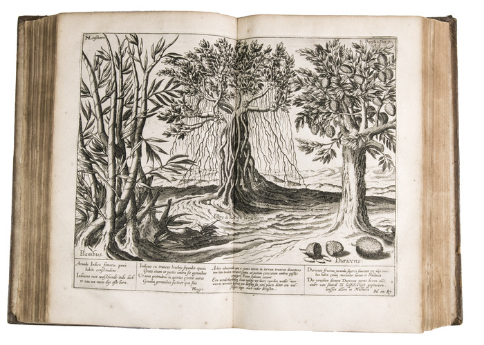
The second French edition of Linschoten's classic illustrated guide for travellers to the East and West Indies, termed by Lach ''the most important of the first-hand accounts published independently of the great travel collections'' (I.198). No other book contained so much useful intelligence on the East and West Indies. Unhindered by the censorship that constrained writers from the Iberian peninsula (details of seas and coasts in Asia and the Americas were military secrets), he included such information as sailing directions, physical descriptions of countries, and statistics on commerce and trade. The work was held in such high regard that for nearly a century, every Dutch ship sailing to Africa and Asia carried a copy of a Dutch edition of Linschoten. The 42 plates, including 11 large folding plates, are especially noteworthy, including 6 maps and several birds-eye views, many with coats of arms of the regions shown and of the colonial powers that controlled parts of them, as well as richly decorated cartouches and other functional and decorative elements.
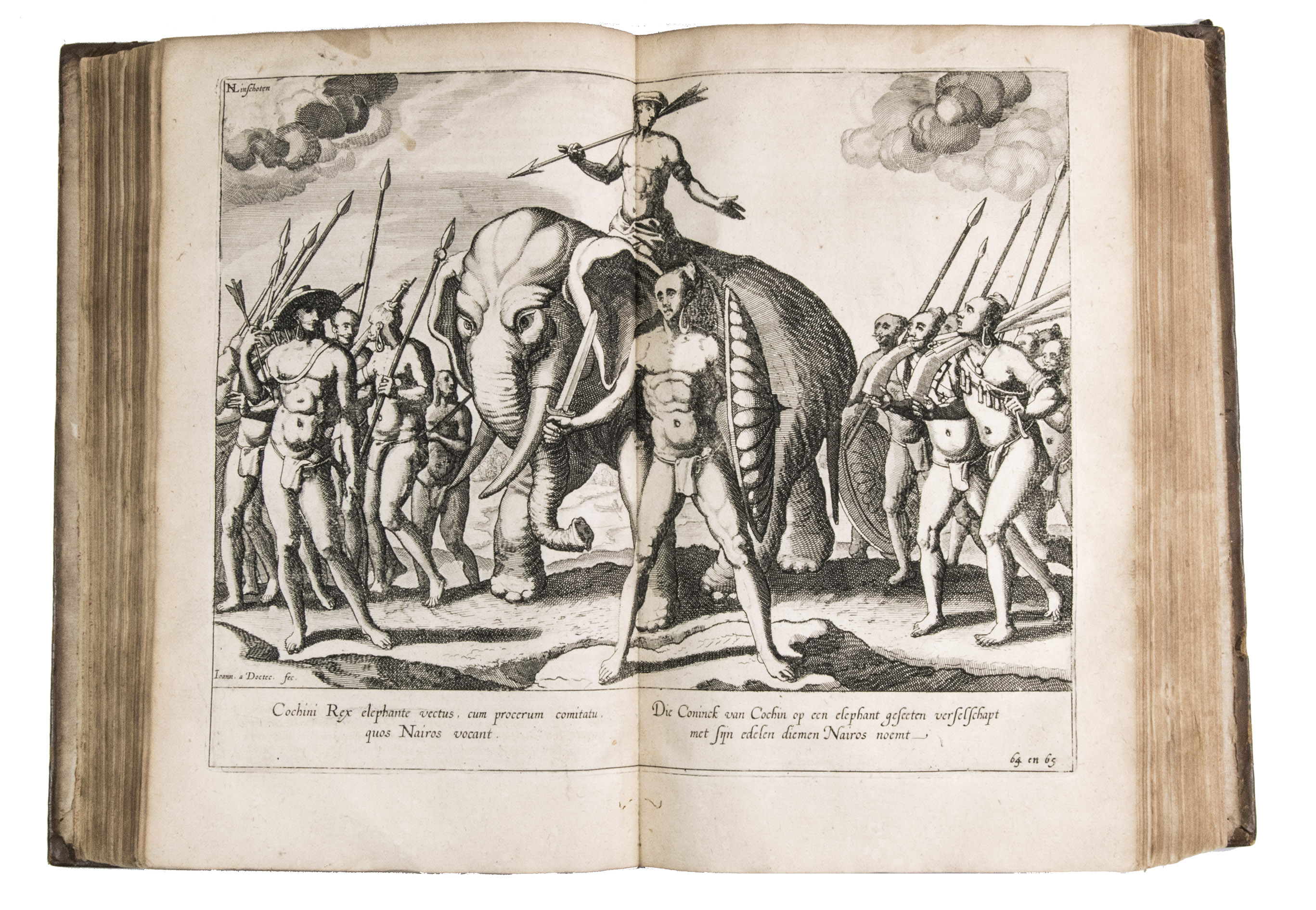
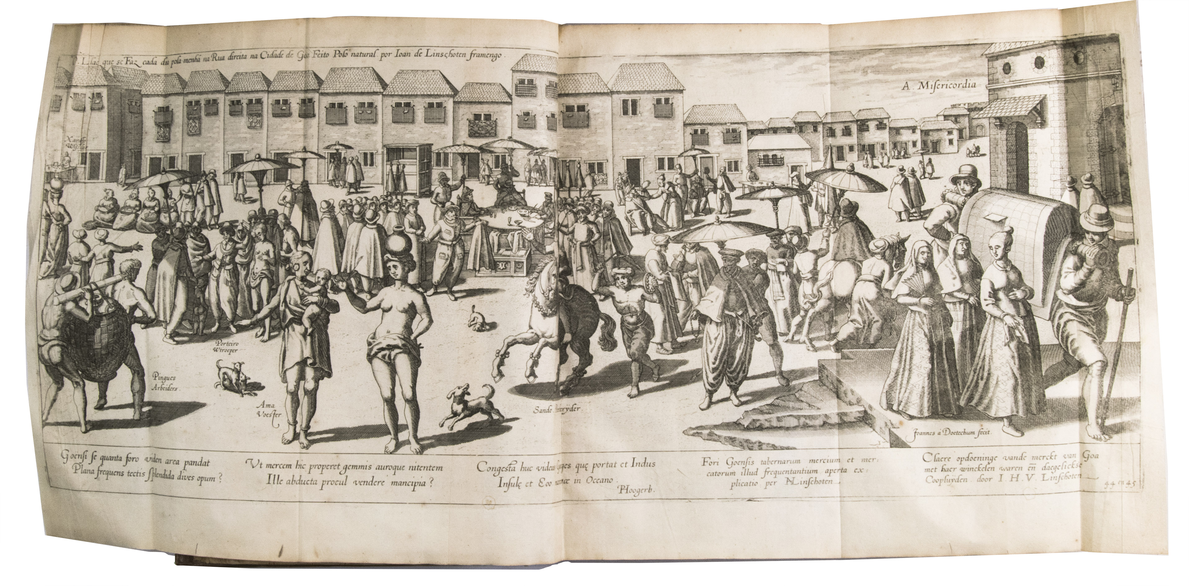
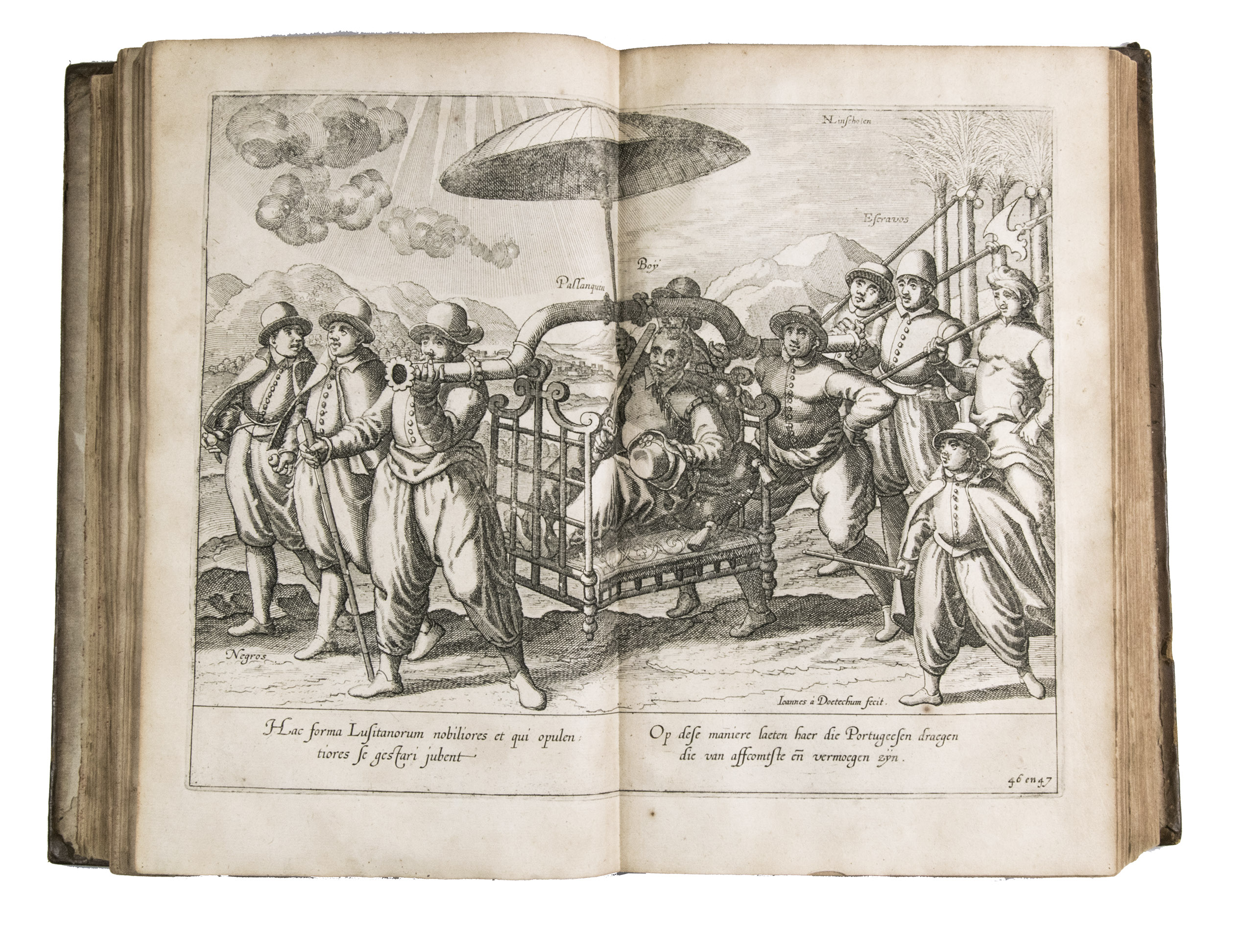
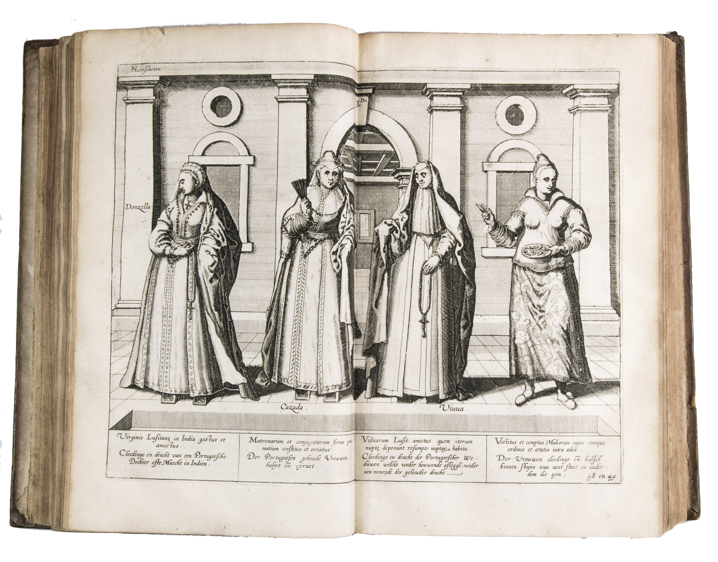
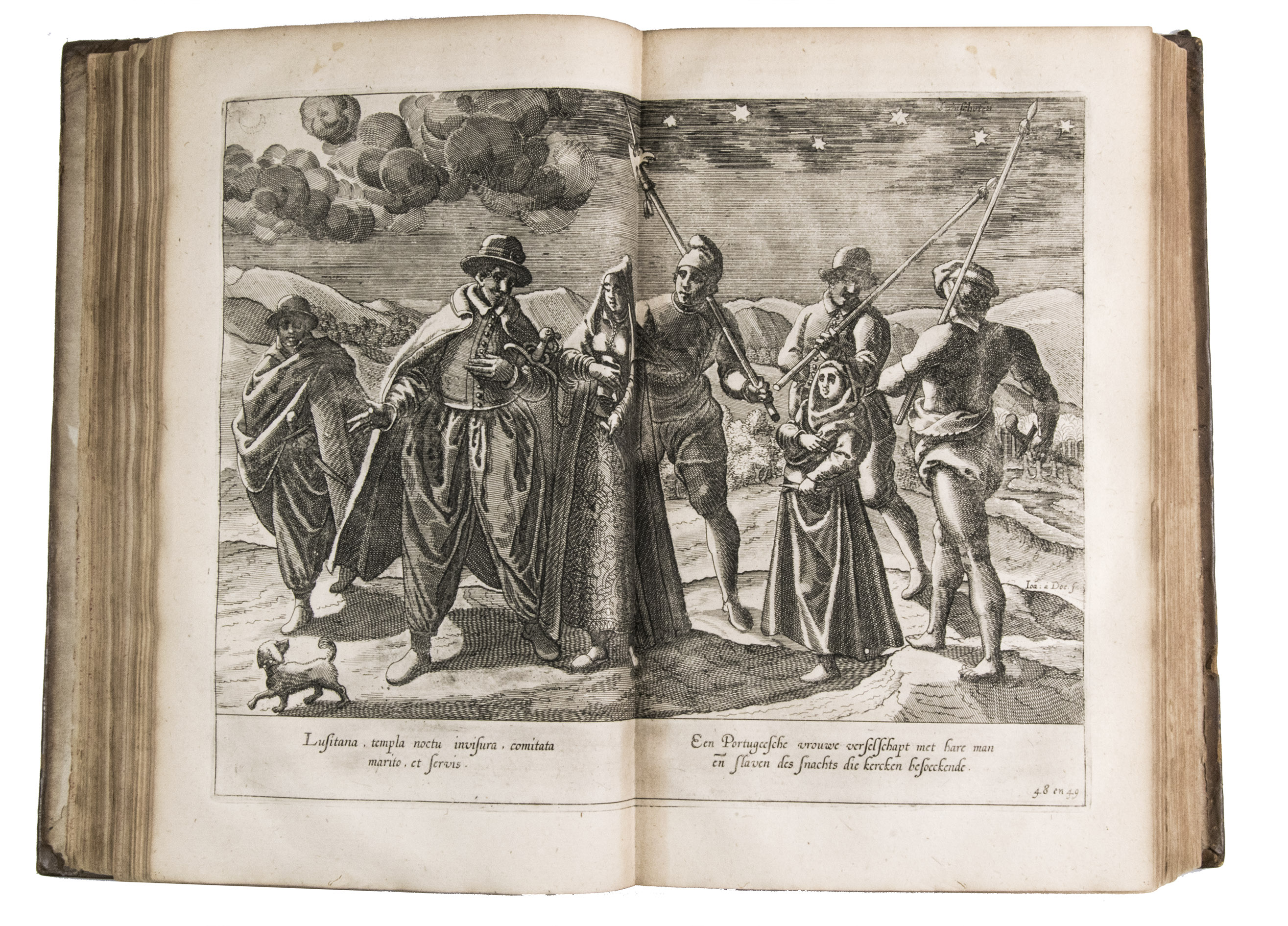
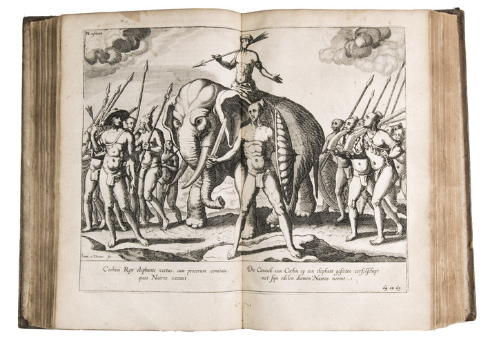
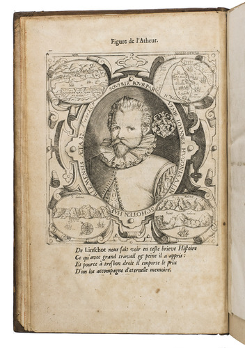
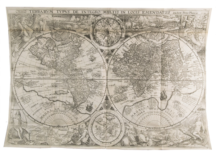
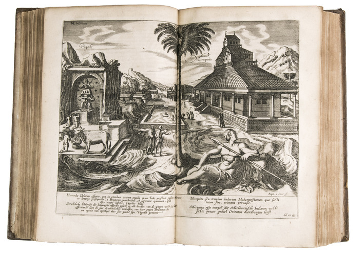
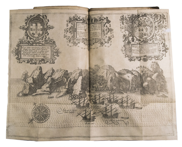
Although the work contains valuable reconnaissance for the New World, the material on India and the East Indies is the most valuable, being the fruit of the author's own observation. In the service of the Portuguese, Linschoten spent five years in Goa (1583-1588/89), making numerous visits to other parts of India. He was thoroughly immersed in Indian culture and the complex relations between the Portuguese colonial apparatus and indigenous peoples. Highlights include a first-hand description of the caste system, political structures, business practices of the Banyas, and exotic natural phenomena. Among the folding plates are Planciuss map of the world in 2 hemispheres; a birds-eye view of Goa; a street view in Goa; a birds-eye view of Terceira Island and the city of Angra in the Azores; the western Indian Ocean and east coast of Africa; the Arabian peninsula, Iran, India and surroundings, from the western Mediterranean and southern Caspian sea to the horn of Africa and to the westernmost tips of Birma and Sumatra, including the Indian Ocean and Bay of Bengal; and Japan, Korea, China, Southeast Asia, and the East Indies.
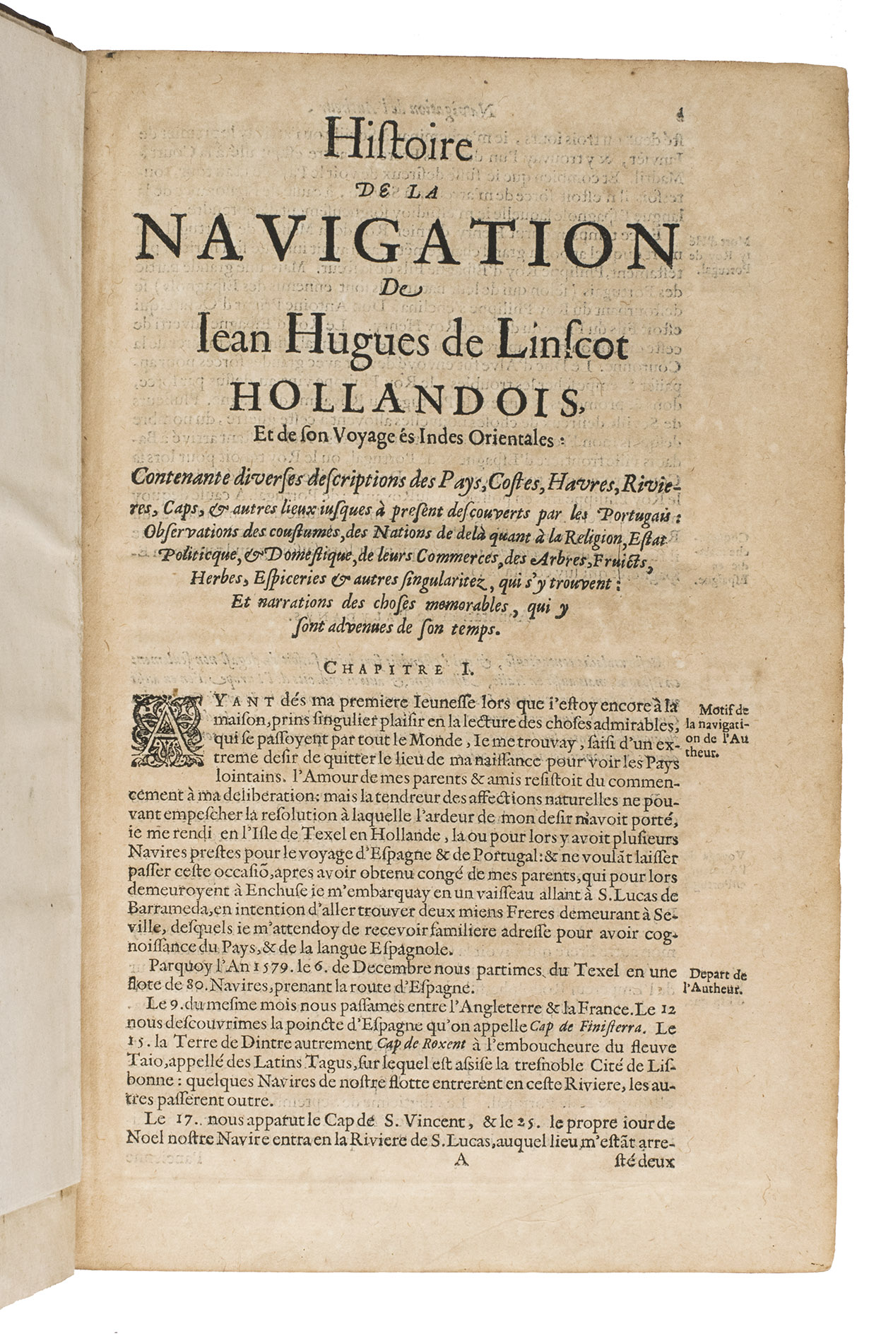
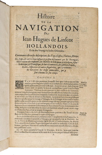
Although the text is divided into three parts, each with its own title page, the divisions between them fall in the middle of the quires, so that they could not easily be issued separately. The first part covers the East Indies and East Africa, including regions as far east as Japan. The second describes the navigation along the coasts of West Africa around the Cape of Good Hope to Arabia, together with some coasts in the New World, with a "real roteiro" after the Portuguese royal navigator Diego Affonso that sets out sailing directions from Portugal to India and from island to island in the East Indies. The third book is devoted to North America, the Caribbean, and Brazil, with a large folding map (not noted in the index of plates, but called for on the title page to part 3).
The work was first published in Dutch in 1595/96 followed by Latin and English translations in 1598. The first French edition appeared in 1610, but its plates are copies of a reduced version and derive from De Bry. The second and third French editions return to the original large plates of the Dutch edition and add Bernardus Paludanus annotations. The 1619 and 1638 editions are accordingly the most desirable. Although the present title page describes this edition as augmented, that is with respect to the first: the second and third editions contain the same plates and have the same collation, with little change to the text. The head- and tailpieces and decorated initials (cast from woodcut patterns) are mostly those best known from their use by William Brewsters so-called Pilgrim Press in Leiden in the years 1616-1619, ornaments II and III and the initials in fig. 33 of Harris & Jones, The Pilgrim Press, 2nd ed., 1987. The pagination in part 3 erroneously omits the numbers 61-66, but no leaves are lacking.
With a manuscript annotation in black ink on the front pastedown, and some later manuscript annotations in pencil on the verso of the first blank flyleaf. The work has been re-backed, some wormholes in the front board, both boards are somewhat scuffed and with some small restorations to the leather, browned throughout, and with occasional minor worm holes in the margins, never affecting the text. With a removed library stamp on the title page and on page 105. Overall in good condition. Alden & Landis 619/74; Borba de Moares I:489-490; Brunet col. 1091 (note); Cordier Bibliotheca Japonica col.221; JCB II, p. 271; Sabin 41370, 41371 & 41372; STCN 853151695 (5 copies); Tiele 686-688; Tiele-Muller 87; cf. for the author: Lach, Asia in the making of Europe, 1.1.196-204 & 482-490.
Related Subjects: