LINSCHOTEN, Jan Huygen van.
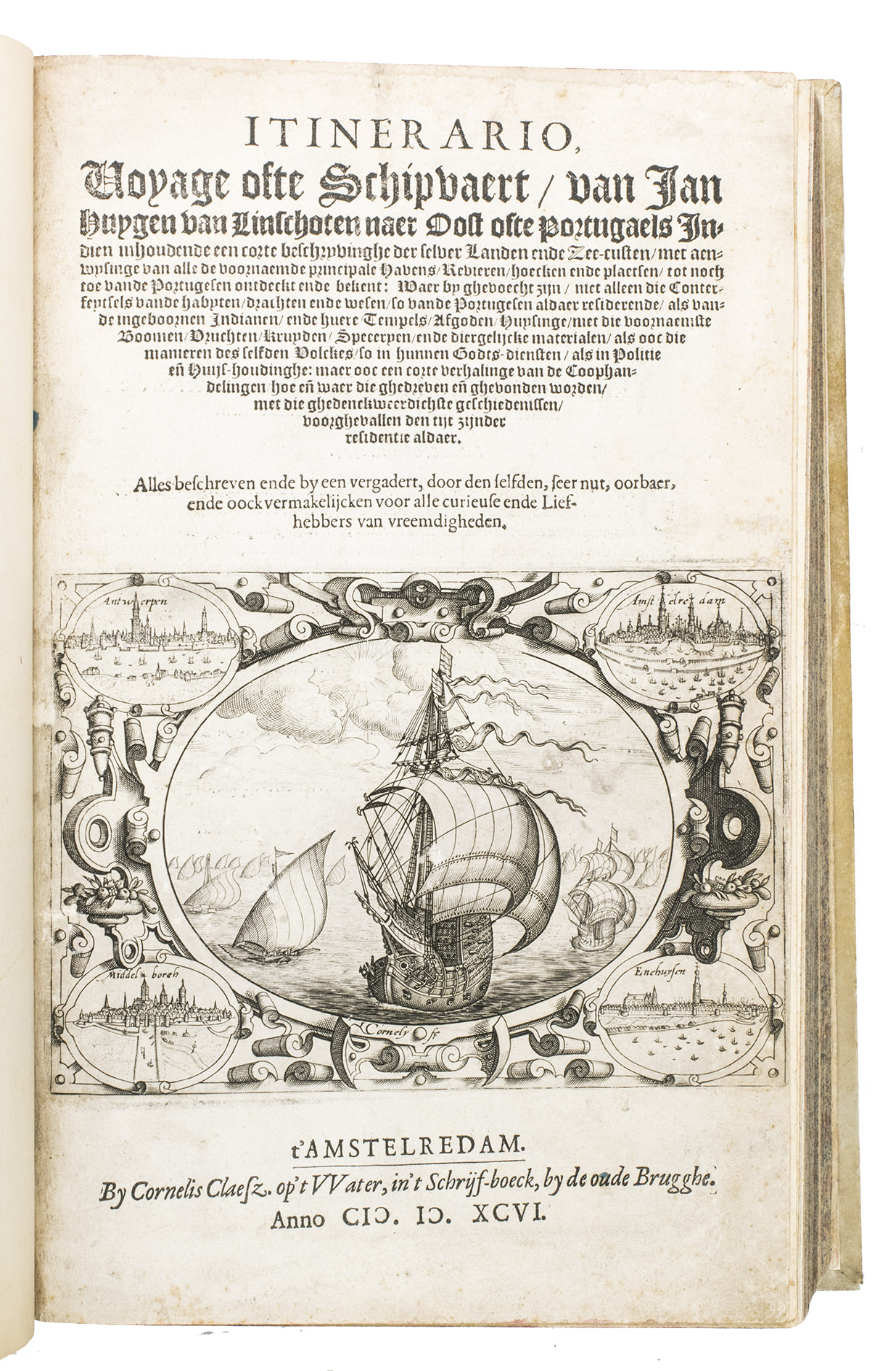
Itinerario, voyage ofte schipvaert, ... naer Oost ofte Portugaels Indien ...
Amsterdam, Cornelis Claesz., [1595-] 1596.
With:
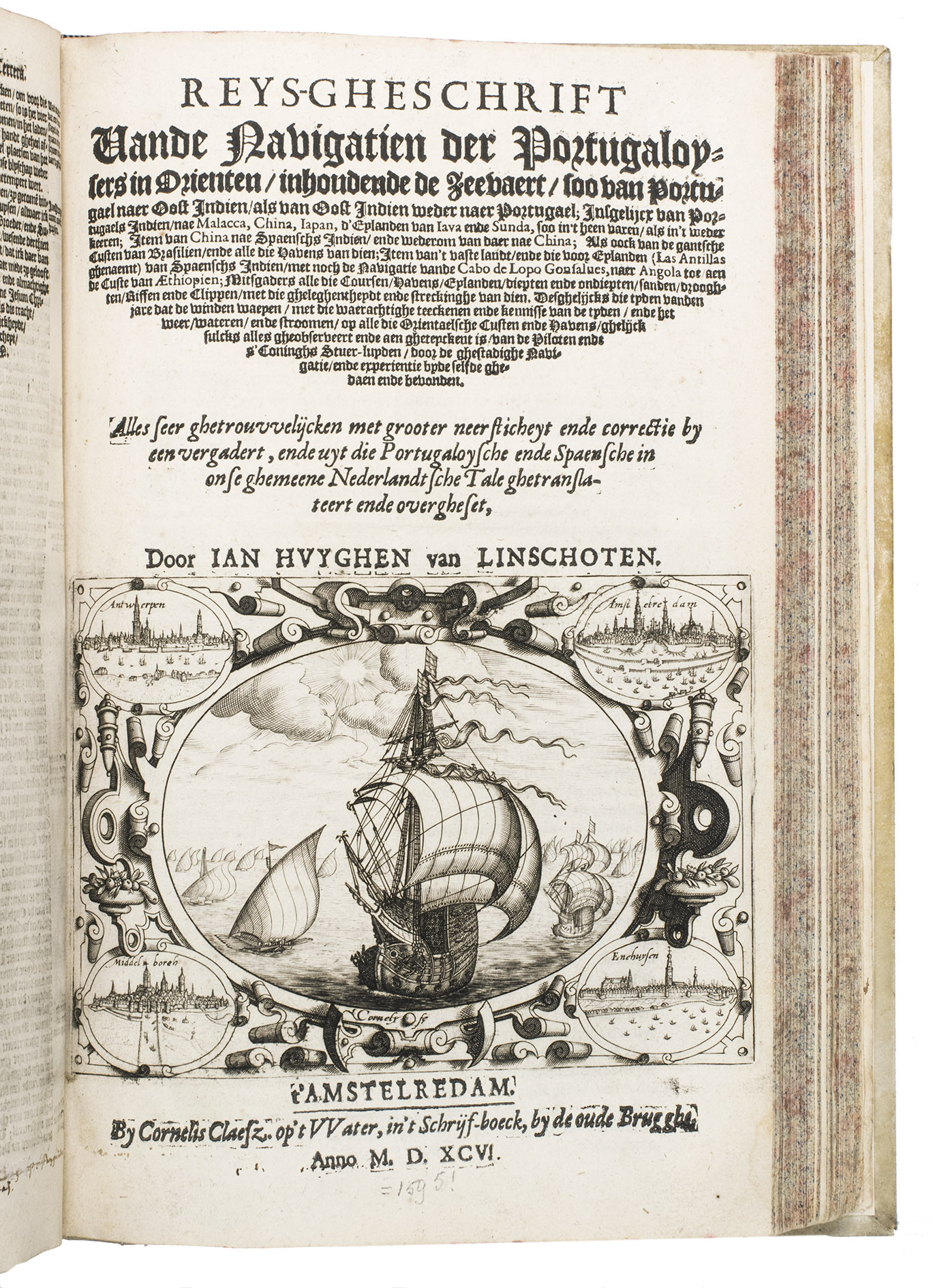
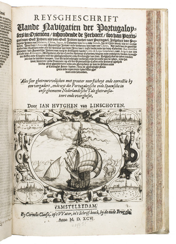
(2) IDEM. Reys-gheschrift van de navigatien der Portugaloysers in Orienten ...
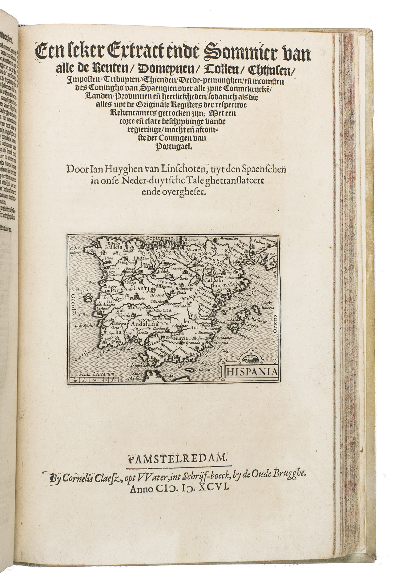
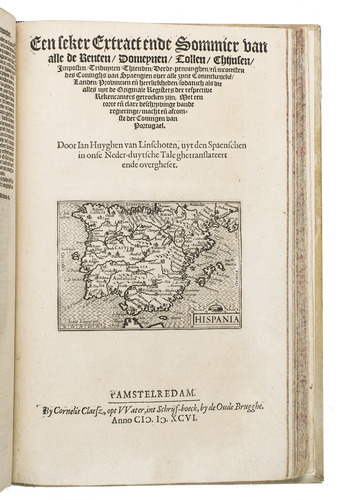
Including: IDEM. Een seker extract ende sommier van alle de renten, domeynen, tollen, ... importen, trubuyten, thienden, derde-penninghen en[de] incomsten des coninghs van Spaengien ...
Amsterdam, Cornelis Claesz., 1596 [= 1595].
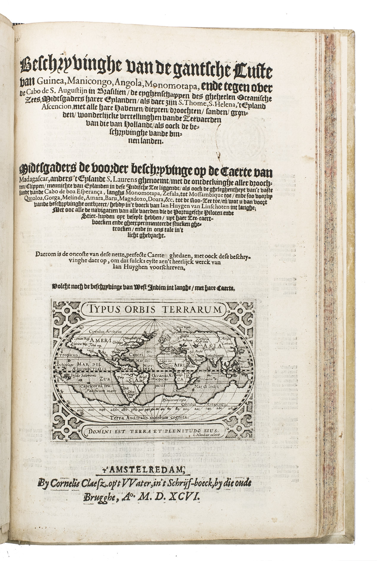
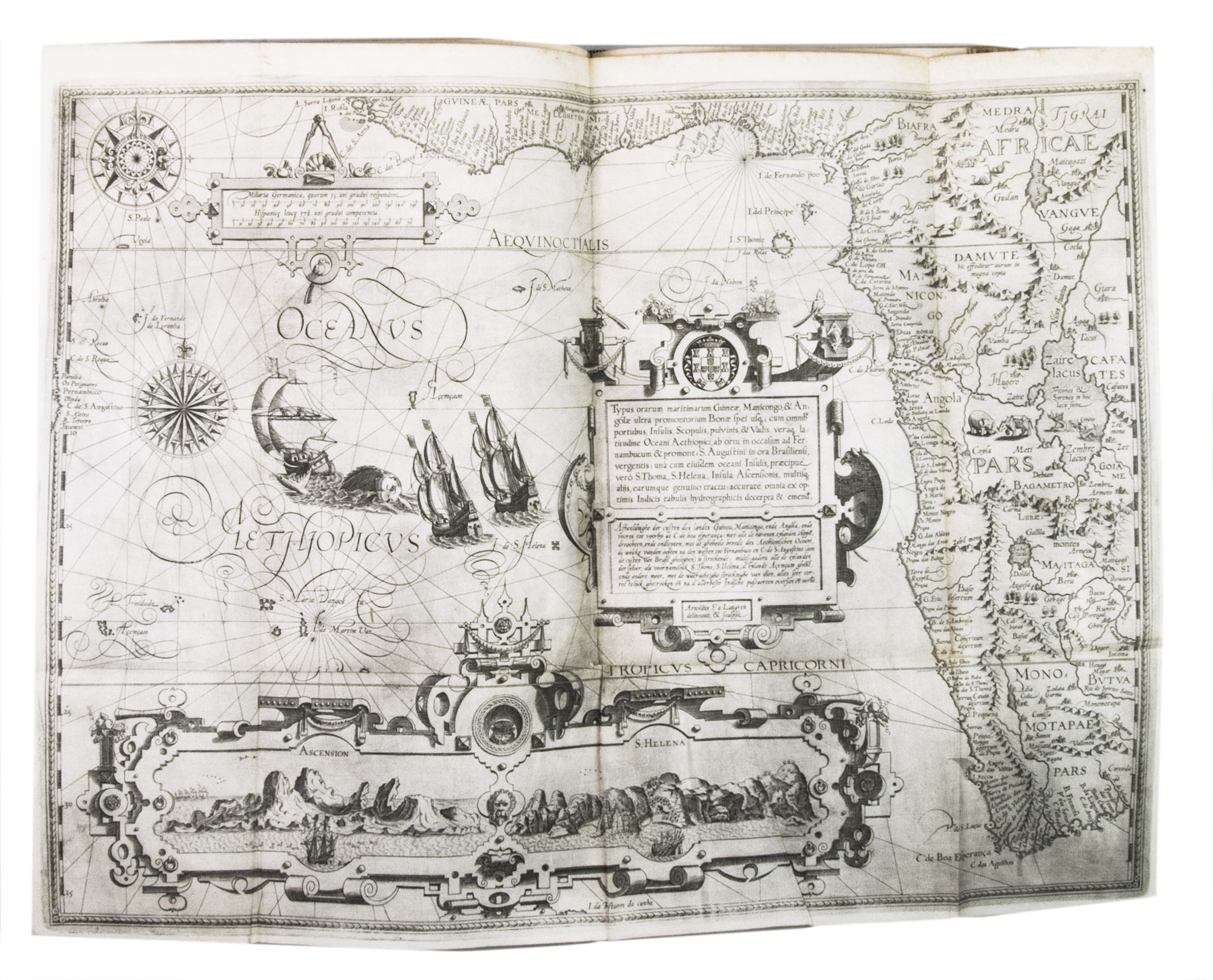
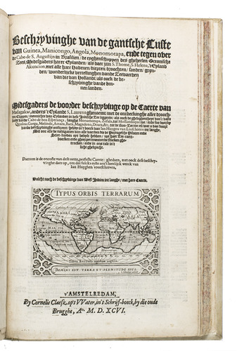
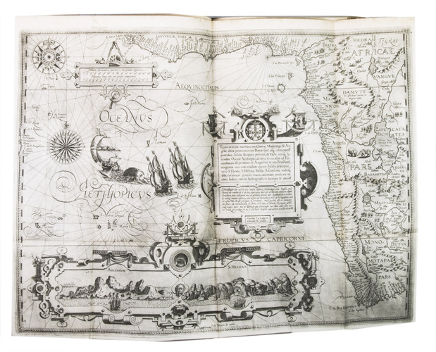
(3) IDEM. Beschijvinghe van de gantsche custe van Guinea, Manicongo, Angola, Monomotapa, ende teghen over de Cabo de S. Augustijn in Brasilien ...
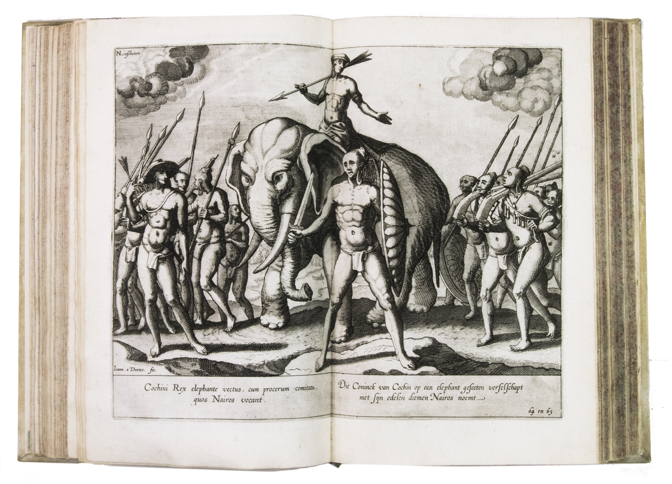
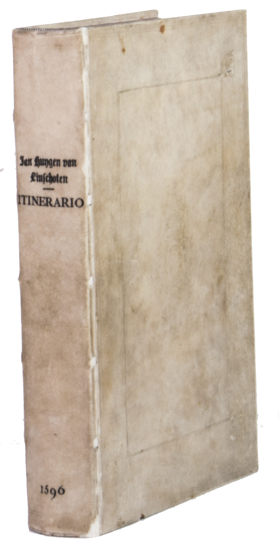
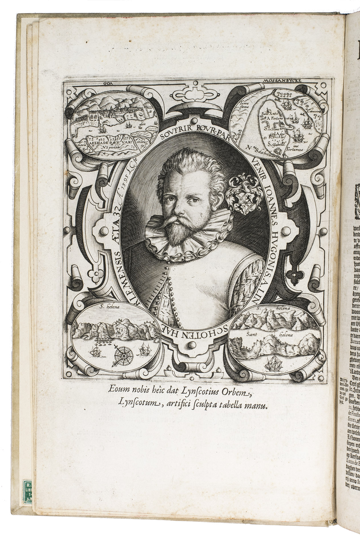
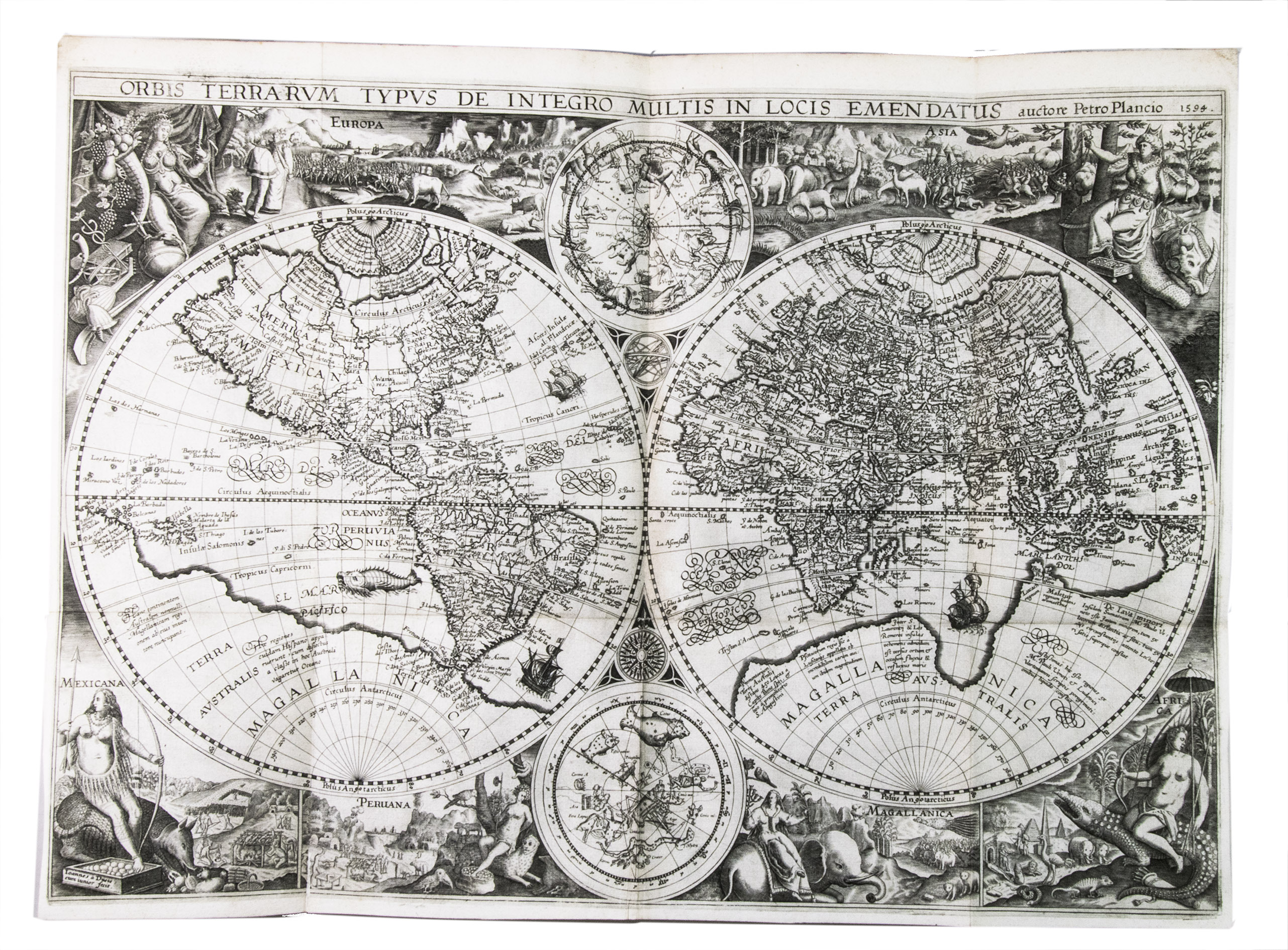
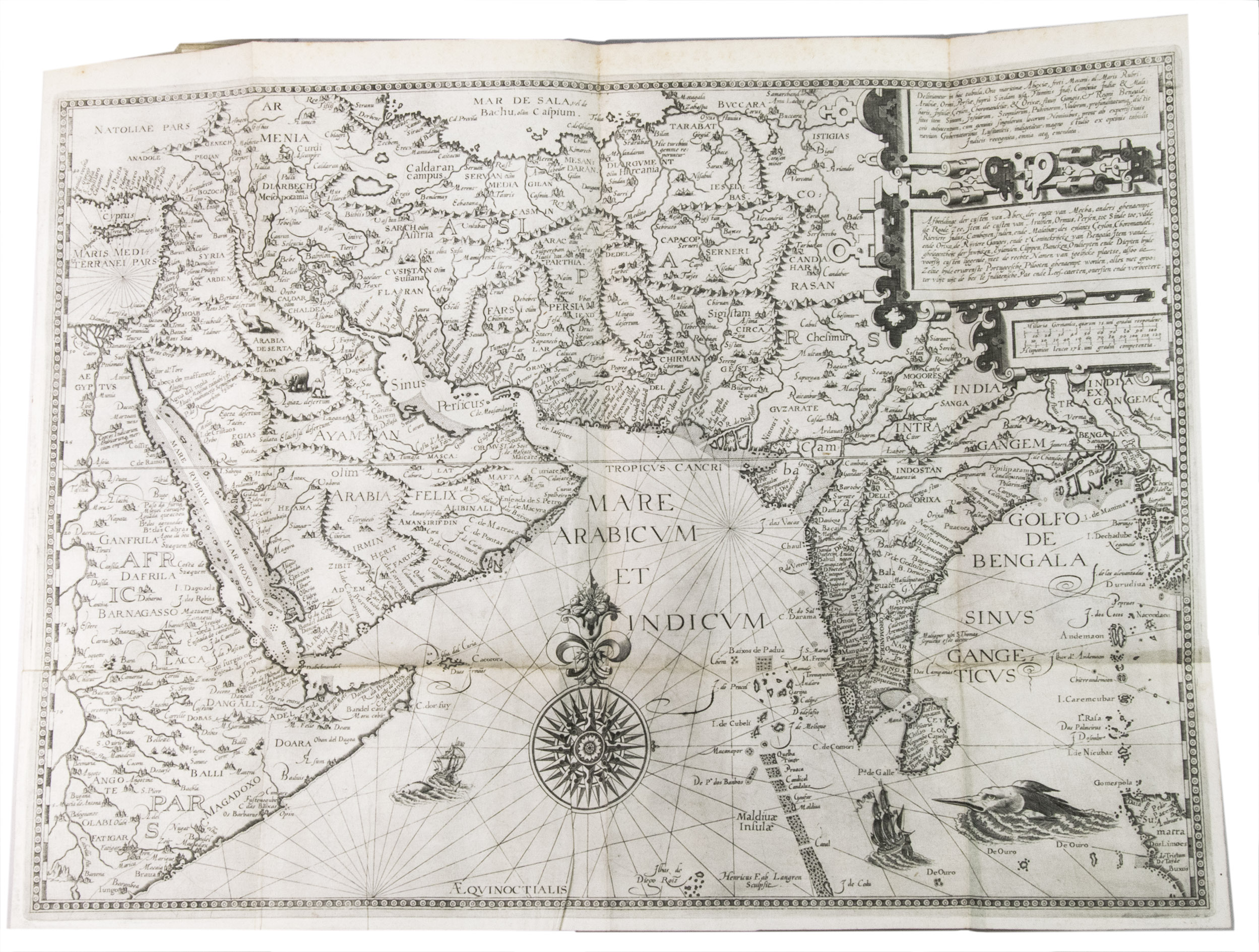
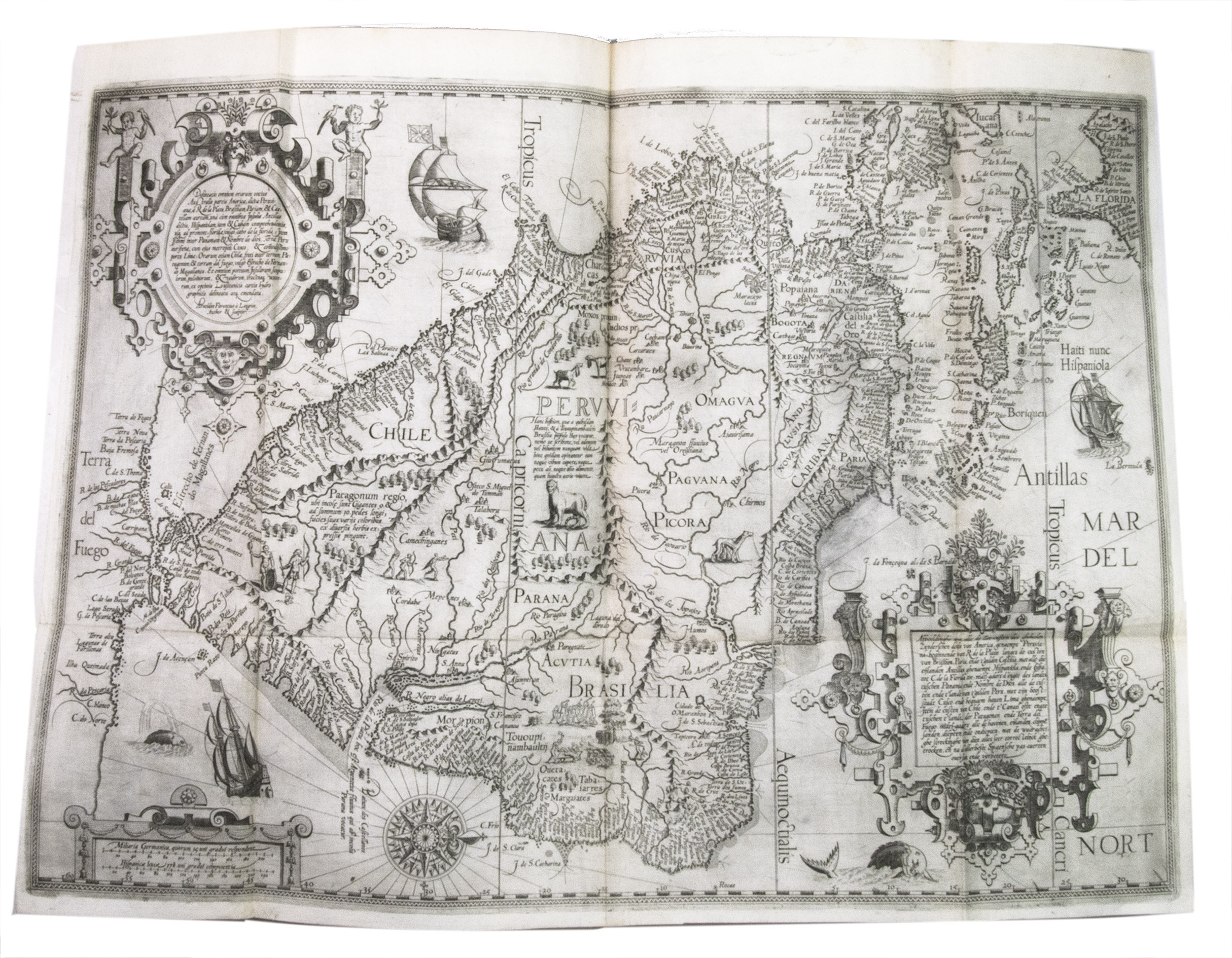
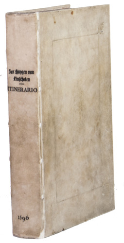
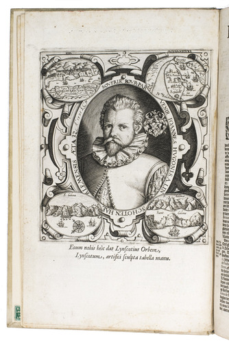
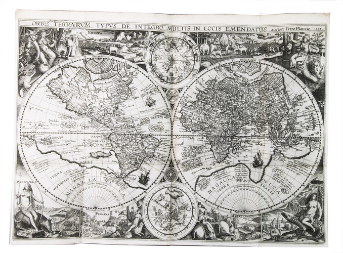
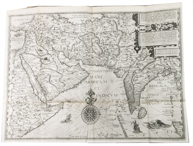
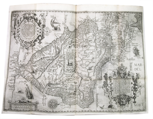
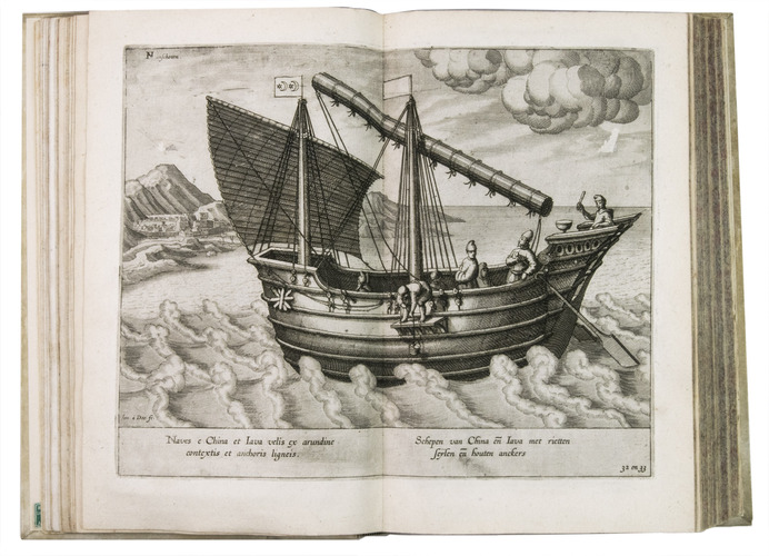
Amsterdam, Cornelis Claesz., 1596. 4 parts in 1 volume. Small folio (ca. 31 x 21 cm). With 6 folding maps, 36 folding or double-page plates, a full-page author's portrait, and a large illustration on each of the 4 divisional title pages, all engraved. Contemporary blind-tooled vellum over modern boards (?), with the manuscript author, title, and year of publication on the spine, red and blue sprinkled edges. [8], 160; 134, [4], 135-147; [82], [2 blank], [8] pp.
€ 110,000
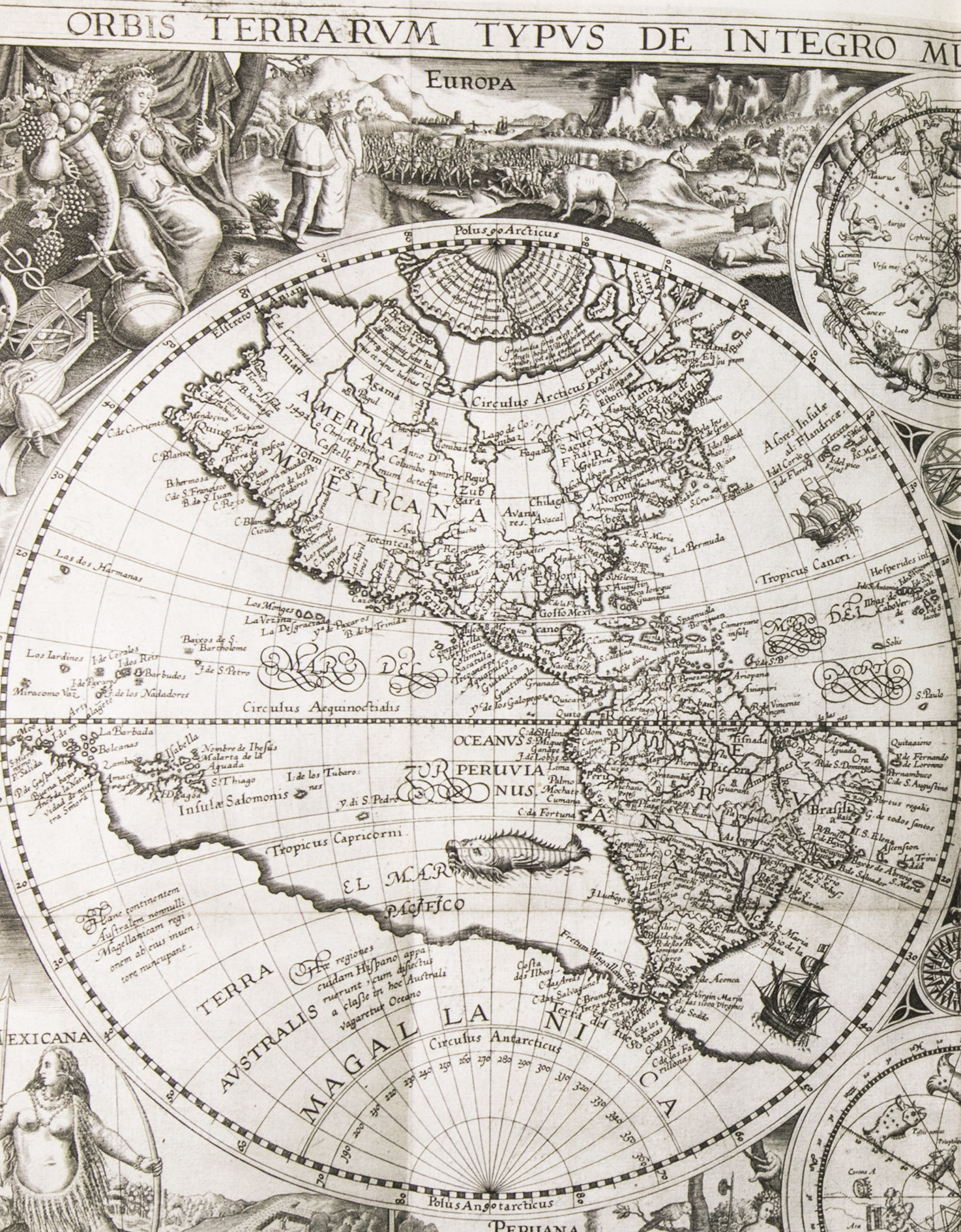
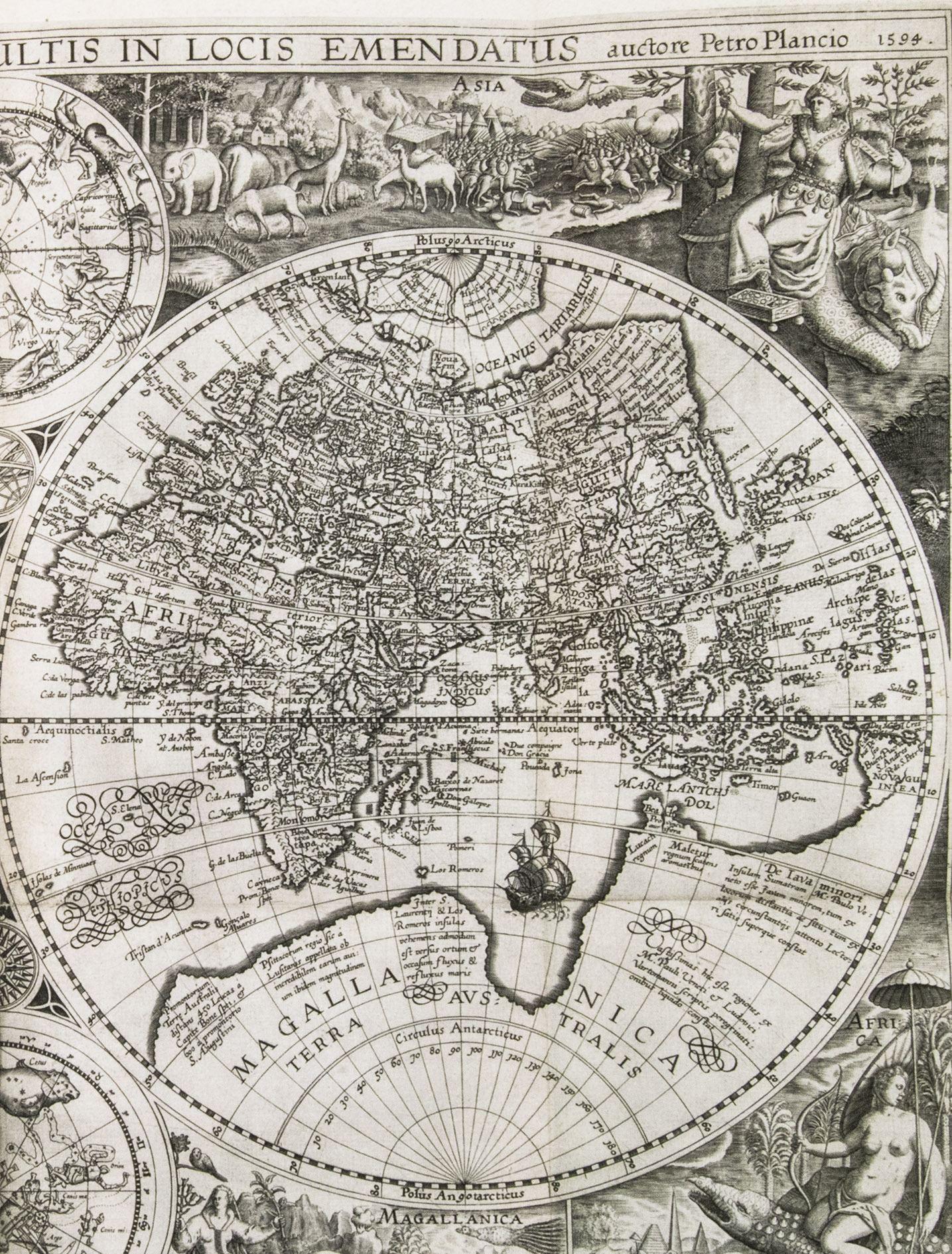
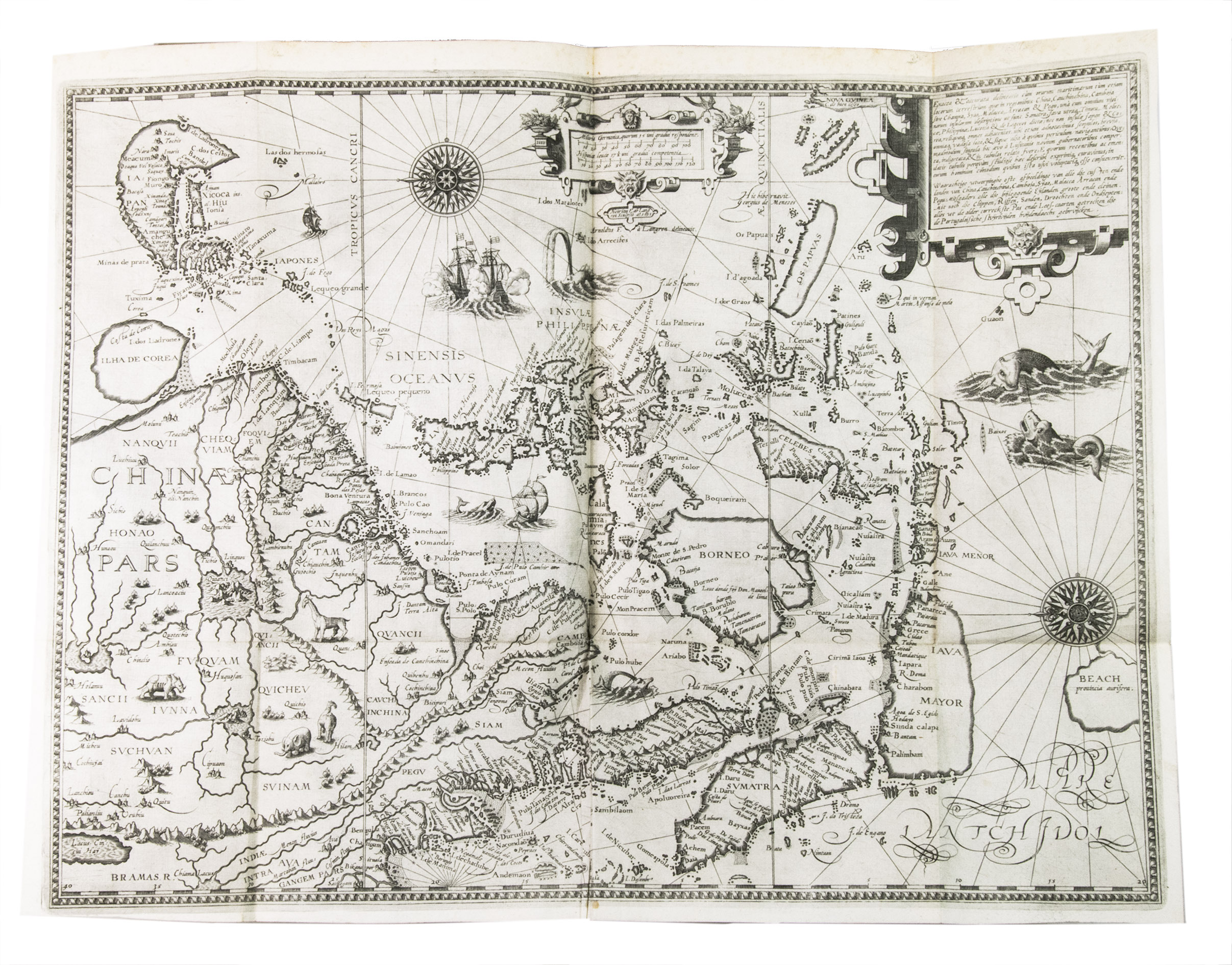
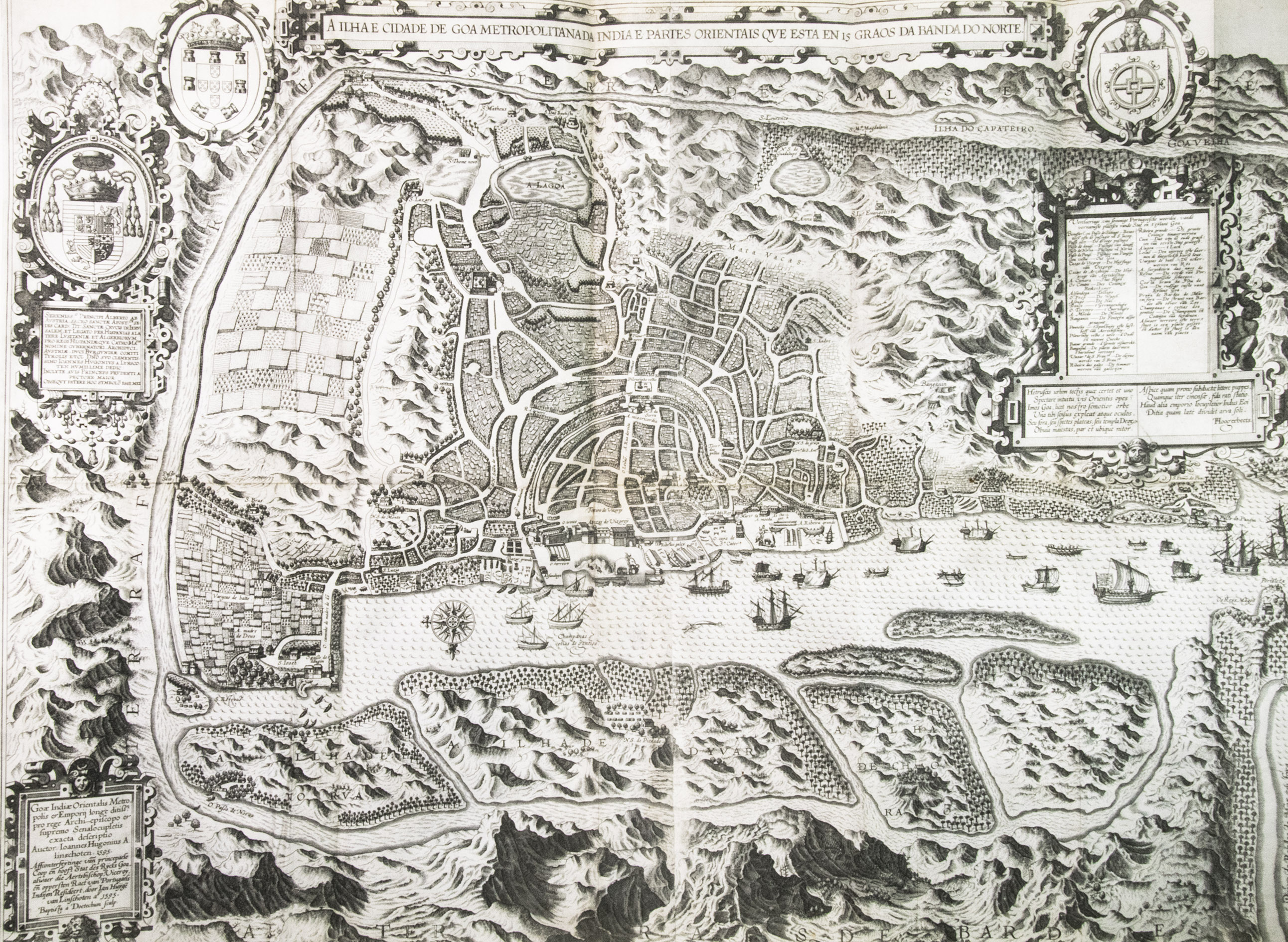
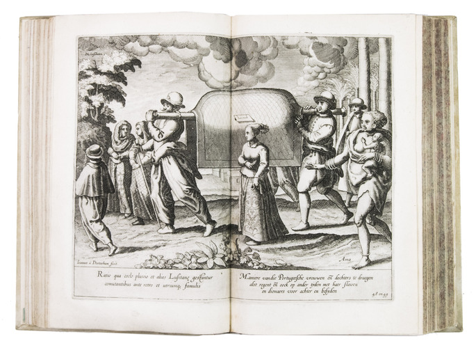
First edition in the original Dutch of one of the most important travel books ever produced. Also known as "The key to the East", it was the first printed work to include precise sailing instructions for the East Indies. This opened the way for both the Dutch East India Company (VOC) and the British East India Company (EIC), ending the Portuguese monopoly on the East Indian trade. "... this important work contains all the knowledge and learning related to the East and West Indies and navigation to those parts that was available at the end of the sixteenth century. It was held in such high esteem that for nearly a century a copy was given to each ship sailing to India as a guide to the sailing directions. The fact that most copies were in continual use is no doubt the reason that fine copies, especially with all correct plates and maps, are so very rare" (Hill). The present copy is complete with all maps and plates, and even includes the often missing instructions for the bookbinder.
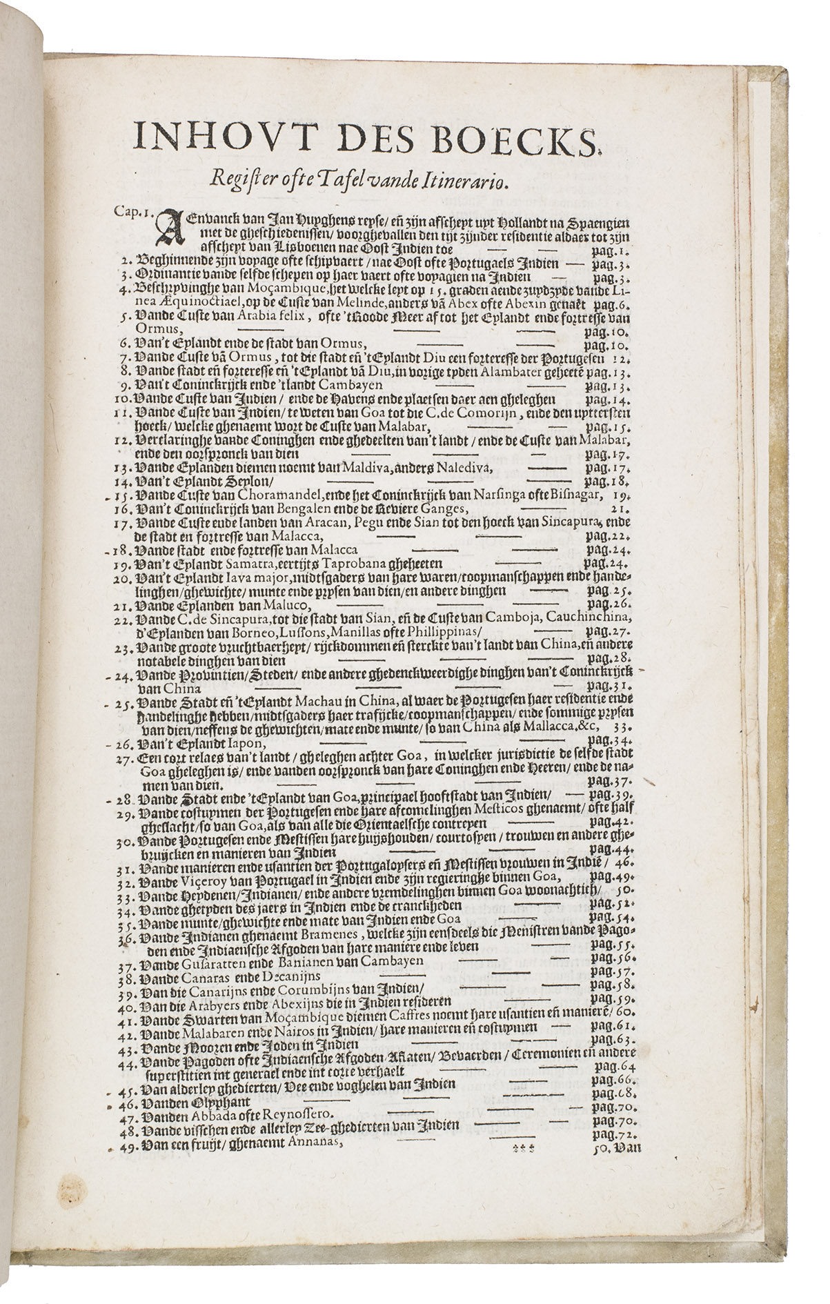
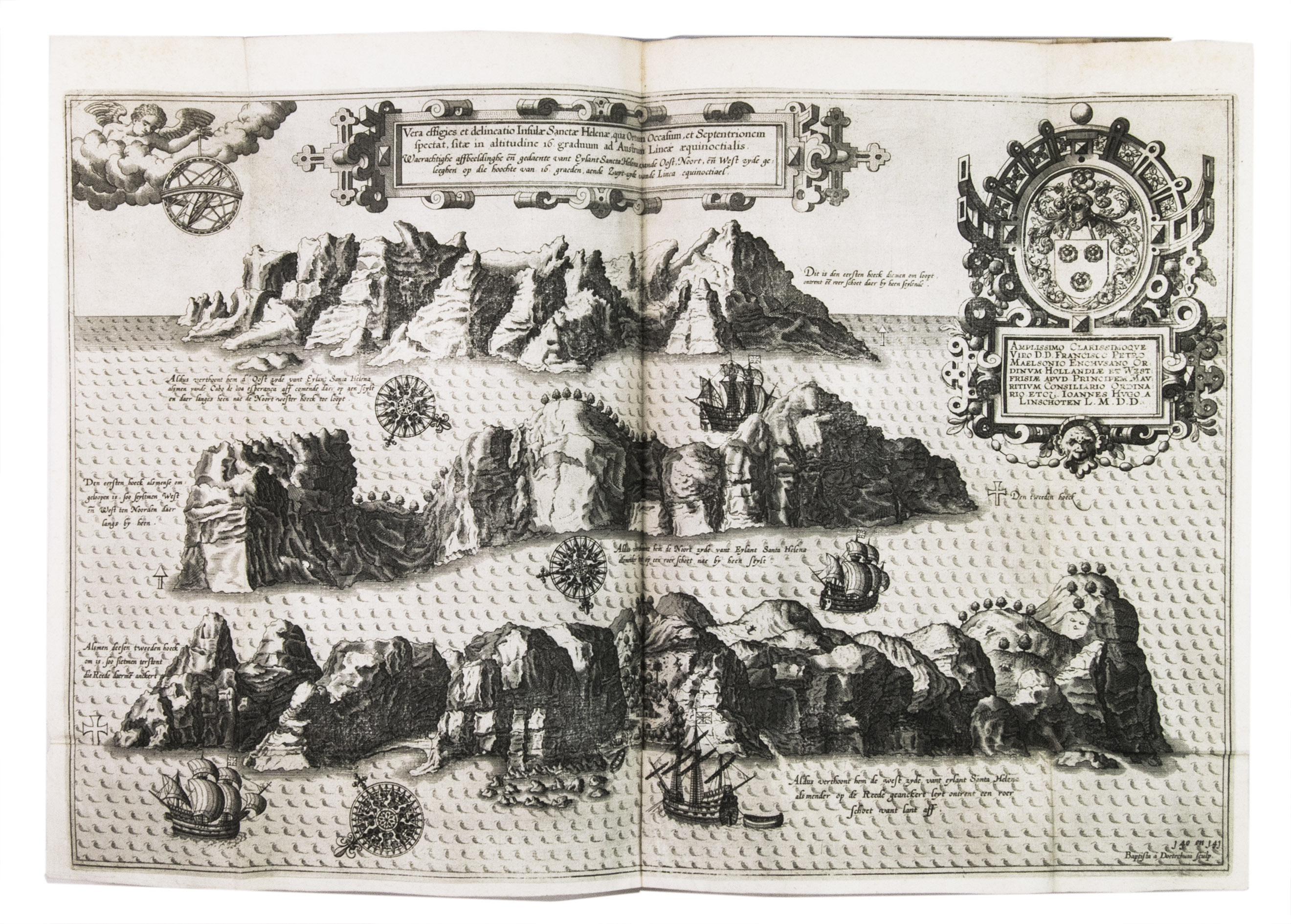
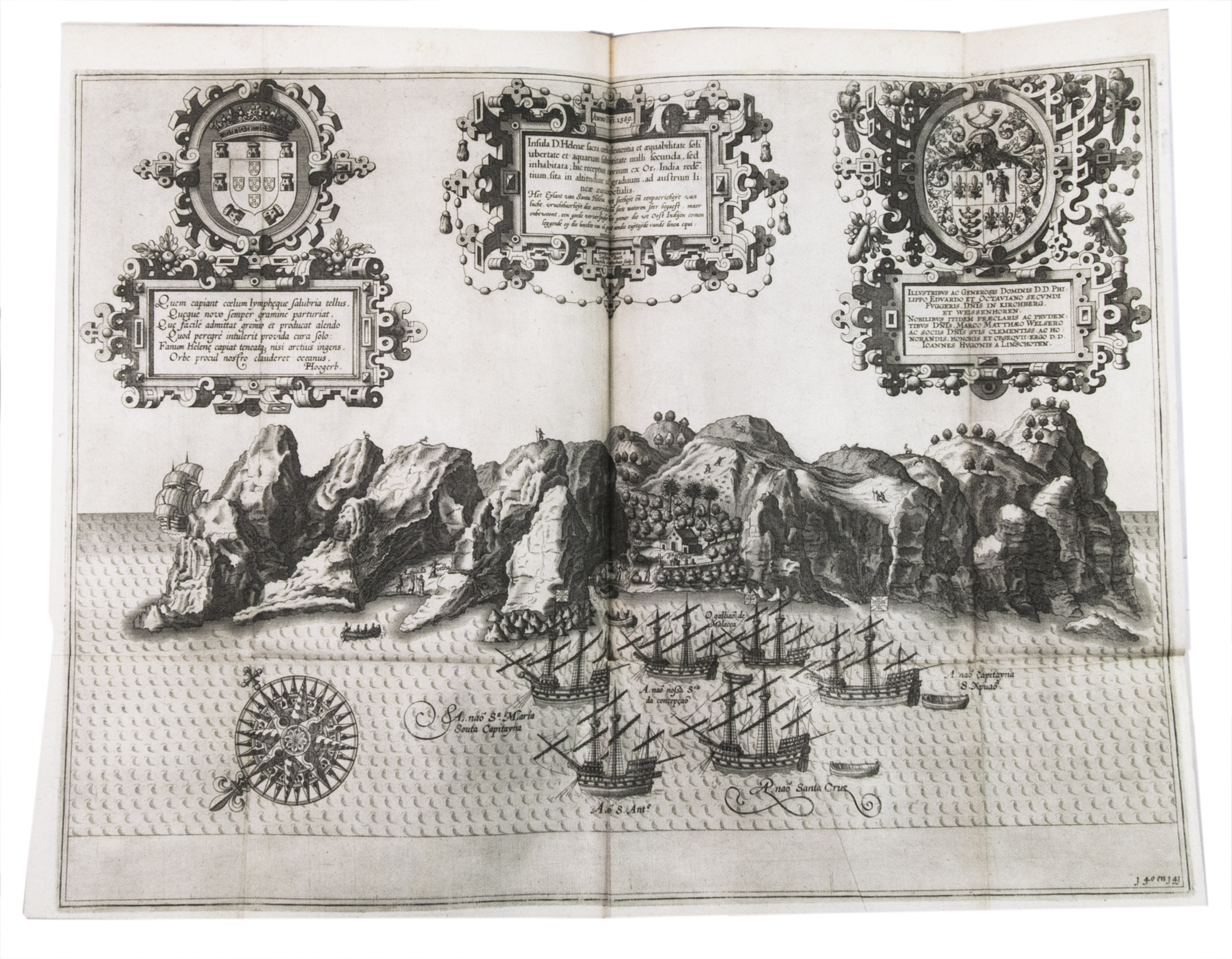
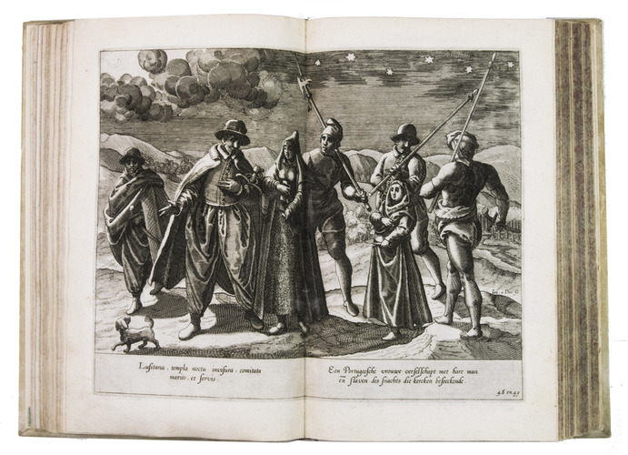
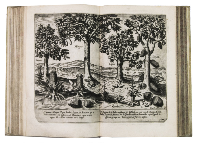
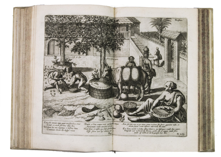
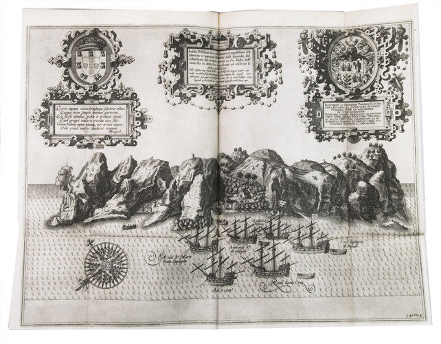
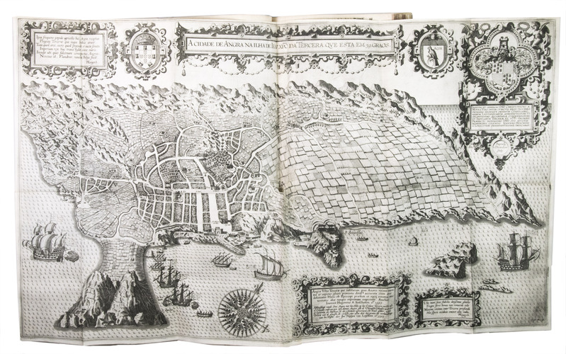
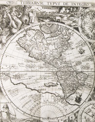
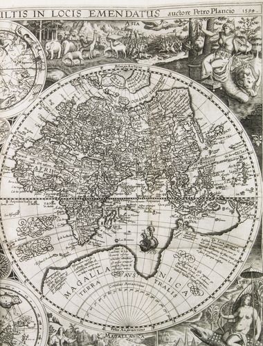
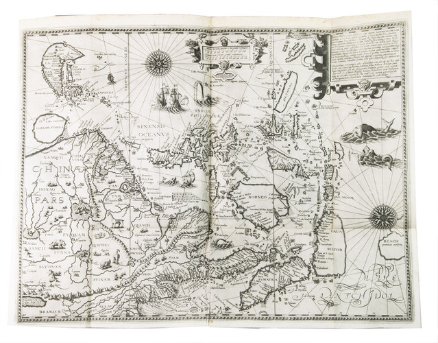
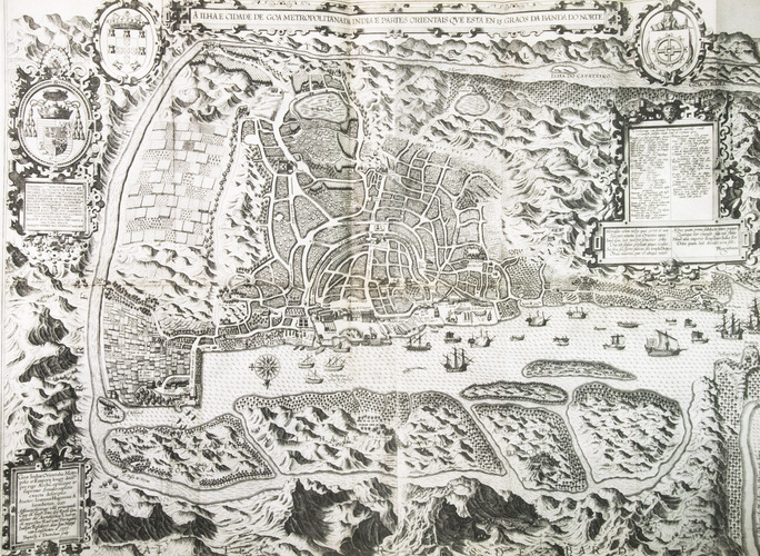
The work is divided into three parts, of which the second is further divided in two parts. The first part treats the East Indies, including eastern Africa and Arabia, and extending to regions as far east as Japan. The second, based on the discoveries of the Portuguese Royal pilot Diego Affonso, contains sailing directions from Portugal to India, and instructions for sailing in the East Indies, from island to island. Similar instructions are given for the New World, particularly Brazil and Spanish America. Part three contains detailed information on the taxes and other income that the King of Spain extracted from his territories, both at home and overseas. The final part, here present in its second issue, describes the navigation of the coasts of West Africa around the Cape of Good Hope to Arabia, together with the coasts of the New World.
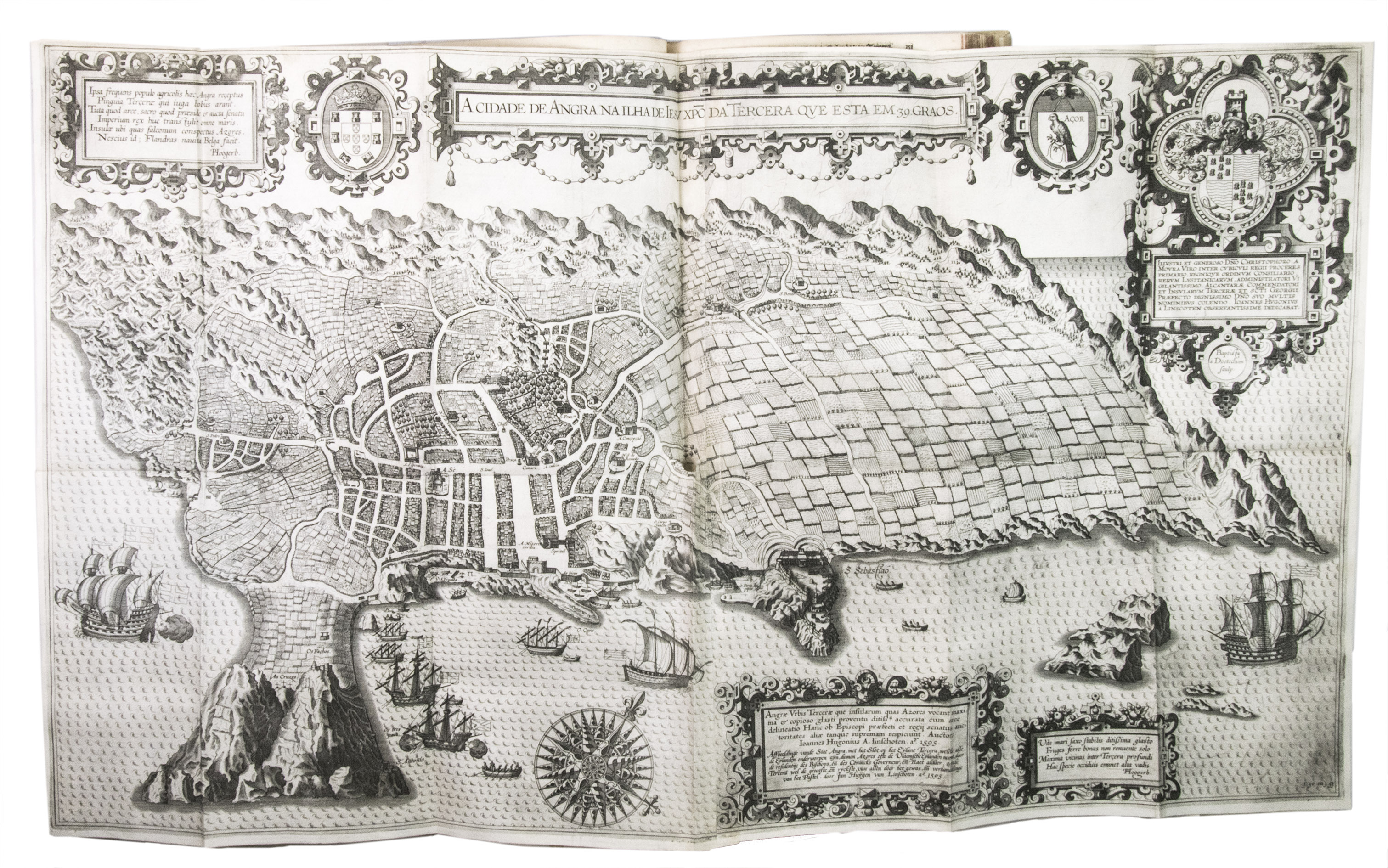
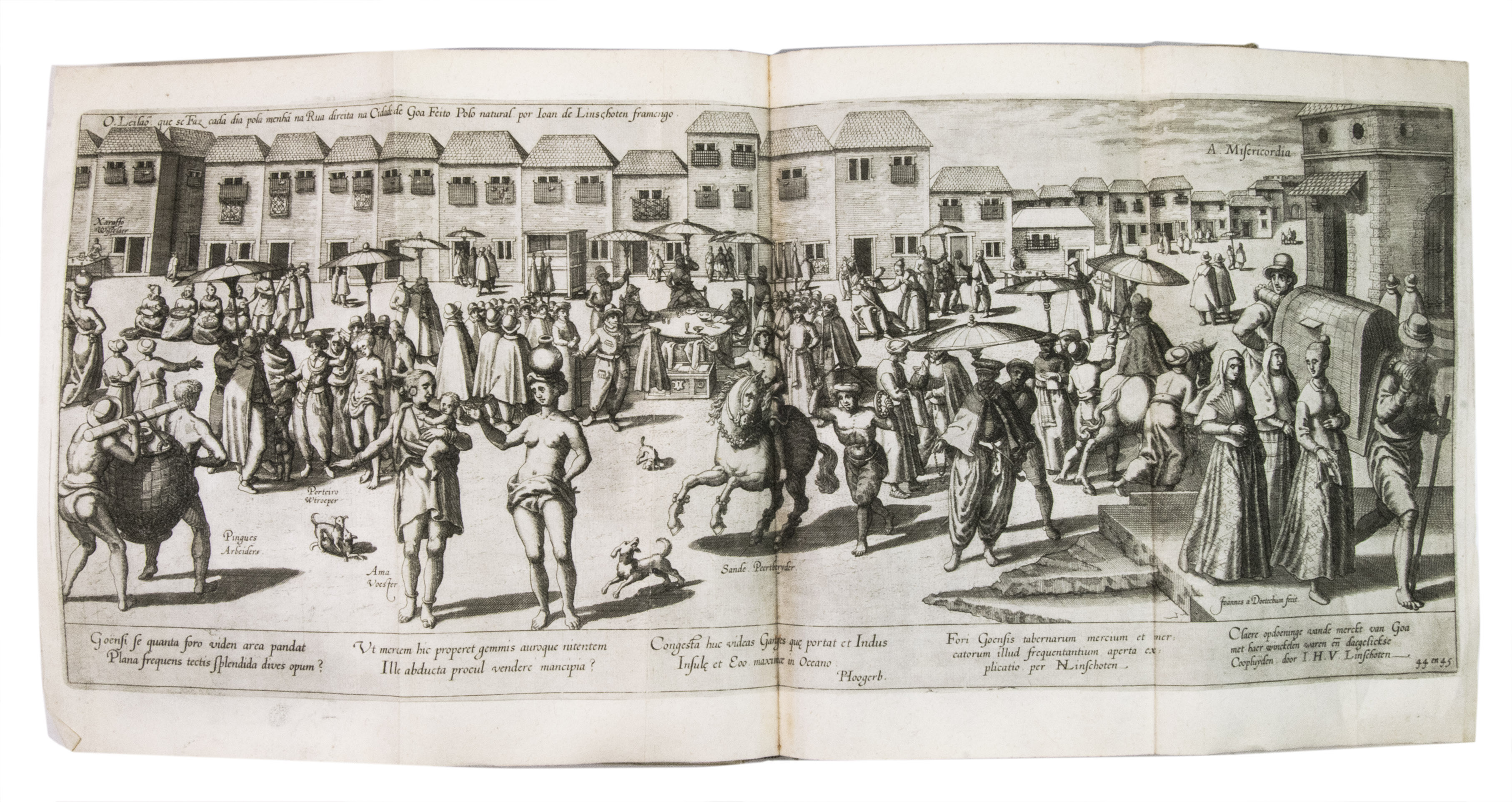
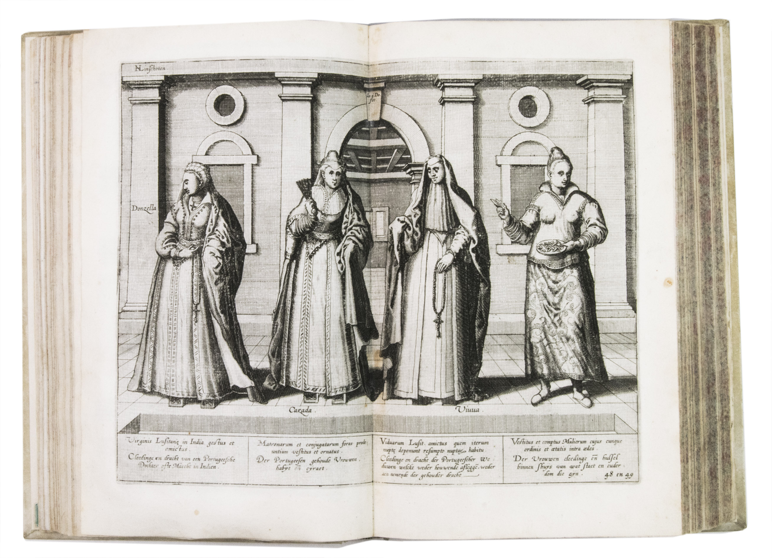
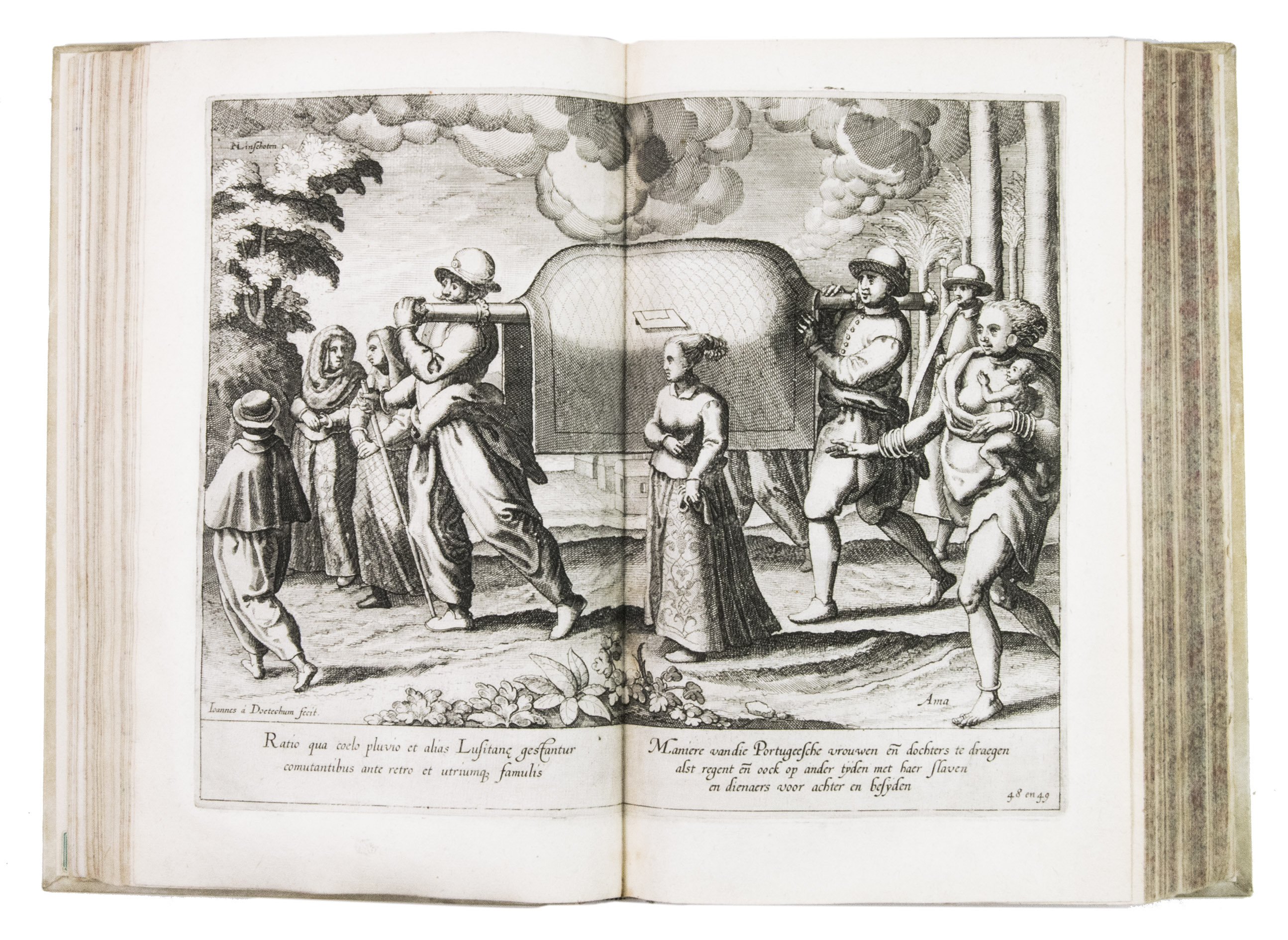
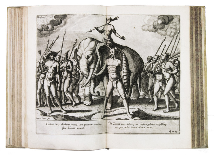
Jan Huygen van Linschoten (1563-1611), merchant, adventurer and explorer, left his birthplace Enkhuizen in December 1576 to join his brothers in Seville. He spent six years on the Iberian peninsula, eventually taking employment with a merchant in Lisbon. There he came into the service of the newly appointed Archbishop of Goa, the capital of Portuguese India, Vincente de Fonesca. He set sail with the Archbishop for Goa in April 1583. Linschoten was in Goa for more than five years as secretary to De Fonesca, in which capacity he not only had easily access to many Portuguese portolans as well as other sensitive commercial information, much of which he copied, but he also travelled throughout the Malabar and Coromandel coastal regions. He left Goa for Lisbon in January 1589. His voyage, however, was not smooth: his ship was pursued by the English fleet and lost its cargo in a storm. After the loss of the cargo Linschoten was persuaded to stay and help to try to recover it and spent two years on Terceira, in the Azores, working and exploring. Linschoten eventually arrived in Lisbon early in 1592 and after having settled his affairs there, he set sail for the Netherlands.
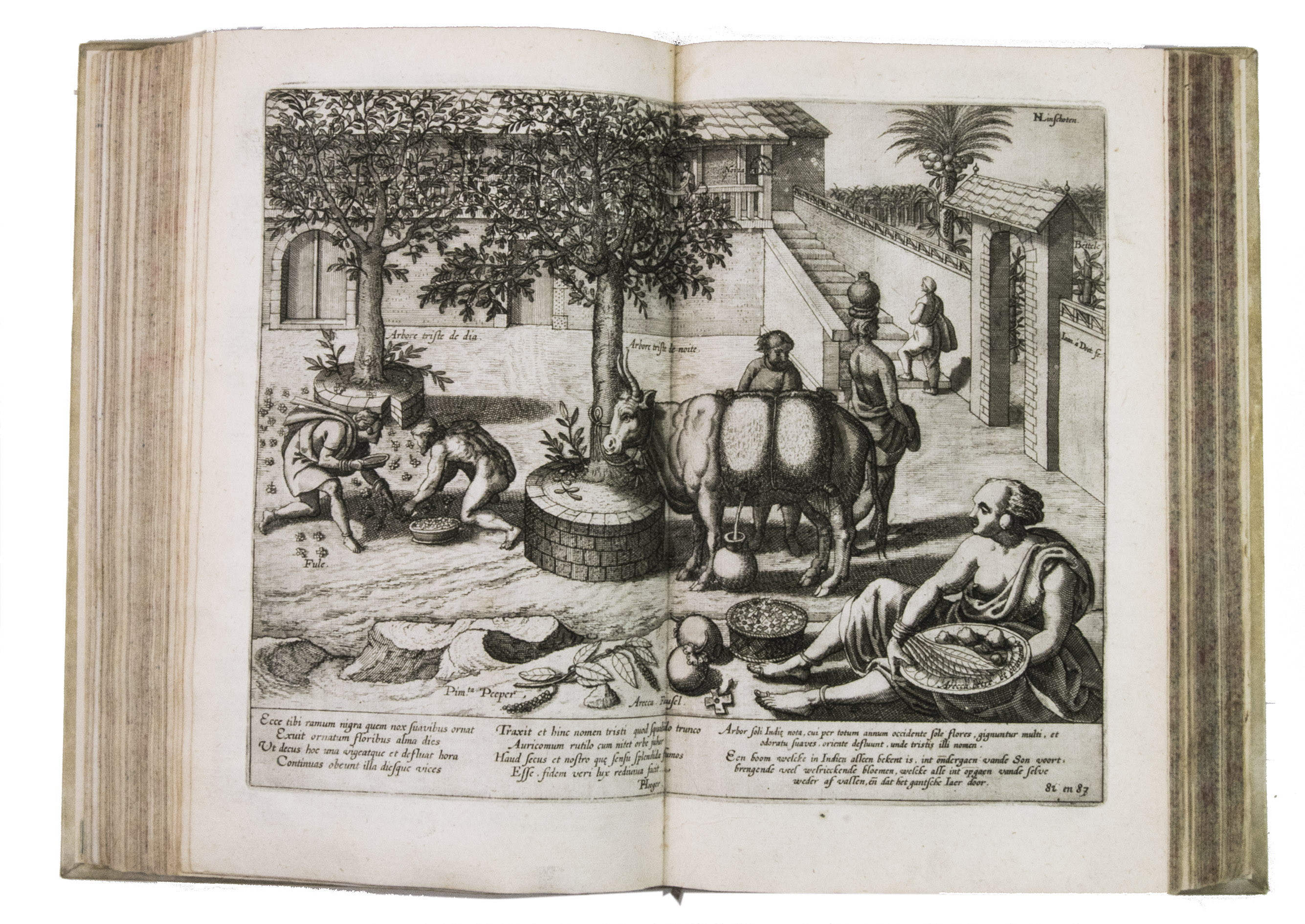
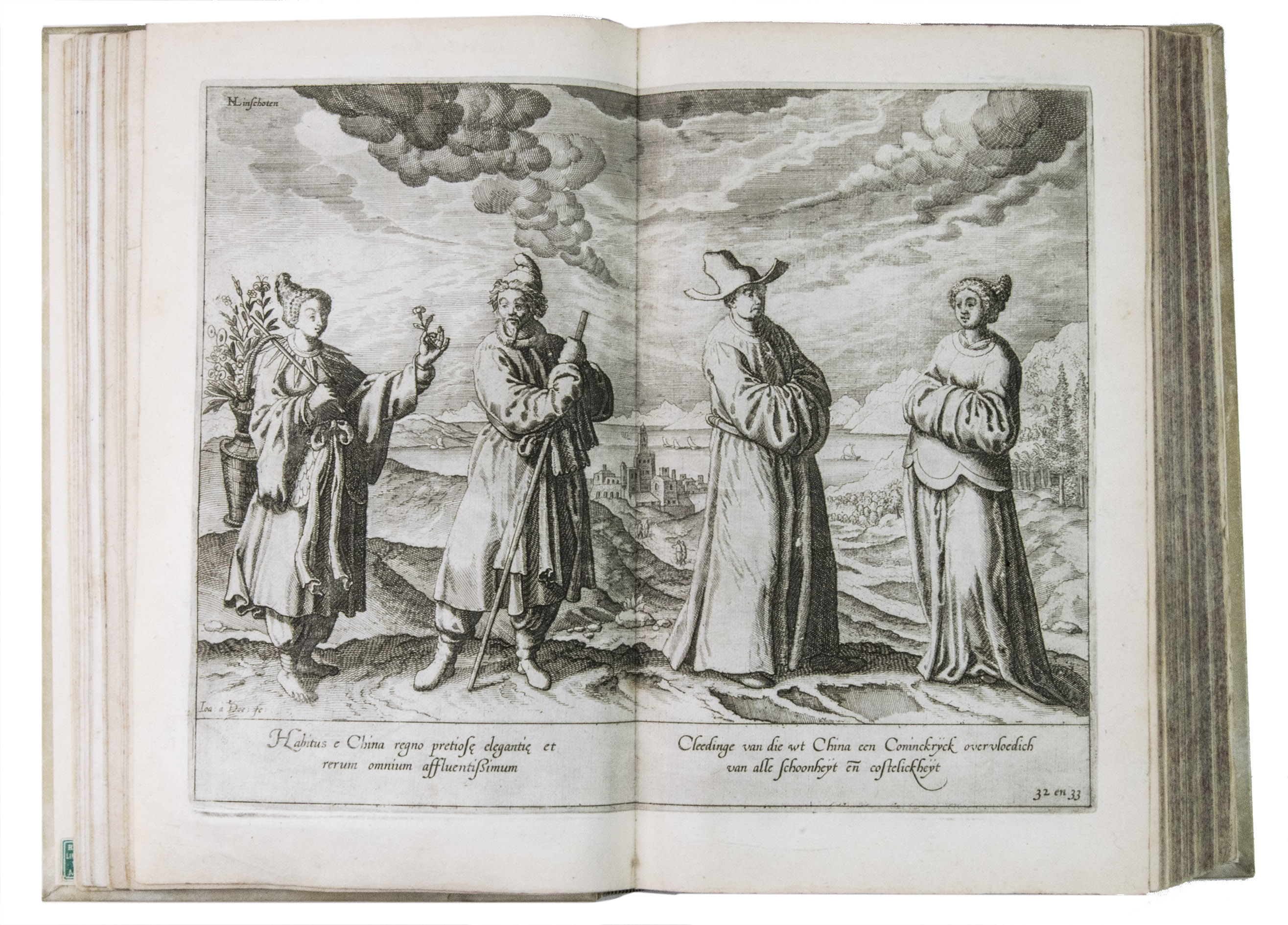
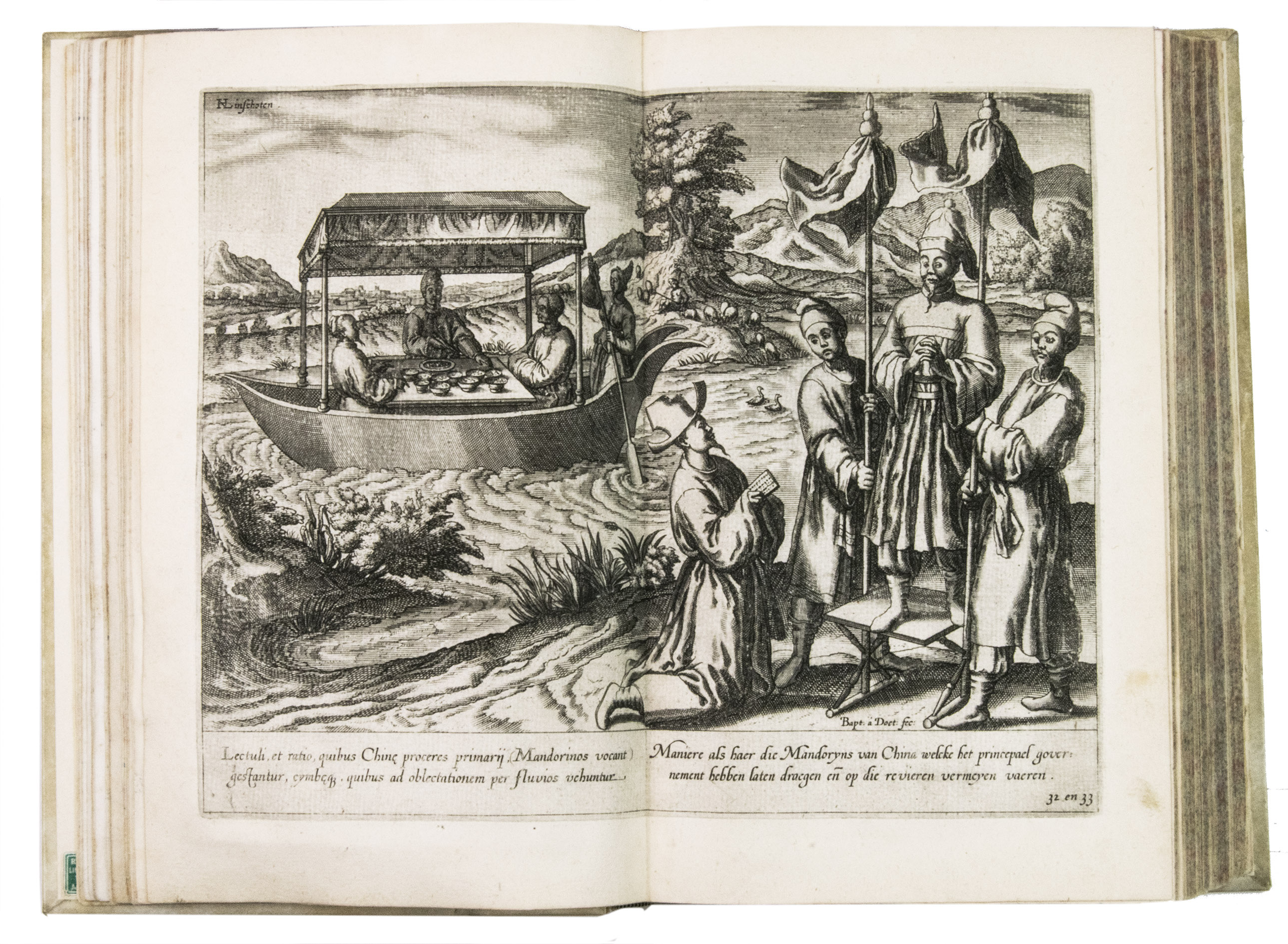
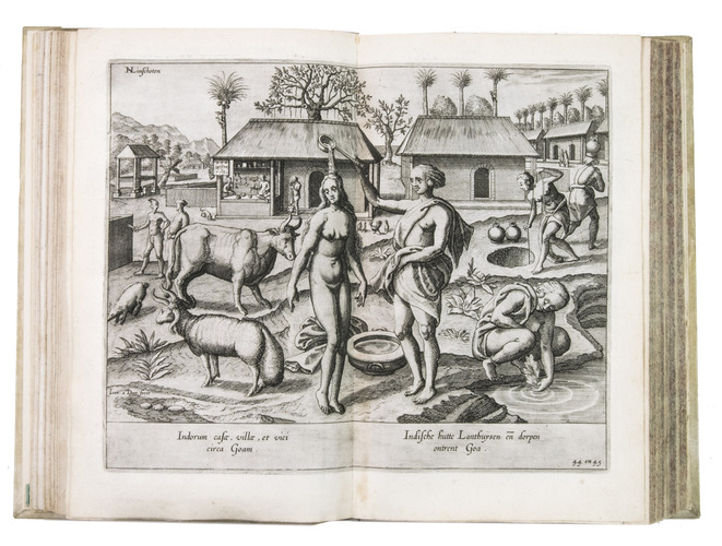
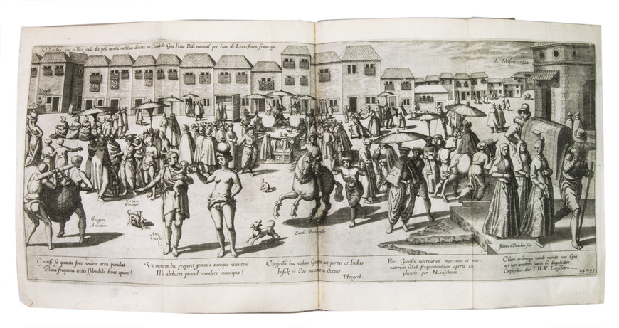
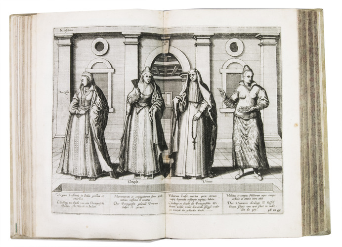
Van Linschoten sold the story of his travels to the Amsterdam bookseller and publisher Cornelis Claesz, who had specialised in shipping, geography and travels, and who published it in 1596 (this copy), containing Van Linschoten's personal experiences and travels, and, among very many other things, the commercially sensitive information to which he had had access to in Goa. The work provided the Dutch with valuable information regarding Portuguese sea routes to the East, their resupply points around Africa and their trading stations in the East, as well as important navigational data about currents, deeps and the location of islands and sandbanks, being absolutely vital for safe navigation. Thus, the greatly coveted shipping route to the East Indies and the route between the Asiatic sea ports came within reach, offering the missing link to the search into itineraries and trade routes to the Indonesian archipelago. Linschoten also gives detailed descriptions of the Portuguese territories and how they were administrated, including descriptions of spice trees and spice growing areas.The work was immediately a great success and went into many editions in Dutch over the course of the next fifty years. In 1598 a German edition appeared, and in the same year an English translation was published in London, entitled: John Huighen van Linschoten his discours of voyages into ye Easte & West Indies. French editions followed in 1610, 1619 and 1638. A Latin edition was published in 1599 without the maps.
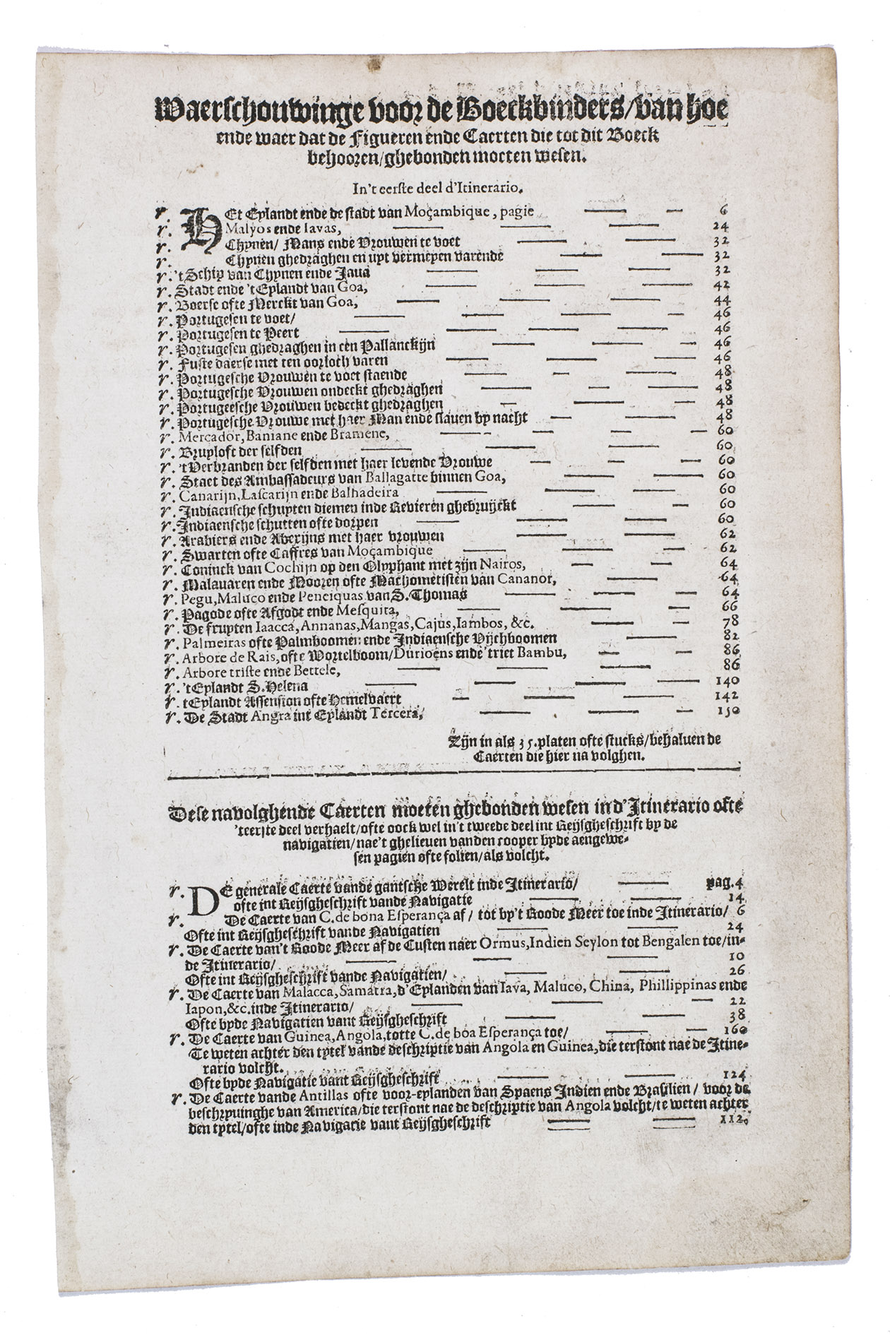
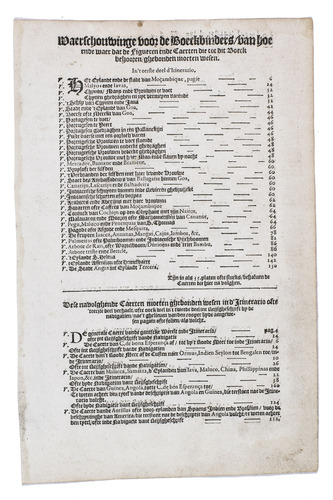
With the bookseller's label of R. W. P. de Vries in Amsterdam mounted at the foot of the front pastedown, and the rare "Waerschouwinge voor de boekbinders" loosely inserted in the back. The work has been recased with new endpapers and supports, small restorations on the head and foot of the spine. The work is slightly browned throughout, part 3 (ads 2a and 2b) has been bound before part 2 (ad 3), small restorations at the bottom outer corner of some of the leaves, small tears in the folds of some of the maps, mostly in the margins, contemporary annotations in the margins of some of the leaves and on the verso of some of the plates, the chapter titles on page 12-20 and 31-34 in ad 1 have been corrected with a small strip of paper glued on top, the leaves of ad 3 have been numbered by hand. Otherwise in good condition. Alden & Landis 596/63; Borba de Moraes, pp. 486-487; Church 252; Howgego, L131-132; Parker, Books to build an empire, pp. 159-161; Sabin 41356; STCN 853189978 (9 copies); cf. Hill 1025 (English ed.); Nave, Philologia Arabica 22 (1623 ed.); for the map of Arabia, Persia and India: Tibbets 46 & pp. 23.
Related Subjects: