FEO CARDOZO DE CASTELLOBRANCO E TORRES, João Carlos.
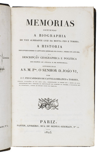
Memorias contendo a biographia do vice almirante Luiz da Motta Feo e Torres. A historia dos governadores e capitaens generaes de Angola, desde 1575 até 1825, e a descripção geographica e politica dos reinos de Angola e de Benguella.
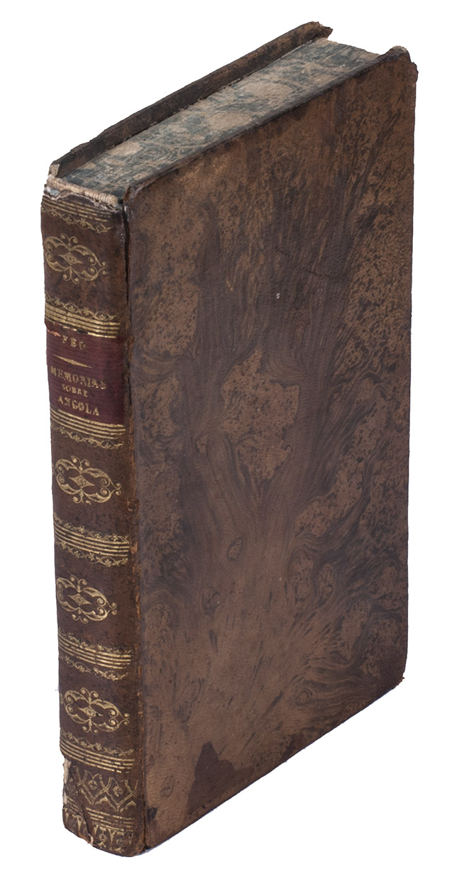
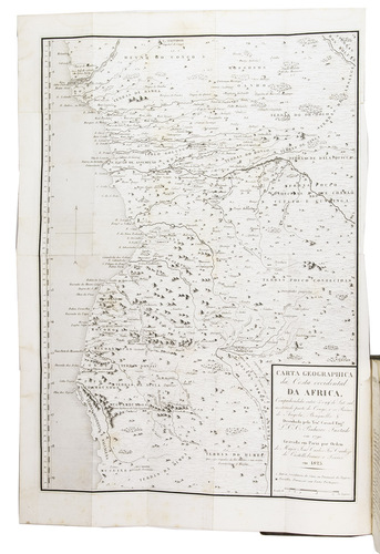
Paris, Fantin, 1825. 3 parts in 1 volume. 4to. With one large folding map at the start of the first volume, showing the coast of Angola, and a small vignette on the title page. Contemporary gold-tooled tree-marbled calf. [14], 375, [6] pp.
€ 2,950
First edition of one of the few works about Angola from its era, containing a very rare map of the country. This work is extremely scarce, as we have only been able to find it in three sales records from the past hundred years.
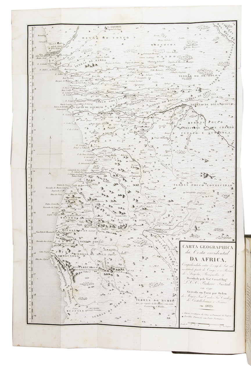
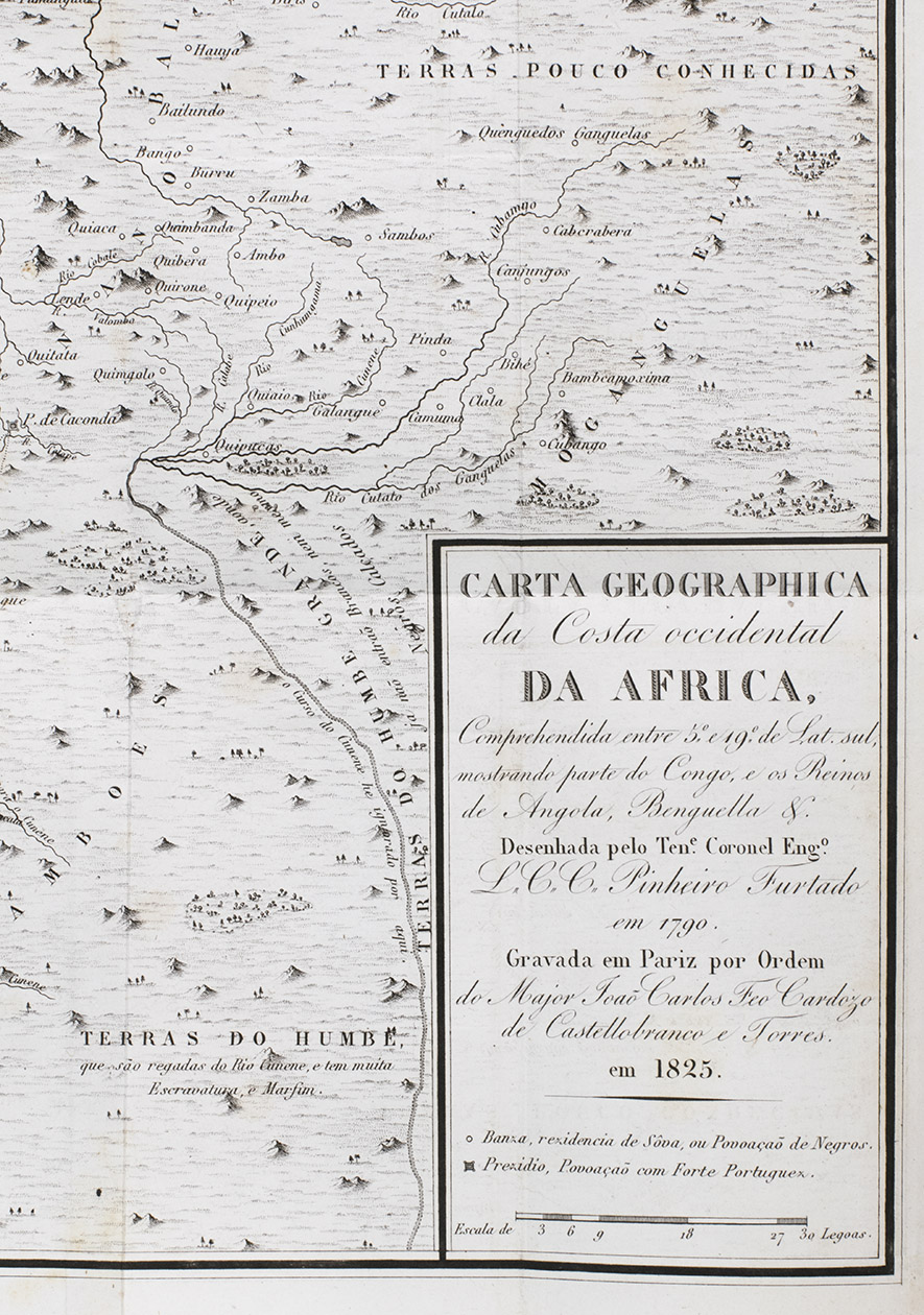
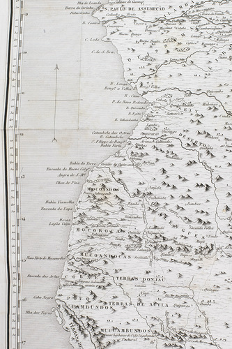
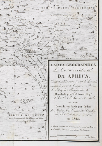
Angola was a part of the Portuguese Empire almost continuously from 1655-1975. The current capital, Luanda, was originally a Portuguese settlement founded in 1576. Since the Portuguese were primarily in Angola for the slave trade, the colony was initially not expanded beyond Luanda and a fort in the bay of Benguela in the south. The region was therefore hardly explored. As foreign interest for Angola grew, and Luanda was even in Dutch hands from 1640-1648, the Portuguese realised they needed to expand to be able to defend it. Different governors enlisted the help of cartographers to explore the region. Governor José de Almeida e Vasconcellos de Soveral e Carvalho, who held this position from 1784-1790, employed the help of Lieutenant Colonel Luís Cândido Cordeiro Pinheiro Furtado (1749-1822), a military engineer and cartographer, and Joaquim José da Silva (1755-1810), a naturalist who had travelled through Angola extensively for his research. The two men joined two missions in 1785, with the goal to explore Angola further and secure more territory. During the journey, Pinheiro Furtado charted the whole coast and made a map of the country based on verbal information of soldiers and explorers. This map, finished in 1790, is included in Memorias contendo a biographia.
Although Pinheiro Furtado was not the first to make a map of Angola, his work is unique for various reasons. Not only was it the most detailed and accurate map of the region at the time, it was also the first that showed Angola as a unified colony under Portuguese rule. Even though this was not the reality. Another interesting aspect of it is that it included the routes of Portuguese expeditions to the south, which are represented with dotted lines. However, Pinheiro Furtado did not show the eastern border, because he had not yet explored that area. This part of the map therefore says "Terra pouco conhecidas" (almost unknown territory). Because Portuguese explorations were ongoing, maps that did show this area were needed and Pinheiro Furtado's work was soon outdated. It was probably because of this that the map remained in manuscript form, until João Carlos Feo Cardozo de Castellobranco e Torres (1798-1868) included it in the present work 35 years later.
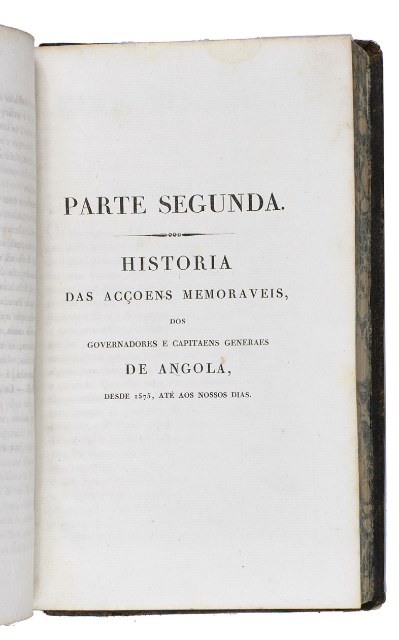
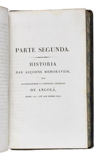
Torres was a Portuguese nobleman, army officer, genealogist and historian, who wrote multiple works about the Portuguese nobility. In Memorias contendo a biographia he explores his own family, as the work starts with a biography of Luís da Mota Feio e Torres (1769-1823), a senior Portuguese naval officer and colonial administrator in Brazil and Angola. A larger part of the work, however, is made up of biographies of all the governors of Angola from 1575 to 1825. This part offers a unique overview of the history of the Portuguese in Angola from the perspective of its governors. The last part of the book is a geographical and political description of the country, illustrated by Pinheiro Furtados map. The combination of text and map, make this work of great historical interest, because it is a rare account of the attempts of the Portuguese to fully colonise Angola during multiple decades.
Head and foot of the spine and corners of the boards show some signs of wear. Browning of the margins of the endleaves. Slightly waterstained in the top margin throughout. The folding map is very slightly foxed and has a small, partially repaired tear at the hinge. The separately published folding plate, with a view of the Angolan capital Luanda, is not present in the majority of the copies, including this one. Otherwise in good condition. Innocencio III, p. 339 and X p. 204; Porbase 170279 (4 copies BnP); WorldCat 1203706605, 1327740981, 252289753, 43082127, 431315021, 457275564, 560032852, 561454767, 69349052 (11 copies); cf. Corada J., The Rise of a new consciousness: early Euro-African voices of dissent in colonial Angola. In: e-JPH, vol. 5, no. 2, winter 2007; Figueiredo, E. and Smith G. F., Joaquim José da Silva (c. 1755-1810): his life, natural history collecting activities, and involvement in the so-called first scientific expedition in the interior of Angola. In: Candollea 76 (1), 2021; Madeira Santos, C., Administrative knowledge in a colonial context: Angola in the eighteenth-century. In: British journal for the history of science, 43 (4), 2010.
Related Subjects: