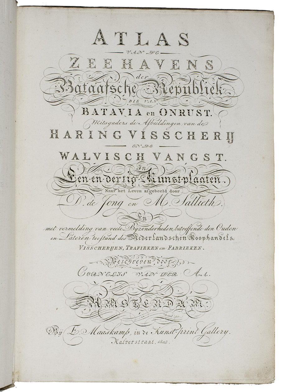
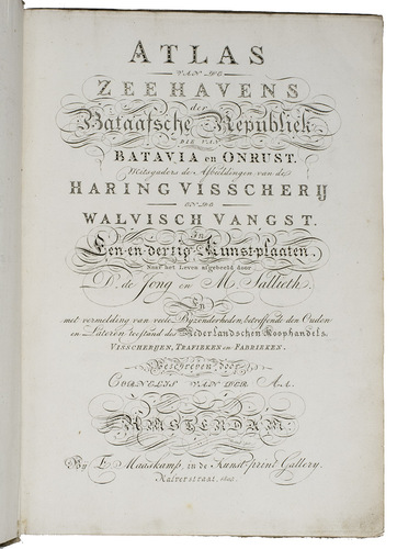
AA, Cornelis van der (illustrated by Dirk de JONG & Hendrik KOBELL jr.).
Atlas van de zeehavens der Bataafsche Republiek, die van Batavia en Onrust. Mitsgaders de afbeeldingen van de haring visscherij en de walvisch vangst. In een-en-dertig kunstplaaten naar het leven afgebeeld ...
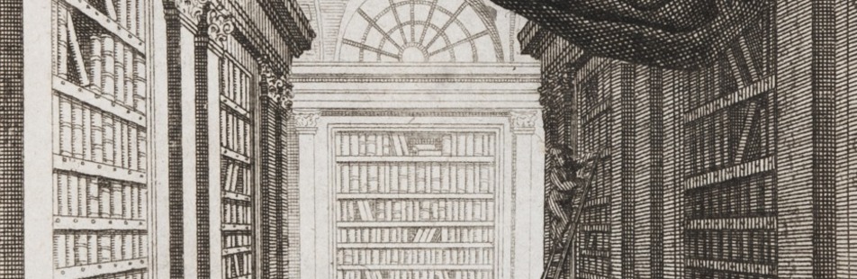
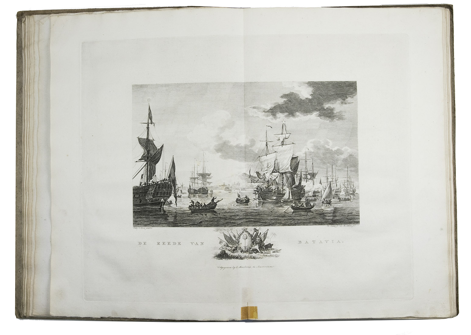
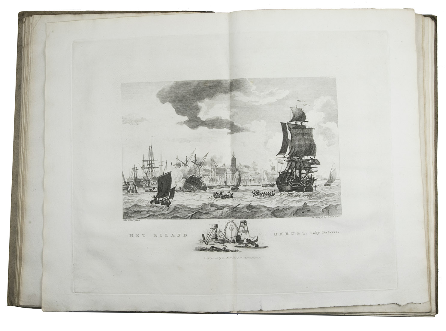
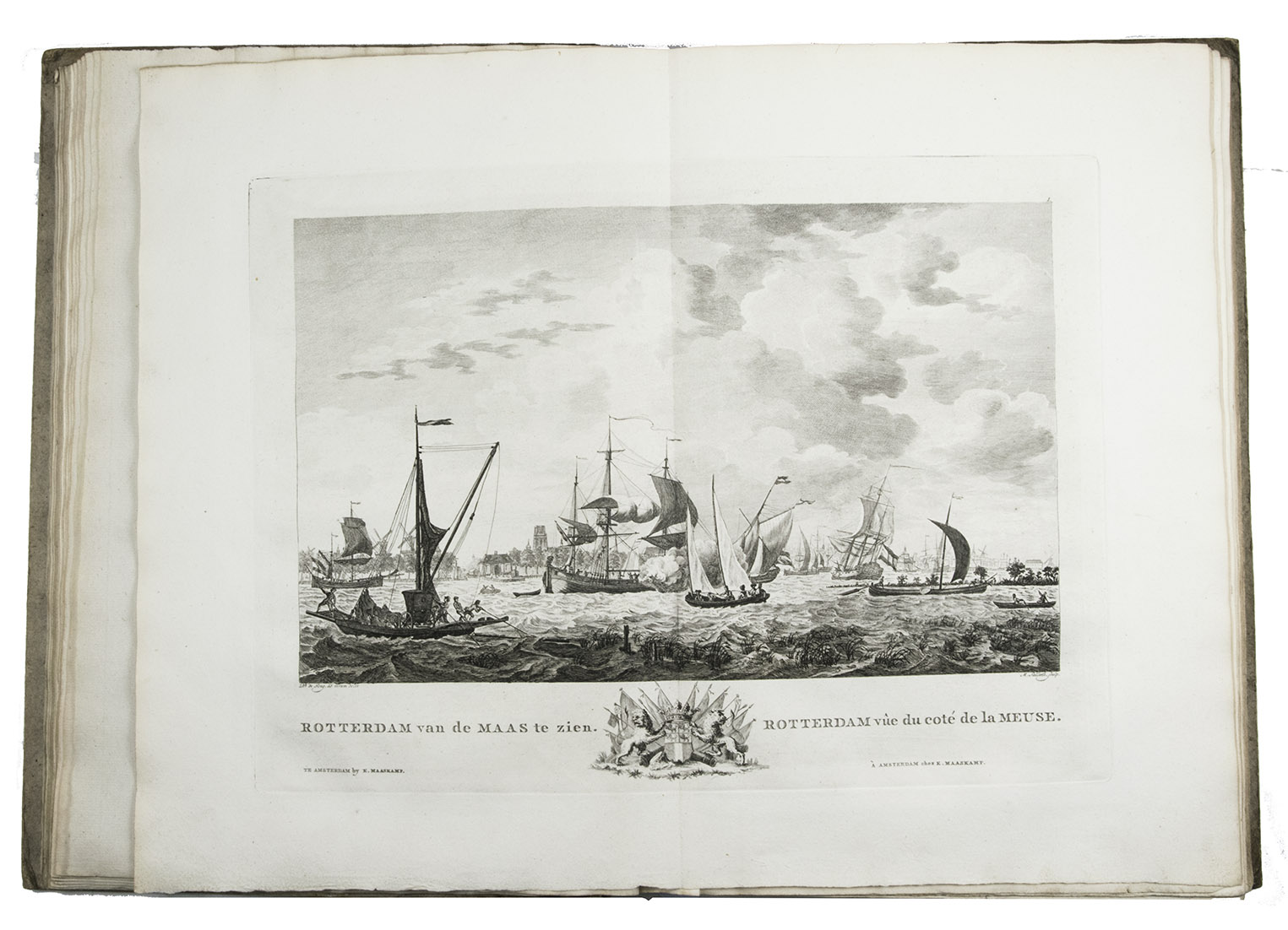
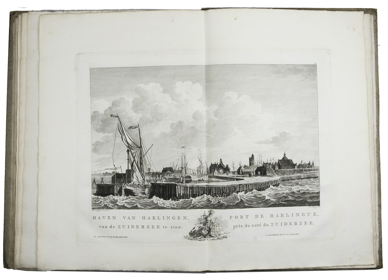
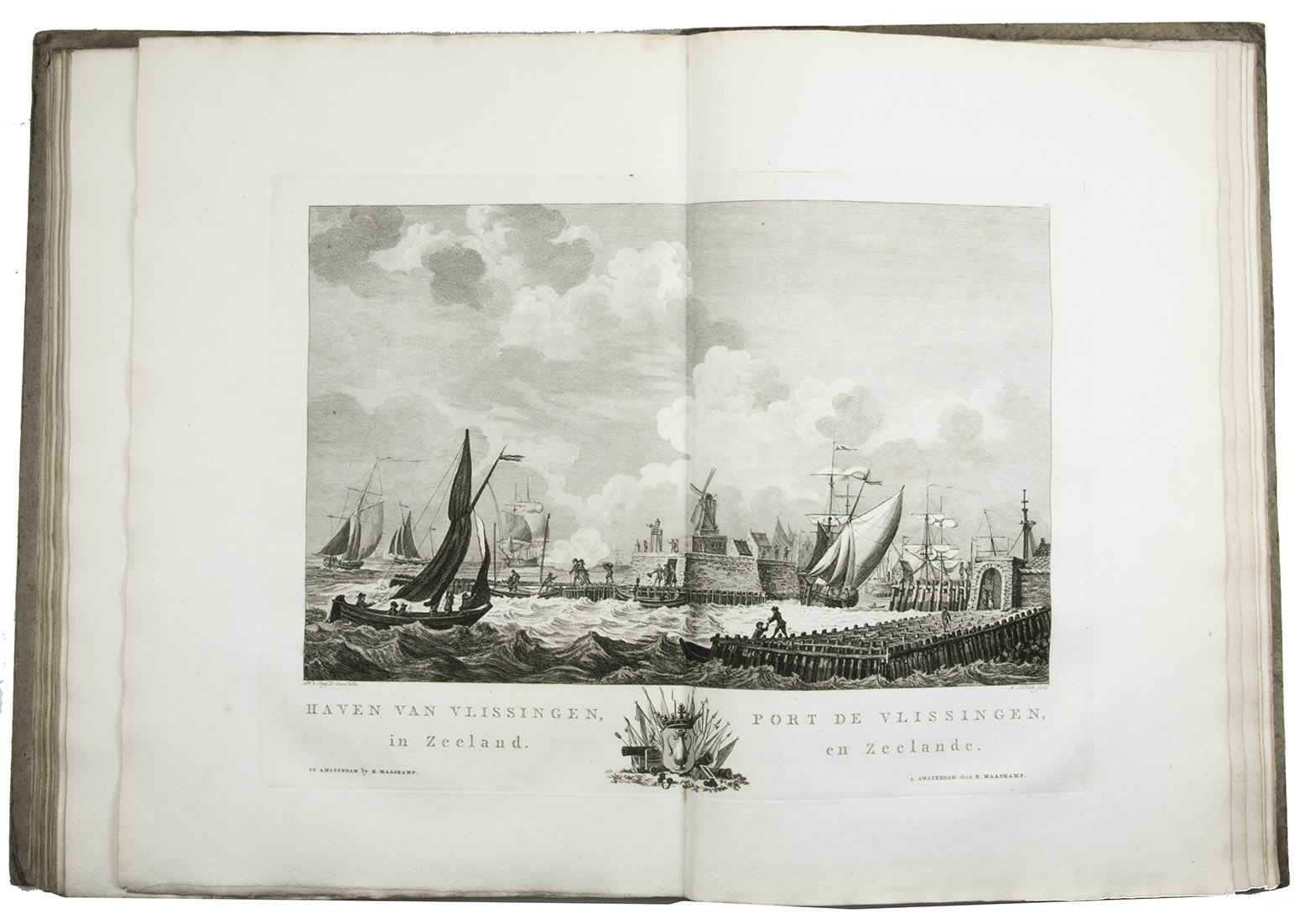
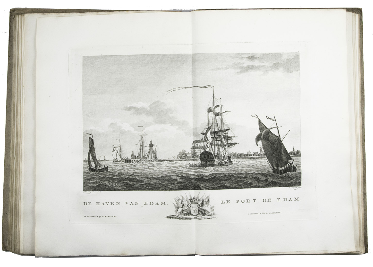
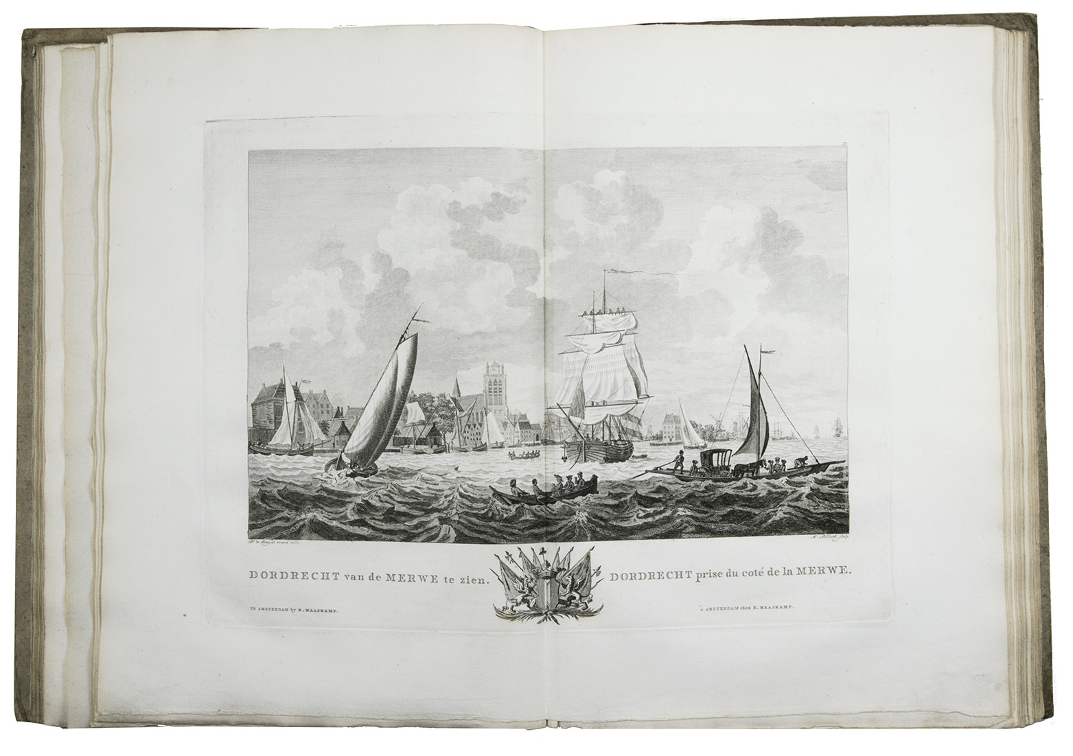
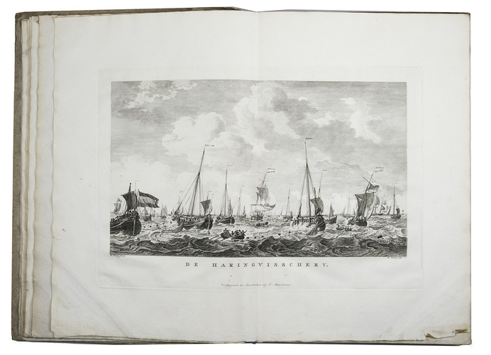
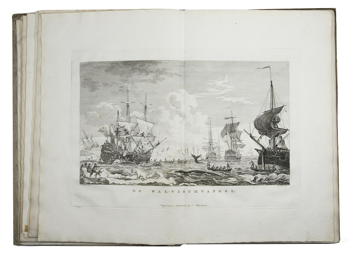
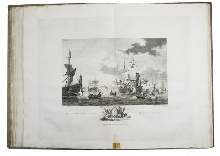
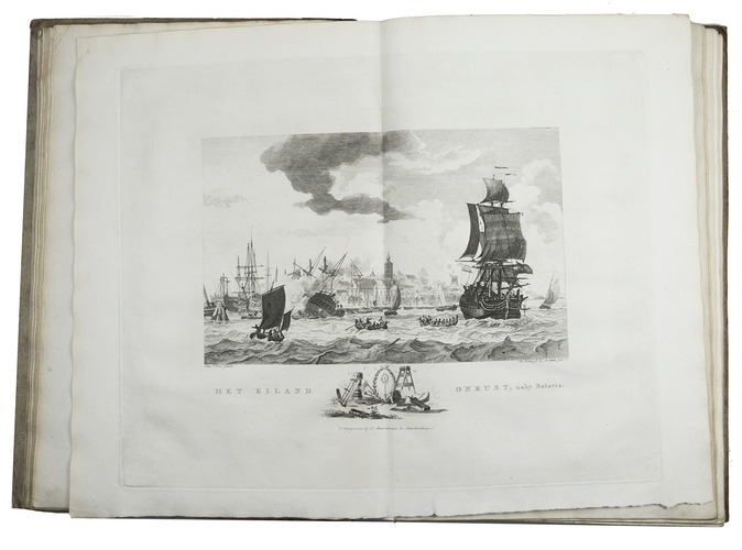
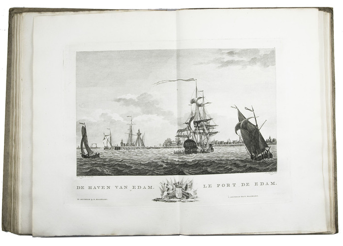
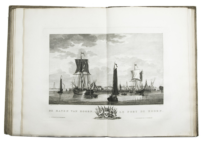
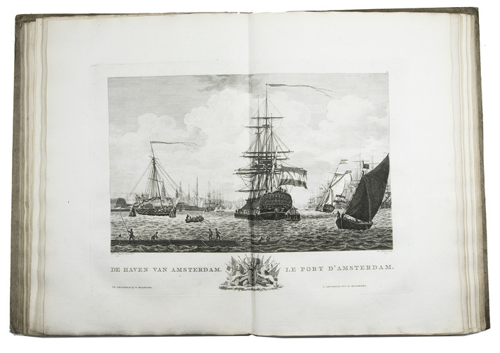
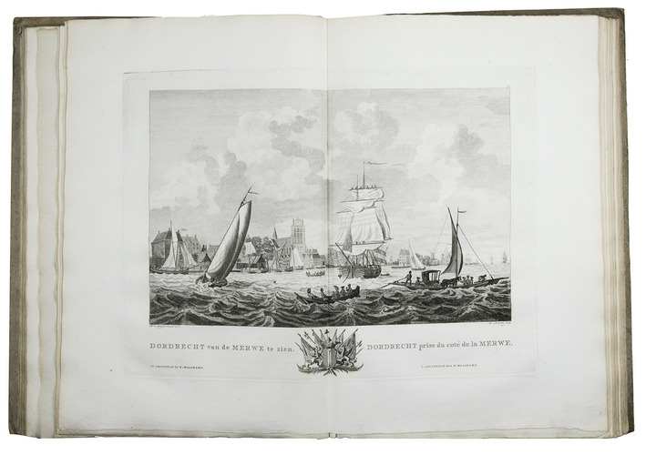
Amsterdam, Evert Maaskamp, [printed by Paul Etienne Briët?], 1805. Large folio (39.5 x 28.5 cm). With a finely engraved title-page in various styles of decorated lettering and flourishes, executed by Klockhoff, and 31 double-page engraved views (ca. 28.5 x 39.5 cm) showing Dutch harbours with a wide variety of sailing boats and ships, the harbours of Batavia and the island Onrust in the Dutch East Indies (now Djakarta and Pulau Kapal in Indonesia), and 2 views of herring fishing and whaling.
With the loosely inserted "prospectus" (actually an advertisement issued on publication):
[MAASKAMP, Evert]. Berigt aan kooplieden, zeevarenden en verzamelaars van vaderlandsche kunstprinten.
[Amsterdam], [Evert Maaskamp], printed by Paul Etienne Briët, [1805]. 4to (27.5 x 22 cm).
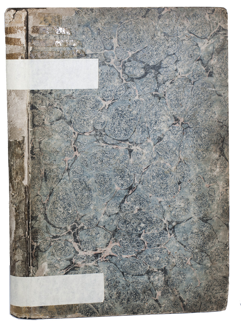
Contemporary boards (including a paperboard spine), as issued by the publisher. XII, 135, [1 blank] pp. plus engraved title-page, 31 plates and the loosely inserted prospectus.
€ 14,500
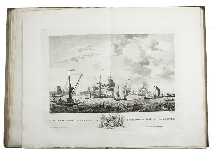
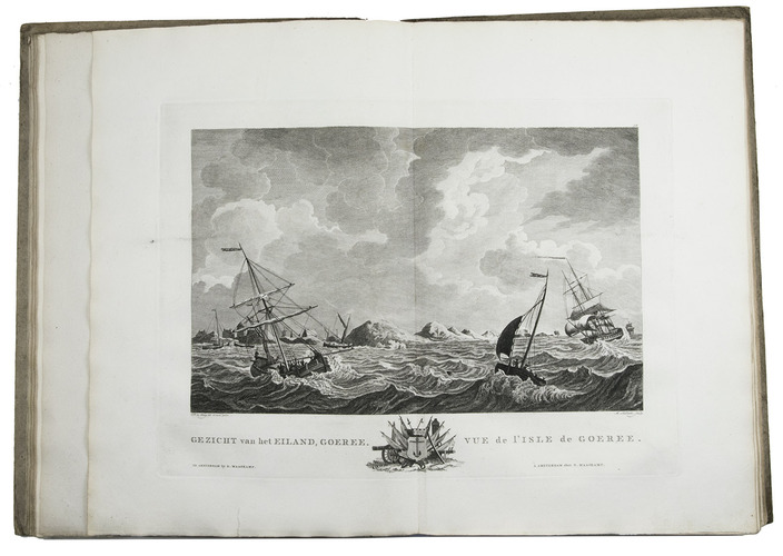
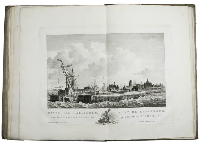
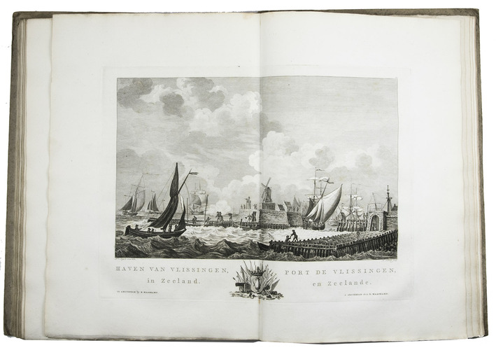
Rare complete copy of the first (and only early) edition of an account of harbours and roadsteads in the Netherlands and the Dutch East Indies, by the bookseller and historian Cornelis van der Aa (1749-1816), written to accompany the 31 beautiful and luxurious plates drawn (mostly from life) and engraved ca. 1772 to ca. 1781: large engraved views of the harbours, showing a wide variety of boats and ships, with people engaged in fishing or trade and 2 showing herring fishing and whaling ("De haring visschery" and "De walvisch vangst"). Loosely inserted in the present copy is the very rare prospectus (actually a separately distributed advertisement, issued at the time of publication), which gives much detailed information about the publication. The plates were first published as a print series and several single prints ca. 1779 to ca. 1781, but those showing the harbours and roadsteads at Batavia and the nearby island Onrust in the East Indies and those showing herring fishing and whaling do not generally appear in the sets of prints.
The greater part of the text (pp. 44-135, with the 25 numbered and 2 unnumbered plates) is devoted to the harbours of the Netherlands: Rotterdam (2 plates), Hellevoetsluis, Goedereede, Brielle, Dordrecht, Maassluis, Vlaardingen, Schiedam, Delfshaven, Amsterdam (2 plates), Texel (2 plates), Den Helder, Hoorn, Enkhuizen, Medemblik, Edam, Middelburg, Rammekens, Flushing, Zierikzee, Veere, Brouwershaven, Harlingen and Stavoren. It is the only major pictorial atlas of Dutch sea ports published in the Netherlands. The book collates: *-3*2 A-2L2 = 74 ll. plus 32 plates, including the engraved title-page. The engraved title-page and the prospectus name Maaskamp as the publisher. The book itself nowhere names the printer, but Paul Etienne Briët printed the prospectus and so perhaps also the book itself.
The plate size varies from about 26 x 38.5 to about 33.5 x 42 cm (image size about 18 x 28.5 to 25 x 35 cm).
The prospectus notes that the book is being published "heden" (today) and is available from Maaskamp and well over fifty book and print sellers thoughout the Netherlands and in Embden, all named. It notes that Maaskamp is publishing the book bound ("in eenen bekwamen atlas gebonden uit te geeven"), and it is offered in boards ("gebonden in een cartonnen band") for ƒ 21, a very expensive book at that time. The copies at the Royal Library in The Hague and the University of Amsterdam have Stormont marbled sides.
Three plates (herring fishery and the ports of Batavia and Middelberg, the last numbered 22 and the other two unnumbered) have small tears in the foot margin, repaired with tape that has left browned patches, none approaching the image or text, the plate showing Goeree (no. 12) has a small and faint smudge that very slightly affects a bit of the sky, and the tape used to affix the newspaper clipping has left brown patches in the first free endleaf, but otherwise internally in very good condition and hardly trimmed, with many deckles at the head and foot. The marbled paper covering the binding is rubbed, scuffed and has split at the hinge, with much of that on the spine lost, and the hinges have been crudely re-enforced with clear (and later masking) tape, but the boards are still attached to the sewing supports. Magnificent views of the busy harbours of the Netherlands and the Dutch East Indies ca. 1780. Ron Brand, "Deining in de duinen: maritieme prenten op kasteel Keukehof", in: G. Jaspers, ed., Zeehelden, ... op kasteel Keukenhof = Jaarboek kasteel Keukenhof, 4 (2010), pp. 11-30, at pp. 14-23 (based on an incomplete set of the prints); Cat. NHSM, p. 319; Molhuysen-Blok I, 3; Saakes (4), 1806, p. 245; Tiele, Land- en volkenkunde 3; for the artists and engravers (and Pieter Yver): Scheen, passim.: Eveline Koolhaas-Grosfeld, De ontdekking van de Nederlander: in boeken en prenten rond 1800, pp. 68-70, citing the prospectus (without location) in note 91 on p. 335; not in WorldCat.
Related Subjects: