HERING, Johannes Hermanus.
Beschryving van het eiland Curaçao, en de daar onder hoorende eilanden, . . .
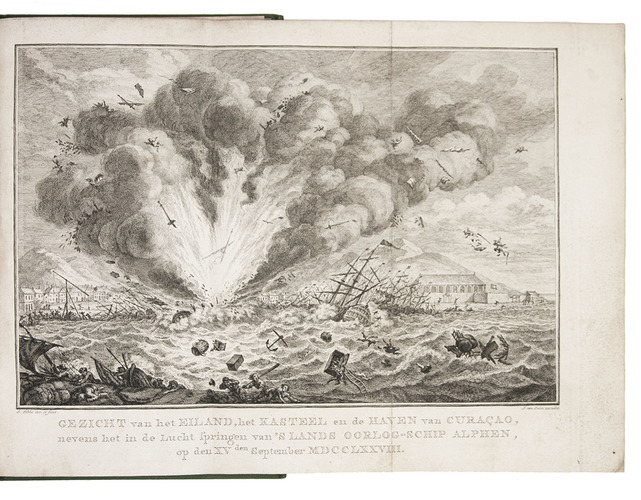
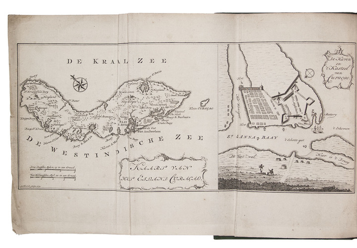
Amsterdam, Johannes van Selm, 1779. 8vo. With 2 folding engraved plates, one providing a map of Curaçao and plan of Fort Amsterdam and its surroundings, and the other showing the spectacular explosion of the warship Alphen on 15 September 1778. Green cloth (ca. 1930?) by George Fredrik Lodewijk Ophof in Rotterdam. [6], 89, [1 blank] pp.
€ 2,500
First and probably the only early edition of a description of the islands of Curaçao, Bonaire and Aruba, with a folding map of Curaçao and plan of Fort Amsterdam, and a folding plate showing the explosion of the Dutch warship Alphen on 15 September 1778.
With binder's ticket of G.F.L. Ophof, probably the younger since the elder died in 1925, and the owner's label and owl bookplate of the jurist and bibliophile F.C. Koch (1873-1957), all on the front paste-down. The map with some folds, slightly soiled, otherwise in good condition. JCB 2569; Muller, America 506; Sabin 31486 (see also 17983); STCN (9 copies); Tiele, Bibl. 469 (misdated 1789); not in Church; Streeter.
Related Subjects: