VRIES, Klaas de; Evert FLORYN (ed.); S. HOLLANDER (rev.).
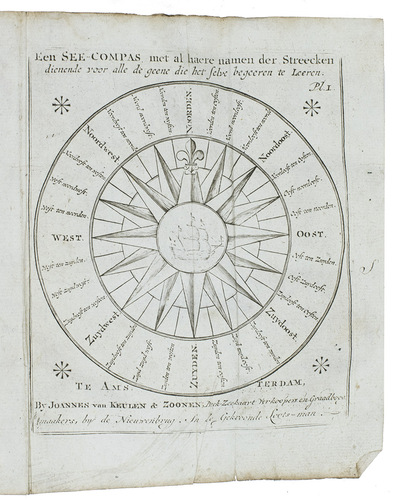
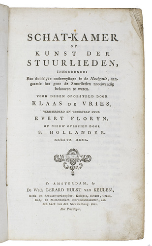
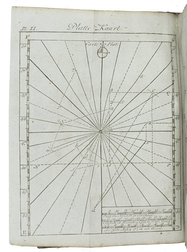
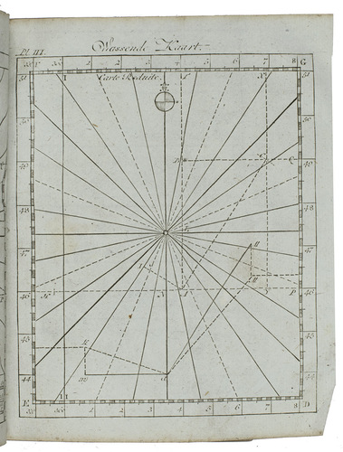
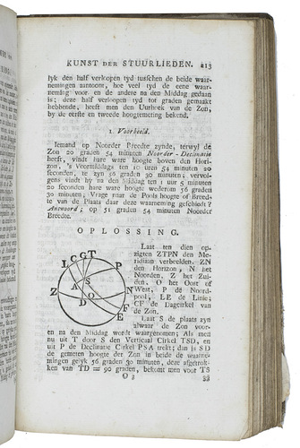
Schat-kamer of kunst der stuurlieden, inhoudende: een duidelyke onderwysinge in de navigatie, aangaande het gene de stuurlieden noodwendig behooren te weten.Amsterdam, widow of Gerard Hulst van Keulen, 1812. With 4 folding plates (1 of a compass and the other 3 on drawing "flat" maps and maps with an enlarged latitude), many mathematical and geographical woodcuts in the text, some tables in the text.
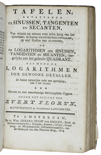
With: (2) FLORYN, Evert. Tafelen, bevattende de sinussen, tangenten en secanten, van minuut tot minuut voor ieder boog van het quadrant, in hunne natuurlyke getallen, op een' radius van 10.000.000, ... als mede de logarithmen der gewoone getallen, in hunne natuurlyke orde van opvolging, van 1 tot 10.000.
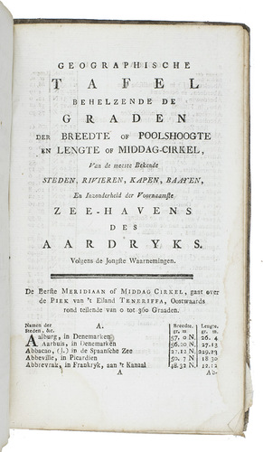
Amsterdam, widow of Gerard Hulst van Keulen, 1815. The whole work consisting of tables and with some woodcut tailpieces.With: (3) Geographische tafel behelzende de graden der breedte op poolshoogte en lengte of middag-cirkel van de meest bekende steden, rivieren, kapen, baayen. ...
Amsterdam, widow of Gerard Hulst van Keulen, 1812.
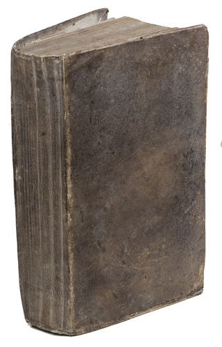
3 works in 1 volume, the first in 2 parts. Large 8vo. Contemporary goatskin parchment over stiff boards, blue sprinkled edges. [6], XVI, 296; 220; [239], [1 blank]; 41, [3 blank] pp.
€ 2,950
Ad 1: Rare tenth edition of a standard practical manual on the art of navigation, written by Klaas de Vries (1716-1766), a mathematics teacher in Amsterdam, and improved by S. Hollander, who also put the three works together. The fact that De Vriess manual went through eleven editions, the last published in 1818, testifies to the popularity and usefulness of the book. We find only two copies of this rare 1812 edition in WorldCat, one in the Delft University of Technology Library and one in the Bibliothèque Nationale de France.
Ad 2: Mathematical work by Evert Floryn (1752-1819), a mathematician and (hydrographic) surveyor, with many tables of trigonometric functions and logarithms, printed as stereotypes. The title-page of the second part of the Schat-kamer of kunst der stuurlieden explicitly mentions the Tafelen, so - as in earlier editions - they were clearly intended for publication together, to make a complete work on the art of navigation.
Ad 3: Geographical work with the longitude and latitude of the most important cities, rivers, capes, bays and ports of the earth, which perhaps brought some practical and efficient help when one tried to navigate at sea. It is added by S. Hollander, as the preface of the Schat-kamer says, as a useful appendix to the more mathematical navigation manuals to make it a complete guide for 18th-century sailors.
Binding dust-soiled and a little worn, some corners a little frayed, front paste-down and last endpaper half loose, a few paper corners in the second work gone without loss of text, with a tear in leaf P7, some water stains in the head margin (not affecting the text) and some other occasional stains. Otherwise a rare edition in good condition. Ad 1: Crone Library, 757 & 758; WorldCat (2 copies); cf. Bierens de Haan 5197; Cat.. NHSM, p. 272 (other eds.). Ad 2: Cat. NHSM, p. 686; Crone Library 76a/765b.
Related Subjects: