OWEN, William Fitzwilliam (ed.) & Richard OWEN.
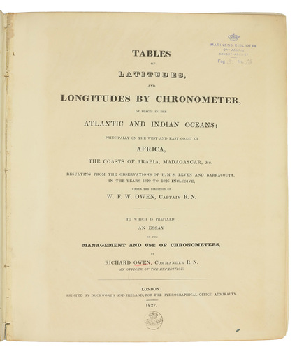
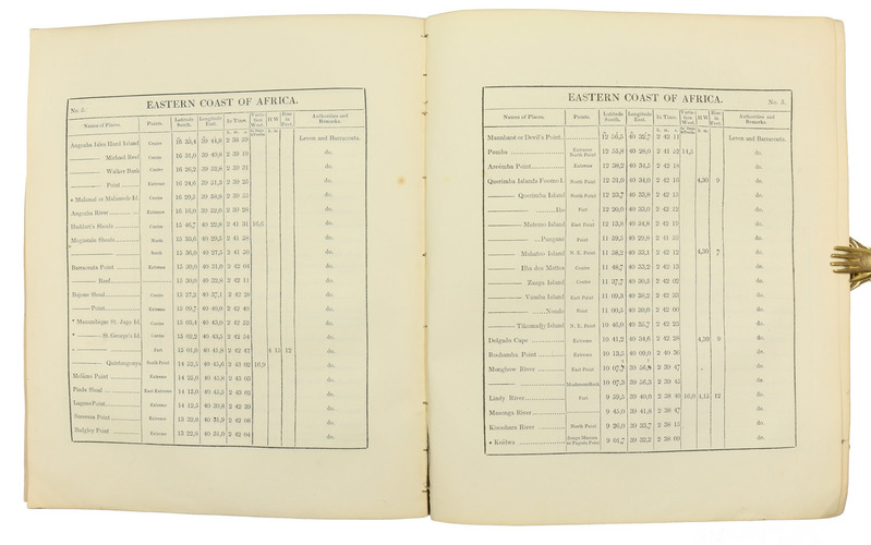
Tables of latitudes, and longitudes by chronometer, of places in the Atlantic and Indian Oceans; principally of the west and east coast of Africa, the coasts of Arabia, Madagascar. &c. resulting from the observations of H.M.S. Leven and Barracouta, in the years 1820 to 1826 inclusive, ... To which is prefixed an essay on the management and use of chronometers ...
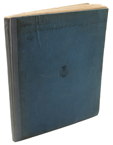
London, George Duckworth and William Ireland, 1827. 4to. Contemporary blue boards for the Danish Navy Library, later backed with cloth. [2], 33, [3], 16, [36], 8 pp
€ 2,500
First edition of an important work in the history of navigation and probably the first manual for the use of the marine chronometer. Richard Owen (1896-1863), an Irish Lieutenant in the royal navy, wrote the account of the chronometer, while the tables are based on observations conducted under the direction of Vice-Admiral William Fitzwilliam Owen (1774-1857). The two men appear not to be related. The places referenced along the Eastern coast of Arabia include Ras Morebat, the Khuriya Muriya Islands, Ras al-Hadd and Muscat. While John Harrison famously demonstrated the accuracy of his chronometer in 1761, making it possible to reliably and precisely determine longitude at sea, it was not acknowledged until 1773. James Cook and William Bligh used Harrisons chronometers on their famous voyages in the 1770s and 1780s, but the chronometer really superseded other methods only when less expensive models appeared in the early 19th century. The present book met the demand for instructions on the use of this new device.
With the stamp of the Royal Danish Navy Library on the title-page and several contemporary handwritten corrections in ink. Binding slightly loose, corners bumped. Final 8 pp. of errata printed on paper of lesser quality and therefore slightly browned but otherwise internally fine. WorldCat 4878142.
Related Subjects: