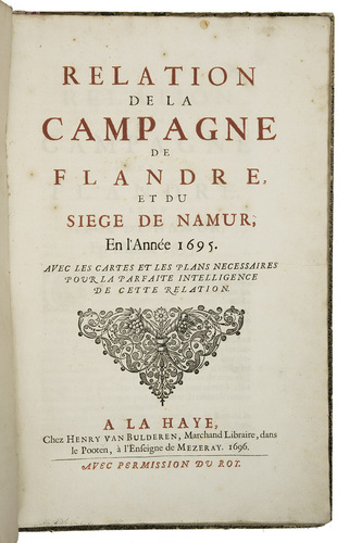
[TRONCHIN DE BREUIL, Jean].
Relation de la Campagne de Flandre, et du Siege de Namur, en l'année 1695.
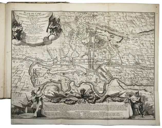
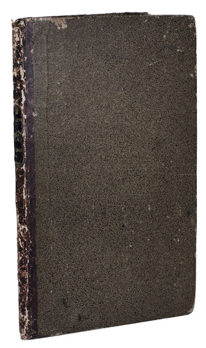
The Hague, Henry van Bulderen, 1696. Folio. With the title-page in red and black, with 4 folding engraved maps and plans of the Namur region and of the fortifications of the city of Namur (plate size ca. 58 x 44 cm), by Nicolaas Visscher II (= Claes Claesz. Visscher (1618-1709)) after designs by Ottmar Elliger the younger, a large arabesque tailpiece on the title-page and a different one at the end, and one woodcut decorated initial. Contemporary half roan (sheepskin). 61, [1 blank) pp.
€ 1,750
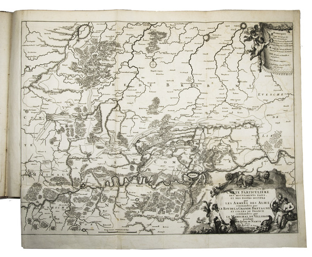
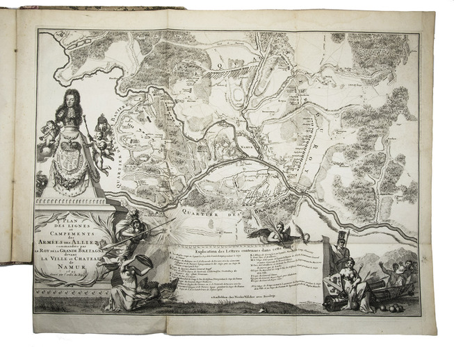
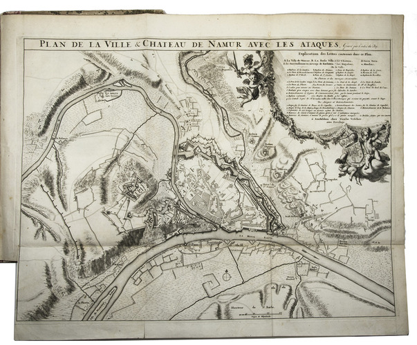
First edition of the account of the battles near Namur against the French by William III of Orange, who married Mary, Queen of England. William took Namur with an army of English, Dutch, and Germans after a siege of 57 days on 26 August 1695. Also included is the account of the victory over the French army on 19 August 1695, under the command of the Duke of Villeroy and Marshall Boufflers. Barbier quotes a manuscript note in the Meerman copy, sold in auction in 1824: "Par M. Doph, quartier-maitre general, et apres general des dragons", so Tronchin de Breuil probably based his work on Doph's notes.
The plans and maps are titled: "Plan de la Ville & Chateau de Namur avec les Ataques", "Plan des Lignes et Campements des Armées des Alliez, commandées par le Roy de la Grande Bretagne devant la Ville et Chateau de Namur", "Plan du Camp que Prit l'Armée des Alliés, commandée par Son Altesse Mr. le Prince de Vaudemont, le 30e du Mois de Iuin à Woutergem", and "Carte Particuliere des Mouvements faits et des Postes occupez par les Armes des Aliez, commandées par le Roy de la Grande Bretagne, et celles de France, commandées par le Marechal de Villeroy pendant le Siege de Namur". All maps are decorated with fine cartouches and dated 1695. Van Bulderen published a second edition, in the same format with the same collation and very similar typography, but the present first edition is much rarer.
Binding slightly rubbed, otherwise in fine condition. Muller, Historieplaten 2872, 2917, 2909, 2926; STCN (2 copies); cf. Hollstein XXXVIII, p. 269 ff. (Claes Claesz. Visscher) 11 & 13 (ill.: XXXIX, p. 231) (2 of the 4 plates); Van der Krogt, Advert. kaarten 79: "Plan de la Ville & Chateau"; not in Nijhoff, Bibl. hist. Neerl.
Related Subjects: