Categories
Shopping cart (0 items € 0)
Advanced search

Cartography & Exploration / Atlases, Charts, Maps & Globes

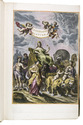
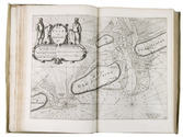
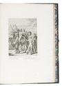
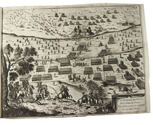
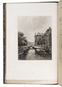
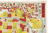
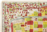
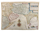
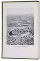
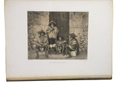
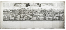
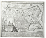
Dutch trade, whaling, herring fishery, etc., with magnificent views of the harbours of the Netherlands
and the Dutch East Indies ca. 1772-ca. 1781, including a wide variety of boats and ships

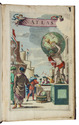
AA, Cornelis van der (illustrated by Dirk de JONG & Hendrik KOBELL jr.). 
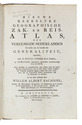
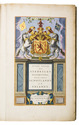
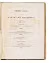
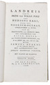
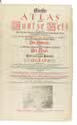
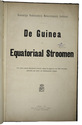
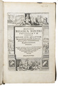
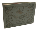
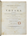
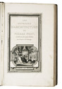
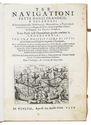
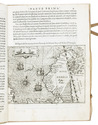
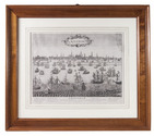
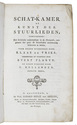
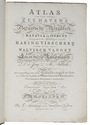
Atlas van de zeehavens der Bataafsche Republiek, die van Batavia en Onrust. Mitsgaders de afbeeldingen van de haring visscherij en de walvisch vangst. In een-en-dertig kunstplaaten naar het leven afgebeeld ...
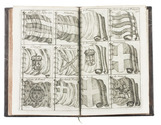
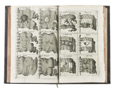
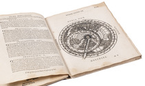
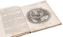
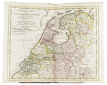
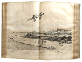
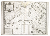
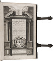
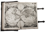
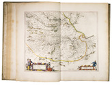
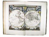
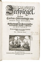
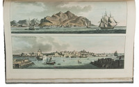
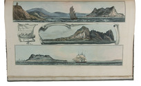
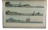
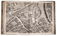
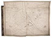
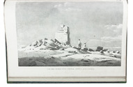
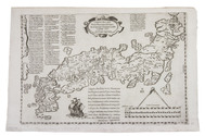
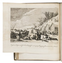
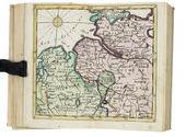
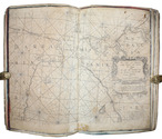
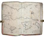
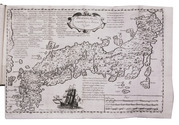
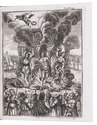
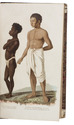
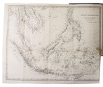
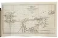
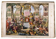
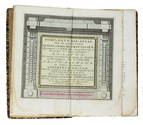
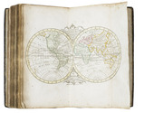
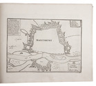
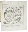
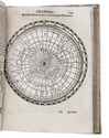
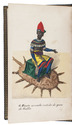
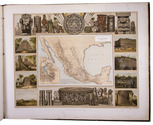
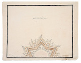
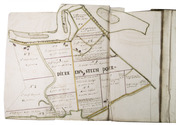
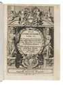
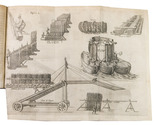
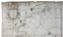
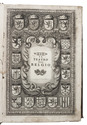
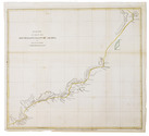
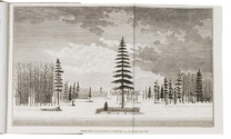
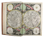
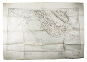
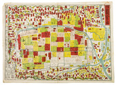
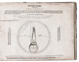
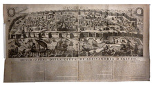
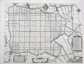
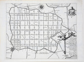
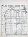
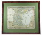
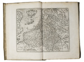
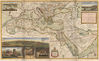
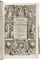
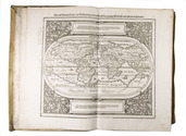
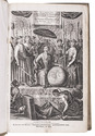
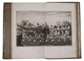
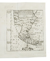
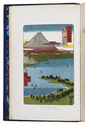
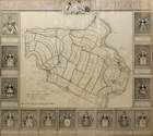
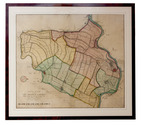
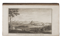
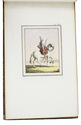
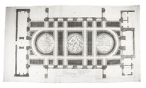
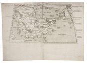
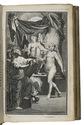
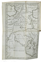
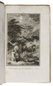
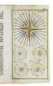
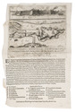
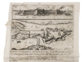
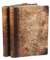
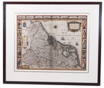
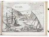
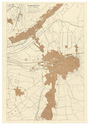
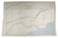
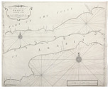
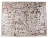
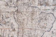
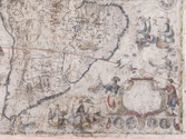
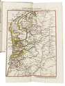
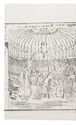
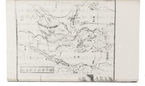
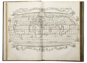
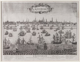
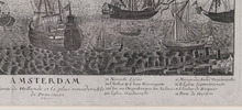
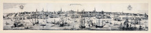
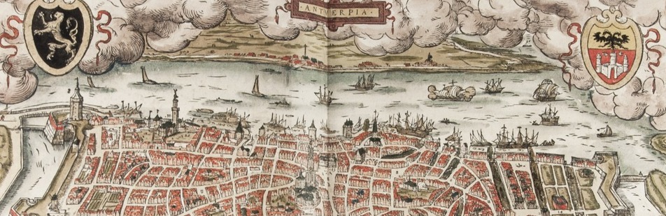
Amsterdam, Evert Maaskamp, [printed by Paul Etienne Briët?], 1805. Large folio (39.5 x 28.5 cm). With a finely engraved title-page in various styles of decorated lettering and flourishes, executed by Klockhoff, and 31 double-page engraved views (ca. 28.5 x 39.5 cm) showing Dutch harbours with a wide variety of sailing boats and ships, the harbours of Batavia and the island Onrust in the Dutch East Indies (now Djakarta and Pulau Kapal in Indonesia), and 2 views of herring fishing and whaling.
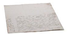
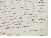
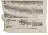
With the loosely inserted "prospectus" (actually an advertisement issued on publication):
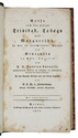
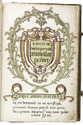
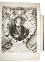
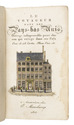
[MAASKAMP, Evert]. Berigt aan kooplieden, zeevarenden en verzamelaars van vaderlandsche kunstprinten.
[Amsterdam], [Evert Maaskamp], printed by Paul Etienne Briët, [1805]. 4to (27.5 x 22 cm).
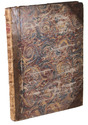
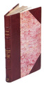
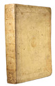
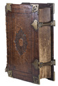
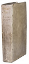
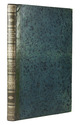
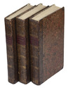
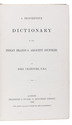
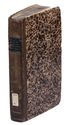
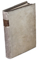
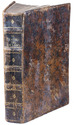
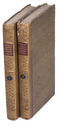
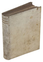
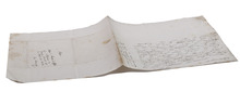
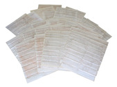
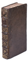
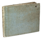
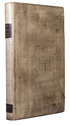
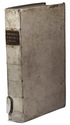
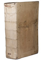
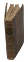
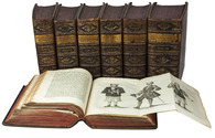
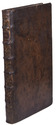
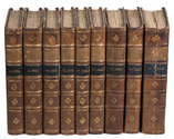
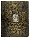
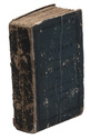
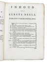
Contemporary boards (including a paperboard spine), as issued by the publisher. XII, 135, [1 blank] pp. plus engraved title-page, 31 plates and the loosely inserted prospectus. Full description
€ 14,500
Order Inquire Terms of sale

Exploring the Amazon River from Quito to the east with the extremely rare map

ACUÑA, Cristóbal Diatristán de. Relation de la Riviere des Amazones traduite par feu Mr de Gomberville de l'Académie Françoise. Avec un dissertation sur la riviere des Amazones pour servir de preface.
Paris, Claude Barbin, 1682. 4 parts in 2 volumes. 12mo. With a folding engraved map of the Amazon River. Contemporary calf, gold-tooled spine. 199, [1; 4], 218; 238, [2 blank]; 206 pp. Full description
€ 14,500
Order Inquire Terms of sale

Extensively illustrated classic of cosmography, geodesy, mensuration, perspective and optics

APIANUS (APIAN), Petrus and Gemma FRISIUS. Cosmographia.
Antwerp, Jan Verwithagen (colophon: printed by Verwithagen), 1574. 4to. With a large woodcut on the title-page (with a terrestrial globe and other instruments); 4 printed paper volvelles with moving parts and a woodcut sun dial with a string attached to its centre; a folding woodcut cordiform mappa mundi (block size 19×27.5 cm) with letterpress text in the margins; well over 100 further woodcut illustrations, diagrams, maps, etc., in the text. Recased in 17th-century(?) limp sheepskin parchment. [2], 64, [2] ll. plus folding woodcut. Full description
€ 12,500
Order Inquire Terms of sale

Abu Dhabi's Oil industry: the Israeli perspective

[MAP - ARABIAN PENINSULA OIL RESOURCES]. Neft ba-mizrah ha-tikhon. Zikaynot, shadot, tzinorot, batei zikuk. [= Oil in the Middle East. Concessions, oilfields, pipelines, refineries].
Tel Aviv, Israel Defence Forces, General Staff, [1957]. 56 x 82.5 cm. Chromolithographic map of the Arabian Peninsula, from Turkey in the north to the Indian Ocean in the south, and covering Saudi Arabia, Egypt, Israel, Palestine, Jordan, Syria, Lebanon, Iraq, Iran, Kuwait, Bahrain, Qatar, United Arab Emirates, Oman, North and South Yemen. Scale 1:5,000,000. Scale and key in Hebrew inset to top-right, inset explanatory panels in Hebrew and English, compass rose in Saudi Arabia. Folded. Full description
€ 7,500
Order Inquire Terms of sale

Rare study describing a 622 AH (1225/26 CE) celestial globe with Cufic lettering, with 3 folding plates

ASSEMANI, Simone. Globus caelestis Cufico-Arabicus Veliterni Musei Borgiani ... illustratus. Praemissa ejusdem De Arabum astronomia dissertatione et adjectis duabus epistolis Cl. Josephi Toaldi.
Padua, Seminary printing office, 1790. Small folio (21.5 x 29.5 cm). With 3 large folding engraved plates. Contemporary green half calf, gold-tooled spine, marbled sides. [16], CCXIX, [9] pp. Full description
€ 28,000
Order Inquire Terms of sale

A wonderfully illustrated rare Dutch compilation of Apian

[ASTRONOMY - APIAN and others]. S.D.V.B (compiler). Een nieu constich boeck inde geometrie en de astronomiae, voor desen noyt in druck gheweest, ende is in ses stucken afghedeylt ...
(Colophon:) Rees, Abraham Wijlicx, 1608. Folio (30 x 19.5 cm). With a half-page woodcut illustration and some decorations built up from typographic ornaments on the title-page, 74 woodcuts of various sizes in text, many (near) full- and half-page, with some woodcut decorated initials (various series), a headpiece built up from typographic ornaments and an ornamental woodcut tailpiece. Contemporary vellum, sewn on four supports laced through the joints. 111, [1] pp. Full description
€ 15,000
Order Inquire Terms of sale

Graphically stunning 3-volume historical manuscript atlas

[ATLAS - HISTORICAL]. Atlas historique. - Souvenirs historiques. - Tableaux et cartes.
[Montpellier?], [date on spine of vol. 1:] 1851. 3 volumes. Folio (vol. 1) and large 4to (vols. 2-3). Neatly written manuscripts on paper with 23 graphically vibrant maps, coloured in outline with subtly shaded washes in grey (for the coasts) and numerous bright colours (for political boundaries), and with calligraphic headings. Contemporary bindings: vol. 1 red half goatskin; vol. 2 black half goatskin; vol. 3 black sheepskin. [1], [26 double]; [1], [22 double]; [1], 30 double, [1] ll. Full description
€ 1,750
Order Inquire Terms of sale

2nd known copy of the only Antwerp edition (1652) of Colom’s 1635 atlas of the Low Countries

[ATLAS - LOW COUNTRIES]. [COLOM, Jacob Aertsz.]. La description de XVII. Provinces, avec les Terres Circonvoicins, a Scavoir Champagnie, Picardie, Liege, Retelle, &c.
Antwerp, Jan Huyssens, 1652. 4to (18 x 14.5 cm). With a double-page letterpress title-page, with a frame built up from typographic ornaments, and 39 unnumbered double-page engraved maps of the northern and southern Low Countries by Jacob Aertsz. Colom, each map coloured in outline. Interleaved with 38 blank leaves and with a manuscript table of contents ([3], [3 blank] pp.) at the end. Later 17th-century mottled calf. Double-page title-page and 39 double-page maps. Full description
€ 4,950
Order Inquire Terms of sale

Presentation copy by the author

AVEZAC-MACAYA, Armand D'. Considérations géographiques sur l'histoire du Brésil. Examen critique d'une nouvelle histoire générale du Brésil recemment publiée en portugais a Madrid par M. François-Adolphe de Varnhagen chargé d'affaires du Brésil en Espagne. Rapport fait à la société de géographie de Paris dans ses séances des 1er Mai et 5 Juin 1857.
Paris, L. Marinet, 1857. 8vo. With 2 folding maps. Modern gold-tooled red half morocco, marbled boards, preserving the printed wrappers. [4], 271, [1] pp. Full description
€ 600
Order Inquire Terms of sale

Very rare map of North Holland in 1575

BEELDSNIJDER, Joost Jansz. Vernieuwde Kaart van Noordholland en Westfriesland, benevens het voornaamste gedeelte van Rhynland, en daar aan grenzende Landen.
Amsterdam, Yntema & Tieboel, 1778. (92 x 68 cm). Large hand-coloured engraved map on 2 sheets, decorated with arms, figures and products from the regions shown, and with the title at the foot. Framed. Full description
€ 7,250
Order Inquire Terms of sale

Keur Bible with 6 maps and 51 plates

[BIBLE - DUTCH]. Biblia, dat is de gantsche H. Schrifture, vervattende alle de Canonijcke Boecken des Ouden en des Nieuwen Testaments.
Dordrecht, Hendrick, Jacob and Pieter Keur; Amsterdam, Marcus Doornick and Pieter Rotterdam, 1702. Large folio (42.5 x 27 cm). With engraved title-page, 2 letterpress title-pages with woodcut printer's device, 1 half-title, double-page engraved world-map, 5 double-page engraved maps and 1 plan, 51 engraved plates with 6 illustrations each, the latter by Lamberecht Causé and Nicolaas Gommerse. Contemporary blind-tooled calf over wooden boards, with brass cornerpieces, clasps and catches. [20], 302; [2], 134; [12], 164; [2], 66 ll. Full description
€ 4,500
Order Inquire Terms of sale

Large paper copy of the first Dutch edition of Blaeu's great atlas of cities and towns of the Dutch Republic, with 320 mostly double-page maps, plans and views

BLAEU, Joan. [Toonneel der steden van de Vereenighde Nederlanden, met hare beschrijvingen, ...].
With: [Toonneel der steden van s Konings Nederlanden, met hare beschrijvingen, ...].
[Amsterdam, Joan Blaeu, 1652]. 2 volumes. Atlas folio (57 × 37 cm). With two engraved architectural title-pages, each with a blank central panel where a letterpress slip with the title and the publishers name would have been pasted; 181 (Dutch Republic) & 139 (Spanish Netherlands) maps, plans and views plus 2 smaller engravings in text; 20 woodcut illustration figures in the text. Uniform, early 18th-century(?) half red sheepskin. Full description
€ 68,500
Order Inquire Terms of sale

Fine untrimmed copy of a pilot guide, with coloured maps and aquatint profiles

BOUGARD, René and John Thomas SERRES. The little sea torch: or, true guide for coasting pilots.
London, J. Debrett for the "author" [Serres], G. & W. Nicol, et al. [printed by T. Rickaby], 1801. Large folio (47 x 30 cm). With 20 numbered aquatint plates containing 137 coastal profiles, and 12 partly numbered engraved plates containing 24 maps of port cities, harbours, islands and the Strait of Gibraltar. All coastal profiles and maps beautifully and subtly coloured by a contemporary hand. Contemporary boards. VI, 144, [5] pp. Full description
€ 14,500
Order Inquire Terms of sale

Excellent early 20th-century facsimile of Marcgraf's famous large wall map of Dutch Brazil, in colour

[BRAZIL - WALL-MAP]. MARCGRAF, Georg and Frans POST. Brasilia qua parte paret Belgis. Nederlands Brasilien.
The Hague, Martinus Nijhoff, 1923 (after the original published in Amsterdam by Joan Blaeu in 1647). ca. 120 x 160 cm. Large wall map of Dutch Brazil, comprised of ca. 11 paper leaves pasted on linen to form the entire rectangular map, mounted between two black wooden rods at the head and foot of the map. The map shows an exact representation of the Brazilian coast from Rio Grande do Norte and the Sergipe region, all illustrative details and the cartouches are beautifully professionally coloured and the map is accompanied by a descriptive text about Dutch Brazil along the foot of the map, including a decorated initial. Full description
€ 9,750
Order Inquire Terms of sale

Early 19th century edition of a woodcut plan imaging Nagasaki and Deshima

[MAP] BUNKINDO HAN. Hishu Nagasaki (no) zu (plan of Nagasaki, Hizen province).
(Nagasaki, Bunkindo, 1821). 615 x 870 mm. Large folding woodcut map of the port and city of Nagasaki, printed in three colours (ochre, blue and green) on four sheets. In Japanese ochre paper etui decorated with blue and white flowers and title label with Japanese characters pasted on, preserved in later dark blue cloth slipcase in Japanese style closing with two ivory clasps. Full description
€ 2,950
Order Inquire Terms of sale

Beautifully illustrated expeditions searching for ancient Egyptian antiquities

CAILLIAUD, Frédéric and Bernardino DROVETTI. Voyage a l'Oasis de Thèbes et dans les déserts situés a l'orient et a l'occident de la Thébaïde, fait pendant les années 1815, 1816, 1817 et 1818.
Paris, Royal press, 1821. With 24 numbered engraved plates, including 2 engraved maps (1 folding), 1 plate coloured by hand and 1 double-page.
With: (2) CAILLIAUD, Frédéric and Bernardino DROVETTI. Voyage a l'Oasis de Syouah ... pendant leurs voyages dans cette oasis, en 1819 et en 1820.
Paris, Rignoux, 1823. With 20 numbered plates (1 engraved map and 19 lithographed plates). 2 works in 1 volume. Folio. Contemporary green goatskin morocco, richly gold-tooled spine. [2 blank], XVII, [1], 120; [12], 28 pp. Full description
€ 19,500
Order Inquire Terms of sale

Rare Dutch translation of a work on Spanish America, with 4 maps

CAMPBELL, John. De tegenwoordige staat der volken van het Spaansche ryk in Amerika, met een byzonder verhaal, van den koophandel uit Oud-Spanje, met de galjoenen, flota, &c.; en van den verboden handel der Hollanders, Engelschen, Franschen, Deenen en Portugezen, in de West-Indiën.
Amsterdam, Bernardus Mourik, [ca. 1745 or ca. 1748]. 8vo. With 4 folding engraved maps, showing the city and harbours of Veracruz, Havana, Portobelo and Cartagena. Contemporary red half sheepskin (roan). [8], 328 pp. Full description
€ 1,200
Order Inquire Terms of sale

Magnificent engraving of the 1661 mosaic floor map of the world in 2 hemispheres, incorporating Tasman's discoveries not otherwise published for decades

[PLAN - AMSTERDAM CITY HALL]. [CAMPEN, Jacob van]. Le pavé de la grand' sale des bourgeois.
[Amsterdam, Gerard Valk, 1719]. Very large engraved folding plan comprising 1 1/2 sheets (measuring 46 x 83 cm as assembled), engraved by Danckert Danckertsz. and his father after drawings by Jacob Vennekool, including the two hemispheres of the world map and a celestial map of the constellations of the northern hemisphere (each 10 cm in diameter). Full description
€ 2,500
Order Inquire Terms of sale

Winds and the weather in the coast of India and the Arabian and Persian Gulf:
first edition of a rare meteorological work

CAPPER, James. Observations on the winds and monsoons; illustrated with a chart and accompanied with notes, geographical and meteorological.
London, Charles Whittingham, 1801. 4to. With 1 folding engraved map of the world depicting all the oceans and seas, and several tables in the text. Half calf, marbled sides and edges. Rebacked. XXVIII, 29-234 pp. Full description
€ 2,750
Order Inquire Terms of sale

Expedition to observe the transit of Venus in Siberia

CHAPPE D'AUTEROCHE, Jean Baptiste. A journey into Siberia ... containing an account of the manners and customs of the Russians, the present state of their empire; with the natural history, and geographical descriptions of their country ...
London, T. Jeffreys, 1770. 4to. With folding map (26.5 x 51.5 cm), partly hand-coloured, and 9 etched plates (1 folding, 8 full-page). Modern sprinkled calf. XIII, [7], 395, [1] pp. Full description
€ 2,000
Order Inquire Terms of sale

A rare pocket atlas for officers and travellers, with 25 maps

[ATLAS - EUROPE]. CLEYNHENS, Bernardus. Accuraat geografisch kaart-boekje of zak-atlas van het keyzerryk en geheel Duytsland, de Oostenrykse Nederlanden, ...
Haarlem, Bernardus Cleynhens, [ca. 1747?]. Small 8vo (16 x 10 cm). With 25 double-page engraved maps (2 overview maps), and an engraved plate with 8 scales, all hand-coloured, partly in outline. Half textured red cloth (ca. 1860?). 40, 23, [1 blank] pp. plus maps and plate of scales. Full description
€ 5,000
Order Inquire Terms of sale

Key work by one of the best cosmographers of his time,
also describing the famous pair of globes he made for Louis XIV

CORONELLI, Vincenzo, and Carlo MALAVISTA. Epitome cosmografica, o compendiosa introduttione all' astronomia, geografia, & idografia, per l'uso, dilucidatione, e fabbrica delle sfere, globi, planisferi, astrolabi e tavole geografiche.
Köln, for Andrea Poletti in Venice, MDCLXXXXIII [=1693]. 8vo. With an engraved allegorical frontispiece with the coat of arms of the Accademia Cosmografica degli Argonauti, several tables in the text and 37 engraved cosmographical and geographical plates: 31 double-page plates (including one with 2 movable volvelles, each with 3 moving parts) and 6 circular folding terrestrial and celestial charts. Later vellum, new endpapers and paste-downs, red edges. [1], [1 blank], [44], 420 pp. plus 37 plates. Full description
€ 17,500
Order Inquire Terms of sale

Only Portuguese edition of Crasset's history of the Jesuits in Japan, the only edition with a map of Japan

CRASSET, Jean and Maria Antonia de Saõ Boaventura MENEZES (translator). Historia da Igreja do Japaõ, . . .
Lisbon, Manoel da Sylva (vols. 1-2), Manoel Soares (vol. 3), 1749-1751. 3 volumes. 4to. With 5 folding engraved plates, 1 folding engraved map of Japan (28×42 cm) and 1 engraved illustration in the text. Contemporary tanned sheepkin, gold-tooled spines. Full description
€ 9,000
Order Inquire Terms of sale

Much acclaimed work on the Indonesian Archipelago

CRAWFURD, John. De Indische Archipel, in het bijzonder het eiland Java.
Haarlem, widow A. Loosjes (colophon: Amsterdam, printed by H. Bakels), 1823-1825. 3 volumes. 8vo. With 3 line-etched frontispieces, 3 full-page plates (2 line-etched, 1 hand-coloured aquatint with line etching), and a folding map (44 x 55.5 cm), hand-coloured in outline. Contemporary mottled half calf, gold-tooled spine. XXII, 332, [2]; LXXII [= LXXIV], 434, [1], [1 blank]; LX, 538, [2] pp. Full description
€ 2,500
Order Inquire Terms of sale

Captivating essays on life in 18th-century North America

CREVECOEUR, Michel-Guillaume. Lettres d'un cultivateur Américain addressées à Wm. S...on Esq. depuis l'année 1770 jusqu'en 1786.
Paris, Cuchet Libraire, 1787. 4 volumes. 8vo. With 3 engraved title-pages, an engraved frontispiece, 5 folding engraved maps and 3 engraved plates (1 folding). 19th-century dark blue half morocco, top edges gilt. XXXII, 478, [2]; 438, [6]; 592, [2] pp. Full description
€ 3,500
Order Inquire Terms of sale

Beautifully coloured composite atlas

[DANCKERTS, ALLARD, VISSCHER, DE WIT, MORTIER and others]. Atlas.
[Amsterdam, Theodorus and Cornelis III Danckerts?, ca. 1706 (dated maps 1694-1706)]. Imperial folio (53.5 x 33.5 cm). Composite atlas, with an engraved title-page, 43 double-page engraved maps and 4 double-page engraved tables, all beautifully coloured in a consistent and balanced manner by a contemporary hand, probably in the workshop of the publisher. With maps by Johannes, Justus, Theodorus and Cornelis III Danckerts, Carel and Abraham Allard, Nicolaas Visscher I & II, Frederik de Wit, Pieter Mortier, Caspar Specht and even Alexis-Hubert Jaillot in Paris. Modern maroon sheepskin. Full description
€ 48,500
Order Inquire Terms of sale

Beautiful atlas of the Land van Voorne, in full contemporary colour

DIJCK (DYCK), Heyman van. Voorne caart-boeck van alle de dorpen, en polders gelegen inden lande van Oost, ende West Voorne, mitsgaders over Flacquée.
[Netherlands, ca. 1701]. Imperial folio (ca. 55 x 38 cm). Etched double-page title-page by Romeyn de Hooghe, dated "1701", and 32 engraved double-page maps (numbered I- VI, A-F and 1-9) engraved by Jan Stemmers and etched by Jan and Caspar Luyken after drawings by A. Steyaart, all in beautiful contemporary colouring. Contemporary red half sheepskin. Full description
€ 25,000
Order Inquire Terms of sale

Highly decorative celestial chart, coloured by a contemporary hand

DOPPELMAYR, Johann Gabriel. Hemisphaerium coeli boreale in quo fixarum loca secundum eclipticae ductum ad an[n]um 1730 completum exhibentur.
[Nürnberg, Heirs of Homann, 1742]. Engraved celestial chart (50 x 59 cm), wholly coloured by a contemporary hand. With title at the head, circular chart in the centre flanked by positional tables and views of the astronomical observatories of Tycho Brahe at Hven, at Paris, of Hevelius at Danzig and of Eimmart at Nürnberg. Framed (69 x 77 cm). Full description
€ 1,750
Order Inquire Terms of sale

Beautiful hand-coloured wall map of Rijnland

DOU, Jan Jansz. (Johannes Dou I), Steven van BROECKHUYSEN and Melchior BOLSTRA. 'T Hooge Heemraedschap van Rhynland.
[Amsterdam], Isaak Tirion, 1746. Atlas folio (58.5 x 37.3 cm). With 15 double-page engraved plates, all coloured by hand, including 13 maps. The plate size is mostly ca. 44.5 x 55 cm and ca. 41.5 x 55 cm, the map of the Haarlemmermeer has plate size 55 x 63 cm. An illustration of existing and projected sluices for drainage of the polder and another illustration with title, both after drawings by Melchior bolstra. All plates mounted on stubs so that they open flat. Half red sheepskin and intricately marbled paper sides. Full description
€ 6,000
Order Inquire Terms of sale

Finely engraved wall map of the Rijnland water district, coloured by a contemporary hand

DOU, Jan Jansz. (Johannes Dou I), Steven van BROECKHUYSEN and Melchior BOLSTRA. 'T Hooge Heemraedschap van Rhynland.
[Amsterdam, Isaak Tirion], 1746. Very large engraved wall map of the Rijnland water district in 12 map sheets and 1 title-sheet, the title-sheet divided into 3 strips, the whole mounted on cloth (measuring 185 x 169 cm as assembled). Coloured and shellacked by a contemporary hand, with gold for the lettering of the title and the coat of arms. With the water board's coat of arms, and two decorative cartouches listing the members of the water board in 1687 and 1746. Framed. Full description
€ 7,500
Order Inquire Terms of sale

Beautiful wall map of Rijnland

DOU, Jan Jansz. (Johannes Dou I), Steven van BROECKHUYSEN and Melchior BOLSTRA. 'T Hooge Heemraedschap van Rhynland.
[Amsterdam], Isaak Tirion, 1746. Atlas folio (58.5 x 37.5 cm). With 15 double-page engraved plates (plate size mostly ca. 44.5 x 55 cm and ca. 41.5 x 55 cm), including 13 maps (that of the Haarlemmermeer with plate size 55 x 63 cm), an illustration of existing and projected sluices for drainage of the polder and another illustration with title, both after drawings by Melchior Bolstra. All plates mounted on stubs so that they open flat. Half calf. Full description
€ 5,000
Order Inquire Terms of sale

Detailed account of a commercial expedition to Senegal and Sierra-Leone, attractive copy with 18 engraved plates and 16 maps

DURAND, Jean-Baptiste-Léonard. Voyage au Sénégal, ou mémoires historiques, philosophiques et politiques sur les découvertes, les établissemens et le commerce des Européens dans les mers de l'Océan Atlantique, depuis le Cap-Blanc jusqu'à la rivière de Serre-Lionne inclusivement; suivis de la relation d'un voyage par terre de l'île Saint-Louis à Galam, et du texte arabe de trois traités de commerce faits par l'auteur avec les princes de pays.
Paris, Henri Agasse, 1802. 2 volumes (1 text and 1 atlas). 4to. Atlas with an engraved portrait of Léonard Durand, 16 double-page engraved maps (mostly folding) and 27 engraved plates. Modern dark green half morocco, gold-tooled spine, upper edges gilt. [4], XXXII, 420; VIII, [4], 68 [1 blank] pp. Full description
€ 6,500
Order Inquire Terms of sale

Pocket atlas of the Low Countries with the world and the continents,
coloured by a contemporary hand

ELWE, Jan Barend. Compleete zak-atlas, van de zeventien Nederlandsche provinciën, begreepen in XXXI ... in 't koper gebragte kaarten.
Amsterdam, Jan Barend Elwe and Dirk Meland Langeveld, 1786. 8vo. With double-page engraved title-page, 29 folding engraved maps and 2 folding engraved tables, all coloured by a contemporary hand. Contemporary half calf, rebacked with the original gold-tooled backstrip. 243, [1] pp. text Full description
€ 2,950
Order Inquire Terms of sale

Pocket atlas of the Low Countries with the world & the continents

ELWE, Jan Barend. Compleete zak-atlas, van de zeventien Nederlandsche Provinciën.
Amsterdam, J.B. Elwe & D.M. Langeveld, 1786. 8vo. With a double-page engraved title, 29 numbered folding engraved maps (the first 5 signed by A. van Krevelt) and 2 folding engraved tables, all coloured by a contemporary hand. Contemporary half calf, gold-tooled spine. 239, [1] pp. Full description
€ 2,950
Order Inquire Terms of sale

The division of Oregon Country between Britain and the United States of America

FÉDIX, P.A. L'Orégon et les côtes de l'Océan Pacifique du Nord, aperçu géographique, statistique et politique, avec une carte du pays d'après les documens les plus récens.
Paris, Librairie de Amyot (printed by Éd. Proux et Cie), 1846. 8vo. With a large folding map (40 x 52.5 cm) depicting what the United States called Oregon Country, dated 1846 and partly coloured in outline. Modern maroon half morocco. 258 pp. Full description
€ 9,500
Order Inquire Terms of sale

Europe fortified: the fortifications of Marolois, Stevin and Vauban, beautifully mapped,
together with an atlas of the coasts of France, also with fortifications

FER, Nicolas de. Les forces de l' Europe, ou description des principales villes; avec leurs fortifications. . . .
Paris, "chez l'auteur" [=Nicolas de Fer, a false imprint], 1695-1696 [printed in Amsterdam, for Pieter Mortier, 1695-ca. 1702]. 10 parts in 1 volume. With 234 beautifully engraved plates (a few folding) with 366 maps and views of fortified cities.
With: (2) FER, Nicolas de. Costes de France, sur l' ocean & sur la Mer Mediterranée &c. avec leurs fortifications. . . .
Paris, "Nicolas de Fer" [a false imprint], 1695. [printed in Amsterdam, for Pieter Mortier]. With engraved title-page and 40 engraved plates (including 2 folding). 2 works in 12 parts or volumes, bound as 1 volume. Oblong 1mo (30×37 cm). Contemporary tanned sheepskin, gold-tooled spine. Full description
€ 17,500
Order Inquire Terms of sale

Collection of 6 maps of the Beemster polder 1644-1979

[MAP - NETHERLANDS - BEEMSTER]. FLORISZ. VAN BERCKENRODE, Balthasar and Daniel van BREEN. Beemsterlants caerte... [with a second title at the head:] Ware afbeeldinge vande bedyckte Beemster-landen... M.DC.XLIIII.
Amsterdam, 1644 [reprinted ca. 1769?]. Engraved map in 6 sheets (each 56 x 44 cm).
With:
(2) [FLORISZ. VAN BERCKENRODE, Balthasar] and Daniel van BREEN. Beemsterlants caerte...
Amsterdam, 1658. Engraved map (43.5 x 58 cm).
(3) Beemster landts kaarte, aenwijsende de hoogte vande ringhdyck.
[Amsterdam(?), ca. 1696]. Engraved map (28 x 35.5 cm).
(4) DORLAND, C. [2 maps of the Beemster].
Amsterdam, Tresling & Co., March 1908. 2 nearly identical chromolithographed maps (ca. 28 x 36 cm), the first partly and the second wholly coloured.
(5) Waterschap de Beemster.
February 1970, updated to 1979. Large map (64 x 50 cm).
Collection of 6 maps (the first in 6 sheets). Bound in modern cloth (57.5 x 47 cm). Full description
€ 3,750
Order Inquire Terms of sale

A Portuguese expedition to the Kingdom of Kazemba

GAMITTO, Antonio Candido Pedroso. O Muata Cazembe e os povos Maraves, Cheva, Muiza, Muembas, Lundas e outros da Africa austral.
Lisbon, Imprensa Nacional, 1854. 8vo. With 22 hand-coloured lithographed plates, and a folding lithographed map (45 x 28 cm), hand-coloured in outline. Contemporary straight-grained, gold-tooled black sheepskin, gilt edges. XXV, [1 blank], 501, [1 blank], [2] pp. Full description
€ 9,000
Order Inquire Terms of sale

Mexico in the 1880s, with atlas volume including 13 chromolithographed maps and 1 general map of Mexico

GARCIA CUBAS, Antonio. Cuadro geográfico, estadístico, descriptivo é histórico de los estados unidos Mexicanos. Obra que sirve de texto al Atlas pintoresco.
Including: Atlas Pintoresco e Historico de los Estados Unidos Mexicanos.
México, Fomento & Debray, 1885. 2 volumes. 8vo and oblong large folio (64.5 x 82 cm). With 2 folding tables and 2 full-page plates in the text volume and in the atlas 13 chromolithographed maps (52 x 69 cm), and a full-page chromolithographed map of Mexico at the end. Contemporary black cloth with gold lettering on front board (text); contemporary red half morocco, title and ornaments in gold on spine (atlas). IV, 474, [3] pp. text. Full description
€ 11,000
Order Inquire Terms of sale

The most accurate map of India and the Gulf region to its time

[GASTALDI, Giacomo]. Seconda tavola.
[Venice], Ferrando Bertelli, 1565 [printed ca. 1570]. Engraved map of the Indian Ocean, Indian subcontinent and most of the Gulf region (28 x 39 cm; margins extended to 50 x 66.5 cm), at a scale of about 1:13,500,000 with north at the foot, with 3 sea monsters, a spouting whale and 3 ships in the ocean; and on the land elephants, lions and 2 people on horseback carrying spears. Although printed from a single copper plate, the present map image is divided into two parts, with a 7 mm gap between the right and left halves, so that nothing would be lost if the map were bound as a double-page plate. Full description
€ 18,000
Order Inquire Terms of sale

A general in the Spanish army on the battles and sieges in Flanders 1601-1609,
during the Dutch war for independence, with 29 folding maps and plans

GIUSTINIANO, Pompeo. Delle guerre di Flandra libri VI. ... Posti in luce da Gioseppe Gamurini ...
Antwerp, J. Trognesio, 1609. 4to. With engraved architectural title-page and 29 folding engraved maps and plans of sieges and fortifications. White sheepskin (ca. 1700 or possibly later). [4], 329, [1 blank], [15], [3 blank] pp. Full description
€ 2,950
Order Inquire Terms of sale

A pair of striking Victorian library globes by map-maker George Frederick Cruchley

[GLOBES - TERRESTRIAL & CELESTIAL]. CRUCHLEY, George Frederick. Cruchley's new terrestrial globe from the most recent and best authorities, exhibiting the discoveries in equatorial Africa, North Pole, and the new settlements and divisions in Australia, New Zealand, California, Texas &c.
London, George Frederick Cruchley, [ca. 1850].
With: CRUCHLEY, George Frederick. Cruchleys new celestial globe on which is accurately laid down the whole of the stars and nebule contained in the astronomical catalogue of the Reverend Mr. Wollaston F.R.S. Also from the authorities Flamstead, De la Caille, Hevellus, Bradley, Herschel, Maskelyne, &c. and the limits of each constellation determined by a boundary line.
London, George Frederick Cruchley, [ca. 1850].
A matching pair of terrestrial and celestial globes (53 cm diameter) each made a hollow paper-marché core (2 hemispheres, joined at the equator), covered with a layer of plaster and 12 hand-coloured, engraved gores, showing the terrestrial geography and celestial bodies in great detail. Each globe mounted in a mahogany tripod stand on small wheels. With a compass (diameter: 25 cm) at the base of each stand; graduated brass meridian ring and engraved graduated horizontal rings (paper pasted on the mahogany frame) showing the months of the year, the zodiac signs and wind directions. Full description
€ 97,500
Order Inquire Terms of sale

A pair of extremely rare Valk table globes

[GLOBES - TERRESTRIAL & CELESTIAL]. VALK, Gerard and Leonard. [Terrestrial globe:] Cosmotheore, caelesti nostro globo, par, et plane novus, hic terrestris ut existeret, certo scias, errore veterum sublato, non tantum utriusque orbis, longitudines ac latitudines, par reiterates neotericorum observationes, hicce esse restitutas, sed et nullum typis emendatiorem prodiisse, hoc igitur novissimô tam diu fruere, donec sub majori forma, meô aere alios excudam Gerardus Valk calcographus, Amsterdami, A[nn]o 17[50] cum privilegio.
Amsterdam, [Maria Schenk, widow of Leonard Valk], 17[50].
And: [Celestial globe:] Uranographia, caelum omne hie complectens, illa pro ut aucta, et ad annum 1700 competum, magno ab hevelio, correcta est, ita, ejus ex prototypis, sua noviter haec ectypa, veris astronomiae cultoribus, exhibit et consecrate, Ger. et Leon. Valk, Amstelaedamenses.
Amsterdam, Gerard and Leonard Valk, [ca. 1711]. Full description
€ 275,000
Order Inquire Terms of sale

Rare Hondius globe dedicated to Archduke Albert and Archduchess Isabella of Austria,
with their arms on the globe and on the pedestal

[GLOBE - TERRESTRIAL]. HONDIUS, Jodocus. [Terrestrial globe].
Antwerp, Joan Baptist Vrients [produced by Jodocus Hondius in Amsterdam], "1601" [= ca. 1603?]. Diameter (21 cm). The globe is assembled from 12 engraved gores, mounted over a hollow wooden sphere, the gores hand-coloured in outline, some areas with full colour infill. Full description
€ 295,000
Order Inquire Terms of sale

Goos's West-Indische paskaert in its very rare first state: a monumental nautical chart of the Atlantic Ocean on vellum in Mercator projection, used by the Dutch West Indian Company (WIC)

GOOS, Pieter. West-Indische Paskaert waer in de graden der breedde over wederzijden van de middellijn wassende so vergrooten dat die geproportioneert sijn tegen hunne nevenstaende graden de lengde. Vertonende behalve[n] Europaes zuydelijcste alle de zeekusten van Africa en America begrepen in 't Octroy bij de H.M.H. Staten Generael der vereenichde Nederl. verleent aende Generale West Indische Compagnie. Mitsgaders die van Peru en Chili inde groote Zuyd-Zee.
Amsterdam, Pieter Goos, [ca. 1660]. Printed on vellum (ca. 80 x 98 cm) from one large copperplate engraving, partly coloured by a contemporary hand. Full description
€ 185,000
Order Inquire Terms of sale

Italian fortification atlas of the Low Countries

GUALDO PRIORATO, Galeazzo. Teatro del Belgio ò sia descritione delle diecisette provincie del medesimo; con le piante delle città, e fortezze principali; da chi al presente possesse; come, in qual modo, & in qual tempo acquistate.
Vienna, Michael Thurnmayer, 1673. Folio. With engraved frontispiece with the coat-of-arms of all Seventeen Provinces, engraved military scene on the title-page, folding engraved map of the Low Countries, 2 folding engraved views of a sea-battle and an army crossing the Rhine, and 120 double-page engraved fortification plans. Contemporary mottled sheepskin, gold-tooled spine. [14], 148, [6] pp. text Full description
€ 5,000
Order Inquire Terms of sale

Hearne's expedition to the Arctic in a rare Dutch edition

HEARNE, Samuel and Johann Reinhold FORSTER (editor). Landreis van 't Prins van Wallis Fort aan Hudson Baai, naar den Noorder-Oceaan.
The Hague, J.C. Leeuwenstijn, 1798. 2 volumes. 8vo. With folding map, hand-coloured in outline (41.5×50.5 cm), a folding map of the Coppermine River, and 2 folding views, all engraved and etched. Contemporary half sheepskin, gold-tooled spine. 16, 247, [1 blank]; [4], 289, [1] pp. Full description
€ 2,500
Order Inquire Terms of sale

The Desert of Paran and the 42 stations of the Exodus, with a map

HERMANN, Amand. Desertum Pharan mystice explicatum, cum quadraginta duabus in eo mansionibus filiorum Isràél ad Palaestinam pergentium: . . .
Kalisz, printed by the college of the Society of Jesus, 1685. 4to. With an engraved frontispiece, showing a map of the Holy Land and the route of the Exodus with the 42 stations numbered. Contemporary overlapping vellum. [32], 505, [1 blank], [16] pp. Full description
€ 1,950
Order Inquire Terms of sale

A magnificent copy of a classic world atlas, hand-coloured and sumptuously bound

HOMANN, Johann Baptist. Grosser Atlas über die gantze Welt.
Nuremberg, Homann heirs (printed by Johann Heinrich Gottfried Bieling), 1737[-1762]. Folio (34 x 53.5 cm). Letterpress title-page printed in red and black with an engraved map of the northern hemisphere in a polar projection, engraved frontispiece with a globe and a dozen allegorical figures (with a decorated cartouche at the foot giving the title in Latin), engraved portrait of Homann by Johann Wilhelm Winter after Johannes Kenckel, and 98 engraved maps (93 double-page, 1 larger folding in 2 sheets and 4 half-page together on a double-page plate) many with further inset maps and/or views, all with decorated cartouches, often with pictorial decoration or coats of arms; and 3 double-page engraved tables of topographic data. With the engraved title-page and all maps and tables (except for the small north polar projection on the letterpress title-page) coloured by an 18th-century hand, the maps in part or in outline. Gold-tooled red morocco (ca. 1800?) in a neo-classical style, from the workshop of or in the style of Georg Friedrich Krauss (Vienna). [3], [1 blank], 40 pp. plus frontispiece, portrait and 99 double-page plates. Full description
€ 85,000
Order Inquire Terms of sale

With a folding map situating the Garden of Eden near Al Basrah, Iraq

HUET, Pierre Daniel. Trattato della situazione del Paradiso terrestre ... Tradotta dalla lingua Francese.
Venice, Giambatista Albrizzi, 1737. Small 8vo (15.5 x 10 cm). With an engraved frontispiece incorporating a map, the engraved arms of the dedicatee Marc'Antonio Morosini above the dedication, and a folding engraved map (22.5 x 19 cm). Contemporary sprinkled tanned sheepskin, gold-tooled spine. [48], 234, [2 blank] pp. Full description
€ 1,500
Order Inquire Terms of sale

Humboldt asks to borrow a map from the Paris Académie des Sciences

[AUTOGRAPH]. HUMBOLDT, Alexander von. [Autograph letter to Le Chevalier de Rossel, director of the Dépôt des Cartes of the Paris Académie des Sciences].
[Paris, 1818?]. 4to (23 x 18.5 cm) Letter in black ink on laid paper, in Humboldt's somewhat cramped but still legible hand. Formerly folded for posting, with the address written on the otherwise blank final page and with traces of a paper seal. [1], [3 blank] pp. Full description
€ 6,500
Order Inquire Terms of sale

British military terrain map of the Persian Gulf, published in Calcutta

HUNTER, Frederic Fraser (editor); Sir Sidney Gerald BURRARD (director). Southern Asia series - Southern Persia sheet - Persia, Arabia and Turkey in Asia
[Dehradun, Survey of India Office], sold at the Map Record and Issue Office, Calcutta, 1912. 61.5 x 88 cm. Large photozincographed (heliozincographed) folding map on a scale of 1:2,000,000 in black, blue and red, with relief shown by contours, hachures and gradient tints. Folded. Full description
€ 15,000
Order Inquire Terms of sale

A Dutch commander's Japanese diary with a large lithographed map

HUYSSEN VAN KATTENDYKE, Willem Johan Cornelis. Uittreksel uit het dagboek van W.J.C. Ridder Huyssen van Kattendyke, Kapitein-Luit. ter zee, gedurende zijn verblijf in Japan in 1857, 1858 en 1859.
The Hague, W.P. van Stockum (printed by Giunta d'Albani), 1860. 8vo. With large folding lithographed map (67 x 54.5 cm) depicting the west coast of Japan and Kiusiu, by E. Spanier after H.O. Wichers. Original publisher's printed stiff paper wrappers. [2 blank], [10], 236 pp. Full description
€ 5,500
Order Inquire Terms of sale

Rare journal of De la Salles last American voyage, exploring the Mississippi River,
including the large folding map, rarely included

JOUTEL, Henri (Monsieur DE MICHEL, ed.). Journal historique du dernier voyage que feu M. De la Sale fit dans le Golfe de Mexique, pour trouver l'embouchure & le cours de la riviere de Missicipi, nommée à présent la rivière de Saint Louis, que traverse la Louisiane. Où on voit l'histoire tragique de sa mort, & plusieurs choses curieuses du nouveau monde.
Paris, Estienne Robinot, 1713. 12mo. With a large folding engraved map. Contemporary calf. XXXIV, 386 pp. Full description
€ 10,000
Order Inquire Terms of sale

World atlas including one 6-sheet and eleven 4-sheet wall maps

KITCHIN, Thomas and others. Kitchin's general atlas, describing the whole universe.
London, Robert Laurie, James Whittle, 1808. Imperial folio (53 x 39.5 cm). With 28 engraved maps (numbered in 41 parts) assembled from 67 sheets. Most include elaborate cartouches with pictorial decoration. With the maps coloured in outline. Contemporary half calf. 1 leaf plus maps. Full description
€ 18,000
Order Inquire Terms of sale

Rare publication by the Royal Dutch Meteorological Institute containing 24 charts of the currents
in the Gulf of Guinea and around the equator

KONINKLIJK NEDERLANDSCH METEOROLOGISCH INSTITUUT. [KLUIT, M.E.B.J. and P.F. van HEERDT]. De Guinea en Equatoriaal stroomen voor iedere maand afzonderlijk bewerkt volgens de gegevens van 2900 journalen, gehouden aan boord van Nederlandsche schepen.
Utrecht, printed by stoom-, boek- en steendrukkerij "De Industrie", J. van Druten for the KNMI, 1895. Folio (58 x 36,5 cm). With 24 double-page charts of the currents in the Gulf of Guinea off the West-African coast, 2 charts for each month, printed in blue, black and red. Half buckram and marbled paper over boards. [1], [1 blank], [1], [1 blank], [3], [1 blank] pp. and 24 double page charts. Full description
€ 1,950
Order Inquire Terms of sale

Large map depicting the world's oil industry, including the Middle East and Egypt

KORYTKO, Stefan. General orientative map of the world's oil industry | Übersichtskarte der Welt- Naphtha-Industrie | Carte d'orientation de l'industrie de pétrole du monde | Mapa pogladowa swiatowego przemyslu naftowego.
Lviv, Stefan Korytko, 1925. Large folding chromolithographed map (map size 65.5 x 88 cm). Original publisher's printed paper wrappers. Full description
€ 6,500
Order Inquire Terms of sale

Dutch edition of a detailed account of an important circumnavigation

LAPLACE, Cyrille Pière Théodore. Reis rondom de wereld door de zeeën van Indië en China; . . .
Zaltbommel, Johannes Noman and sons, 1834-1836. 7 volumes bound as 3. 8vo. Each volume with a lithographed title-page, each with a different topographic view, folding engraved map tracking Laplace's journey, 13 lithographed plates (7 folding). Near contemporary uniform blue-black half calf, gold- and blind-tooled spines. XXXVI, 511, [1]; [II], 328; [II], 272; [II], 288; IV, 272; [II], 262, [1], [1 blank]; IV, 323, [1] pp. Full description
€ 2,750
Order Inquire Terms of sale

A rare guide to Moscow, with 8 plates

LECOINTE DE LAVEAU, Georges. Guide du voyageur à Moscou, contenant ce que cette capitale offre de curieux et d'intéressant...
Moscow, August Semen, 1824. 8vo. With lithographed frontispiece, 7 lithographed plates, 4 folding tables, and several tables in the text. Contemporary gold-tooled, half purple sheepskin, spine faded to brown, marbled sides and edges. [4], VI, 11-459, [1] pp. Full description
€ 2,250
Order Inquire Terms of sale

First edition of Le Maire’s journal and first Dutch edition of Herrera’s description of the New World, with 19 newly engraved maps, including the first two to show California as an island

LE MAIRE, Jacob. Spieghel der Australische navigatie, ...
Amsterdam, Michiel Colijn, 1622. With an engraved world map on the title-page, engraved portrait of the author on the back of the title-page, 3 double-page engraved maps, 5 nearly full-page numbered engraved views on integral leaves.
With:
(2) HERRERA Y TORDESILLAS, Antonio de. Nieuwe werelt, anders ghenaempt West-Indien. [engraved title-page:] Descriptio Indiae Occidentlis.
Amsterdam, Michiel Colijn, 1622. With engraved Latin title-page and 14 numbered double-page engraved maps.
(3) ORDONEZ DE CEBALLOS, Pedro. Eyghentlijcke beschryvinghe van West-Indien: ...
Amsterdam, Michiel Colijn, 1621. With a woodcut view on the title-page. 3 volumes bound as 1. Small folio (28.5 x 20 cm). 19th-century vellum. [16], 72 pp., 73-85 ll.; 8, 111, [1 blank]; 29, [1 blank] pp. Full description
€ 28,000
Order Inquire Terms of sale

Rare first Dutch edition of the famous Lewis and Clarke expedition

LEWIS, Meriwether, William CLARKE and Nicolaas Godfried van KAMPEN (translator). Reize naar de bronnen van den Missouri, en door het vaste land van America naar de Zuidzee. Gedaan op last van de regering der Vereenigde Staten van America, in de jaren 1804, 1805 en 1806.
Dordrecht, A. Blussé and son, 1816-1818. 3 volumes. 8vo. With a large folding engraved map of the Missouri River (34.5 x 71 cm) by Cornelis van Baarsel and son, after the map in the first British edition. Modern half calf. XXXII, 398; VIII, 390; "XII" (lacking I-II), 335, [1 blank] pp. Full description
€ 8,500
Order Inquire Terms of sale

Battle of words over the best practical solution to the determination of longitude before Harrison's chronometer

LEY, Jan Hendrick Jarichs van der. Het gulden zeeghel des grooten zeevaerts, daerinne beschreven wordt de waerachtige grondt vande zeylstreken en platte pas-caerten ...
Leeuwarden, Abraham vanden Rade, 1615. Oblong 4to (16.5 x 22 cm). With an emblematic engraved device/navigational diagram on the title-page and 27 (of 28) woodcut figures: 18 printed on integral leaves and the others on 3 folding plates. 18th-century(?) half vellum, blue-green paper sides, with manuscript author and title on spine. 114, [2] pp. Full description
€ 55,000
Order Inquire Terms of sale

Historical map of the Netherlands, printed on silk, together with the separately published manual, with a hand-coloured world map

MAASKAMP, Evert. Geschiedkundige kaart der Nederlanden. | Carte historique des Pays-Bas.
Amsterdam, Evert Maaskamp, 1830. Map (plate size 48 x 38 cm) engraved by "Giersbergen et fils", printed on silk and hand-coloured in outline, with the title at upper left, a dedication at lower left, and a key and scale (ca. 1:1,000,000) at lower right.
With: (2) MAASKAMP, Evert. Handboek, ter verklaring der geschiedkundige kaart van het Koningrijk der Nederlanden, en der wereldkaart; behelzende eene opgave van de roemrijkste en lofwaardste daden der Nederlanders, derzelver krijgsbedrijven te land en ter zee, scheepstochten, ontdekkingen, uitvindingen enz.; als mede van zoodanige voorname personen, die in wetenschap, kunst of heldenmoed, hebben uitgeblonken.
Amsterdam, Evert Maaskamp, 1830. 8vo. With a folding engraved map of the world, with the continents hand-coloured. Contemporary red boards, boards gold-tooled along the extremities. VIII, 8, 1-38, 37-77, [1 blank], [1], [1 blank]. Full description
€ 1,500
Order Inquire Terms of sale

Survey of the roads of South India, with a large map

[MADRAS GOVERNMENT]. C.C. JOHNSTON & H.C. MONTGOMERY. Selections from the records of the Madras government. Published by authority. No. VI. General report of the road department.
Madras [Chennai], Printed at the Fort St. George Press, 1854. 2 parts in 1 volume. 4to. With a large folding lithographed and hand-coloured map of South India (58 x 44 cm) and 7 folding tables. Later cloth with the original front cover preserved. [2], 48 pp. Full description
€ 1,750
Order Inquire Terms of sale

Extremely rare example of the largest globe engraved by Malby (45.5 cm diameter), with lines of magnetic variation, London 1848, showing “Debai” (Dubai)

[GLOBE - TERRESTRIAL]. MALBY & CO. Malby's terrestrial globe.
[London], Malby & Co. (engraved by Chas. Malby), 1 January 1848. Diameter: 45.5 cm (18 inch), height in stand: 64.5 cm. An engraved terrestrial globe with 12 gores and 2 polar caps over a plaster-covered core, and the engraved horizon ring on the wooden stand, all coloured by a contemporary hand. In a contemporary wooden stand with 3 turned legs supporting the horizon ring, and 3 turned stretchers with a cylindrical centrepiece with a knob on the underside. Further with a contemporary brass hour circle and a slightly later iron meridian ring (and probably the axis pivots). Full description
€ 35,000
Order Inquire Terms of sale

Very detailed manuscript map of the Duchy of Guelders and surroundings (ca. 1580/1600) with 7 provincial coats of arms, the whole in coloured inks and gold on parchment

[MAP - GELDERLAND - MANUSCRIPT]. [SGROOTEN, Christiaan]. Gelderlant.
[Gelderland?], [ca. 1580/1600]. (36 x 37.5 cm; map image 35.5 x 36.5 cm). Manuscript map in coloured inks (and gold) on parchment (at a scale of about 1:315,000, with north to the left, covering about 51.4-52.8° N latitude and 4.9-6.8° E longitude), with 7 provincial coats of arms (rendered in colour and gold), three different variable scales (presumably intended as miles) in the lower right corner (2 units ranging from 30 to 45 mm) and a 6 cm square-rigged, two-masted ship in the Zuyder Zee. It shows rivers in dark blue, lakes and seas in light blue, hills in brown and trees in green, both highlighted with gold, and political regions both shaded and outlined in various colours. Cities and hundreds of towns and villages appear in red, the cities shown in profile with a gold dot, the others indicated by red dots, and all their names (and the names of regions) written quite clearly in brown ink. The whole map has a border in red ink on all four sides, with "Noordt" (North) lettered in gold capitals and small capitals in the right border. Full description
€ 32,500
Order Inquire Terms of sale

Fine wall map coloured by a contemporary hand

[MAP - NETHERLANDS - ALBLASSERWAARD]. ]. Den Alblasserwaard en Vyf Heeren Landen, te samen groot 33110. mergen. Nieuwe caerte vertoonende den geheelen Alblasserwaert. Nieuwlycx uytgegeven door Abel de Vries landmeter tot Dordrecht 1716. Met een nette aanwijzing der dijkbreuken en hulpgaten van 't jaar 1740 en 1741. uytgegeeven door Matth. de Vries.
[Dordrecht], Matthias de Vries, [ca. 1741]. 66 x 117 cm. Wall-map on 4 sheets, originally engraved by Bastiaan Stopendaal (1637-1693), in contemporary hand colouring. Framed (93 x 143 cm). Full description
€ 9,500
Order Inquire Terms of sale

Vividly hand-coloured, extremely rare copy of one of the best early maps of Amsterdam

[MAP - NETHERLANDS - AMSTERDAM]. SWART, Dirck Cornelisse. Amstelredam Anno 1623.
[Amsterdam, Dirck Cornelisse Swart?, 1623]. Leaf size ca. 50.5 x 63 cm, map size ca. 45 x 57.5 cm. Engraved map on a scale of about 1:7000 with north at the foot. With the title in a banderole above centre, the Amsterdam arms supported by lions above right, and a decorative cartouche with drapery and garlands above left with a key to 42 numbered features in the map, above the city seal and Swarts name. The whole is vividly hand-coloured in great detail, probably by a slightly later hand. Full description
€ 15,000
Order Inquire Terms of sale

Rare wall map of the Gooi, coloured by a contemporary hand

[MAP - ‘t GOOI]. POST, Hendrik. Nieuwe kaart van Gooilandt word met schuldige eerbiedigheidt aan den wel. ed. gestr. Heere en Mr. Henrick Bicker schepen der stadt Amsterdam, raadt en advt. fiscaal ter Admiraliteit aldaar meestersknaap van Gooilandt, enz, enz. opgedragen door Reinier & Josua Ottens.
Amsterdam, Reinier & Josua Ottens. [ca. 1737]. 52.5 x 82 cm. Framed. Full description
€ 28,000
Order Inquire Terms of sale

Tuscan cosmography in a local binding, with Augsburg gold-brocade cover papers

MARCHETTI, Angelo. Introduzione alla Cosmografia ... edizione seconda si aggiunge in fine un Succinto Trattato di Navigazione dell' istesso Autore.
Pistoia, Atto Bracali, 1738. 2 parts in 1 volume. 4to. With 3 folding half-page plates and 1 folding letterpress table, 2 full-page plates, and 17 additional woodcut diagrams in the text. Contemporary boards, covered with gold-brocade paper. [4], 137, [1 blank]; 33 pp. Full description
€ 4,500
Order Inquire Terms of sale

Field guide for officers during the Mesopotamian campaign (1914-1918), with a folding map

[MESOPOTAMIA]. [Indian Army General Staff]. For official use only. Field notes. Mesopotamia. General staff, India. February 1917.Including: Index to field notes, Mesopotamia, 1917.
Calcutta, Superintended government printing, 1917. Small 8vo. With 1 folding heliozincographed map of "Lower Mesopotamia", with some routes in red, and three folding letterpress tables. Original green cloth. [3], [1], 326(=325), [1]; [1], [1 blank], XX pp. Full description
€ 6,500
Order Inquire Terms of sale

Highly detailed maritime atlas

GREAT BRITAIN METEOROLOGICAL OFFICE. Monthly current charts for the Indian Ocean. From information collated & prepared in the Meteorological Office.
London, Admiralty Hydrographic Office, under the superintendence of Rear-Admiral W. J. L. Wharton, 1895-1896. Plano. Oblong Royal 1mo (full-sheet leaves: 51 x 62 cm). An atlas of 12 large black and white nautical charts. Limp cloth with gold-tooled title on front cover. [12] ll. plus the 1-page “Advertisement”. Full description
€ 3,500
Order Inquire Terms of sale

The first contemporary history of the Netherlands. In the first Latin edition, with a rare portrait of the author

METEREN, Emanuel van. Historia Belgica nostri potissimum temporis Belgii sub quatuor Burgundis & totidem Austriacis principibus coniunctionem & gubernationem breviter. Turbas autem, bella et mutationes tempore regis Philippi, Carli V. Caesaris filii, ad annum usque 1598. plenius complectens, conscripta.
[Cologne, A. Mylius, 1598]. Folio. With letterpress title-page in engraved border with scenes of trade and war (Verduyn, pl. XIV), additional engraved medallion portrait of the author mounted on blank back of title-page, by Hendrik Hondius the Elder, double-page engraved map of the Netherlands, by Frans Hogenberg and 22 engraved portraits on 19 plates. Contemporary vellum. [8], "623" [= 643], [1] pp. Full description
€ 2,000
Order Inquire Terms of sale

Excellent, attractively coloured large map of the Ottoman Empire at its height

MOLL, Herman. The Turkish empire in Europe, Asia and Africa, divided into all its governments, together with the other territories that are tributary to it, as also the dominions of the Emperor of Marocco.
London, Herman Moll, John Bowles, Thomas Bowles & John King, ca. 1730. A large engraved map in two sheets (61 x 101 cm as assembled) at a scale of about 1:7,100,000, with 3 insets containing 6 topographic and architectural views. Coloured. Full description
€ 8,500
Order Inquire Terms of sale

An early treatise on sundials, together with an influential work on geography

MÜNSTER, Sebastian. Compositio horologiorum, in plano, muro, truncis, anulo, con concavo, cylindro & variis quadrantibus, cum signorum zodiaci & diversarum horarum inscriptionibus: ...
Basel, Henricus Petrus, 1531 (changed in manuscript to 1535). With woodcut on title-page showing sundials of various kinds, Petri's woodcut device on last page, large folding woodcut plate (31.5 x 40.5 cm) of a wall sundial, and 56 woodcut illustrations in the text (many full-page).
With: (2) GLAREAN(US), Heinrich. De geographia liber unus, ab ipso authore iam tertio recognitus.
Freiburg im Breisgau, (colophon: Joannis Faber), 1533. With Faber's device on title-page with a larger version on last page, and 21 woodcut illustrations in the text (several full-page). 2 works in 1 volume. 4to. Contemporary sheepskin parchment. [8], 198, [2] pp.; 35, [1] ll. Full description
€ 19,500
Order Inquire Terms of sale

Most extensive edition of a monumental, extensively illustrated description of the world

MÜNSTER, Sebastian. Cosmographia, das ist: Beschreibung der gantzen Welt, ...
Basel, heirs of Sebastian Henricpetri, 1628. Folio (38 x 24.5 cm). With engraved title-page, letterpress title-page printed in red and black with woodcut portrait of Münster on the back, 26 numbered double-page woodcut maps on inserted bifolia, 72 double-page woodcut maps, plans and views on integral leaves, and about 1500 woodcut illustrations in the text (including repeats) showing maps, plans, views, plants, animals, monsters, etc. Contemporary vellum. [24], “1752” [=1748] , [12] pp. Full description
€ 48,000
Order Inquire Terms of sale

For official use only: Royal Navy wartime handbook on Iraq and the Persian Gulf

NAVAL INTELLIGENCE DIVISION. [MASON, Kenneth, a.o.]. Iraq and the Persian Gulf. September 1944. B.R. 524 (restricted) geographical handbook series for official use only.
[Oxford,] Naval Intelligence division, 1944. 8vo. With numerous diagrams, reproductions of photographs and (folding) maps, including a loose map in the pocket at the back. Publisher's green cloth. 682 pp. Full description
€ 3,500
Order Inquire Terms of sale

Voyage to the Strait of Le Maire and first detailed exploration of the region,
with an engraved folding map, and types made famous by Ibarra in Madrid

NODAL, Bartholome Garcia de & Gonzalo. Relacion del viage, que por orden de su magestad, y acuerdo de el real consejo de Indias ...
Including: ECHELEVAR, D. Manuel de, J.M. y J. Instruccion exacta, y util de las derrotas, y navegaciones ...
Cadiz, Don Manuel Espinosa de los Monteros, Impressor de la Real Marina, [1766?-1769]. 4to. With a folding map of the Strait of Magellan drawn and engraved by D.M. de Rueda, dated 1769. 2 parts in 1 volume. 4to. Contemporary limp sheepskin parchment by the Cadiz printing office's own bindery. [18], [2 blank], "162" [= 164], [2], [2 blank]; 41, [2], [1 blank] pp. Full description
€ 18,000
Order Inquire Terms of sale

Large and beautifully executed panorama of Amsterdam

[VIEW - NETHERLANDS - AMSTERDAM]. OTTENS, Reinier and Josua OTTENS. Amsterdam.
[Amsterdam], Reinier and Josua Ottens, [ca. 1730]. Large engraved panorama on 4 sheets (ca. 42 x 218 cm as assembled). With title in banner at top centre, arms of the city at top right, city seal at top left and the primary locations with captions. Mounted and framed. Full description
€ 48,500
Order Inquire Terms of sale

Topographical wall map of the Dutch (polder) district Vijfheerenlanden, coloured by a contemporary hand

OTTENS, Reinier and Josua OTTENS. Nieuwe kaart van de Vyf Heeren landen gelegen tusschen den Dief en Zouwen dyk.
Amsterdam, Reinier and Josua Ottens, 1741. Engraved map on 4 sheets (85 x 98 cm as assembled), coloured by a contemporary hand. With the title and publisher at the foot left, together with a scale (ca. 1:19,000) and the name of the engraver at the right (Jan van Jagen). Framed. Full description
€ 6,000
Order Inquire Terms of sale

Topographical wall map of the Dutch (polder) district Vijfheerenlanden,
including the very rare engraved borders with coats of arms

OTTENS, Reinier and Josua OTTENS. Nieuwe kaart van de Vyf Heeren landen gelegen tusschen den Dief en Zouwen dyk.
Amsterdam, Reinier and Josua Ottens, 1741. Engraved map on 4 sheets (85 x 98 cm as assembled), with an engraved title ("Kaart van de Vyf Heerenlanden") with the coat of arms of the water district at the head, and surrounded by 14 engraved coats of arms at the left, right and foot (measuring 122 x 134 cm in total). The map with the title and publisher at the foot left, together with a scale (ca. 1:19,000) and the name of the engraver at the right (Jan van Jagen). Framed. Full description
€ 6,500
Order Inquire Terms of sale

Ottoman manuscript atlas of the western (mostly European) parts of the Ottoman Empire, with 10 maps

[OTTOMAN ATLAS - MANUSCRIPT]. [Atlas of the western Ottoman Empire].
Ottoman Empire, ca. 1910. Oblong 4to (26.5 x 19.5 cm). 14 leaves with 10 pen-and-ink maps, hand coloured with watercolours. Tissue guards. Gold-stamped cloth with the tughra of Mehmed V (ruled 1908-18) on the front board (when reading right to left) and "Album" on the back board (the front when reading left to right), with an inscription below the tughra and the European numerals "16" and "2" flanking an ornament below the inscription, the whole framed by 4 large floral cornerpieces. Full description
€ 8,500
Order Inquire Terms of sale

Probably the first manual for the use of chronometers at sea

OWEN, William Fitzwilliam (ed.) & Richard OWEN. Tables of latitudes, and longitudes by chronometer, of places in the Atlantic and Indian Oceans; principally of the west and east coast of Africa, the coasts of Arabia, Madagascar. &c. resulting from the observations of H.M.S. Leven and Barracouta, in the years 1820 to 1826 inclusive, ... To which is prefixed an essay on the management and use of chronometers ...
London, George Duckworth and William Ireland, 1827. 4to. Contemporary blue boards for the Danish Navy Library, later backed with cloth. [2], 33, [3], 16, [36], 8 pp Full description
€ 2,500
Order Inquire Terms of sale

Rare first Dutch edition of Oxley's expeditions into the interior of New South Wales

OXLEY, John. Reizen in de binnenlanden van Australie, in de jaren 1817 en 1818, . . . Uit het Engelsch, met platen en kaarten.
Dordrecht, Blussé, Van Braam, 1821. 8vo. With 2 engraved views (1 folding) by J.C. Bendorp and 2 engraved folding maps by C. van Baarsel & son (30.5×62 and 21.5×63 cm). Contemporary sprinkled half sheepskin. XVI, 420 pp. Full description
€ 3,950
Order Inquire Terms of sale

Very rare French translation of Pallas' second expedition to South Russia,
the Black Sea and the Crimea in 1793 and 1794

PALLAS, Peter Simon. Observations faites dans un voyage entrepris dans les gouvernements méridionaux de l'Empire de Russie dans les années 1793 et 1794.
Paris, Strasbourg, Amand Koening; Leipzig, Godefroi Martini, 1799-1802. 2 text volumes and 1 atlas volume. 4to (text) and oblong folio (atlas: 24 x 40 cm). With 28 engravings in the text and 1 woodcut in each text volumes (23 hand-coloured), and 55 engraved plates and maps (43 hand-coloured) in the atlas volume. Text volumes in contemporary and uniform gold-tooled mottled calf. Atlas in matching contemporary mottled half calf. XXXII, 438; XVI, 452 pp. ; 55 ll. Full description
€ 8,500
Order Inquire Terms of sale

Rare fine complete set of the great Atlas of Denmark

PONTOPPIDAN, Erik and Hand de HOFMAN. Den Danske Atlas, eller Konge-Riget Dannemark, med dets naturlige Egenskaber, Elementer, Indbyggere, Vaexter, Dyr og andre Affödninger, dets gamle Tildragelser og naervaerende Omstaendigheder i alle Provintzer, Staeder, Kirker, Slotte og Herre-Gaarde. Forestillet ved en udförlig Lands-Beskrivelse, ... Tomus I[-VII].
Copenhagen, Andreas Hartvig Godiche, Royal University Printer (vols. I-V) and heirs (vols. VI-VII), 1763-1781. 7 volumes. 4to. With 296 mostly folding engraved maps, plans and views of Denmark and Danish cities, castles, houses and gardens, including engraved plates showing Danish antiquarian relics, plants, animals and costumes. Contemporary uniform calf, richly gold-tooled spines. 723 to 1104 pp. per volume, giving more than 6000 pp. in total. Full description
€ 13,500
Order Inquire Terms of sale

One of the earliest maps of Arabia, with unique contemporary illumination

[MAP - ARABIAN PENINSULA]. PTOLEMAEUS, Claudius. [Jacobus ANGELUS, trans.; Nicolaus GERMANUS, ed.]. Sexta Asie Tabula.
Ulm, Lienhart Holle, 1482. Oblong 1mo (whole sheet: 41.5 by 57 cm). With a double-page woodcut map. Finely coloured by a contemporary hand, with near-contemporary manuscript vignette illustrations of an Ababeel bird, Makkah (Mecca) and the Kaaba in pen and wash highlighted in gold. Full description
€ 150,000
Order Inquire Terms of sale

Second map of the Arabian peninsula ever published

[MAP - ARABIAN PENINSULA]. PTOLEMAEUS, Claudius. Sexta Asiae tabula.
[Rome, Petrus de Turre, 1490 (engraved Rome, ca. 1478)]. Engraved map of the Arabian peninsula (topographic image 25.5 x 46 cm) printed, as usual, on two joined folio leaves (together 39.5 x 56 cm). Mounted on paper board, in a modern gilt frame (50.5 x 67 cm). Full description
€ 50,000
Order Inquire Terms of sale

Dutch scientific journal for craftsmen, with folding plates, 20 years before Diderot & d’Alambert

RANOUW, Willem van. Kabinet der natuurlyke historien, wetenschappen, konsten en handwerken, geopent met de maanden January en February 1719. Verciert en opgeheldert met kopere plaaten.
Including: MEERSCH, Pieter van der. Register tot alle de deelen van het kabinet ... van W. v. Ranouw.
Amsterdam, Hendrik Strik; Zacharia Moelé and Johannes de Ruiter; Balthasar Lakeman, 1730; 1719-1727; 1732. 21 parts in 9 volumes. 8vo. With an identical engraved allegorical frontispiece in volumes 1-8, different woodcut vignettes on the title-pages and 49 numbered engraved maps and plates, all but one folding. Contemporary vellum, manuscript title on the spines. [16], 176, [2], 552, [8]; [4], 564, [8]; [8], 562, [6]; 570, [6]; 570; [9]; [8], 176, [2], 191-380, [2], 563, [6]; [8], 183, [1], 1-192, 1-192, [8]; [16], 176, 1-191, [1], [20], 1-151, [1]; [12], 690 pp. Full description
€ 3,950
Order Inquire Terms of sale

Radical critique of European overseas expansion in 10 volumes. Extremely rare second Dutch edition

RAYNAL, Guillaume Thomas François. Wysgeerige en staatkundige geschiedenis van de bezittingen en den koophandel der Europeaanen, in de beide Indiën.
Amsterdam, Matthijs Schalekamp, 1792-1803. 10 volumes bound as 9. 8vo. With 2 different engraved author's portraits, 8 engraved plates (5 as frontispieces), 12 engraved folding maps and 23 letterpress folding tables. Contemporary half calf, gold-tooled spine. VI, [4], 469, [19]; [8], 533, [1 blank], 11, [1 blank]; [8], 508, [11], [1 blank]; [8], 427, [9], [2 blank]; [8], 365, [9]; [8], 426, [10]; [10], 501, [7]; [8], 458, [11], [1 blank]; [8], 339, [10], [1 blank]; [4], 432, [13], [1 blank] pp. Full description
€ 7,500
Order Inquire Terms of sale

Very interesting large folding map of Galicia (southeastern Poland) as part of the Habsburg Empire

REYMANN, Daniel Gottlob. Karte eines Theils von Neu oder West Gallicien welcher die Woywodschaften Sendomier und Krakau enthält nebst einem Theil von Alt Gallicien in XII Blatt, entworffen von Daniel Gottlob Reymann Königl: Preuss: Plan Kammer Inspector und Ingénieu Géographe.
[Berlin, S. Schropp & Comp.,] 1797. Engraved map in 12 sheets, cut into 49 (7 x 7) sections (each ca. 22 x 21 cm) with a total size of 154 x 154 cm. Scale ca. 1:180,000. Partly hand-coloured in outline. Mounted on linen. Full description
€ 2,500
Order Inquire Terms of sale

Celestial atlas containing an introduction on astronomy,
with 38 contemporary hand-coloured plates showing celestial maps, spheres, constellations etc.

MEIJLAN, Johann Leonard. Atlas portatilis coelestis. Oder Compendiöse Vorstellung des gantzen Welt-Gebäudes in den Anfangs-Gründen des wahren Astronomie...; sondern auch zugleich daraus, sich einen bessern Begriff von dem wahren Fundament sowol der Geographie als Schiffahrt zueignen kan.
Nürnberg, Johann Christoph Weigel, printed by Johann Ernst Adelbulner, 1723. Large 8vo. With a double-page title-page printed in red and black and XXVIII (38) engraved plates (1 double-page) with celestial maps, globes, armillary spheres and astronomical diagrams and constellations, coloured by a contemporary hand and tipped onto the fore-edge, folding out so that they can be viewed while reading the book. Contemporary calf. [16], 362, [22] pp. Full description
€ 3,500
Order Inquire Terms of sale

The great Lisbon earthquake of 1755 and the city of Augsburg: a splendid publication with more than 100 engraved maps, plans and views, in an Augsburg gold-brocade paper wrapper

ROTH, Johann Michaël. Augsburgische Sammlung derer wegen des höchstbetrübten Untergangs der Stadt Lissabon, ... anbey hat man die Stadt Augsburg in Grundriß mit 48. Prospecten der schönsten Gebäude denselben mit beygefüget ...
Augsburg, Johann Michael Roth, [ca. 1756].
Including:
(2) [MAP - GERMANY - AUGSBURG]. KRAUS, Johann Thomas. Accurata recens delineate ichnographia ... metropolis Augustae Vindelicorum ... = Neu verfertigt accurater Grund Riß der ... Statt Augspurg, ...
Augsburg, Matthäus Seutter, [ca. 1750]. Large engraved map on a folding sheet (50 x 61 cm) at a scale of about 1:4000.
(3) WEYERMANN, Jakob Christoph. Prospectus praecipuorum aedificorum et locorum intra et extra urbem Augustam Vindelicorum ...
Augsburg, Matthäus Seutter, 1742. 4 large uncut folding sheets (each 40 x 70 cm) containing the engraved title-page in an elaborately decorated cartouche and 47 engraved views of buildings in and around Augsburg (each 16 x 13.5 cm), numbered [I], II-XLIII.
1mo (50 x 38.5 cm). With an engraved title-page, the title in the arched doorway of an architectural ruin with a female figure with the Portuguese coat of arms in mourning on the steps, flanked by 2 putti; an engraved report on the earthquake and resulting tsunami on 1 November 1755; and in the first part 60 engraved views, maps and plans printed from 25 copperplates on 13 leaves (4 large folding, including 1 constructed from 2 sheets, the rest on both sides of 9 leaves, except the last, which is blank on the reverse). Gold on black gold brocade paper wrapper, probably from the publisher, sewn without supports at 3 stations, each wrapper made from a whole sheet of the decorated paper, with as centrepiece a statue in a domed gazebo, the dome carried by 4 visible (probably of 6) caryatids. The sheet is further filled with scrollwork decoration with oval portraits in the upper corners, winged angels in the lower corners, 4 more angels plus 2 faces in the scrollwork. Pasted in the centre of the front wrapper is an engraving of the Augsburg pine cone flanked by Neptune with his trident and a river God with an oar, above a city view with cornucopias (10 x 6.5 cm), with a manuscript label below it, "1755 et 1756." The whole is kept is a finely produced modern tanned sheepskin box with the form of a book, the spine with 7 raised bands and a red morocco label, a single brass fastening, and the interior and what would be the edges of the paper lined with marbled paper combining Stormont, zebra and Spanish patterns. [20] engraved ll., some printed on both sides. Full description
€ 47,000
Order Inquire Terms of sale

Large map of Spain and Portugal

[MAP - SPAIN & PORTUGAL]. SANSON, Nicolas. l'Espagne divisée en tous ses royaumes et principautés suivant qu'ils sont compris sous les Couronnes de Castille et d'Aragon, possedees par le Roy Catholique et sous la couronne de Portugal possedee par le Roy de Portugal.
Paris, Hubert Jaillot, [1708]. Engraved map on 2 assembled sheets (55.5 x 78 cm), engraved by Cordier. With title in decorated cartouche on the bottom right corner, scales and privilege in decorated cartouche on the bottom left corner, and a few lines coloured in green. Full description
€ 650
Order Inquire Terms of sale

Large map of the Pyrenees

[MAP - PYRENEES]. SANSON, Nicolas. Les Monts Pyrenées, ou sont remarqués les Passages de France en Espagne.
Paris, Hubert Jaillot, 1719. Engraved map on 2 assembled sheets (54.5 x 88 cm). With title in decorated cartouche (signed F.C.) in upper right corner and scalebars in decorated cartouche in the lower left corner. Coloured in outline. Full description
€ 500
Order Inquire Terms of sale

Hand-coloured heraldic chart of German nobility and clergy

[HERALDIC CHART - GERMANY]. SCHENK, Pieter. Germaniae compendium tria continens imperii collegia forumdemque insignia et sessiones ut et circulorum divisiones una cum suis annotationibus. | Kort begryp van Duytsland, desselfs ryx collegien hunne zittingen en wapens, kreitsverdelingen, en aantekeningen daar op.
Amsterdam, Pieter Schenk, [1707]. Engraved chart (50 x 57) on a single sheet of paper (52.5 x 61 cm), coloured by a contemporary hand, depicting various coats of arms and including a small map (15.5 x 15.5 cm) of Germany. Full description
€ 350
Order Inquire Terms of sale

Finely executed Royal Naval Academy exercises by the teenage future Admiral,
Charles Sotheby 493 pages including nautical charts, fortification plans,
astronomical diagrams, topographic views, etc.:

SOTHEBY, Charles. [engraved title-page:] A plan of mathematical learning taught in the Royal Academy Portsmouth performed by [in pencil: Charles Sotheby] a student there.
[Portsmouth], "177 " [recté 1795-1798]. 2 volumes. Imperial 4to (37.5 x 27 cm). Manuscript school exercises with a pre-printed engraved title-page with a blank space for the student to add his name, with 4 full-page and 1 larger folding nautical charts (some partly in colour), 7 full-page fortification plans (in black ink with 1 to 3 colours), 4 full-page astronomical diagrams (2 also with yellow), a full-page compass rose, 23 pen and ink wash views in the text (9 x 15 cm to 12.5 x 22 cm, 1 also with blue washes), and numerous other diagrams (including maps in the surveying section) and some illustrations in the text. Near contemporary (ca. 1803) blind- and gold-tooled half calf, blue sprinkled edges. engraved title-page + “229” [= 228]; 230-493, [2 blank] pp., with pp. 229 and 493 blank excepting the page numbers. Full description
€ 25,000
Order Inquire Terms of sale

Large chart of European countries and their royal or noble families

[HERALDIC CHART - EUROPE]. [SPECHT, Caspar]. Historische en geographische tafel om te leren een kort begrip vande landen en staaten in Europa haar grootheyt, besitting en alles dat tot onderricht der liefhebbers van de landbeschryvinge dienen kan.
Amsterdam, Cornelis Danckerts II, [ca. 1703-1705]. Engraved chart (47.5 x 57 cm) printed on a single sheet of paper (51.5 x 61 cm), partly hand-coloured, including several coats of arms, with an added title in German engraved just above the image. Full description
€ 250
Order Inquire Terms of sale

Large chart of European countries and their royal or noble families

[HERALDIC CHART - EUROPE]. SPECHT, Caspar. Historische en geographische tafel om te leren een kort begrip vande landen en staaten in Europa haar grootheyd, besitting en alles dat tot onderricht der liefhebbers van de landbeschryvinge dienen kan.
Amsterdam, Reinier and Joshua Ottens, [before 1750]. Engraved chart (47.5 x 57 cm) printed on a single sheet of paper (51.5 x 64 cm), coloured by hand, including several coats of arms. Full description
€ 250
Order Inquire Terms of sale

A bestseller of illustrated 17th-century travel literature, probably printed by Izaak Elzevier

SPILBERGEN, Joris van and Jacob Le MAIRE. Miroir Oost & West-Indical, auquel sont descriptes les deux dernieres navigations, faictes es années 1614. 1615. 1616. 1617. & 1618.
Amsterdam, Johannes Janssonius [printed by Izaak Elzevier?], 1621. Oblong 4to (17.5 x 23 cm). With 24 (of 25) engraved plates, including 5 double-page and 10 larger folding. Modern vellum. [4], 172 pp. Full description
€ 16,500
Order Inquire Terms of sale

Socialist propaganda about the state of the Syria and its people after the March Revolution in 1963

[SYRIA - BA'ATH ARAB SOCIALIST PARTY]. Syria after two years of the March Revolution.
[Syria, Ba'ath Arab Socialist Party], 1965. 24 x 17 cm. With 28 photos on 16 plates and some tables in the text.
With: [MAP - SYRIAN ARAB REPUBLIC MINISTRY OF ECONOMY DIRECTORATE OF TOURISM]. Syria.
Damascus, Tourist Office, [ca. 1965]. Folded. 70 x 49.5 cm.
A brightly coloured folding map of Syria with some information about the country and its principal cities with a table of distances on the back, all text in the map and on the back is in English and Arabic.
Original publisher's printed wrappers, stapled. 175, [1 blank] pp. Full description
€ 850
Order Inquire Terms of sale

Very rare first edition of a very interesting early 19th-centure travel guide for The Netherlands

[TRAVEL GUIDE - THE NETHERLANDS]. Le voyageur dans les Pays-Bas Unis. Ouvrage indispensable pour chacun qui voyage dans ces Pays. Orné de 28 cartes, plans, vues, etc.
Amsterdam, Evert Maaskamp, 1815. 12mo. With a title vignette showing the Amsterdam publishing house of Evert Maaskamp, 3 folding maps, 13 double-page maps by I.B.D.B., 3 double-page city plans of Amsterdam, the Hague and Rotterdam, 6 full-page plates of the coins in use in The Netherlands on 1 folding leaf and 2 full-page plates of the ground floor of the Amsterdam city hall and Paleis Het Loo; all coloured by a contemporary hand. Original publisher's blue paper wrappers over boards. [2], 380, XXII, [10] pp. Full description
€ 1,850
Order Inquire Terms of sale

Japanese woodblock geography of the Middle and Near East and Indonesia, with 5 maps and 35 views

UCHIDA Masao. Yochi shiryaku [Compendium of world geography].
[Tokyo], Meiji 4 [= 1871]. (25.5 x 17 cm). With the title and all text in Japanese, printed from woodblocks on rice paper, with 1 double-page, 2 full-page and 2 half-page maps and 12 full-page and 23 half-page illustrations of architecture, people and costumes, topography, plants and animals. Original publisher's heavy paper wrapper. [1 blank], 59, [1] ll. Full description
€ 4,500
Order Inquire Terms of sale

First edition of Vadianus’ important description of the world, including the very rare map

VADIANUS, Joachim (Joachim von WATT). Epitome trium terrae partium, Asiae, Africae et Europae compendiariam locorum descriptionem continens, praecipue autem quorum in actis Lucas, passim autem evangelistae & apostoli meminere. Cum addito in fronte libri elencho regionum, urbium, amnium, insularu[m], quorum Novo Testamento fit mentio, quo expeditius pius lector quae velit, invenire queat.
Zurich, Christoph Froschauer, 1534. Folio. With woodcut printer's device on title-page, numerous decorated woodcut initials and a double page woodcut world map "Typus cosmographus universalis" after Sebastian Münster. Modern calf. [44], 273, [1] pp. Full description
€ 38,500
Order Inquire Terms of sale

In search of a northeast passage

VEER, Gerrit de. Tre navigationi fatte dagli Olandesi, e Zelandesi al settentrione nella Norvegia, Moscovia, e Tartaria verso il Catai, e regno de' Sini, doue scopersero il Mare di Veygatz, la Nuova Zembla.
Venice, Giovanni Battista Ciotti, 1599. 4to. With an engraved plate on title-page, full-page engraving of a compass and 31 half-page engraved maps and plates in text. Later vellum. [4] 79 ll. Full description
€ 8,500
Order Inquire Terms of sale

Well-executed wall map of polder land between Gouda and Utrecht

[MAP]. [VINGBOONS, Johannes, Justus and David]. 'T hooghe heymraedtschap vanden lande van Woerden.
[Amsterdam, Hendrik de Leth], 1740. Wall map of the water district Woerden (South Holland) in 9 large loose untrimmed sheets (each 48 x 67 cm), with the title in a banderole across the head of three sheets, information about the 14th-century charters in a cartouche, a list of city and town officials in 1739 on a plinth, a compass rose, and a scale of Rijnland rods. Full description
€ 6,500
Order Inquire Terms of sale

Hand-coloured map of Africa, with an especially accurate southern coastline

[MAP - AFRICA]. VISSCHER, Nicolaas. Africae accurata tabula.
[Amsterdam], Nicolas Visscher, [ca. 1690?]. Engraved double-page map (image size: 43.5 x 54 cm; leaf size: 51 x 60 cm), coloured by a contemporary hand. With title in a decorated cartouche on the top right flanked by two Africans and two putti and dedication to Gerardus Schaap in a decorated cartouche on the bottom left, with Schaap's coat of arms on top and flanked by mythical figures. Further illustrated with small ships and African animals (including lions, monkeys, rhinoceros and ostriches). In passepartout (56 x 66 cm). Full description
€ 2,500
Order Inquire Terms of sale

Rare tenth edition of a practical and mathematical manual on the art of navigation

VRIES, Klaas de; Evert FLORYN (ed.); S. HOLLANDER (rev.). Schat-kamer of kunst der stuurlieden, inhoudende: een duidelyke onderwysinge in de navigatie, aangaande het gene de stuurlieden noodwendig behooren te weten.Amsterdam, widow of Gerard Hulst van Keulen, 1812. With 4 folding plates (1 of a compass and the other 3 on drawing "flat" maps and maps with an enlarged latitude), many mathematical and geographical woodcuts in the text, some tables in the text.
With: (2) FLORYN, Evert. Tafelen, bevattende de sinussen, tangenten en secanten, van minuut tot minuut voor ieder boog van het quadrant, in hunne natuurlyke getallen, op een' radius van 10.000.000, ... als mede de logarithmen der gewoone getallen, in hunne natuurlyke orde van opvolging, van 1 tot 10.000.
Amsterdam, widow of Gerard Hulst van Keulen, 1815. The whole work consisting of tables and with some woodcut tailpieces.With: (3) Geographische tafel behelzende de graden der breedte op poolshoogte en lengte of middag-cirkel van de meest bekende steden, rivieren, kapen, baayen. ...
Amsterdam, widow of Gerard Hulst van Keulen, 1812.
3 works in 1 volume, the first in 2 parts. Large 8vo. Contemporary goatskin parchment over stiff boards, blue sprinkled edges. [6], XVI, 296; 220; [239], [1 blank]; 41, [3 blank] pp. Full description
€ 2,950
Order Inquire Terms of sale
133 books books found / Show pages