Categories
Shopping cart (0 items € 0)
Advanced search

Cartography & Exploration / Europe

The roads of the Roman Empire and a late antique “Michelin guide” for Rome

[ANTONINUS PIUS], Vibius SEQUESTER, Publius VICTOR & DIONYSIUS Periegetes. Itinerarium provinciarum Antonini Augusti. Vibius Sequester De fluminum, & aliarum rerum nominibus in ordinem elementorum digestis. P. Victor De regionibus urbis Romae. Dionysius Afer De situ orbis Prisciano interprete.
Lyon, heirs of Simon Vincent (colophon: printed by Nathias [recté Mathias] Bonhomme, [ca. 1540]. Small 8vo. With Vincents woodcut device on the title-page. Nineteenth-century vellum, gold-tooled spine with brown title label lettered in gold, marbled endpapers. 206, [1], [1 blank] pp. Full description
€ 2,750
Order Inquire Terms of sale

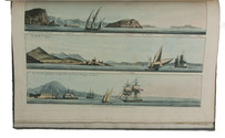
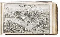
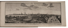
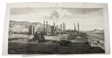
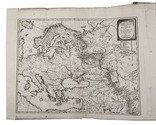
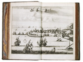
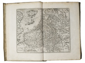
First edition of a detailed description and illustration of the cities along the coasts of the Baltic Sea
in the context of the Crimean War

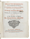
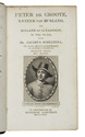
[BOSCHETTI, Ambrogio]. 
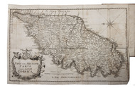
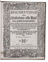
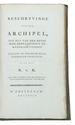
Il Mar Baltico e le sue coste descritti e illustrati con alcune carte geografiche topografiche ed orografiche per la guerre d'Oriente.
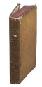
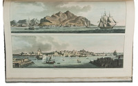
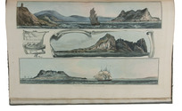
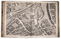
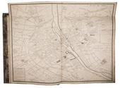
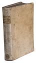
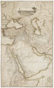
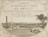
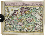
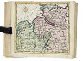
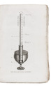
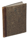
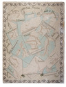
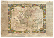
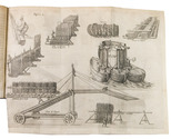
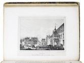
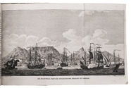
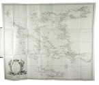
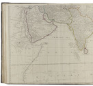
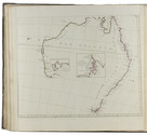
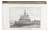
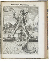
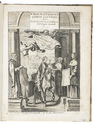
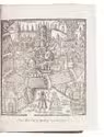
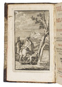
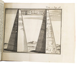
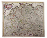
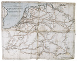
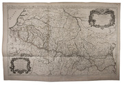
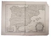
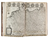
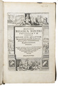
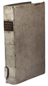
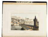
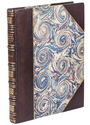
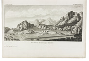
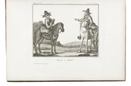
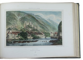
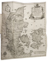
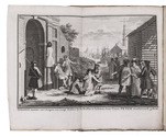
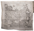
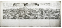
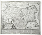
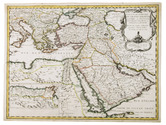
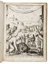
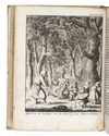
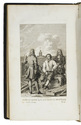
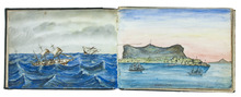
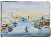
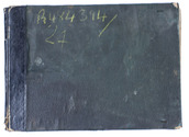
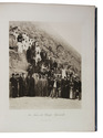
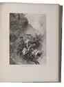
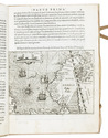
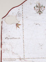
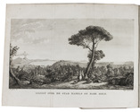
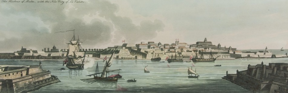
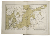
Triest, Colombo Coen, 1854. Large 4to (32.5 x 23.5 cm). With 1 folding map of the Baltic Sea as the frontispiece, 1 military plan of Kronstadt, 15 plates of Finnish, Swedish, Baltic and Russian cities, and 1 small illustration in the text on p. 58. Contemporary half brown cloth, grey paper sides, with the publishers front wrapper (for the "seconda edizione") printed letterpress on pink paper. 131, [1] pp. Full description
€ 3,250
Order Inquire Terms of sale

The first German edition of Boswell's Account of Corsica with a folding map

BOSWELL, James. Beschreibung von Corsica nebst vielen wichtigen Nachrichten und Anecdoten vom Pascal Paoli dem General der Corsen.
Leipzig, Caspar Fritsch, 1768. 2 parts in 1 volume. 8vo. With an engraved folding map of Corsica (29 x 44 cm). Contemporary paper-covered boards, spine with red title label lettered in gold, red edges. [14], 346 pp. Full description
€ 1,875
Order Inquire Terms of sale

Fine untrimmed copy of a pilot guide, with coloured maps and aquatint profiles

BOUGARD, René and John Thomas SERRES. The little sea torch: or, true guide for coasting pilots.
London, J. Debrett for the "author" [Serres], G. & W. Nicol, et al. [printed by T. Rickaby], 1801. Large folio (47 x 30 cm). With 20 numbered aquatint plates containing 137 coastal profiles, and 12 partly numbered engraved plates containing 24 maps of port cities, harbours, islands and the Strait of Gibraltar. All coastal profiles and maps beautifully and subtly coloured by a contemporary hand. Contemporary boards. VI, 144, [5] pp. Full description
€ 14,500
Order Inquire Terms of sale

3 little-known works by Italian scientist on astronomy, hydrostatics and navigation

BRUNETTI, Francesco Saverio. Trattenimenti scientifici su la sfera, geografia istorica, meteore, ed astronomia.
Rome, Bernabò and Lazzarini, 1754. With several woodcut illustrations in the text (including an armillary sphere), and an extra added folding engraved frontispiece.
With:
(2) BRUNETTI, Francesco Saverio. Trattenimenti scientifici su lindrografia, nautica, blasone, statica, meccanica, architectura, pirotecnia, e suono.
Roma, Bernabò and Lazzarini, 1755. With several woodcut illustrations in the text, and an extra added frontispiece (facsimile of an engraving?).
(3) BRUNETTI, Francesco Saverio. Macchina semplicissima per cui lacqua da se stessa salice ad una data altezza.
Rome, Bernabò and Lazzarini, 1747. With folding engraved plate as frontispiece. 3 works (the first in 2 parts) in 1 volume. 4to. Contemporary sheepskin parchment. [24], 180, 112; [8], 173, [3 blank]; 12 pp. Full description
€ 4,500
Order Inquire Terms of sale

Enlarged issue of a series of views of Danish buildings, gardens and cities

BRUUN, Johan Jacob. Novus atlas Daniae eller Prospecter af alle hoved-og kiöbstaederne, af alle kongelige slotte, samt andre kongelige lyst-slotte og staeder udi begge konge-rigerne Dannemark og Norge og underliggende fyrstendömme. Iste tome af Siaelland.
Copenhagen, Johan Jacob Bruun, 1761[-ca. 1789?]. Oblong folio (26.5 x 40 cm), preliminaries upright folio, bound with foot folded in. With 60 engraved views, including one folding plate with a view of the Royal Castle near Copenhagen, engraved by Jonas Haas and Hans Quist after designs by Johan Jacob Bruun. Contemporary Danish mottled sheepskin, richly gold-tooled spine. [8] pp. text. Full description
€ 16,000
Order Inquire Terms of sale

First edition of a sumptuous account of a voyage to Russia, Persia and the East Indies,
with large folding views of Moscow and Isfahan (194x42 cm)

BRUYN (LE BRUN), Cornelis de. Reizen over Moskovie, door Persie en Indie: verrykt met driehondert konstplaten, vertoonende de beroemste lantschappen en steden, ook de byzondere dragten, beesten, gewassen en platen, die daer gevonden worden ...
Amsterdam, Willem and David Goeree for the author, 1711. Folio (40x25.5 cm). With engraved frontispiece by Bernard Picart, engraved author's portrait, 2 folding engraved maps, 109 engraved plates (13 folding, 55 double-page, 41 full-page) and 36 engraved illustrations in text. Contemporary blind-tooled vellum. [8], 472, [12] pp. Full description
€ 9,000
Order Inquire Terms of sale

Travels through Switzerland, Italy and the Netherlands, by celebrated clergyman

BURNET, Gilbert. Nauwkeurige voyagie door Italiën, Switserland, &c. Behelsende veele aanmerkenswaardige, curieuse, en tot noch toe ongehoorde saken, welke in geen Reys-beschrijvingen aangetekend zijn.
Utrecht, Johannes Ribbius, 1687. 4to. With woodcut decoration on title-page and a woodcut tailpiece. Modern multi-coloured decorative boards. [1], [1 blank], 182, [13], [1 blank] pp. Full description
€ 750
Order Inquire Terms of sale

The future King Philip II of Spain’s travels from Spain to the Low Countries: eye-witness account by his tutor

CALVETE DE ESTRELLA, Juan Cristóbal. El felicissimo viaje d'el muy alto y muy poderoso Principe Don Phelippe, hijo d'el Emperador Don Carlos Quinto Maximo, desde España à sus tierras dela Baxa Alemaña: con la descripcion de todos los estados de Brabante y Flandes. Escrito en quatro libros, ...
Antwerp, Martinus Nutius I, 1552 (colophon 25 May 1552). Small folio (27 x 19.5 cm). With the woodcut arms of Charles V on title-page, a full-page woodcut triumphal arch erected in Ghent for Philip's entry, Nutius's woodcut device at the end, and dozens of woodcut decorated initials (4 series). Near contemporary limp vellum, with 6 fragments of a 16th-century manuscript reinforcing the spine of the bookblock, blind- and (later) gold-tooled spine. [8], 335, [19] ll. Full description
€ 9,000
Order Inquire Terms of sale

A rare pocket atlas for officers and travellers, with 25 maps

[ATLAS - EUROPE]. CLEYNHENS, Bernardus. Accuraat geografisch kaart-boekje of zak-atlas van het keyzerryk en geheel Duytsland, de Oostenrykse Nederlanden, ...
Haarlem, Bernardus Cleynhens, [ca. 1747?]. Small 8vo (16 x 10 cm). With 25 double-page engraved maps (2 overview maps), and an engraved plate with 8 scales, all hand-coloured, partly in outline. Half textured red cloth (ca. 1860?). 40, 23, [1 blank] pp. plus maps and plate of scales. Full description
€ 5,000
Order Inquire Terms of sale

Large paper copy of a collection of travelogues on Russia, Poland, Scandinavia and the British Isles

COXE, William (Paul Henri MALLET, transl.), Thomas PENNANT, Joseph BANKS, and others. Nouveau recueil de voyages au nord de l'Europe et de l'Asie, contenant les extraits des relations de voyages les plus estimées, et qui n'ont jamais été publiées en français.Including: William COXE (Paul Henri MALLET, transl.). Voyage en Pologne, Russie, Suède, Dannemarc, &c.
Paris, Paul Barde, Moutard, Mérigot (vol. 1), Barde, Manget & Buisson (vol. 2 & 3), 1785-1786. 3 volumes. 4to. Vol. 1 with 1 hand-coloured folding map, 1 folding engraved plate and 8 full-page engravings. Vol. 2 with 2 hand-coloured folding maps, 2 folding city plans, 3 full-page engraved portraits. Extra added: a loosely inserted engraved portrait of Empress and 2 further engravings. Vol. 3 with 2 hand-coloured folding maps, 1 hand-coloured full-page engraved map, 3 engraved folding plans of canals, 2 folding city plans, 1 full-page engraved portrait and 1 full-page engraving. Contemporary half red morocco. [6]; 355, [4], [1 blank]; [2], VI, [2], 422, [6]; [4], 382 pp. Full description
€ 8,500
Order Inquire Terms of sale

Travels in Siberia and China

DOBELL, Peter. Travels in Kamtchatka and Siberia; with a narrative of a residence in China.
London, Henry Colburn and Richard Bentley (back of title-page: J.B. Nichols and son), 1830. 2 volumes. 12mo. With two hand-coloured aquatint frontispieces by J. Clarck. Contemporary boards. IX, [1 blank], 351, [1]; X, 341, [1 blank], [2] pp. Full description
€ 2,250
Order Inquire Terms of sale

25 beautiful ca. 1660 etchings depicting a cavalry battle, animals and landscapes, including 3 complete series

FLAMEN, Albert. [5 etched print series:]
1) Divers combats.
Series of 6 unnumbered prints including title-print.
2) Diverses especes d[']animaus faits apres nature.
Series of 7 unnumbered prints including title-print.
3) Veuës et païsages du Chasteau de Longuetoise et des environs.
6 unnumbered prints, including title-print, from a series of 12.
4) [Views near Paris].
Series of 4 numbered prints, published without title.
5) [Pastoral views].
Series(?) of 2 unnumbered prints without title.
Paris, [Jacques Lagniet (ads 1, 3), Jacques van Merlen (ad 4), unknown publisher (ads 2, 5)], [ca. 1660]. Small 4to (16.5 x 13 cm). Five series of small oblong folio etched views (16 x 21.5-23 cm; plate size: 10 x 17 to 12.5 x 21.5 cm), 3 complete, 1 incomplete and 1 documented only as separate prints. Each print folded to form a double leaf and mounted on a stub so that it can open flat. Gold-tooled, dark green goatskin morocco (ca. 1890). [6]; [7]; [6 of 12]; 4; [2] etched ll. Full description
€ 7,500
Order Inquire Terms of sale

French edition of Forster’s acclaimed and influential Ansichten vom Niederrhein

FORSTER, Georg. Voyage philosophique et pittoresque, sur les rives du Rhin, a Liège, dans la Flandre, le Brabant, la Hollande, l'Angleterre, la France, etc. fait en 1790, ...
Paris, F. Buisson and Charles Pougens, l'an VIII [= 1800]. 3 volumes. 8vo. With a folding engraved map of Great Britain and 9 folding engraved views of famous English buildings. Contemporary mottled, tanned sheepskin (tree pattern), gold-tooled spines. [4], XVI, 408; [4], 446; 8, 407 pp. Full description
€ 2,650
Order Inquire Terms of sale

The first ethnographic survey of the Russian Empire

GEORGI, Johann Gottlieb. Russland. Beschreibung aller Nationen des russischen Reiches, ihrer Lebensart, Religion, Gebräuche, Wohnungen, Kleidungen und übrigen Merkwürdigkeiten.
Leipzig, Dyk, 1783. 2 volumes. 4to. With 2 etched hand-coloured frontispieces by Schoenberg (coloured by Capieux), and several delicate engraved head- and tailpieces in the text by C.M. Roth. Contemporary half calf, sprinkled boards. [4], XII, [5], [1 blank], 271, [1 blank]; [2], 273-530, [10] pp. Full description
€ 4,500
Order Inquire Terms of sale

A general in the Spanish army on the battles and sieges in Flanders 1601-1609,
during the Dutch war for independence, with 29 folding maps and plans

GIUSTINIANO, Pompeo. Delle guerre di Flandra libri VI. ... Posti in luce da Gioseppe Gamurini ...
Antwerp, J. Trognesio, 1609. 4to. With engraved architectural title-page and 29 folding engraved maps and plans of sieges and fortifications. White sheepskin (ca. 1700 or possibly later). [4], 329, [1 blank], [15], [3 blank] pp. Full description
€ 2,950
Order Inquire Terms of sale

Charming lithographed topographic and architectural views of northern France

HÉDOUIN, Pierre. Souvenirs historiques et pittoresques du nord de la France, ou Collection des plus belles vues et des plus beaux monumens, de cette partie de la France.
Paris, Dondey-Dupré, père et fils, 1830. Super Royal 4to (34.5 x 27 cm). With a letterpress half-title, title-page, 4-page letterpress introductory letter from Hédouin (dated 14 August) and 25 somewhat irregularly numbered, finely lithographed plates (mostly in landscape orientation with image size ca. 14.5 x 20 cm but the largest in portrait orientation 23.5 x 18 cm), printed on thin so-called "China" paper and mounted on blank leaves, each with a view of a site in northern France, by Pierre Langlumé after various artists, each followed by a letterpress account of the site. Modern half calf over contemporary boards with shell on shell marbled sides. [56] pp. Full description
€ 1,950
Order Inquire Terms of sale

Hand-coloured engraved map showing the rivers of Germany and the Low Countries

[MAP - GERMANY - LOW COUNTRIES]. HOMANN, Johann Baptist. Hydrographia Germaniae qua geographiae naturalis ea pars quae de aquis celebrioribus praesertim vero de fluminibus Germaniae agit...
Nuremberg, Johann Baptist Homann, [ca. 1710?]. Engraved map (48.5 x 58 cm) on a whole sheet of paper (53 x 63.5 cm), coloured in an early hand, with the title in an illustrated cartouche with Neptune and other mythological figures at lower left, an illustrated cartouche at upper left with a coat of arms, and a scale (ca. 1:2,400,000) in the margins. Full description
€ 200
Order Inquire Terms of sale

Account of an important mining voyage

JARS, Gabriel. Voyages métallurgiques, ou recherches et observations sur les mines & forges de fer, la fabrication de l'acier, celle du fer-blanc, & plusieurs mines de charbon de terre, faites depuis l'année 1757 jusques & compris 1769, en Allemagne, Suéde, Norwege, Angleterre & Ecosse.
Lyon & Paris, Gabriel Regnault, L. Cellot, P. Didot et al., 1774-1781. 3 volumes. 4to. With 52 folding engraved plates. Contemporary French mottled calf, gold-tooled spine. XXXII, 416; XXVIII, 612; VIII, 568 pp. Full description
€ 3,750
Order Inquire Terms of sale

An informative account of a voyage to the Mediterranean

JONG, Cornelius de. Derde reize naar de Middellandsche zee gedaan in de jaren 1786, 1787 en 1788.
Haarlem, François Bohn, 1810-1812. 2 volumes bound as 1. 8vo. Witha stipple engraved frontispiece portrait of the author, an engraved view of two Corsican farmers and a folding engraved view of the Cave of Dogs, a small cave on the eastern side of the Phlegraean Fields near Pozzuoli, Naples. Contemporary half calf. XXIV, 284; XVI, 291, [1 blank] [1], [1 blank] pp. Full description
€ 750
Order Inquire Terms of sale

World atlas including one 6-sheet and eleven 4-sheet wall maps

KITCHIN, Thomas and others. Kitchin's general atlas, describing the whole universe.
London, Robert Laurie, James Whittle, 1808. Imperial folio (53 x 39.5 cm). With 28 engraved maps (numbered in 41 parts) assembled from 67 sheets. Most include elaborate cartouches with pictorial decoration. With the maps coloured in outline. Contemporary half calf. 1 leaf plus maps. Full description
€ 18,000
Order Inquire Terms of sale

Travels through the Middle East, India and Europe, with 34 woodcut illustrations, including several trees

LA BOULLAYE LE GOUZ, Francois de. Les voyages et observations du sieur de la Boullaye-le-Gouz gentil-homme Angevin...
Paris, Francois Clousier, 1653. 4to. With a woodcut and an engraved author's portrait, 34 woodcut illustrations in text, including several full-page, and some woodcut initals, head- and tailpieces. Contemporary calf, gold-tooled spine. [16], 540, [10], [2 blank] pp. Full description
€ 18,000
Order Inquire Terms of sale

A rare guide to Moscow, with 8 plates

LECOINTE DE LAVEAU, Georges. Guide du voyageur à Moscou, contenant ce que cette capitale offre de curieux et d'intéressant...
Moscow, August Semen, 1824. 8vo. With lithographed frontispiece, 7 lithographed plates, 4 folding tables, and several tables in the text. Contemporary gold-tooled, half purple sheepskin, spine faded to brown, marbled sides and edges. [4], VI, 11-459, [1] pp. Full description
€ 2,250
Order Inquire Terms of sale

Very rare pocket atlas of the Rhineland, owned by the commander of the Buffs
during the Battle of Fontenoy and containing the original entry in his ledger

L'ISLE (DELISLE), Guillaume, and others. Le flambeau de la guerre allumee au Rhin; representee en 36 nouvelles cartes geographiques, ... = De fakkel des oorlogs ontstoken aan den Rhyn; verbeeld in 36 nieuwe geographische landkaarten, ...
Amsterdam, Petrus Schenk II, 1735. 8vo. With a double-page engraved title, two double-page engraved pages of text in Dutch and French, a folding engraved map and 36 double-page engraved maps; all coloured by hand. Original publisher's red sheepskin with a flap and wrapping band. Full description
€ 7,500
Order Inquire Terms of sale

Detailed observations of life in the Ottoman Empire, Egypt
and elsewhere in the Levant and Middle East ca. 1610

LITHGOW, William. Willem Lithgouws 19 jaarige lant-reyse, uyt Schotlant nae de vermaerde deelen des werelts Europa, Asia en Africa.
Amsterdam, Jacob Benjamin (colophon: printed by Christoffel Cunradus), 1653. 2 parts in 1 volume. 4to. With engraved frontispiece by Crispijn de Passe, 1 engraved plate and 6 engraved illustrations in the text. 19th-century half vellum. [8], 186, 98 pp. Full description
€ 1,950
Order Inquire Terms of sale

Detailed observations of life in the Ottoman Empire, Egypt and elsewhere in the Levant and Middle East ca. 1610

LITHGOW, William. Nineteen years travels through the most eminent places in the habitable world.
London, for John Wright & Thomas Passinger, 1682. 8vo. With a folding woodcut frontispiece and 6 folding woodcut plates and 1 woodcut in the text. 19th-century dark brown sheepskin, sewn on 3 recessed cords, brown spine label, Stormont on shell marbled endpapers. [8], 481, [7] pp. Full description
€ 3,500
Order Inquire Terms of sale

One of the greatest printing enterprises of the 17th century

MERIAN, Matthäus. Theatrum Europaeum. Beschreibung aller Geschichten so sich 1617[-1718] zugetragen haben.
Frankfurt am Main, Daniel Fievet, Johann Görlin et al., ca. 1633-1738. 21 vols. Folio (ca. 22 × 33.5 cm). With 19 (of 20) engraved title-pages, 1 engraved title vignette, 1 armorial plate, 646 (of 686) engraved views, plans, and maps, many folding or double-page-sized, 690 (of 692) engravings in the text (mostly portraits on interleaves), and several folding tables. Early 18th century full leather bindings with gold-tooled spines (titles and crown crest) and blind-tooled frame on the boards; slightly differing from vol. 16 onwards with gilt supralibros "Academ. Marburg.". Full description
€ 75,000
Order Inquire Terms of sale

A famous topography of Switzerland enlarged with 68 extra engravings

MERIAN, Matthäus. Topographia Helvetiae Rhaetiae et Valesiae. Das ist, Beschreibung und eigentliche Abbildung der vornembsten Stätte und Plätz, in der hochlöblichen Eydgnoßschafft, Grawbündten, Walliß, und etlicher zugewanten Orten.
[Frankfurt am Main], Matthäus Merian, 1642. Folio. With richly engraved title-page, 74 (of 76) engraved maps, plans and views on 54 (of 56) plates normally included the 1642 first edition (nearly all double-page) plus 1 large folding plate from the 1653 Anhang, and 67 additional engravings from the 17th and 18th century, including at least 16 by or after Merian. Altogether there are 3 general maps (1 of Germany and surroundings and 2 of Switzerland), 4 detail maps, and numerous city plans and views. Lacking the bird's eye view of Herisau and the second of two views of Neuchâtel. Tanned sheepskin (ca. 1700?), gold-tooled spine. 72, [8] pp. plus engraved plates. Full description
€ 29,500
Order Inquire Terms of sale

The first contemporary history of the Netherlands. In the first Latin edition, with a rare portrait of the author

METEREN, Emanuel van. Historia Belgica nostri potissimum temporis Belgii sub quatuor Burgundis & totidem Austriacis principibus coniunctionem & gubernationem breviter. Turbas autem, bella et mutationes tempore regis Philippi, Carli V. Caesaris filii, ad annum usque 1598. plenius complectens, conscripta.
[Cologne, A. Mylius, 1598]. Folio. With letterpress title-page in engraved border with scenes of trade and war (Verduyn, pl. XIV), additional engraved medallion portrait of the author mounted on blank back of title-page, by Hendrik Hondius the Elder, double-page engraved map of the Netherlands, by Frans Hogenberg and 22 engraved portraits on 19 plates. Contemporary vellum. [8], "623" [= 643], [1] pp. Full description
€ 2,000
Order Inquire Terms of sale

Uphill! A collection of folders, brochures and books on mountaineering

[MOUNTAINEERING]. [A collection of brochures and folders on mountaineering].
[Austria and Switzerland, ca. 1920- ca. 1980]. Ca. 653 brochures (including a few duplicates and variant issues).
With: [A collection of books relating to mountaineering].
[Globally, ca. 1830- ca. 2000]. Ca. 875 books (including a few duplicates and variant issues, and several multiple-volume titles). Full description
€ 45,000
Order Inquire Terms of sale

Eyewitness account of the horrors of the Napoleonic campaigns:
Germany, Poland, Moldavia & Turkey in aquatint

NEALE, Adam. Travels through some parts of Germany, Poland, Moldavia, and Turkey.
London, (back of title-page: printed by A. Straham), 1818. 4to. With 15 hand-coloured aquatints on 11 plates by I. Clark after drawings by author. 19th-century half morocco (Root bookbinders, London), richly gold-tooled spine. XIII, 295 pp. Full description
€ 1,950
Order Inquire Terms of sale

French edition of Pallas's travels through Russia

PALLAS, Peter Simon. Voyages du professeur Pallas, dans plusieurs provinces de l'empire de Russie et dans l'Asie septentrionale; Traduits de l'allemand par le C. Gauthier de la Peyronie. Nouvelle Édition, Revue et enrichie de Notes par CC. Lamarck ... et Langlès...
Paris, Maradan, an II [1794]. 8 text-volumes and 1 atlas-volume. 8vo (text) and large 4to (atlas). With 8 title-pages and 8 half-titles, 108 engraved plates and maps, of which 22 folding and 2 double-page. Uniform contemporary mottled calf, richly gold-tooled spines. [8], 422, [2]; [4], 490; [4], 492; [4], 499; 448; 455; 448; [4], VIII, 463 pp. Full description
€ 2,950
Order Inquire Terms of sale

Very rare French translation of Pallas' second expedition to South Russia,
the Black Sea and the Crimea in 1793 and 1794

PALLAS, Peter Simon. Observations faites dans un voyage entrepris dans les gouvernements méridionaux de l'Empire de Russie dans les années 1793 et 1794.
Paris, Strasbourg, Amand Koening; Leipzig, Godefroi Martini, 1799-1802. 2 text volumes and 1 atlas volume. 4to (text) and oblong folio (atlas: 24 x 40 cm). With 28 engravings in the text and 1 woodcut in each text volumes (23 hand-coloured), and 55 engraved plates and maps (43 hand-coloured) in the atlas volume. Text volumes in contemporary and uniform gold-tooled mottled calf. Atlas in matching contemporary mottled half calf. XXXII, 438; XVI, 452 pp. ; 55 ll. Full description
€ 8,500
Order Inquire Terms of sale

Beautiful lithographed plates after a manuscript description of Russia from 1674

PALMQUIST, Erich. Nagre widh sidste Kongl. ambassaden till Tzaren i Muskou giorde observationer öfwer Ryszland, dess wäger, pasz med fästningar och gräntzer - Sammandragne aff Erich Palmquist anno 1674.
Stockholm, Generalstabens Litografiska Anstalt, [1898]. Large oblong folio. With the 1674 title-page, the text, 14 maps and charts, 13 full-page illustrations and several figures on one page (1 page illustrating flags hand-coloured as published). All lithographed after the original manuscript. Paper imitating tree calf, with a gilt-stamped frame, gold-tooled spine. [72] pp, some leaves printed on one side only. Full description
€ 8,500
Order Inquire Terms of sale

Attractive coloured views of the Pyrenees, including several panoramas

PETIT, Victor Jean-Baptiste. Bagneres de Luchon et ses environs.
Paris, Charles Boivin; Pau, Auguste Bassy, [ca. 1850]. Oblong folio (26.5 x 37.5 cm). With a lithographed title-page with a hand-coloured vignette, and 29 numbered lithographed plates, all coloured by hand and some double-page (including 1 folding out vertically) or folding panoramas. All plates mounted on thick wove paper with letterpress captions. Contemporary gold- and blind-blocked dark green cloth, gilt edges. Full description
€ 1,250
Order Inquire Terms of sale

Only published edition of the original 1521 text of the navigation book of the great Ottoman admiral

PIRI REIS (Paul KAHLE, ed.). Bahrije. Das türkische Segelhandbuch für das Mittelländische Meer vom Jahre 1521.
Berlin and Leipzig, Walter de Gruyter & Co., 1926-1927. 3 volumes. Large 8vo (26 x 18 cm). Volume 1 with 137 reproductions of manuscript pages of Ottoman Turkish text and maps and volume 2 with 4 plates. Publisher's original printed wrappers. [1], [1 blank], [2] pp. + 64 ll. + [4], [1 blank], [1] pp.; ll. 65-137; [1], [1 blank], XLVIII, 88 pp. Full description
€ 2,500
Order Inquire Terms of sale

Rare fine complete set of the great Atlas of Denmark

PONTOPPIDAN, Erik and Hand de HOFMAN. Den Danske Atlas, eller Konge-Riget Dannemark, med dets naturlige Egenskaber, Elementer, Indbyggere, Vaexter, Dyr og andre Affödninger, dets gamle Tildragelser og naervaerende Omstaendigheder i alle Provintzer, Staeder, Kirker, Slotte og Herre-Gaarde. Forestillet ved en udförlig Lands-Beskrivelse, ... Tomus I[-VII].
Copenhagen, Andreas Hartvig Godiche, Royal University Printer (vols. I-V) and heirs (vols. VI-VII), 1763-1781. 7 volumes. 4to. With 296 mostly folding engraved maps, plans and views of Denmark and Danish cities, castles, houses and gardens, including engraved plates showing Danish antiquarian relics, plants, animals and costumes. Contemporary uniform calf, richly gold-tooled spines. 723 to 1104 pp. per volume, giving more than 6000 pp. in total. Full description
€ 13,500
Order Inquire Terms of sale

Rare description of Russia just after the Turkish war,
with a revised version of the first map of the entire Russian Empire

REITZ, Johann Frederik, and others. Oude en nieuwe staat van't Russische of Moskovische Keizerryk, behelzende eene uitvoerige historie van Rusland en deszelfs groot-vorsten; benevens de beschryvinge van dat uitgestrekte ryk, de zeden en godsdienst der inwoneren: zyne opkomst en voortgang in koophandel, kunsten, land- en zeemacht, oproeren, oorlogen en verdere wisselvalligheden, tot dezen tegenwoordigen tydt toe.
Utrecht, Johannes Broedelet, 1744. 4 volumes. 4to. With 4 folding maps, 3 folding plates and a folding letterpress table. Early 19th-century half red sheepskin. [2], 296; [2], 200, 200a-200d; [2], 501; [2], 830 pp. Full description
€ 4,250
Order Inquire Terms of sale

The great Lisbon earthquake of 1755 and the city of Augsburg: a splendid publication with more than 100 engraved maps, plans and views, in an Augsburg gold-brocade paper wrapper

ROTH, Johann Michaël. Augsburgische Sammlung derer wegen des höchstbetrübten Untergangs der Stadt Lissabon, ... anbey hat man die Stadt Augsburg in Grundriß mit 48. Prospecten der schönsten Gebäude denselben mit beygefüget ...
Augsburg, Johann Michael Roth, [ca. 1756].
Including:
(2) [MAP - GERMANY - AUGSBURG]. KRAUS, Johann Thomas. Accurata recens delineate ichnographia ... metropolis Augustae Vindelicorum ... = Neu verfertigt accurater Grund Riß der ... Statt Augspurg, ...
Augsburg, Matthäus Seutter, [ca. 1750]. Large engraved map on a folding sheet (50 x 61 cm) at a scale of about 1:4000.
(3) WEYERMANN, Jakob Christoph. Prospectus praecipuorum aedificorum et locorum intra et extra urbem Augustam Vindelicorum ...
Augsburg, Matthäus Seutter, 1742. 4 large uncut folding sheets (each 40 x 70 cm) containing the engraved title-page in an elaborately decorated cartouche and 47 engraved views of buildings in and around Augsburg (each 16 x 13.5 cm), numbered [I], II-XLIII.
1mo (50 x 38.5 cm). With an engraved title-page, the title in the arched doorway of an architectural ruin with a female figure with the Portuguese coat of arms in mourning on the steps, flanked by 2 putti; an engraved report on the earthquake and resulting tsunami on 1 November 1755; and in the first part 60 engraved views, maps and plans printed from 25 copperplates on 13 leaves (4 large folding, including 1 constructed from 2 sheets, the rest on both sides of 9 leaves, except the last, which is blank on the reverse). Gold on black gold brocade paper wrapper, probably from the publisher, sewn without supports at 3 stations, each wrapper made from a whole sheet of the decorated paper, with as centrepiece a statue in a domed gazebo, the dome carried by 4 visible (probably of 6) caryatids. The sheet is further filled with scrollwork decoration with oval portraits in the upper corners, winged angels in the lower corners, 4 more angels plus 2 faces in the scrollwork. Pasted in the centre of the front wrapper is an engraving of the Augsburg pine cone flanked by Neptune with his trident and a river God with an oar, above a city view with cornucopias (10 x 6.5 cm), with a manuscript label below it, "1755 et 1756." The whole is kept is a finely produced modern tanned sheepskin box with the form of a book, the spine with 7 raised bands and a red morocco label, a single brass fastening, and the interior and what would be the edges of the paper lined with marbled paper combining Stormont, zebra and Spanish patterns. [20] engraved ll., some printed on both sides. Full description
€ 47,000
Order Inquire Terms of sale

Large map of Spain and Portugal

[MAP - SPAIN & PORTUGAL]. SANSON, Nicolas. l'Espagne divisée en tous ses royaumes et principautés suivant qu'ils sont compris sous les Couronnes de Castille et d'Aragon, possedees par le Roy Catholique et sous la couronne de Portugal possedee par le Roy de Portugal.
Paris, Hubert Jaillot, [1708]. Engraved map on 2 assembled sheets (55.5 x 78 cm), engraved by Cordier. With title in decorated cartouche on the bottom right corner, scales and privilege in decorated cartouche on the bottom left corner, and a few lines coloured in green. Full description
€ 650
Order Inquire Terms of sale

Large map of the Pyrenees

[MAP - PYRENEES]. SANSON, Nicolas. Les Monts Pyrenées, ou sont remarqués les Passages de France en Espagne.
Paris, Hubert Jaillot, 1719. Engraved map on 2 assembled sheets (54.5 x 88 cm). With title in decorated cartouche (signed F.C.) in upper right corner and scalebars in decorated cartouche in the lower left corner. Coloured in outline. Full description
€ 500
Order Inquire Terms of sale

First edition of an account of Tsar Peter's visits to the Dutch Republic, with 3 plates

SCHELTEMA, Jacobus. Peter de Groote, keizer van Rusland in Holland en Zaandam in 1697 en 1717.
Amsterdam, Hendrik Gartman, 1814. 2 volumes. 8vo. With 2 engraved title-pages showing a portrait of Peter the Great, 1 letterpress title-page and 2 half-titles, and 3 engraved plates. Mid-19th-century tree calf, each board with a gold-tooled fillets, gold-tooled spine and board edges, antique spot marbled endpapers, green ribbon markers. XXVI, 339; [2], XXXI, [1 blank], 328 pp. plus engraved titles and plates. Full description
€ 1,500
Order Inquire Terms of sale

First Spanish edition of Strahlenberg’s work on the exploration of Russia and Northern Asia

STRAHLENBERG, Philipp Johann von and Josef Vicente TOMÁS Y CATALÁ (translator). Nueva descripcion geographica del imperio Ruso, en particular y en general de todas las provincias que componen aquel dilatado imperio, con muchas noticias historicas antiguas y modernas.
Valencia, Francisco Burguete, 1780. 2 parts in 1 vol. 4to. With a woodcut printers device on both title-pages (of part 1 and part 2) and two decorated initials (one at the start of each part). Contemporary vellum with ink-lettering to spine. [28], 188; [8], 237, [1] pp. Full description
€ 5,000
Order Inquire Terms of sale

With a map of the island and a folding plan of the city of Funchal

TAYLOR, Ellen M. Madeira: Its scenery and how to see it. With letters of a year's residence, and lists of the trees, flowers, ferns, and seaweeds.
London, Edward Stanford, 1882. 8vo. With a wood-engraved frontispiece, a lithographed folding map of the island of Madeira and a lithographed folding plan of the city of Funchal. Also with a publisher's advertisement at the end with "books useful for visitors to Madeira" from the publisher Trübner and Co., London. Original publisher's black- and gold-blocked green cloth. XVI, 261, [1 blank], [1], [1 blank] pp. Full description
€ 500
Order Inquire Terms of sale

Richly illustrated journey of Nicholas II of Russia through Asia

UKHTOMSKY (UCHTOMSKIJ), Esper Esperovich and Hermann BRUNNHOFER (translator). Orientreise seiner kaiserlichen Hoheit des Grossfürsten-Thronfolgers Nikolaus Alexandrowitsch von Russland, 1890-1891.
Leipzig, F.A. Brockhaus, 1894-1899. 2 volumes. 4to. With engraved portrait of Nicholas, 7 photogravures, 541 wood engravings after drawings and photographs and 5 chromolithographed maps. Publisher's cloth, richly blocked in black, gold and grey, gilt edges. [4], 476; [4], 482 pp. Full description
€ 8,500
Order Inquire Terms of sale

In search of a northeast passage

VEER, Gerrit de. Tre navigationi fatte dagli Olandesi, e Zelandesi al settentrione nella Norvegia, Moscovia, e Tartaria verso il Catai, e regno de' Sini, doue scopersero il Mare di Veygatz, la Nuova Zembla.
Venice, Giovanni Battista Ciotti, 1599. 4to. With an engraved plate on title-page, full-page engraving of a compass and 31 half-page engraved maps and plates in text. Later vellum. [4] 79 ll. Full description
€ 8,500
Order Inquire Terms of sale

In search of a northeast passage

VEER, Gerrit de (et al.). Verhael van de eerste schip-vaert der Hollandische ende Zeeusche schepen door 't Way-gat, by Noorden Noorwegen, Moscovien ende Tartarien, na de coninckrijcken Cathay ende China. Met drie schepen, uyt Texel gezeylt in den jare 1594. Hier achter is by-ghevoeght de beschrijvinghe van de landen Siberien, Samoyeda, ende Tingoesa. Seer vreemt en vermaackelijck om lesen.
Amsterdam, for Joost Hartgers, 1648. 4to. With woodcut illustration on title-page and a double-page engraved plate with 6 illustrations. Old marbled wrappers. [2], 57, [1 blank] pp. Full description
€ 3,950
Order Inquire Terms of sale

The other way around: North America and Europe seen through the eyes of a Chilean historian

VICUÑA MACKENNA, Benjamin. Pájinas de mi diario durante tres años de viajes. 1853. - 1854. - 1855. ... California. - Mejiico. - Estados-Unídos. - Canada. - Islas Britanicas. - Francia. - Italia. - Alemania. - Paises-Bajos. - Costas del Brasil. - Provincias del Plata.
Santiago, Imprenta del Ferrocarril, 1856. 4to. Contemporary half green sheepskin, marbled edges. [8], 454 pp. Full description
€ 4,950
Order Inquire Terms of sale

The travel adventures of a famous book and art collector

WILLIGEN, Adriaan van der. Aanteekeningen op eene reize van Parijs naar Napels, door het Tirolsche en van daar door Zwitserland en langs den Rhijn terug naar Holland.
Haarlem, Adriaan Loosjes, (back of half-title parts 2-4: Utrecht, G. Post), 1811-1813. 4 parts in 2 volumes. Large 8vo. With an engraved title-page to the first part (with a stipple-engraved medallion portrait of the author) and 13 engraved plates by J. P. Visscher Bender. Contemporary half calf, gold-tooled spines. VIII, 269, [1]; IV, 292; VIII, 322; "VIII"[=6], 405, [3] pp. Full description
€ 4,000
Order Inquire Terms of sale
56 books books found / Show pages