Categories
Shopping cart (0 items € 0)
Advanced search

Cartography & Exploration / Geography, Topography & Views

Dutch trade, whaling, herring fishery, etc., with magnificent views of the harbours of the Netherlands and the Dutch East Indies ca. 1772-ca. 1781, including a wide variety of boats and ships

AA, Cornelis van der (ill. by Dirk de JONG, Hendrik KOBELL jr. and Mattheus SALLIETH). Atlas van de zeehavens der Bataafsche Republiek, die van Batavia en Onrust. Mitsgaders de afbeeldingen van de haring visscherij en de walvisch vangst. In een-en-dertig kunstplaaten naar het leven afgebeeld ...
Amsterdam, Evert Maaskamp, 1805. Large folio. With engraved title-page and 31 double-page engraved views (ca. 28.5 x 39.5 cm) showing Dutch harbours with a wide variety of sailing boats and ships. Modern half calf. XII, 135 pp. Full description
€ 19,500
Order Inquire Terms of sale

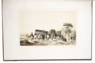
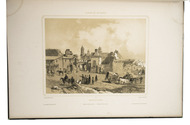
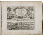
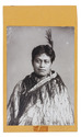
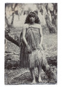
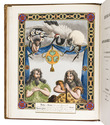
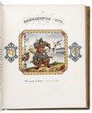
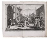
Ethnography of the Xhosa people of South Africa, with the very rare album with four attractive hand-coloured aquatints

ALBERTI, Lodewyk and Ludwig Gottlieb PORTMAN. 
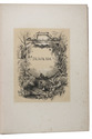
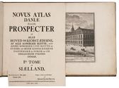
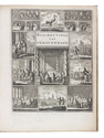
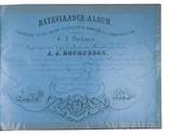
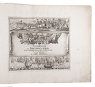
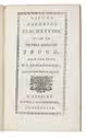
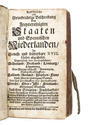
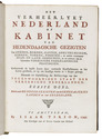
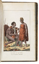
[Drop-title:] Zuid-Afrikaansche gezichten.
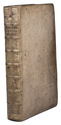
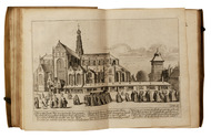
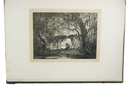
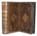
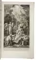
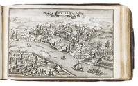
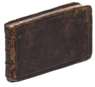
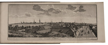
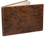
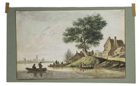
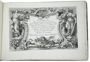
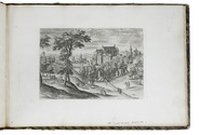
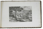
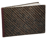
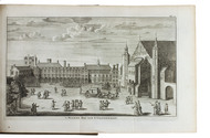
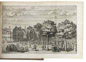
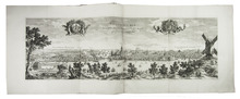
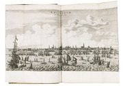
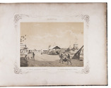
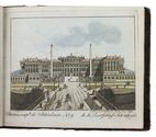
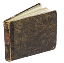
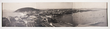
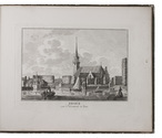
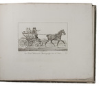
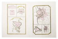
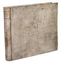
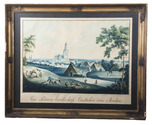
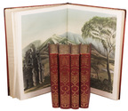
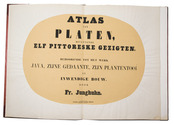
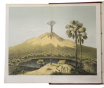
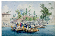
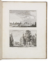
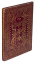
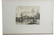
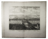
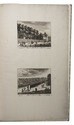
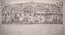
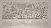
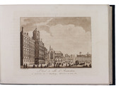
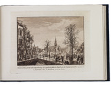
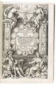
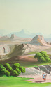
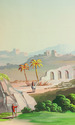
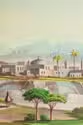
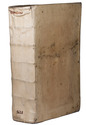
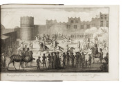
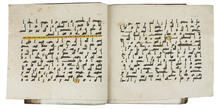
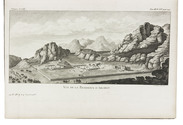
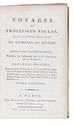
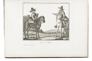
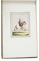
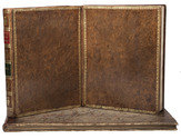
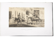
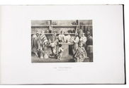
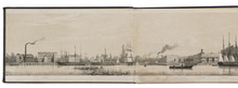
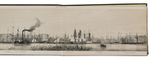
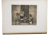
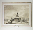
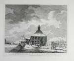
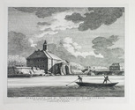
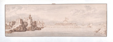
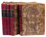
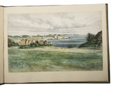
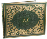
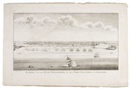
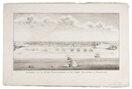
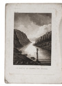
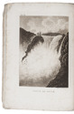
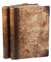
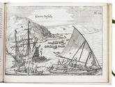
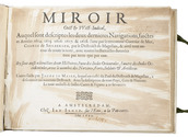
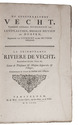
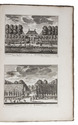
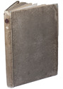
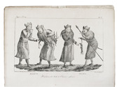
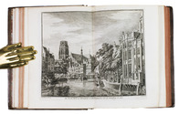
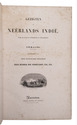
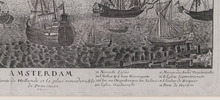
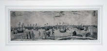
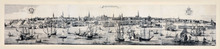
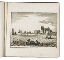
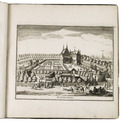
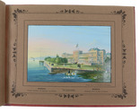
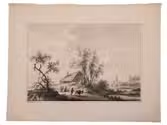
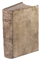
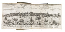
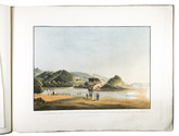
Amsterdam, Evert Maaskamp, [1810]. Oblong 1mo (45 x 60 cm). Letterpress text leaf and 4 large aquatint plates coloured by a contemporary hand, engraved by Ludwig Gottlieb Portman after drawings by Jacob Smies and Christopher Howen. Contemporary stiff, marbled paper wrappers, kept in a modern green half morocco clamshell box.
With:
(2) ALBERTI, Lodewyk. De Kaffers aan de zuidkust van Afrika, natuur en geschiedkundig beschreven.
Amsterdam, Evert Maaskamp, 1810. 8vo. With engraved title-page, aquatint folding plan, with coastal view, of Algoa Bay, and 2 stipple-engraved plates, all but the title-page coloured by a contemporary hand. Contemporary gold-tooled calf; rebacked, with new endpapers.
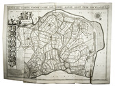
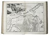
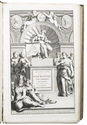
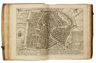
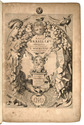
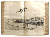
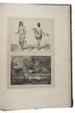
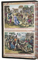
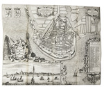
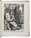
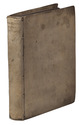
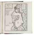
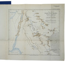
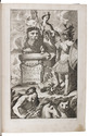
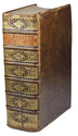
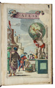
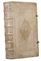
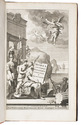
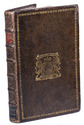
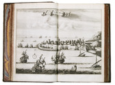
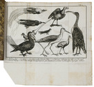
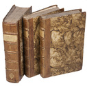
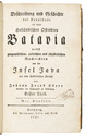
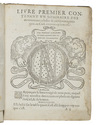
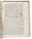
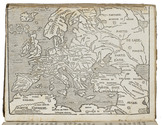
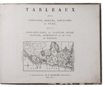
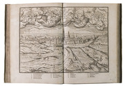
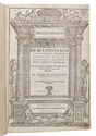
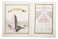
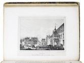
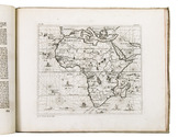
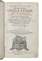
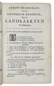
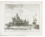
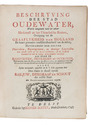
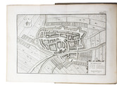
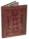
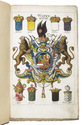
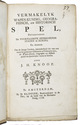
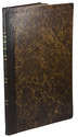
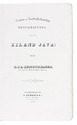
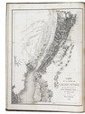
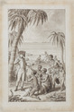
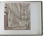
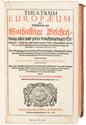
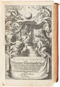
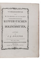
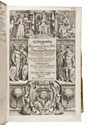
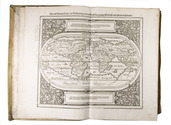
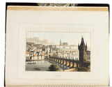
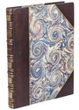
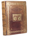
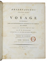
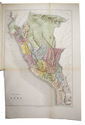
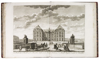
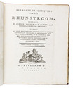
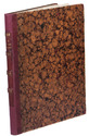
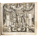
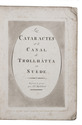
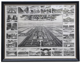
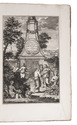
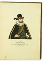
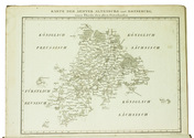
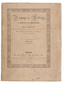
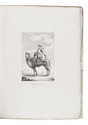
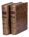
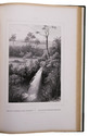
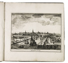
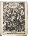
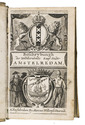
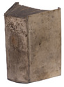
(3) ALBERTI, Lodewyk. Description physique et historique des Cafres, sur la côte méridionale de l'Afrique ...
Amsterdam, Evert Maaskamp, 1811. 8vo. With the same plan and 2 plates as ad. 2, also coloured by a contemporary hand. Contemporary gold-tooled calf, richly gold-tooled spine. [1] l. text + 4 plates; [8], VIII, [4], 260, [1], [1 blank] pp.; XII, [4], 255, [1 blank] pp. Full description
€ 25,000
Order Inquire Terms of sale

Description of Den Briel

ALKEMADE, Cornelis van and Pieter van der SCHELLING. Beschryving van de stad Briele, en den lande van Voorn, ...
Rotterdam, Philippus Losel, 1729. 2 parts in 1 volume. Folio. With a double-page engraved plan of Den Briel and 3 folding engraved maps of different parts of Voorne (each ca. 50 x 70.5 cm). Contemporary blind-tooled vellum. [28], 224, [8], 225-376; [8], 306, [20] pp. Full description
€ 2,500
Order Inquire Terms of sale

First and only edition of Alting’s extensive geography of Holland and Friesland

ALTING, Menso. Descriptio secundum antiquos, agri Batavi & Frisii una cum conterminis sive notitia Germaniae Inferioris, cis & ultra Rhenum, quà hodie est in dicione VII Foederatorum. ... [Volume 2 with title:] Descriptio Frisiae inter Scaldis portum veterem & Amisiam, ...
Amsterdam, Henricus Wetstein (vol. 2 adds Rudolf & Gerard Wetstein), 1697-1701. 2 volumes bound as 1. Large folio (37.5 x 24 cm). Richly engraved frontispiece by Jan Goeree, 2 letterpress title-pages in black and red, volume I with 6 double-page engraved maps,3 full-page engraved plates and a letterpress table, and numerous engravings in text; volume II with 9 double-page engraved maps by Gerard de Broen and a double-page letterpress table. Contemporary blind-tooled vellum. [24], 132, [20], 18, [2]; [32], 216, [40] pp. Full description
€ 3,250
Order Inquire Terms of sale

Unrecorded watercolour view of Heukelom

[HEUKELOM]. [BEIJER, Jan de]. View of Heukelom.
Heukelom, 8 August, 1750. 13 x 21.5 cm. Original watercolour highlighted with white.Detached from a 19th-century paperboard support with hand drawn decorative frame and cartouche with the title "Heukelom J. de Beijer 1703-1768" (24 x 32 cm). Full description
€ 9,500
Order Inquire Terms of sale

First edition of a richly illustrated account of Surinam

BENOIT, Pierre Jacques. Voyage a Surinam. Description des possessions néerlandaises dans la Guyane.
Brussels, De Wasme & Laurent (back of half-title: Imprimerie de Societé des Beaux-Arts), 1839. Folio (47.5 x 31 cm). With a lithographed frontispiece, a small wood-engraved illustration on the title-page, and 99 tinted lithographed illustrations on 49 plates. Contemporary half black morocco, black cloth sides, gold-tooled spine. [4], 1-69, [3], 75-76, [2] pp. Full description
€ 2,750
Order Inquire Terms of sale

Extra illustrated "Staten Bijbel"

[BIBLE - DUTCH]. Bybel, dat is, de gansche H. Schrift, vervattende alle de kanonyke boeken des Ouden en Nieuwen Testaments.
Gorinchem, Nicolas Goetzee, 1748. 2 volumes. Large folio. With engraved allegorical frontispiece by J. Punt after J. de Wit, large engraved vignette by J. Punt on title, 12 double-page folding engraved maps by W.A. Bachine, including a plan of Jerusalem, and 61 double-page engraved plates by Jan Luyken, including 2 with four half-page illustrations to one plate, and extra mounted on endpapers of both volumes 8 half-page engraved bible-illustrations by G. de Jode, all richly coloured by hand. Contemporary calf over wooden boards, spines ribbed and richly gilt in a fine light flower design, with broad richly ornamental gilt borders and elegant gilt inner-panel with large gilt flowers at the four corners and large flowered gilt central ornaments. [12], 19, [3], 342, [2], 151; [4], 12, 172, [4], 77 ll. Full description
€ 12,500
Order Inquire Terms of sale

Extremely rare print series engraved by Simon Frisius

BRIL, Matthaeus. Topographia variarum regionum, inventa à Mathaeo Bril, aeri incisa à Simone Frisio. Ab C.J. Visscherio excusa.
[Amsterdam], Claes Jansz. Visscher, 1651. Oblong 8vo. Engraved title-print, and 24 engraved topographic views numbered 1-25 (11 x 16 cm; plate size 10 x 15.5 cm). Half green cloth (1840s?), green paper sides made from waste paper with a mirror image letterpress text (showing through from the underside or offset?), difficult to read but probably in French, with a heading in fat-face roman capitals, plain paper label with manuscript title in ink on front board. 25 engraved ll. Full description
€ 3,950
Order Inquire Terms of sale

Enlarged issue of a series of views of Danish buildings, gardens and cities

BRUUN, Johan Jacob. Novus atlas Daniae eller Prospecter af alle hoved-og kiöbstaederne, af alle kongelige slotte, samt andre kongelige lyst-slotte og staeder udi begge konge-rigerne Dannemark og Norge og underliggende fyrstendömme. Iste tome af Siaelland.
Copenhagen, Johan Jacob Bruun, 1761[-ca. 1789?]. Oblong folio (26.5 x 40 cm), preliminaries upright folio, bound with foot folded in. With 60 engraved views, including one folding plate with a view of the Royal Castle near Copenhagen, engraved by Jonas Haas and Hans Quist after designs by Johan Jacob Bruun. Contemporary Danish mottled sheepskin, richly gold-tooled spine. [8] pp. text. Full description
€ 16,000
Order Inquire Terms of sale

Picturesque view of houses and fishing boats on the river Lek, showing Vianen on the opposite bank

[BURG, Dirk van der (formerly attributed to Nicolaas WICART)]. [View of Vianen across the river Lek with fishermen and their boats and houses in the foreground].
[North bank of the Lek River, near Vianen], [Ca. 1760/70]. Oblong Elephant 4to or possibly cut down oblong whole sheet (1mo) (19.5 x 31 cm). Original watercolour view on laid paper, looking southwest across the river, with Vianen in the background on the opposite bank, and a tree, houses, 11 people (mostly fishermen) and 3 fishing boats in the foreground. Mounted with 2 paper hinges on green laid paper in a passe partout (35 x 50 cm). Full description
€ 4,500
Order Inquire Terms of sale

Rare Dutch translation of a work on Spanish America, with 4 maps

CAMPBELL, John. De tegenwoordige staat der volken van het Spaansche ryk in Amerika, met een byzonder verhaal, van den koophandel uit Oud-Spanje, met de galjoenen, flota, &c.; en van den verboden handel der Hollanders, Engelschen, Franschen, Deenen en Portugezen, in de West-Indiën.
Amsterdam, Bernardus Mourik, [ca. 1745 or ca. 1748]. 8vo. With 4 folding engraved maps, showing the city and harbours of Veracruz, Havana, Portobelo and Cartagena. Contemporary red half sheepskin (roan). [8], 328 pp. Full description
€ 1,200
Order Inquire Terms of sale

Rare complete first edition of Visentini's print series with views of Venice after Canaletto,
"crucial to forming the image of Venice in the mind of its visitors"

[CANALETTO]. VISENTINI, Antonio. Urbis Venetiarum prospectus celebriores, ex Antonii Canal tabulis XXXVIII.
Venice, Joannem Baptistam Pasquali, 1742. 3 parts in 1 volume. Oblong folio (ca. 36.5 x 52.5 cm). With 3 letterpress title-pages printed in red and black with engraved vignettes by Visentini, the original engraved title-page for the first series (Prospectus Magni Canali), a double portrait of Canaletto and Visentini by Visentini after Giovanni Battista Piazetta and and XIV, XII and XII numbered engraved prints with familiar views based upon 38 paintings by Canaletto, engraved by Visentini, showing the Grand Canal, public buildings, renowned places in Venice and regatta scenes. Contemporary half morocco, brown paper sides, manuscript title (?) and two old shelfmarks on the spine. [8]; [1]; [1] ll. plus the part-title, double portrait and XIV, XII, XII prints. Full description
€ 45,000
Order Inquire Terms of sale

On Bedouin tribes, with a map and pictures

CARRUTHERS, Alexander Douglas Mitchell. A journey in North-Western Arabia.
[London, W. Clowes], March 1910. 4to. With 12 black and white photographs made during the journey and a folding chromolithographed map of North-West Arabia (27x30.5 cm). Modern blue wrappers. [32] (numbered 225-248) pp. Full description
€ 750
Order Inquire Terms of sale

The complete series of Collaert's views around Brussels in its first state

[VIEWS - BRUSSELS AREA]. COLLAERT, Hans I [after Hans BOL or Jacob GRIMMER?]. [Views in the vicinity of Brussels].
[Antwerp], Hans van Luyck, [ca. 1575/80]. Oblong folio album (24.5 x 35.5 cm). Series of 24 engravings (plate size ca. 20 x 14 cm) with views of landscapes around Brussels, by Hans I Collaert possibly after Hans Bol or Jacob Grimmer, each with a caption in the plate (plates 8 and 20 also with Van Luyck and Collaert's monograms "H.V.L.EX[cudit]" and "H.C.F[ecit]"). Trimmed down to the plate edge and mounted on album leaves, numbered in pencil on the album leaves, next to the engravings. Modern red half cloth, marbled sides. [24] ll. Full description
€ 19,500
Order Inquire Terms of sale

First edition of an account of The Hague, with 2 frontispieces and 9 plates

CRETSER, Gysbert de and Constantijn HUYGENS. Beschryvinge van 's Gravenhage, behelsende desselfs eerste opkomste, stichtinge en vermakelyke situatie, het Graven-hof aldaar gebouwt ... Mitsgaders de oude coustumen ... Waar achter bygevoegt is de Zeestraat op Scheveninge door de Heer van Zuylichem [= Constantijn Huygens].
Amsterdam, Jan ten Hoorn, 1711. 3 part in 1 volume. 4to. With 2 engraved frontispieces (by Jan Luyken and Jan van Lamsvelt] and 9 engraved plates (4 folding). Contemporary vellum. [16], 140, [8], 104, [8]; 56 pp. Full description
€ 1,250
Order Inquire Terms of sale

Ancient and modern Sweden in 355 engraved plates

[DAHLBERG, Erik]. Suecia antiqua et hodierna.
[Stockholm, 1769? (engraved ca. 1670-ca. 1750)]. 3 parts in 1 volume. Folio. With 355 engraved plates (including 3 engraved title-pages and the large view of the Swedish Church in London, often lacking); most plates double-page, several folding. Only the index is printed letterpress. Contemporary mottled calf, richly gold-tooled spine. In a modern slipcase. 13, [1 blank] pp. plus 355 plates. Full description
€ 20,000
Order Inquire Terms of sale

Beautifully coloured composite atlas

[DANCKERTS, ALLARD, VISSCHER, DE WIT, MORTIER and others]. Atlas.
[Amsterdam, Theodorus and Cornelis III Danckerts?, ca. 1706 (dated maps 1694-1706)]. Imperial folio (53.5 x 33.5 cm). Composite atlas, with an engraved title-page, 43 double-page engraved maps and 4 double-page engraved tables, all beautifully coloured in a consistent and balanced manner by a contemporary hand, probably in the workshop of the publisher. With maps by Johannes, Justus, Theodorus and Cornelis III Danckerts, Carel and Abraham Allard, Nicolaas Visscher I & II, Frederik de Wit, Pieter Mortier, Caspar Specht and even Alexis-Hubert Jaillot in Paris. Modern maroon sheepskin. Full description
€ 48,500
Order Inquire Terms of sale

10 splendid and nostalgic views of Batavia

DEELEMAN, Charles Theodore. Bataviaasch album. Verzameling van een tiental gezigten van de hoofdstad van Nederlandsch Indië. Opgedragen aan Zijne Exellentie den Minister van Staat J.J. Rochussen.
Batavia, G. Kolff & Co., [1859-1860]. Large oblong folio (33.5 x 44 cm). With 10 beautiful tinted lithographs (ca. 18.5 x 26 cm). Modern half calf, with original blue printed paper wrappers bound in. Full description
€ 6,500
Order Inquire Terms of sale

Encyclopaedic description of Jakarta and Java with folding plates

EBERT, Johann Jakob (transl.). Beschreibung und Geschichte der Hauptstadt in dem Holländischen Ostindien Batavia nebst geographische, politische und physikalische Nachrichten von der Insel Java.
Leipzig, Weidmanns Erben und Reich, 1785-1786. 4 parts in 3 volumes. 8vo. With 6 folding engraved plates: a map of Java, 3 plans of Batavia (Jakarta) and surroundings, and 2 depicting reptiles and birds. Contemporary half calf with raised bands , gold-tooled spine, title-labels and unidentified coat of arms. Marbled sides. [16], 296; [4], 252; [4], 336; [4], 352 pp. Full description
€ 3,750
Order Inquire Terms of sale

64 lovely coloured views of Vienna and vicinity in Beethoven’s time

EISNER, Josef, [and others?]. Collection de vues des prinéipaux [recté principaux] palais, eglises, bâtimens publies, campagnes & jardins tant de Vienne que de ses environs. | Ansichten Sam[m]lung der berühmtesten Palläste, Gebäude, und der schönsten Gegenden von und um Wien.
Vienna, Maria Geissler, [1812]. Large oblong 16m? (11 x 13.5 cm). With an engraved title-page and 64 (of a possible 100) engraved plates numbered 1-56, 58-61, and odd numbers 63-73 (including 2 folding plates with 2 numbers each, 21/22 and 23/24). Hand-coloured in watercolour by a contemporary hand. Contemporary half sheepskin, gold-tooled spine. [1], "73" [= 64] engraved ll. Full description
€ 6,500
Order Inquire Terms of sale

Europe fortified: the fortifications of Marolois, Stevin and Vauban, beautifully mapped,
together with an atlas of the coasts of France, also with fortifications

FER, Nicolas de. Les forces de l' Europe, ou description des principales villes; avec leurs fortifications. . . .
Paris, "chez l'auteur" [=Nicolas de Fer, a false imprint], 1695-1696 [printed in Amsterdam, for Pieter Mortier, 1695-ca. 1702]. 10 parts in 1 volume. With 234 beautifully engraved plates (a few folding) with 366 maps and views of fortified cities.
With: (2) FER, Nicolas de. Costes de France, sur l' ocean & sur la Mer Mediterranée &c. avec leurs fortifications. . . .
Paris, "Nicolas de Fer" [a false imprint], 1695. [printed in Amsterdam, for Pieter Mortier]. With engraved title-page and 40 engraved plates (including 2 folding). 2 works in 12 parts or volumes, bound as 1 volume. Oblong 1mo (30×37 cm). Contemporary tanned sheepskin, gold-tooled spine. Full description
€ 17,500
Order Inquire Terms of sale

25 beautiful ca. 1660 etchings depicting a cavalry battle, animals and landscapes, including 3 complete series

FLAMEN, Albert. [5 etched print series:]
1) Divers combats.
Series of 6 unnumbered prints including title-print.
2) Diverses especes d[']animaus faits apres nature.
Series of 7 unnumbered prints including title-print.
3) Veuës et païsages du Chasteau de Longuetoise et des environs.
6 unnumbered prints, including title-print, from a series of 12.
4) [Views near Paris].
Series of 4 numbered prints, published without title.
5) [Pastoral views].
Series(?) of 2 unnumbered prints without title.
Paris, [Jacques Lagniet (ads 1, 3), Jacques van Merlen (ad 4), unknown publisher (ads 2, 5)], [ca. 1660]. Small 4to (16.5 x 13 cm). Five series of small oblong folio etched views (16 x 21.5-23 cm; plate size: 10 x 17 to 12.5 x 21.5 cm), 3 complete, 1 incomplete and 1 documented only as separate prints. Each print folded to form a double leaf and mounted on a stub so that it can open flat. Gold-tooled, dark green goatskin morocco (ca. 1890). [6]; [7]; [6 of 12]; 4; [2] etched ll. Full description
€ 7,500
Order Inquire Terms of sale

French edition of Forster’s acclaimed and influential Ansichten vom Niederrhein

FORSTER, Georg. Voyage philosophique et pittoresque, sur les rives du Rhin, a Liège, dans la Flandre, le Brabant, la Hollande, l'Angleterre, la France, etc. fait en 1790, ...
Paris, F. Buisson and Charles Pougens, l'an VIII [= 1800]. 3 volumes. 8vo. With a folding engraved map of Great Britain and 9 folding engraved views of famous English buildings. Contemporary mottled, tanned sheepskin (tree pattern), gold-tooled spines. [4], XVI, 408; [4], 446; 8, 407 pp. Full description
€ 2,650
Order Inquire Terms of sale

Rare 16th-century treatise pointing out the interaction between astronomy and geography

GIRAULT, Simon. Globe du monde contenant un bref traité du ciel & de la terre.
Langres, Jean des Preyz, 1592. 4to. With a woodcut on the title-page showing an armillary sphere, 3 woodcut folding plates of the solar system, a celestial chart in two hemispheres and a (terrestrial) map of the world in two hemispheres, 4 woodcut maps in the text (including a map of Europe), many astronomical and cosmographical woodcut figures and tables in the text and woodcut head- and tailpieces and initials.18th-century half brown sheepskin, brown paper sides. 92 ll. Full description
€ 18,000
Order Inquire Terms of sale

19th-century Muiden and Laren

[GOOI - NETHERLANDS]. Gezichten langs den Gooischen stoomtram.
[Amsterdam], E. van Elfrinkhoff, [ca. 1893]. (Ca. 22.5 x 17.5 cm). With the title-page and each of the 12 photographs (12 x 17 cm) pasted on paperboard (17 x 22 cm), the photographs with printed titles below. Contemporary paperboard box. Full description
€ 1,250
Order Inquire Terms of sale

12 engraved views and costumes from North Holland

GREEVEN, Hendrik. Tableaux des costumes, moeurs, coutumes et vues, de la Nord-Hollande, de Zaandam, Broek, Alkmaar, Assendelft et de l'Île de Marken.
Amsterdam, Evert Maaskamp, [ca. 1826]. Oblong 4to (22.5 x 29 cm). With an engraved map of North Holland by C.H. Koning on title-page and 11 engraved plates, mostly engraved by Willem van Senus after Hendrik Greeven, all protected by tissue guards. Contemporary boards; preserved in a modern cloth clamshell box. [2] ll. + 10 plates. Full description
€ 1,750
Order Inquire Terms of sale

First edition of Guicciardini's celebrated 16th-century description of the Low Countries

GUICCIARDINI, Ludovico. Descrittione ... di tutti i Paesi Bassi, altrimenti detti Germania Inferiore.
Antwerp, Willem Silvius, 1567. Folio. With the title, the large coat of arms of Philip II, and his portrait set within a woodcut architectural frame with allegorical figures on separate pages, 5 double-page woodcut maps (including 1 folding), 4 double-page woodcut views of cities, 6 double-page woodcut plans of cities, and 2 double-page illustrations of buildings (1 woodcut, 1 engraved). Further with 15 woodcut divisional title-pages for the illustrations and descriptions of the regions and cities set within a woodcut ornamental frame and numerous woodcut decorated initials (at least 4 series) Later overlapping vellum, sewn on 3 parchment tapes laced through the joints. [3], [1 blank], [16], "296"[= 339], [1 blank], [19], [1 blank] pp. Full description
€ 7,500
Order Inquire Terms of sale

Charming lithographed topographic and architectural views of northern France

HÉDOUIN, Pierre. Souvenirs historiques et pittoresques du nord de la France, ou Collection des plus belles vues et des plus beaux monumens, de cette partie de la France.
Paris, Dondey-Dupré, père et fils, 1830. Super Royal 4to (34.5 x 27 cm). With a letterpress half-title, title-page, 4-page letterpress introductory letter from Hédouin (dated 14 August) and 25 somewhat irregularly numbered, finely lithographed plates (mostly in landscape orientation with image size ca. 14.5 x 20 cm but the largest in portrait orientation 23.5 x 18 cm), printed on thin so-called "China" paper and mounted on blank leaves, each with a view of a site in northern France, by Pierre Langlumé after various artists, each followed by a letterpress account of the site. Modern half calf over contemporary boards with shell on shell marbled sides. [56] pp. Full description
€ 1,950
Order Inquire Terms of sale

Dutch translation of the first schoolbook for geography to be used in Europe

HUBNER, Johann. Kort begrijp der oude en nieuwe geographije; zijnde eene beknopte onderwijzinge der land en kaartkennis; verhandeld in een beschrijvinge der geheele vlakte des aardboodems ... Met een korte schets, tot kennisse der globe. Deze twede druk, merkelijk verholpen; met ... aanwijzing der beste landkaarten ...
Amsterdam, Nicolaas ten Hoorn, 1711. 8vo. With Ten Hoorns woodcut device on the title-page (incorporating a NTH cypher monogram, woodcut initials and tailpieces. Contemporary vellum. [52], 766, [56] pp. Full description
€ 1,950
Order Inquire Terms of sale

A Dutch commander's Japanese diary with a large lithographed map

HUYSSEN VAN KATTENDYKE, Willem Johan Cornelis. Uittreksel uit het dagboek van W.J.C. Ridder Huyssen van Kattendyke, Kapitein-Luit. ter zee, gedurende zijn verblijf in Japan in 1857, 1858 en 1859.
The Hague, W.P. van Stockum (printed by Giunta d'Albani), 1860. 8vo. With large folding lithographed map (67 x 54.5 cm) depicting the west coast of Japan and Kiusiu, by E. Spanier after H.O. Wichers. Contemporary gold-tooled red sheepskin (morocco), gilt edges, silk-watered endpapers. [2 blank], [10], 236 pp. Full description
€ 4,000
Order Inquire Terms of sale

63 delicate watercolour views of Switzerland and England

[SWITZERLAND - ENGLAND]. HVM. [Album with 63 watercolour views of Switzerland and England].
Switzerland and England, 1857-1868. Oblong folio (28 x 35 cm). With 63 watercolours on wove paper, inserted into an album via small slits in each corner. Some captioned in English below. With on paste-down and watercolours 8, 31 and 58 the unidentified monogram "HVM". Contemporary dark purple, tanned sheepskin. Full description
€ 4,500
Order Inquire Terms of sale

Over 200 scientific articles on Western & Central Asia and India, bound in 107 volumes

[JOURNALS – WESTERN AND CENTRAL ASIA; INDIA], Olaf CAROE, Aurel STEIN, Richard TEMPLE, Francis YOUNGHUSBAND et al. [Large collection of journal articles about the scientific exploration of Western and Central Asia and India].Including:
- Journal of the Royal Asiatic Society.
- Geographical Journal.
- Journal of the Asiatic Society of Bengal.
- Journal of the Royal Central Asian Society.
- Journal of the Royal Geographical Society.
- Transactions of the Bombay Geographical Society.
- National Geographic.
Various places, a.o. London and Calcutta, various publishers, 1837-1981. 107 volumes, many containing multiple articles. 8vo. Some illustrated with plates and maps. Half calf with marbled sides and gilt lettering on spine or cloth with marbled sides and label on spine. Full description
€ 35,000
Order Inquire Terms of sale

The most extensive, precise and complete descriptions of Java ca. 1850, beautifully illustrated

JUNGHUHN, Franz Wilhelm. Java, zijne gedaante, zijn plantentooi en inwendige bouw. ... Tweede verbeterde uitgave.
Including: JUNGHUHN, Franz Wilhelm. Atlas van platen, bevattende elf pittoreske gezigten. − Behoorende tot het werk Java, zijne gedaante, zijn plantentooi en inwendige bouw.
Den Haag, C.W. Mieling, 1853-1854. 4 text volumes and 1 plates volume. Large 8vo (26 x 17.5 cm: text volumes 1-4) and large folio (44 x 31.5 cm: plates volume). Each text volume with a lithographic title-page, vol. 1 with the text blue on white and vols. 2-4 with the text white on buff; the plates volume with a double-page letterpress title-page. Further with 12 double-page chromolithographed or double-tinted lithographed views: 1 as frontispiece to vol. 1 and 11 (43 x 58 cm; image 31 x 43 cm to 38 x 54 cm, 5 numbered VII, VIII, X, XI & XV) in the atlas volume; most in black, buff and blue and at least most drawn by Junghuhn and lithographed by Mieling (all but the frontispiece signed by the latter), and 51 black and white lithographic plates (45 folding) with topographic maps, views, cross-sections, etc. Contemporary half red sheepskin(?), (text vols.) and goatskin morocco (atlas vol.), gold-tooled spines. Bound by Hendrik Willem Ywema (1828-1905) in Utrecht. 16, VIII, 17-671; XII, 538; 539-1432; VIII, 498 pp. plus title-pages & plates. Full description
€ 32,500
Order Inquire Terms of sale

The history, economy and politics of Oudewater

[KINSCHOT, Gaspar Rudolph van]. Beschryving der stad Oudewater; waarin aangetoont word der zelver herkomst uit het Uitrechtsche Bisdom, overgang tot de Graaflykheid van Holland en haare gemaakte onafscheidbaarheid van de zelve, ...
Including:
-Handvesten, privilegien, octroyen, placaaten en ordonnantien; mitsgaders keuren, giften, resolutien, en andere voorname stukken, de stad Oudewater betreffende.
-Oude en nieuwe keuren der stad Oudewater.
-Ordonnantie en instructie, voor schepenen commissarissen der stede Oudewater, ...
Delft, Reinier Boitet, 1747. 4to. With title in red and black with engraved vignette with the arms of Oudewater supported by lions, in a decorative cartouche with vines, full-page engraved dedication to the 4 burgomasters and governors of Delft, including the author's father (with their arms and the crowned arms of Oudewater, Delft and Alkmaar), 2 engraved maps and 5 views of Oudewater (all folding), 2 engraved numismatic illustrations in text. Contemporary vellum. XVI, "600" [= 604], 14, [1], [1 blank] pp. Full description
€ 750
Order Inquire Terms of sale

Incredibly rare collection of views by De Beijer and Van Liender of the castles, houses,
churches and towns surrounding the city of Kleve in a spectacular 18th-century Dutch binding

[KLEEFSCHE OUTHEEDEN - VIEWS]. BEIJER, Jan de (draughtsman) and Paulus van LIENDER (engraver). Verzameling van twaalf Kleefsche outheden en gezichten.
Amsterdam, Gerrit Tielenburg, (signed in the plates:) 1758-1762. Large 4to (29 x 23 cm). With 50 leaves showing 46 engravings containing a total of 91 views: 42 leaves with 2 views per leaf, 6 leaves with 2 double page views each, and 1 double page view on 2 leaves. All engraved plates are signed "J. de Beyer del. Paul: van Liender fec [year: between 1758 and 1762]". All views are captioned beneath the illustration, telling the viewer what building, town, or view they are seeing, and some captions even mention the year when the view was captured by De Beyer. Near contemporary (ca. 1778) elaborately gold-tooled red morocco, with a green morocco title-label lettered in gold on the spine, gold-tooled edges and turn-ins, floral decorated paper end leaves, gilt edges. [1], [1 blank] pp. and 50 leaves showing 91 engraved views. Full description
€ 12,500
Order Inquire Terms of sale

Rare heraldic game for young noblemen, improving and displaying their knowledge
of the genealogy, heraldry, geography and history of the main regions of Europe

KNOOP, Johann Hermann. Vermakelyk wapen-kundig, geographisch, en historisch spel, betreffende de voornaamste heerschende staten in Europa. En dienende om de jonge lieden, inzonderheid die van een meer als gemeene geboorte of educatie zyn, de wapen-kunde, geographie en historie gelyk als speelender wyze te leeren.
Amsterdam, David Klippink, 1768. 8vo. With a full-page engraved armorial plate with the coat-of-arms of the British chivalric Order of the Garter with their motto "Honi soit qui mal y pense" and small woodcut hearts, clubs, spades and diamonds in a card game in the text. 19th-century brown cloth, yellow endpapers. [24], 203, [5] pp. Full description
€ 1,250
Order Inquire Terms of sale

24 lithographed Dutch city and harbour views

KOSTER, Everhardus. Schetsboek. Nederlandsche stads- en havengezigten.
Amsterdam, F. Buffa & son; Delft, H. Koster; Leiden, P.H. van den Heuvel, 1858. Folio. With letterpress title-page, lithographed portrait of Koster and 24 tinted lithographed views of Dutch cities and harbours by Johannes Hilverdink after Everhardus Koster, printed by Steuerwald. Contemporary half calf. [26] ll. Full description
€ 1,500
Order Inquire Terms of sale

19th-century photographic views of Indonesia

LANG, Carl Emanuel Friedrich. Album van Buitenzorg. Een souvenir aan de residentie van Insulinde. Vier en twintig onveranderlijke lichtdrukken.
Buitenzorg (Bogor, Indonesia), [ca. 1888]. Folio (43 x 33.5 cm). With photolithographed title-page and 24 numbered collotype reproductions of photographic views. Loose in the original publisher's portfolio: gold, black and blind-blocked red cloth over boards. [2] ll. Full description
€ 3,750
Order Inquire Terms of sale

Richly illustrated collection of writings on aerial photography and photogrammetry, by a pioneer in the field.

LAUSSEDAT, Aimé. Recherches sur les instruments, le méthodes et le dessin topographiques, ... Tome I. Aperçu historique sur les instruments et les méthodes. La topographie dans tous les temps. Tome II. Première partie: Iconométrie et métrophotogravure. Tome II. Deuxième partie: Développement et progrès de la métrophotographie à l'étranger et en France.
Paris, Gauthier-Villars, 1898-1903. 3 parts in 2 volumes. Large 8vo. With more than 300 illustrations in the text, several photographic, and 47 mostly folding or double-page maps, plans, profiles and plates. Contemporary half sheepskin. XI, [1 blank], 449, [1]; [4], 198; [4], 287, [1] pp. Full description
€ 1,500
Order Inquire Terms of sale

Wonderful account of the geography and development of Palestine and Syria during the Muslim rule

LE STRANGE, Guy. Palestine under the Moslems. A description of Syria and the Holy Land from A.D. 650 to 1500. Translated from the work of the mediaeval Arab geographers.
Boston and New York, Houghton, Mifflin and Company, The Riverside Press, Cambridge, 1975. Illustrations, maps, plans (some fold-out) throughout. Original cloth binding. XXII, [2], 604 pp. Full description
€ 650
Order Inquire Terms of sale

King William III of England's Dutch palace and gardens

LETH, Hendrik de. [Views of the Dutch royal estate Soestdijk].
[Amsterdam], Hendrik de Leth, [ca. 1731]. Royal folio (55 x 34 cm). With large double-page general bird's-eye view of the Dutch royal estate Soestdijk (image size 35 x 47 cm) by B. Stoopendaal after B. Stuyvenburgh, and 16 numbered engraved views of details of the palace, gardens and other buildings (image size 12 x 16 cm) printed on 8 leaves. Modern half parchment. Full description
€ 4,750
Order Inquire Terms of sale

Drawing of a scene on the Coromandel Coast for an engraving in a book by Johann Georg Jacobi

[COROMANDEL COAST]. LIPS, Johann Heinrich. Die Küste Coromandel.
[Zürich, 1803]. Pen drawing (10.3 x 6.3 cm) in grey ink with washes on paper (12.5 x 8.5 cm), signed by the artist in the lower right corner of the illustration and with the title in pencil in the lower margin. The whole mounted on a larger paper leaf (with notes: "dessin no 522" and "Lips f." in ink), with a passepartout and in a gilt wooden frame. Full description
€ 6,500
Order Inquire Terms of sale

Charming aquatints of Dutch historical monuments and folklore

[MAASKAMP, Evert (editor)]. Merkwaardige gezigten, gebouwen, monumenten en standbeelden in de noordelijke provintien van het Koningrijk der Nederlanden. | Vues remarquables, edifices, monumens et statues dans les provinces septentrionales du Royaume des Pays-Bas.
Amsterdam, Evert Maaskamp, 1816. Oblong 8vo. With an engraved illustration on title-page and 37 sepia aquatints by Ludwig Portman after Gerrit Jan Michaëlis, Franciscus Aandreas Milatz, and Cornelius Overman. Contemporary gold-tooled dark blue boards. [40] ll. + 37 plates. Full description
€ 1,750
Order Inquire Terms of sale

One of the greatest printing enterprises of the 17th century

MERIAN, Matthäus. Theatrum Europaeum. Beschreibung aller Geschichten so sich 1617[-1718] zugetragen haben.
Frankfurt am Main, Daniel Fievet, Johann Görlin et al., ca. 1633-1738. 21 vols. Folio (ca. 22 × 33.5 cm). With 19 (of 20) engraved title-pages, 1 engraved title vignette, 1 armorial plate, 646 (of 686) engraved views, plans, and maps, many folding or double-page-sized, 690 (of 692) engravings in the text (mostly portraits on interleaves), and several folding tables. Early 18th century full leather bindings with gold-tooled spines (titles and crown crest) and blind-tooled frame on the boards; slightly differing from vol. 16 onwards with gilt supralibros "Academ. Marburg.". Full description
€ 75,000
Order Inquire Terms of sale

A famous topography of Switzerland enlarged with 68 extra engravings

MERIAN, Matthäus. Topographia Helvetiae Rhaetiae et Valesiae. Das ist, Beschreibung und eigentliche Abbildung der vornembsten Stätte und Plätz, in der hochlöblichen Eydgnoßschafft, Grawbündten, Walliß, und etlicher zugewanten Orten.
[Frankfurt am Main], Matthäus Merian, 1642. Folio. With richly engraved title-page, 74 (of 76) engraved maps, plans and views on 54 (of 56) plates normally included the 1642 first edition (nearly all double-page) plus 1 large folding plate from the 1653 Anhang, and 67 additional engravings from the 17th and 18th century, including at least 16 by or after Merian. Altogether there are 3 general maps (1 of Germany and surroundings and 2 of Switzerland), 4 detail maps, and numerous city plans and views. Lacking the bird's eye view of Herisau and the second of two views of Neuchâtel. Tanned sheepskin (ca. 1700?), gold-tooled spine. 72, [8] pp. plus engraved plates. Full description
€ 29,500
Order Inquire Terms of sale

Enormous panoramic Middle Eastern view with ruins, nearly 6 metres long

[VIEW - MIDDLE EAST]. [Mountainous landscape with Middle Eastern and classical Roman ruins, 6 shepherds with their flocks, several figures riding dromedaries and one riding a donkey, (date?) palms, lakes, etc.].
[Palestine?, ca. 1910?]. An enormous panoramic view drawn in coloured gouaches on a single, continuous roll of paper (70 x 583 cm), the drawing running to the edges of the paper. Full description
€ 35,000
Order Inquire Terms of sale

Splendid view that brought renown to Heemstede’s gardens

[VIEWS - NETHERLANDS - HEEMSTEDE]. MOUCHERON, Isaac de. Plan ou veüe de Heemstede, dans la province d'Utrecht | Afbeeldinge van Heemstede, in de provincie van Utrecht.
[Amsterdam], Nicolas Visscher, [ca. 1700]. Very large etched bird's-eye view of the Heemstede estate and gardens (99 x 71 cm) engraved by Daniël Stoopendaal and printed on 2 2/3 sheets from 2 copper plates. Framed. Full description
€ 15,000
Order Inquire Terms of sale

Most extensive edition of a monumental, extensively illustrated description of the world

MÜNSTER, Sebastian. Cosmographia, das ist: Beschreibung der gantzen Welt, ...
Basel, heirs of Sebastian Henricpetri, 1628. Folio (38 x 24.5 cm). With engraved title-page, letterpress title-page printed in red and black with woodcut portrait of Münster on the back, 26 numbered double-page woodcut maps on inserted bifolia, 72 double-page woodcut maps, plans and views on integral leaves, and about 1500 woodcut illustrations in the text (including repeats) showing maps, plans, views, plants, animals, monsters, etc. Contemporary vellum. [24], “1752” [=1748] , [12] pp. Full description
€ 48,000
Order Inquire Terms of sale

Eyewitness account of the horrors of the Napoleonic campaigns:
Germany, Poland, Moldavia & Turkey in aquatint

NEALE, Adam. Travels through some parts of Germany, Poland, Moldavia, and Turkey.
London, (back of title-page: printed by A. Straham), 1818. 4to. With 15 hand-coloured aquatints on 11 plates by I. Clark after drawings by author. 19th-century half morocco (Root bookbinders, London), richly gold-tooled spine. XIII, 295 pp. Full description
€ 1,950
Order Inquire Terms of sale

A superb set of two lavishly illustrated descriptions of Arabia and the Middle East

NIEBUHR, Carsten. Beschryving van Arabie.
Amsterdam, Steven Jacobus Baalde; Utrecht, Johannes van Schoonhoven & comp. (colophon: printed by Johan Joseph Besseling, Utrecht), 1774. With engraved title-page and 25 engraved plates, including 7 folding showing 1 view of military exercises, 2 Kufic inscriptions (coloured by hand) and 4 maps. The unnumbered map of Yemen (plate size 58.5 x 39 cm) is coloured by hand in outline.
With: (2) NIEBUHR, Carsten. Reize naar Arabië en andere omliggende landen.
Amsterdam, Steven Jacobus Baalde; Utrecht, Johannes van Schoonhoven & comp. (colophons: printed by Johan Joseph Besseling, Utrecht), 1776-1780. With 2 engraved title-pages and 125 engraved plates (38 folding). 2 works in 3 volumes. Large 4to (28.5 x 22.5 cm). Contemporary sprinkled and polished half calf. Untrimmed. [6], XXXXI, [1], 408, [14]; [2], VIII, [6], 484, [2]; [16], 455, [1] pp. Full description
€ 10,000
Order Inquire Terms of sale

Large and beautifully executed panorama of Amsterdam

[VIEW - NETHERLANDS - AMSTERDAM]. OTTENS, Reinier and Josua OTTENS. Amsterdam.
[Amsterdam], Reinier and Josua Ottens, [ca. 1730]. Large engraved panorama on 4 sheets (ca. 42 x 218 cm as assembled). With title in banner at top centre, arms of the city at top right, city seal at top left and the primary locations with captions. Mounted and framed. Full description
€ 48,500
Order Inquire Terms of sale

French edition of Pallas's travels through Russia

PALLAS, Peter Simon. Voyages du professeur Pallas, dans plusieurs provinces de l'empire de Russie et dans l'Asie septentrionale; Traduits de l'allemand par le C. Gauthier de la Peyronie. Nouvelle Édition, Revue et enrichie de Notes par CC. Lamarck ... et Langlès...
Paris, Maradan, an II [1794]. 8 text-volumes and 1 atlas-volume. 8vo (text) and large 4to (atlas). With 8 title-pages and 8 half-titles, 108 engraved plates and maps, of which 22 folding and 2 double-page. Uniform contemporary mottled calf, richly gold-tooled spines. [8], 422, [2]; [4], 490; [4], 492; [4], 499; 448; 455; 448; [4], VIII, 463 pp. Full description
€ 2,950
Order Inquire Terms of sale

Very rare French translation of Pallas' second expedition to South Russia,
the Black Sea and the Crimea in 1793 and 1794

PALLAS, Peter Simon. Observations faites dans un voyage entrepris dans les gouvernements méridionaux de l'Empire de Russie dans les années 1793 et 1794.
Paris, Strasbourg, Amand Koening; Leipzig, Godefroi Martini, 1799-1802. 2 text volumes and 1 atlas volume. 4to (text) and oblong folio (atlas: 24 x 40 cm). With 28 engravings in the text and 1 woodcut in each text volumes (23 hand-coloured), and 55 engraved plates and maps (43 hand-coloured) in the atlas volume. Text volumes in contemporary and uniform gold-tooled mottled calf. Atlas in matching contemporary mottled half calf. XXXII, 438; XVI, 452 pp. ; 55 ll. Full description
€ 8,500
Order Inquire Terms of sale

Spectacular views of Argentina, Brazil, Chile, Bolivia and Uruguay

PALLIERE, Jean Léon. Album Palliere. Escenas Americanas. Reduccion de cuadros, aquarelles y bosquejos.
Buenos Aires, Fusoni brothers, [1864?]. Oblong Royal folio (32.5 x 52 cm). With lithographed title-page and 52 tinted lithographed plates (image size mostly about 19 x 32 cm), lithographed by J. Pelvilain after designs by Juan Léon Palliere. Contemporary, gold-tooled green morocco. Lithographic title-page plus 52 plates. Full description
€ 39,500
Order Inquire Terms of sale

Extremely rare bound copy of a mid-19th-century panorama cityscape of the Dutch city of Rotterdam

[PANORAMA - ROTTERDAM]. Johan Conrad GREIVE jr. (illustrator). Panorama de Rotterdam.
Amsterdam, [printed by R. de Vries for] François Buffa & Sons, [1861]. Oblong (14.5 x 25 cm). The panorama is made up of 6 numbered views, which were originally published on three loose leaves of 2 views per leaf. The viewer looks northward from the river Meuse over the city from the old "sailor's house" (zeemanshuis) in the west along the Willemskade and the Haringvliet to the train station and large warehouse (rijks entrepot) in the east. Original brown blind-stamped wave-grained cloth. 6 numbered views folded making 12 pages. Full description
€ 4,950
Order Inquire Terms of sale

Physical and human geography for early readers

PERPONCHER SEDLNITZKY, Willem Emmery Baron de. Nieuwe aardryks-beschryving voor de Nederlandsche jeugd, tot gebruik zyner kinderen, opgesteld.
Utrecht, widow of Johannes van Schoonhoven, 1784-1786. 3 volumes. 12mo. With 4 folding engraved plates illustrating the planets, the solar system and the stellar constellations. Contemporary marbled stiff paper wrappers. XL, 532; X, 432, [1]; VI, 592, [4] pp. Full description
€ 1,750
Order Inquire Terms of sale

Pendant of a drawing in the Amsterdam city archives, together with two engravings after the drawing

[AMSTERDAM]. PHILIPS, Caspar Jacobsz. Afbeelding van de Oostzijde der Muijder Poort te Amsterdam, na dat dezelve tussen den 29 en 30 Januarij 1769 bij na 16 voeten diep in de grond gezakt was.
[Netherlands], 1772. (23 x 29 cm). Original pen drawing.
With:
(2) KEUN, Hendrik. Afbeelding van de Muyderpoort te Amsterdam, zo als die zig vertoonde, na dat dezelve tussen den 29 en 30 Jannuary 1769 by de 16 voeten in de grond gezakt was.
Amsterdam, F.W. Greebe, [1769]. (22 x 28.7 cm)
(3) KEUN, Hendrik. Afbeelding van de Muyderpoort te Amsterdam, zoo als die ingezakt synde, van buiten af te zien zig vertoond.
Amsterdam, F.W. Greebe, [1769]. (21.7 x 28.2 cm.
Two engraved views with captions below the image, both signed "H. Keun Fecit" in the plate. Full description
€ 2,500
Order Inquire Terms of sale

One of the earliest sources on the Congo and central Africa, complete with all plates and maps

PIGAFETTA, Filippo and Duarte LOPEZ. Relatione del reame di Congo et delle circonvicine contrade tratta dalli scritti & ragionamenti di Odoardo Lopez.
Rome, Bartolomeo Grassi, [1591]. 4to. With an integral engraved architectural title-page (with the coat of arms of the dedicatee Antonio Migliore, Bishop of San Marco), large folding engraved general map of Africa (64×44 cm), large folding engraved map of the Congo (43.5×51.5 cm) and 8 numbered folding engraved plates of plants, animals and inhabitants of the country, by Natalis Bonifazio. Contemporary limp sheepskin parchment. [8], 82, [1], [1 blank] pp. Full description
€ 60,000
Order Inquire Terms of sale

Rare description of Russia just after the Turkish war,
with a revised version of the first map of the entire Russian Empire

REITZ, Johann Frederik, and others. Oude en nieuwe staat van't Russische of Moskovische Keizerryk, behelzende eene uitvoerige historie van Rusland en deszelfs groot-vorsten; benevens de beschryvinge van dat uitgestrekte ryk, de zeden en godsdienst der inwoneren: zyne opkomst en voortgang in koophandel, kunsten, land- en zeemacht, oproeren, oorlogen en verdere wisselvalligheden, tot dezen tegenwoordigen tydt toe.
Utrecht, Johannes Broedelet, 1744. 4 volumes. 4to. With 4 folding maps, 3 folding plates and a folding letterpress table. Early 19th-century half red sheepskin. [2], 296; [2], 200, 200a-200d; [2], 501; [2], 830 pp. Full description
€ 4,250
Order Inquire Terms of sale

22 excellent watercolour views of rocky sea-coasts in New Caledonia & Peru

ROMIEUX, Osmond. [Watercolour views of sea-coasts in New Caledonia and Peru].
[New Caledonia & Peru], [1855/60?]. Album: full-sheet leaves (oblong 1mo) (39.5 × 52.5); drawings: oblong folio and oblong 4to. An album with 21 watercolour drawings on paper with views of sea coasts from the shore (24 × 31 cm to 29.5 × 46.5 cm), one with a 22nd watercolour drawing on the back with a similar view, and one with about 15 human figure drawings in graphite pencil on the back. All bear the artists stamp on the front (Lugt 3703) and 4 are signed or initialled by the artist. Richly gold- and blind-tooled green goatskin morocco, white watered silk endleaves. 21 album ll. with 1 drawing mounted on each recto. Full description
€ 18,000
Order Inquire Terms of sale

Magnificent 18th-century view Leiden's trade and commerce centre

[VIEW - NETHERLANDS - LEIDEN]. SCHENK, Leonardus [and Abraham RADEMAKER]. Gesigt van de Visbrug, de Waag en Vismarkt, te sien naar de Hooglandsche kerk en Stadhuys tooren, tot Lyden. | Vüe du Visbrug, du Pois et Poissonerie, vers l'eglise de Hooglande et la tour de la Maison de Ville a Leide.
[Amsterdam], Leonardus Schenk, [ca. 1728/35]. Large engraved wall print on 2 sheets, (together 58 x 97 cm) the sheets overlapping each other slightly, showing the traditional business centre of the city of Leiden. The title, both in Dutch and French, is printed in a banderole at the head, with putti on each side supporting the arms of Leiden and Holland. Leonardus Schenk's name appears as engraver and publisher at the right tip of the banderole. In black passepartout and gilt frame (82 x 121 cm). Full description
€ 8,500
Order Inquire Terms of sale

Beautiful 18th-century view of Leiden

[VIEW - NETHERLANDS - LEIDEN]. SCHENK, Leonardus [and Abraham RADEMAKER]. Gesigt van de stadt Leyden beroemt door syn hooge schoole geleege in Holland op den verstopten Ryn. | Vue de la ville de Leide fameuse par son academie située en Hollande sur le Rhin bouché.
[Amsterdam], Leonardus Schenk, [ca. 1728/36]. Large engraved wall print on 2 sheets (together 57.5 x 97 cm) showing the Leiden city wall between the Koepoort and Zijlpoort, with various windmills and prominent buildings in the background identified by name. The title appears in a banderole at the head, with putti on either side holding the arms of Leiden and Holland. Leonardus Schenk's name appears as engraver and publisher at the right end of the banderole. Framed (82.5 x 121 cm). Full description
€ 8,500
Order Inquire Terms of sale

Contemporary illustrations of the Trollhätte Canal

SKJÖLDEBRAND, Anders Frederik. Description des cataractes et du canal de Trollhätta en Suède; avec un précis historique.
Stockholm, Charles Delén, 1804. 4to. With an aquatint title-page and 12 aquatint plates, including 1 map, all drawn and engraved by the author. Contemporary grey-blue wrappers. [1], [1 blank], 47, [2] pp. Full description
€ 850
Order Inquire Terms of sale

Finely executed Royal Naval Academy exercises by the teenage future Admiral,
Charles Sotheby 493 pages including nautical charts, fortification plans,
astronomical diagrams, topographic views, etc.:

SOTHEBY, Charles. [engraved title-page:] A plan of mathematical learning taught in the Royal Academy Portsmouth performed by [in pencil: Charles Sotheby] a student there.
[Portsmouth], "177 " [recté 1795-1798]. 2 volumes. Imperial 4to (37.5 x 27 cm). Manuscript school exercises with a pre-printed engraved title-page with a blank space for the student to add his name, with 4 full-page and 1 larger folding nautical charts (some partly in colour), 7 full-page fortification plans (in black ink with 1 to 3 colours), 4 full-page astronomical diagrams (2 also with yellow), a full-page compass rose, 23 pen and ink wash views in the text (9 x 15 cm to 12.5 x 22 cm, 1 also with blue washes), and numerous other diagrams (including maps in the surveying section) and some illustrations in the text. Near contemporary (ca. 1803) blind- and gold-tooled half calf, blue sprinkled edges. engraved title-page + “229” [= 228]; 230-493, [2 blank] pp., with pp. 229 and 493 blank excepting the page numbers. Full description
€ 25,000
Order Inquire Terms of sale

A bestseller of illustrated 17th-century travel literature, probably printed by Izaak Elzevier

SPILBERGEN, Joris van and Jacob Le MAIRE. Miroir Oost & West-Indical, auquel sont descriptes les deux dernieres navigations, faictes es années 1614. 1615. 1616. 1617. & 1618.
Amsterdam, Johannes Janssonius [printed by Izaak Elzevier?], 1621. Oblong 4to (17.5 x 23 cm). With 24 (of 25) engraved plates, including 5 double-page and 10 larger folding. Modern vellum. [4], 172 pp. Full description
€ 16,500
Order Inquire Terms of sale

98 lovely engravings of the Vecht region by Stoopendaal

[STOOPENDAAL, Daniël and Andries de LETH]. De zegepraalende Vecht, vertoonende verscheidene gesichten van lustplaatsen, heeren huysen en dorpen; beginnende van Uitrecht en met Muyden besluytende.
Including: [BRUIN, Claas]. Speelreis langs de Vechtstroom, op de uitgegeevenen gezichten van de zeegepraalende Vecht.
Amsterdam, Widow of Nicolaus Visscher, 1719. 2 parts in 1 volume. Folio. With engraved frontispiece, 1 engraved map of the river Vecht and 102 engravings on 51 leaves (numbered 1-98). Contemporary red half sheepskin. [2], 16, 37, [1 blank] pp Full description
€ 2,000
Order Inquire Terms of sale

With a map of the island and a folding plan of the city of Funchal

TAYLOR, Ellen M. Madeira: Its scenery and how to see it. With letters of a year's residence, and lists of the trees, flowers, ferns, and seaweeds.
London, Edward Stanford, 1882. 8vo. With a wood-engraved frontispiece, a lithographed folding map of the island of Madeira and a lithographed folding plan of the city of Funchal. Also with a publisher's advertisement at the end with "books useful for visitors to Madeira" from the publisher Trübner and Co., London. Original publisher's black- and gold-blocked green cloth. XVI, 261, [1 blank], [1], [1 blank] pp. Full description
€ 500
Order Inquire Terms of sale

Russian mission to China, with a plan of Beijing

TIMKOWSKI, Egor Fedorovitch. Voyage à Peking, à travers la Mongolie en 1820 et 1821.
Paris, Dondey-Dupré père et Fils, 1827. 2 text volumes (8vo) and one atlas volume (folio). With lithographed title-page, 3 lithographed maps and plans, 8 lithographed plates with copies after Chinese and other drawings. Text volumes in contemporary half calf and atlas in original brown wrappers. [8], XII, 480; [4], 459; 32 pp. Full description
€ 4,500
Order Inquire Terms of sale

Beautifully illustrated work on Indonesia, with lithographed plates

VELDE, Charles William Meredith van de. Gezigten uit Neêrlands Indië, naar de natuur geteekend en beschreven.
Amsterdam, Frans Buffa en Zonen (printed by C.A. Spin), [1844-45]. Large folio (52 x 35 cm). With woodengraved view of the Palace at Buitenzorg on title, signed by P. Lauters and W. Brown, and 50 full-page lithographed views and plates (ca. 22 x 31 cm) by P. Lauters after the designs by the author. Contemporary green half morocco. [8], 87, [1 blank] pp. Full description
€ 14,000
Order Inquire Terms of sale

One of the oldest spa towns of Europe: Wiesbaden in Hesse depicted in a suite of views

[VODDIGEL, Jan Simon & Ferdinand Karl KLIMSCH]. [Album von Wiesbaden].
Wiesbaden, C.W. Kreidel, [1852]. Small oblong folio (30 x 23 cm). Suite of 10 steel-engraved views, all finely hand-coloured and highlighted with gum arabic, tipped onto thick brown leaves with printed decorative borders and captions. Contemporary decorated red cloth, gold-tooled spine, new endpapers. [10] engraved views. Full description
€ 4,800
Order Inquire Terms of sale

Rare tenth edition of a practical and mathematical manual on the art of navigation

VRIES, Klaas de; Evert FLORYN (ed.); S. HOLLANDER (rev.). Schat-kamer of kunst der stuurlieden, inhoudende: een duidelyke onderwysinge in de navigatie, aangaande het gene de stuurlieden noodwendig behooren te weten.Amsterdam, widow of Gerard Hulst van Keulen, 1812. With 4 folding plates (1 of a compass and the other 3 on drawing "flat" maps and maps with an enlarged latitude), many mathematical and geographical woodcuts in the text, some tables in the text.
With: (2) FLORYN, Evert. Tafelen, bevattende de sinussen, tangenten en secanten, van minuut tot minuut voor ieder boog van het quadrant, in hunne natuurlyke getallen, op een' radius van 10.000.000, ... als mede de logarithmen der gewoone getallen, in hunne natuurlyke orde van opvolging, van 1 tot 10.000.
Amsterdam, widow of Gerard Hulst van Keulen, 1815. The whole work consisting of tables and with some woodcut tailpieces.With: (3) Geographische tafel behelzende de graden der breedte op poolshoogte en lengte of middag-cirkel van de meest bekende steden, rivieren, kapen, baayen. ...
Amsterdam, widow of Gerard Hulst van Keulen, 1812.
3 works in 1 volume, the first in 2 parts. Large 8vo. Contemporary goatskin parchment over stiff boards, blue sprinkled edges. [6], XVI, 296; 220; [239], [1 blank]; 41, [3 blank] pp. Full description
€ 2,950
Order Inquire Terms of sale
85 books books found / Show pages