First Dutch edition of Niebuhr's detailed and extensively illustrated description of his travels
in Arabia and surrounding regions
NIEBUHR, Carsten.
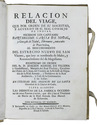
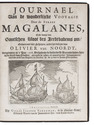
Reize naar Arabië en andere omliggende landen.
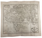
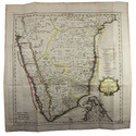
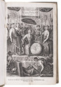
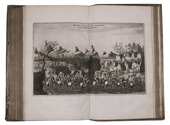
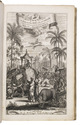
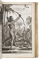
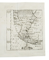
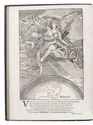
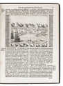
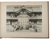
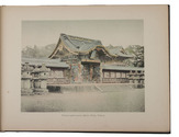
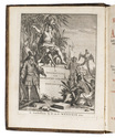
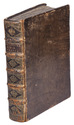
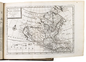
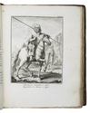
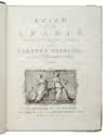
Amsterdam, S.J. Baalde; Utrecht, J. van Schoonhoven & Comp. (vol. 1) and Bartholomeus Wild (vol. 2) (colophons: printed in Utrecht by Johan Joseph Besseling), 1776-1780. 2 volumes. 4to (27.5 x 22 cm). With 2 engraved title-pages, each with the same vignette, 35 maps and plans (9 folding and the large map of Yemen coloured by hand in red and green outlines), 21 views (12 folding) and 69 other illustrations (19 folding) of people, sculptures and examples of ancient script, engraved by C. Philips, Th. and C.H. Koning, C.J. de Huyser, C.F. Fritsch, C. Brouwer and others. Half calf, sprinkled paper sides, gold-tooled spine with a red title label with gold lettering. VIII (I and III blank), [6], 484, [2]; [1], [1 blank], [1], [1 blank], [12], 455, [1] pp. Full description
€ 5,000
Amsterdam, S.J. Baalde; Utrecht, J. van Schoonhoven & Comp. (vol. 1) and Bartholomeus Wild (vol. 2) (colophons: printed in Utrecht by Johan Joseph Besseling), 1776-1780. 2 volumes. 4to (27.5 x 22 cm). With 2 engraved title-pages, each with the same vignette, 35 maps and plans (9 folding and the large map of Yemen coloured by hand in red and green outlines), 21 views (12 folding) and 69 other illustrations (19 folding) of people, sculptures and examples of ancient script, engraved by C. Philips, Th. and C.H. Koning, C.J. de Huyser, C.F. Fritsch, C. Brouwer and others. Half calf, sprinkled paper sides, gold-tooled spine with a red title label with gold lettering. VIII (I and III blank), [6], 484, [2]; [1], [1 blank], [1], [1 blank], [12], 455, [1] pp. Full description