Categories
Shopping cart (0 items € 0)
Advanced search

Cartography & Exploration

Official record of an important French circumnavigation around the world

BOUGAINVILLE, Hyacinthe-Yves-Philippe POTENTIEN, Baron de. 
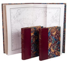
Journal de la navigation autour du globe de la frégate la Thétis et de la corvette l'Espérance pendant les années 1824, 1825 et 1826.
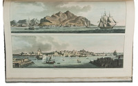
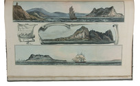
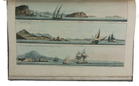
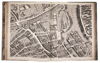
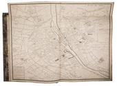
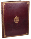
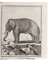
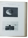
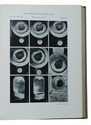
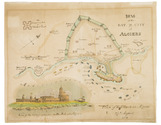
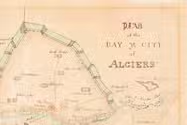
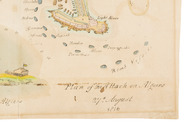
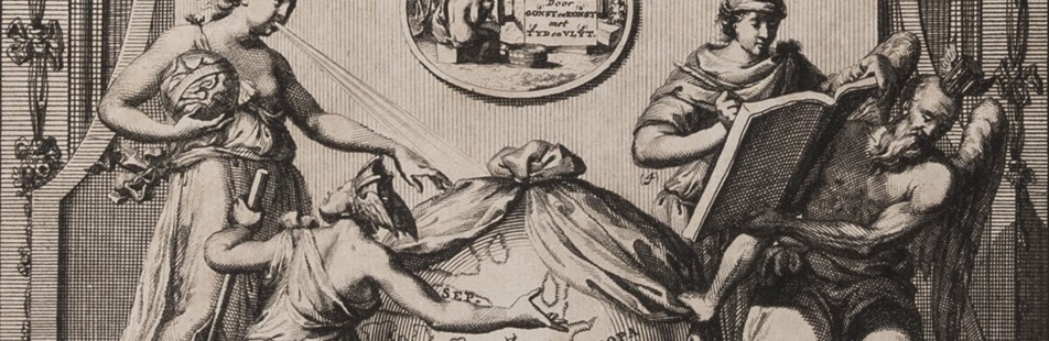
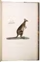
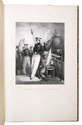
Paris, Impr. De Rignoux for Arthus Bertrand, 1837. 2 text volumes (4to) and 1 atlas volume (folio: 545 x 350 mm). With 34 full-page lithographed views and costume plates, 12 hand-coloured, full-page engraved plates, a double-page, hand-coloured aquatint, 7 engraved maps (1 folding, 6 double-page), 2 double-page plates, and few steel-engraved illustrations in the text. Later three-quarter red morocco. VIII, 742; XVI, 351, 165, [3] pp. Full description
€ 45,000
Order Inquire Terms of sale

Fine untrimmed copy of a pilot guide, with coloured maps and aquatint profiles

BOUGARD, René and John Thomas SERRES. The little sea torch: or, true guide for coasting pilots.
London, J. Debrett for the "author" [Serres], G. & W. Nicol, et al. [printed by T. Rickaby], 1801. Large folio (47 x 30 cm). With 20 numbered aquatint plates containing 137 coastal profiles, and 12 partly numbered engraved plates containing 24 maps of port cities, harbours, islands and the Strait of Gibraltar. All coastal profiles and maps beautifully and subtly coloured by a contemporary hand. Contemporary boards. VI, 144, [5] pp. Full description
€ 14,500
Order Inquire Terms of sale

Five rare publications on the 17th-century French mission in southeast Asia

BOURGES, Jacques de. Relation du voyage de Monseigneur l'evesque de Beryte, vicaire apostolique du royaume de la Cochinchine, par la Turquie, la Perse, les Indes, &c. jusqu'au royaume de Siam, & autres lieux.
Paris, Charles Angot, 1683. 8vo.
With:
(2) PALLU, François. Relation abregée des missions et des voyages des evesques François envoyez aux royaumes de la Chine, Cochinchine, Tonquin, & Siam.
Paris, Charles Angot, 1682.
(3) [FERMANEL DE FAVERY, Luc (editor)]. Relation des missions des evesques François aux royaumes de Siam, de la Cochinchine, de Camboye, & du Tonquin, &c. Divisée en quatre parties.
Paris, Charles Angot, 1684.
(4) Relation des missions et des voyages des evesques vicaires apostoliques, et de leurs ecclesiastiques és années 1672, 1673, 1674 & 1675.
Paris, Charles Angot, 1682.
(5) Relation des missions et des voyages des evesques vicaires apostoliques, et de leurs ecclesiastiques és années 1676 & 1677.
Paris, Charles Angot, 1682. 5 works in 1 volume. 8vo. Contemporary limp sheepskin parchment. [8], 167, [1]; [6], 51, [1 blank]; [16], 248; [16], 389, [1 blank]; [16], 170, [1] pp. Full description
€ 12,500
Order Inquire Terms of sale

17th-century Hungary, Dalmatia, and the Peloponnese depicted in numerous engraved plates

BOUTTATS, Gaspar (engraver). Korte en nette beschryvinghe van de koninckrycken Hongheryen en Dalmatien, Midts-gaeders de vorstendommen van Sevenberghen, Wallachien, Moldavien, Burgarien, etc. ...
Antwerpen, Hendrick van Dunewalt and Gasper Bouttats, 1688.
With: (2) [BOUTATTS Gaspar (compiler) and Vincenzo Maria CORONELLI (engraver)]. Korte, beknoopte, en nette beschryvinghe van het koninck-ryck Morea. ...
Antwerpen, Hendrick van Dunwalt and Gaspar Bouttats, [ca. 1685?].
Oblong 8vo (ca. 12 x 19 cm). With 82 full-page engraved plates (44 in ad 1 and 38 (including 1 folding) in ad 2). Contemporary gold-tooled calf (or sheepskin), sewn on 3 supports with the corresponding raised bands on the spine. 47, [1 blank] and 44 engraved plates; [1], [1 blank], 24 pp. and 38 engraved plates. Full description
€ 4,800
Order Inquire Terms of sale

First edition of the history and description of Enkhuizen

[BRANDT, Gerard]. Historie der vermaerde zee- en koop-stadt Enkhuisen, vervaetende haere herkomste, en voortgangh. Mitsgaders verscheide gedenkwaerdige geschiedenissen, aldaer voorgevallen.
Enkhuizen, Egbert van den Hoof, 1666. 4to. With the woodcut coat of arms of Enkhuizen on the title page, an engraved allegorical frontispiece by H. Bary, 5 full-page engraved portraits by H. Bary, a large folding plan of Enkhuizen after design by O. Suermondt, and a large folding plate with 31 coats of arms of the members of the city council. Contemporary sheepskin parchment. [12], 207, [1], 167, [1 blank], [16] pp. Full description
€ 1,950
Order Inquire Terms of sale

The greatest map of Paris, 240 x 316 cm, here with the 20 sheets and key map bound as an atlas
in contemporary gold-tooled morocco with the Paris city arms

BRETEZ, Louis. Plan de Paris commencé l'année 1734. Dessiné et gravé, sous les ordres de Messire Michel Etienne Turgot, Marquis de Sousmons ... Achevé de graver en 1739.
[Paris, 1739]. Grand-Aigle folio (56 x 45.5 cm). An enormous engraved map of Paris in 20 numbered sheets plus a key map, at a scale of about 1:2000, each segment measuring 55 x 84 cm (plate size 51.5 x 80.5 cm; image 48 x 79 cm) which would give an assembled map with image size about 240 x 316 cm! The key map is slightly larger than the segments and folds out at the head. Bound as an atlas (but with segments 18 and 19, containing the cartouche, assembled to make a long fold-out) in contemporary gold-tooled red morocco, each board with as centrepiece the Paris coat of arms (a ship with chief a field of fleurs-de-lis). Full description
€ 15,000
Order Inquire Terms of sale

An expedition to the South African interior: "of great permanent worth",
together with a description of the Cape of Good Hope

[BRINK, Carel Frederik]. Nouvelle description du Cap de Bonne-Espérance, avec un Journal historique d'un voyage de terre, . . . , dans l'intérieur de l'Afrique. . . . Sous le commandement du Capitain Mr. Henri Hop, . . .
Amsterdam, J.H. Schneider, 1778. 2 parts in 1 volume. 8vo. Title-page with an engraved vignette by Christian Friedrich Fritzsch and 16 folding engraved plates. Olive half calf (ca. 1840), gold-tooled spine. [6], 130, [2], 100 pp. Full description
€ 3,950
Order Inquire Terms of sale

Hand coloured battle plan for the 1816 attack on Algiers

[BRITISH NAVY - BATTLE PLAN - ALGIERS]. Plan of the Bay and City of Algiers.
[London?, 1816]. 35 x 44. With an illustration of the plan of attack and a view of the fortifications on the Mole at Algiers. Full description
€ 1,750
Order Inquire Terms of sale
689 books found / Show all