Categories
Shopping cart (0 items € 0)
Advanced search

Cartography & Exploration / Low Countries

Very rare first edition of a very interesting early 19th-centure travel guide for The Netherlands

[TRAVEL GUIDE - THE NETHERLANDS]. 
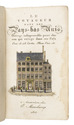
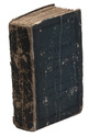
Le voyageur dans les Pays-Bas Unis. Ouvrage indispensable pour chacun qui voyage dans ces Pays. Orné de 28 cartes, plans, vues, etc.
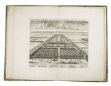
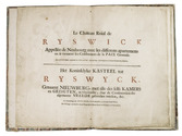
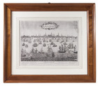
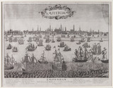
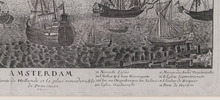
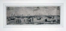
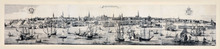
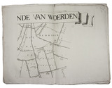
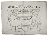
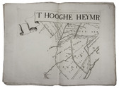
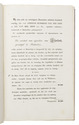
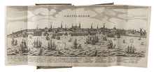
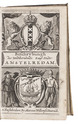
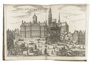
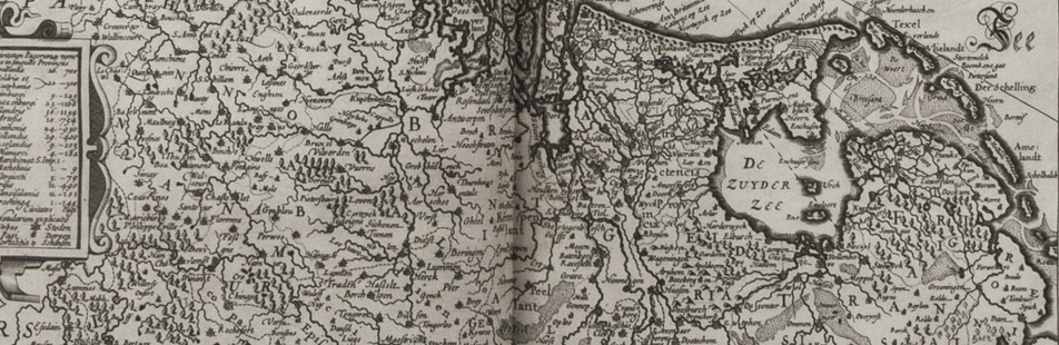
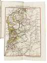
Amsterdam, Evert Maaskamp, 1815. 12mo. With a title vignette showing the Amsterdam publishing house of Evert Maaskamp, 3 folding maps, 13 double-page maps by I.B.D.B., 3 double-page city plans of Amsterdam, the Hague and Rotterdam, 6 full-page plates of the coins in use in The Netherlands on 1 folding leaf and 2 full-page plates of the ground floor of the Amsterdam city hall and Paleis Het Loo; all coloured by a contemporary hand. Original publisher's blue paper wrappers over boards. [2], 380, XXII, [10] pp. Full description
€ 1,850
Order Inquire Terms of sale

Spectacular views of Nieuwburg castle at Rijswijk in 1697, with an extra plate

[VIANEN, Jan van (illustrator)]. Le château Roial de Ryswick appellée de Neubourg avec les differens apartemens ou se tiennent les conferences de la paix generale.- Het koninklyke kasteel tot Ryswyck. Genaamt Nieuwburg, met alles des selfs kamers en gezigten, in 't bysonder, daar de conferentien der algemeene vreede gehouden werden, &c.
The Hague, Anna Beek, [1697]. Folio (33 x 20.5 cm). With a double-page title in red and black, 13 double-page engraved views (ca. 22 x 27 cm) on guards of Nieuwburg castle, 12 of which signed by Jan van Vianen. Contemporary quarter red sheepskin, marbled paper sides. [14] double-page ll. Full description
€ 5,950
Order Inquire Terms of sale

Large and beautifully executed panorama of Amsterdam

[VIEW - NETHERLANDS - AMSTERDAM]. OTTENS, Reinier and Josua OTTENS. Amsterdam.
[Amsterdam], Reinier and Josua Ottens, [ca. 1730]. Large engraved panorama on 4 sheets (ca. 42 x 218 cm as assembled). With title in banner at top centre, arms of the city at top right, city seal at top left and the primary locations with captions. Mounted and framed. Full description
€ 48,500
Order Inquire Terms of sale

Well-executed wall map of polder land between Gouda and Utrecht

[MAP]. [VINGBOONS, Johannes, Justus and David]. 'T hooghe heymraedtschap vanden lande van Woerden.
[Amsterdam, Hendrik de Leth], 1740. Wall map of the water district Woerden (South Holland) in 9 large loose untrimmed sheets (each 48 x 67 cm), with the title in a banderole across the head of three sheets, information about the 14th-century charters in a cartouche, a list of city and town officials in 1739 on a plinth, a compass rose, and a scale of Rijnland rods. Full description
€ 6,500
Order Inquire Terms of sale

A unique and reliable source for all matter concerning the Amsterdam Lutheran community

ZESEN, Philipp von. Beschreibung der Stadt Amsterdam. Darinnen von derselben ersten Ursprunge bis auf gegenwärtigen Zustand, ihr unterschiedlicher Anwachs, herliche Vorrechte, und in 60 Kupferstücken entworfene führnehmste Gebeue, zusamt ihrem Stahtswesen, Kaufhandel, und ansehnlicher Macht zur See, wie auch wass ich in und mit derselben märkwürdiges zugetragen, vor Augen gestellet werden. Hier ist auch beigefügt, ein Appendix oder Beschreibung der neuen Auslage der Stadt Amsterdam, samt den Kupferstücken.
Amsterdam, Markus Wilhelmsen Doornik, 1664. 12mo. With an engraved allegorical frontispiece, and 58 engraved plates (2 full-page, 4 folding, and 52 double-page). Contemporary overlapping vellum. [22], 567 pp. Full description
€ 2,500
Order Inquire Terms of sale
58 books found / Show all