Categories
Shopping cart (0 items € 0)
Advanced search

Cartography & Exploration / Navigation

Navigational guide covering the coast and coastal waters of Brazil, by the French Imprimerie Royale

ROUSSIN, Albin-Reine. 
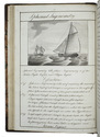
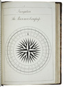
Le pilote du Brésil, ou description des côtes de l'Amérique Méridionale comprises entre l'ile Santa-Catharina et celle de Maranaõ, avec les instructions nécessaires pour atterrir et naviguer sur ces côtes; ...
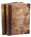
Paris, Imprimerie Royale, 1827. 8vo. Modern half calf, marbled sides. [3], [1 blank], 241, [1 blank] pp. Full description
€ 1,950
Order Inquire Terms of sale

Finely executed Royal Naval Academy exercises by the teenage future Admiral,
Charles Sotheby 493 pages including nautical charts, fortification plans,
astronomical diagrams, topographic views, etc.:

SOTHEBY, Charles. [engraved title-page:] A plan of mathematical learning taught in the Royal Academy Portsmouth performed by [in pencil: Charles Sotheby] a student there.
[Portsmouth], "177 " [recté 1795-1798]. 2 volumes. Imperial 4to (37.5 x 27 cm). Manuscript school exercises with a pre-printed engraved title-page with a blank space for the student to add his name, with 4 full-page and 1 larger folding nautical charts (some partly in colour), 7 full-page fortification plans (in black ink with 1 to 3 colours), 4 full-page astronomical diagrams (2 also with yellow), a full-page compass rose, 23 pen and ink wash views in the text (9 x 15 cm to 12.5 x 22 cm, 1 also with blue washes), and numerous other diagrams (including maps in the surveying section) and some illustrations in the text. Near contemporary (ca. 1803) blind- and gold-tooled half calf, blue sprinkled edges. engraved title-page + “229” [= 228]; 230-493, [2 blank] pp., with pp. 229 and 493 blank excepting the page numbers. Full description
€ 25,000
Order Inquire Terms of sale

Manuscript course in the art of navigation, with figures in colour, including 2 volvelles

[NAVIGATION]. [VRIES, Klaas de, and others]. Schatkamer of konst der stuurlieden.
[Holland?], [ca. 1735/40?]. Folio (31.5 x 20.5 cm). A manuscript course in navigation written in brown ink on laid paper in a largely upright cursive hand, with 6 colour figures, including 2 volvelles, about 100 black and white diagrams, and numerous tables of data, highlighted with a yellow wash. Green paper wrappers (made from a discarded prospectus or the wrapper of an instalment of a book, [ca. 1865?]), later green cloth spine. [2 blank], 16, 19-109, [9 blank] pp. Full description
€ 18,000
Order Inquire Terms of sale
24 books found / Show all