
Unrecorded, detailed printed inventory and auction announcement of an 18th-century Dutch frigate
FLINES, Jacob de, and Jacob de FLINES the younger.
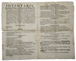
Inventaris.
Amsterdam, Jan van der Linde, [1747]. Folio. Folded. [1 blank], [2], [1 blank] pp. Full description
€ 2,250
Amsterdam, Jan van der Linde, [1747]. Folio. Folded. [1 blank], [2], [1 blank] pp. Full description