Categories
Shopping cart (0 items € 0)
Advanced search

Middle East & Islamic World / Cartography & Exploration

Illustrated eye-witness accounts and tall tales: sixty years of a sailor's world travels

LE BLANC, Vincent. De vermaarde reizen van de heer Vincent Le Blanc van Marsilien, die hy sedert d'ouderdom van veertien jaren, tot aan die van zestig, in de vier delen des werrelts gedaan heeft ...
Amsterdam, Jan Hendricksz. Boom, Jan Rieuwertsz., 1654. 2 parts in 1 volume. 4to. With engraved title-page and 7 engraved plates. 19th-century boards. [1], [1 blank], 152, 116 pp. Full description
€ 4,500
Order Inquire Terms of sale

Journal of a 1674/75 overland voyage through India, Iran, Iraq and Syria to Amsterdam

LEEUWENSON, Joannes (Pieter Arend LEUPE, ed. & intro.). Eene overlandreis uit Indië naar Nederland, in 1674-1675.
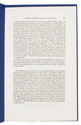
[Amsterdam, Frederik Muller, 1863]. 8vo. Offprint, retaining the original pagination and collation, of an article in Bijdragen tot de Taal-, Land- en Volkenkunde van Nederlandsch-Indië, 6 (1863). 20th-century stiff paper wrappers, with a printed label on the front. pp. [89], 90-142. Full description
€ 1,250
Order Inquire Terms of sale

Rare treatise on three posthumously published maps of Syria by Guillaume de l'Isle

L'ISLE (DELISLE), Joseph Nicolas de. Mémoire sur trois cartes nouvellement publiées en juillet 1764, destinées a servir de suite a la carte de l'ancienne Palestine ou Terre-Sainte, publie l'année dernière; Sçavoir: 1. Une carte particuliere de la Syrie, ou seulement de la partie septentrionale à la Palestine. 2. Une carte plus générale de la Syrie, qui comprend en même tems la Palestine avec les pays voisins, pour servir à l'histoire des croisades, etc. 3. Une carte encore plus générale & plus étendüe pour la recherche de la situation du paradis terrestre.
Paris, Imprimerie Veuve Delatour, 1764. 4to. With a woodcut vignette on the title page, a large woodcut headpiece, and a decorated woodcut initial. Contemporary gold-tooled mottled quarter brown calf. 15, [1] pp. Full description
€ 2,700
Order Inquire Terms of sale

Famous work on the Middle East, illustrated with very early photogravures of the Holy Land

LUYNES, Honoré d'Albert de. Voyage d'exploration à la mer Morte, à Petra et sur la rive gauche du Jourdain. ... Oeuvre posthume publiée par ses petit-fils sous la direction de M. le Comte de Vogüé.
Paris, Arthus Bertrand (on back of half-title: printed by E. Martinet (vols. 1-2) and Arnous de Rivière (vol. 3)), [1874]. 3 volumes of text and 1 atlas of plates. Imperial 4to (35.2 x 26.5 cm). With 14 numbered lithographed plates in volume 3 (4 double-page chromolithographed maps, views and geological sections; 2 further geological plates and 8 plates showing archaeological specimens), 85 plates in the atlas volume (including 65 photogravures and double-page chromolithographed maps) and numerous wood-engravings in the text. Set in roman and italic types with occasional passages in Greek and especially Arabic. Text volumes in original publisher's letterpress-printed light blue wrappers, atlas in half cloth portfolio with the original publisher's letterpress-printed paper sides, matching the text volumes; the 4 volumes preserved in 2 modern black half calf clamshell boxes. [8], 388; [6], 226; [4], VI, 326; [4] pp. Full description
€ 35,000
Order Inquire Terms of sale

Extremely rare example of the largest globe engraved by Malby (45.5 cm diameter), with lines of magnetic variation, London 1848, showing “Debai” (Dubai)

[GLOBE - TERRESTRIAL]. MALBY & CO. Malby's terrestrial globe.
[London], Malby & Co. (engraved by Chas. Malby), 1 January 1848. Diameter: 45.5 cm (18 inch), height in stand: 64.5 cm. An engraved terrestrial globe with 12 gores and 2 polar caps over a plaster-covered core, and the engraved horizon ring on the wooden stand, all coloured by a contemporary hand. In a contemporary wooden stand with 3 turned legs supporting the horizon ring, and 3 turned stretchers with a cylindrical centrepiece with a knob on the underside. Further with a contemporary brass hour circle and a slightly later iron meridian ring (and probably the axis pivots). Full description
€ 35,000
Order Inquire Terms of sale

Cross-cultural mapping of the Red Sea: Bruce's chart in an early Egyptian manuscript copy

[MAP - ARABIAN PENINSULA]. BRUCE, James. Carte de la mer Rouge, relevée sur celle de James Bruce.
[Egypt, probably Cairo], 1827. Folio leaf (46 x 31.5 cm). Manuscript map in pen and ink with watercolour, with a French text on Middle Eastern hand-made paper. Full description
€ 15,000
Order Inquire Terms of sale
117 books found / Show all