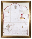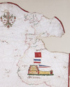

First edition of Vadianus’ important description of the world, including the very rare map
VADIANUS, Joachim (Joachim von WATT).
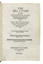
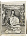
Epitome trium terrae partium, Asiae, Africae et Europae compendiariam locorum descriptionem continens ...
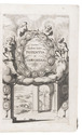
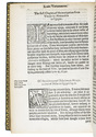
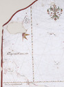
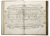
Zürich, Christoph Froschauer, 1534. Folio. With woodcut printer's device on title-page, numerous decorated woodcut initials and a double page woodcut world map "Typus cosmographus universalis" after Sebastian Münster. Modern calf. [44], 273, [1] pp. Full description
€ 38,500
Zürich, Christoph Froschauer, 1534. Folio. With woodcut printer's device on title-page, numerous decorated woodcut initials and a double page woodcut world map "Typus cosmographus universalis" after Sebastian Münster. Modern calf. [44], 273, [1] pp. Full description