
The most beautiful work on Dutch military uniforms
TEUPKEN, Jan Frederik.
Beschrijving hoedanig de Koninklijke Nederlandsche troepen en alle in militaire betrekking staande personen gekleed, geëquipeerd en gewapend zijn ...
The Hague, Gebroeders van Cleef (printed by de gebroeders Giunta d'Albanie), 1826.
With: IDEM. Vervolg van de beschrijving hoedanig de koninklijke Nederlandsche troepen en alle in militaire betrekking staande personen gekleed, geëquipeerd en gewapend zijn.
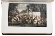
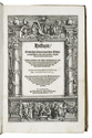
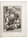
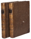
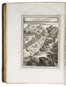
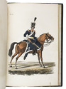
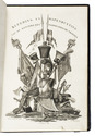
The Hague, Gebroeders van Cleef (printed by de gebroeders Giunta d'Albanie), 1826. 2 parts in 2 volumes. Folio. With 68 full-page numbered plates (65 hand coloured and engraved, 3 lithographed), a full-page hand-coloured unnumbered engraved plate, and an engraved title page in the first volume.
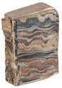
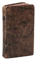
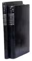
Slightly later black paper, with a black paper title label on the spine, lettered in gold. The work is housed in a modern gold-tooled half black morocco clamshell box with marbled paper sides, with the title and author lettered in gold on the spine. [1], [1 blank], 10, 110, 20, [2], [2]; 4, [2], 54, 7, [3] pp. Full description
€ 9,500
The Hague, Gebroeders van Cleef (printed by de gebroeders Giunta d'Albanie), 1826.
With: IDEM. Vervolg van de beschrijving hoedanig de koninklijke Nederlandsche troepen en alle in militaire betrekking staande personen gekleed, geëquipeerd en gewapend zijn.
The Hague, Gebroeders van Cleef (printed by de gebroeders Giunta d'Albanie), 1826. 2 parts in 2 volumes. Folio. With 68 full-page numbered plates (65 hand coloured and engraved, 3 lithographed), a full-page hand-coloured unnumbered engraved plate, and an engraved title page in the first volume.
Slightly later black paper, with a black paper title label on the spine, lettered in gold. The work is housed in a modern gold-tooled half black morocco clamshell box with marbled paper sides, with the title and author lettered in gold on the spine. [1], [1 blank], 10, 110, 20, [2], [2]; 4, [2], 54, 7, [3] pp. Full description