
Extremely rare Dutch collection of early voyages, including Pelsaert’s account of Australia
[DUTCH VOYAGES - Joost HARTGERS (publisher)].
Oost-Indische voyagien door dien begin en voortgangh van de Vereenighde Nederlandtsche Geoctroyeerde Oost-Indische Compagnie. Vervatende de voornaemste reysen, by de inwoonderen der selver provintien derwaerts ghedaen ... Eerste deel. daer in begrepen zijn 16 voyagien.
Amsterdam, [printed by Adriaen Hermansz. Roest for] Joost Hartgers, 1648.
Comprising:
(1) [VEER, Gerrit]. Verhael van de eerste schip-vaert der Hollandische ende Zeeusche schepen, door 't Way-gat ...
Amsterdam, Joost Hartgers, 1648.
(2) [HOUTMAN, Cornelis]. Eerste schip-vaert der Hollanders naer Oost-Indien ... anno 1595.
Amsterdam, Joost Hartgers, 1648.
(3) [NECK, Jacob van en Wybrand van WARWIJCK]. Waerachtigh verhael van de schip-vaert op Oost-Indien ...
Amsterdam, Joost Hartgers, 1648.
(4) [NOORT, Olivier van and Jacob van NECK]. Wonderlijcke voyagie by de Hollanders gedaen, door de Strate Magalanes ...
Amsterdam, Joost Hartgers, 1648.
(5) [SPILBERGEN, Joris van and Steven vander HAGEN]. Historis journael van de voyage gedaen met 3 schepen ...
Amsterdam, Joost Hartgers, 1648.
(6) [MATELIEF, Cornelis]. Journael, ende historische verhael, van de treffelijcke reyse ghedaen naer Oost-Indien ...
Amsterdam, Joost Hartgers, 1648.
(7) [BROECKE, Pieter van den]. Wonderlijcke historische ende journaelsche aenteyckeningh ...
Amsterdam, Joost Hartgers, 1648.
(8) [SPILBERGEN, Joris van]. Oost- en West-Indische voyagie, door de Strate Magallanes naer de Moluques ...
Including: [SCHOUTEN, Willem Cornelisz. and Jacob le MAIRE]. Journael, ofte beschrijvinge van de wonderlijcke reyse ghedaen door Willem Cornelisz. Schouten van Hoorn. In de jaren 1615, 1616, 1617 ...
Amsterdam, Joost Hartgers, 1648.
(9) HEREMITE, Jacques l' and Gheen Huygen SCHAPENHAM]. Journael vande Nassausche vloot ...
Amsterdam, Joost Hartgers, 1648.
(10) [BONTEKOE, Willem Ysbrantsz.]. Journael ofte gedenckwaerdige beschrijvinge van de Oost-Indische reyse van Willem Ysbrantsz. Bontekoe van Hoorn ...
Including: [RAVEN, Dirck Albertsz.]. Journael ofte beschrijvinge van de reyse ghedaen by den Commandeur Dirck Albertsz. Raven, na Spitsberghen ...
"Sardam, Willem Willemsz., 1648." [= Amsterdam, Joost Hartgers, 1648?].
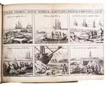
(11) [PELSAERT, François and Jeremias van VLIET]. Ongeluckige voyagie, van 't schip Batavia, nae Oost-Indien ...
Amsterdam, Joost Hartgers, 1648.
(12) TWIST, Johan van. Generale beschrijvinge van Indien ...
Amsterdam, Joost Hartgers, 1648.
(13) CARON, François. Beschrijvinge van het machtigh coninckrijcke Japan ...
Including:
- GYSBERTSZ., Reyer. Historie der martelaren ...
- KRAMMER, Coenraad. Verhael van de groote pracht ... op den feest ghehouden in de stadt van Meaco ...
- CAMPEN, Leonart. Kort verhael van 't profijt, dienst, ende nuttigheydt dat de Oost-Indische vereenighde Nederlandtsche Compagni in Japan soude genieten, by so verre sy den Chineesen handel bequaemen.
- SCHOUTEN, Joost. Beschrijvinghe van de regeeringe, macht, religie, costuymen, traffijcquen, en[de] andere remercquable saken, des Coninghrijcx Siam. Gestelt inden jare 1636 ...
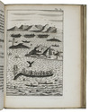
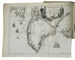
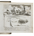
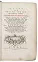
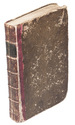
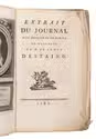
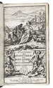
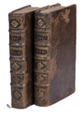
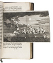
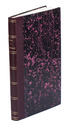
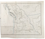
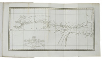
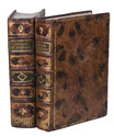
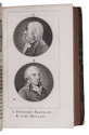
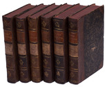
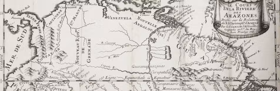
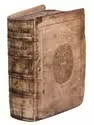
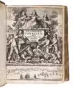
Amsterdam, Joost Hartgers, 1648. 13 works in 1 volume. 4to. With an engraved general title page for the whole collection, a typographical general title page with a woodcut illustration of ships at sea, each part of the collection has its own title page (in some cases two) with a woodcut illustration (the majority the same as on the general title page). Further with 11 folding woodcut illustrations, several woodcut tailpieces, and woodcut decorated initials throughout. Contemporary blind-tooled vellum with the manuscript title on the spine, remnants of ties. A detailed list of contents is available upon request. Full description
€ 80,000
Amsterdam, [printed by Adriaen Hermansz. Roest for] Joost Hartgers, 1648.
Comprising:
(1) [VEER, Gerrit]. Verhael van de eerste schip-vaert der Hollandische ende Zeeusche schepen, door 't Way-gat ...
Amsterdam, Joost Hartgers, 1648.
(2) [HOUTMAN, Cornelis]. Eerste schip-vaert der Hollanders naer Oost-Indien ... anno 1595.
Amsterdam, Joost Hartgers, 1648.
(3) [NECK, Jacob van en Wybrand van WARWIJCK]. Waerachtigh verhael van de schip-vaert op Oost-Indien ...
Amsterdam, Joost Hartgers, 1648.
(4) [NOORT, Olivier van and Jacob van NECK]. Wonderlijcke voyagie by de Hollanders gedaen, door de Strate Magalanes ...
Amsterdam, Joost Hartgers, 1648.
(5) [SPILBERGEN, Joris van and Steven vander HAGEN]. Historis journael van de voyage gedaen met 3 schepen ...
Amsterdam, Joost Hartgers, 1648.
(6) [MATELIEF, Cornelis]. Journael, ende historische verhael, van de treffelijcke reyse ghedaen naer Oost-Indien ...
Amsterdam, Joost Hartgers, 1648.
(7) [BROECKE, Pieter van den]. Wonderlijcke historische ende journaelsche aenteyckeningh ...
Amsterdam, Joost Hartgers, 1648.
(8) [SPILBERGEN, Joris van]. Oost- en West-Indische voyagie, door de Strate Magallanes naer de Moluques ...
Including: [SCHOUTEN, Willem Cornelisz. and Jacob le MAIRE]. Journael, ofte beschrijvinge van de wonderlijcke reyse ghedaen door Willem Cornelisz. Schouten van Hoorn. In de jaren 1615, 1616, 1617 ...
Amsterdam, Joost Hartgers, 1648.
(9) HEREMITE, Jacques l' and Gheen Huygen SCHAPENHAM]. Journael vande Nassausche vloot ...
Amsterdam, Joost Hartgers, 1648.
(10) [BONTEKOE, Willem Ysbrantsz.]. Journael ofte gedenckwaerdige beschrijvinge van de Oost-Indische reyse van Willem Ysbrantsz. Bontekoe van Hoorn ...
Including: [RAVEN, Dirck Albertsz.]. Journael ofte beschrijvinge van de reyse ghedaen by den Commandeur Dirck Albertsz. Raven, na Spitsberghen ...
"Sardam, Willem Willemsz., 1648." [= Amsterdam, Joost Hartgers, 1648?].
(11) [PELSAERT, François and Jeremias van VLIET]. Ongeluckige voyagie, van 't schip Batavia, nae Oost-Indien ...
Amsterdam, Joost Hartgers, 1648.
(12) TWIST, Johan van. Generale beschrijvinge van Indien ...
Amsterdam, Joost Hartgers, 1648.
(13) CARON, François. Beschrijvinge van het machtigh coninckrijcke Japan ...
Including:
- GYSBERTSZ., Reyer. Historie der martelaren ...
- KRAMMER, Coenraad. Verhael van de groote pracht ... op den feest ghehouden in de stadt van Meaco ...
- CAMPEN, Leonart. Kort verhael van 't profijt, dienst, ende nuttigheydt dat de Oost-Indische vereenighde Nederlandtsche Compagni in Japan soude genieten, by so verre sy den Chineesen handel bequaemen.
- SCHOUTEN, Joost. Beschrijvinghe van de regeeringe, macht, religie, costuymen, traffijcquen, en[de] andere remercquable saken, des Coninghrijcx Siam. Gestelt inden jare 1636 ...
Amsterdam, Joost Hartgers, 1648. 13 works in 1 volume. 4to. With an engraved general title page for the whole collection, a typographical general title page with a woodcut illustration of ships at sea, each part of the collection has its own title page (in some cases two) with a woodcut illustration (the majority the same as on the general title page). Further with 11 folding woodcut illustrations, several woodcut tailpieces, and woodcut decorated initials throughout. Contemporary blind-tooled vellum with the manuscript title on the spine, remnants of ties. A detailed list of contents is available upon request. Full description