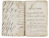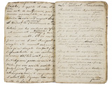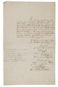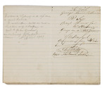

Crucial letter in the life of Maria Malibran, the greatest opera star of her time
MALIBRAN, Maria.
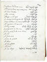
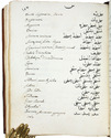
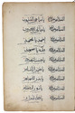
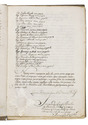
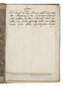
[Autograph letter, signed, from Maria Malibran to Mr. Colladon].
Norwich, 23 September [1830]. 4to. Written in ink on paper. Disbound. Gilt edges. 4 pp. Full description
€ 6,500
Norwich, 23 September [1830]. 4to. Written in ink on paper. Disbound. Gilt edges. 4 pp. Full description