
Rare fine complete set of the great Atlas of Denmark
PONTOPPIDAN, Erik and Hand de HOFMAN.
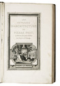
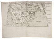
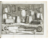
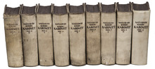
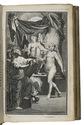
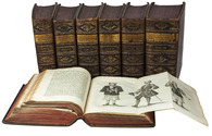
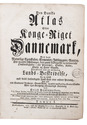
Den Danske Atlas, eller Konge-Riget Dannemark, med dets naturlige Egenskaber, Elementer, Indbyggere, Vaexter, Dyr og andre Affödninger, dets gamle Tildragelser og naervaerende Omstaendigheder i alle Provintzer, Staeder, Kirker, Slotte og Herre-Gaarde. Forestillet ved en udförlig Lands-Beskrivelse, ... Tomus I[-VII].
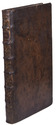
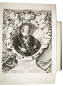
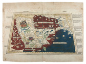
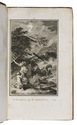
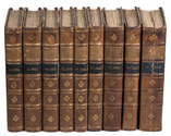
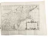
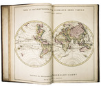
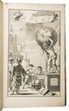
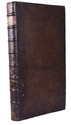
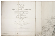
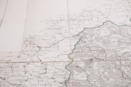
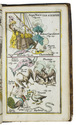
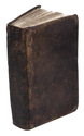
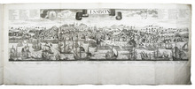
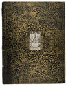
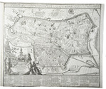
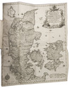
Copenhagen, Andreas Hartvig Godiche, Royal University Printer (vols. I-V) and heirs (vols. VI-VII), 1763-1781. 7 volumes. 4to. With 296 mostly folding engraved maps, plans and views of Denmark and Danish cities, castles, houses and gardens, including engraved plates showing Danish antiquarian relics, plants, animals and costumes. Contemporary uniform calf, richly gold-tooled spines. 723 to 1104 pp. per volume, giving more than 6000 pp. in total. Full description
€ 13,500
Copenhagen, Andreas Hartvig Godiche, Royal University Printer (vols. I-V) and heirs (vols. VI-VII), 1763-1781. 7 volumes. 4to. With 296 mostly folding engraved maps, plans and views of Denmark and Danish cities, castles, houses and gardens, including engraved plates showing Danish antiquarian relics, plants, animals and costumes. Contemporary uniform calf, richly gold-tooled spines. 723 to 1104 pp. per volume, giving more than 6000 pp. in total. Full description