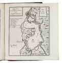

17th-century map of Persia
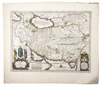
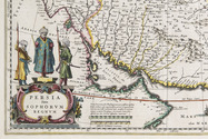
BLAEU, Willem Janszoon.
Persia sive Sophorum Regnum.
Amsterdam, 1642. Engraved map (38 x 49,5 cm), in contemporary hand-colouring. Scale 1:9,000,000. Full description
€ 1,500
Amsterdam, 1642. Engraved map (38 x 49,5 cm), in contemporary hand-colouring. Scale 1:9,000,000. Full description