Categories
Shopping cart (0 items € 0)
Advanced search

Cartography, Exploration & Voyages / Africa

First edition of Vadianus’ important description of the world, including the very rare map

VADIANUS, Joachim (Joachim von WATT). Epitome trium terrae partium, Asiae, Africae et Europae compendiariam locorum descriptionem continens ...
Zürich, Christoph Froschauer, 1534. Folio. With woodcut printer's device on title-page, numerous decorated woodcut initials and a double page woodcut world map "Typus cosmographus universalis" after Sebastian Münster. Modern calf. [44], 273, [1] pp. Full description
€ 38,500
Order Inquire Terms of sale

Egypt in 309 beautiful illustrations, many in colour

VALERIANI, Domenico and Girolamo SEGATO. Nuova illustrazione istorico-monumentale del basso e dell'alto Egitto.
Including: Atlante monumentale del basso e dell'alto Egitto.
Florence, Paolo Fumagalli, 1836-1837 (text) & 1837-1841 (plates). 2 text volumes (8vo) and 2 plates volumes (large folio). With an engraved portrait of Segato as frontispiece in the first text volume and the plate volumes with 160 engraved and aquatint plates (7 double-page), including 51 tinted and/or coloured by a contemporary hand; many plates contain multiple illustrations, making 309 illustrations in total. Contemporary green (text vols.) and brown (plates vols.) half morocco. [2], 491, [1 blank], [4]; 788, [6] pp. text. Full description
€ 18,000
Order Inquire Terms of sale

Della Valle's travels in Persia and the Near East, "one of the finest works of travel literature" (Howgego)

VALLE, Pietro della. De volkome beschryving der voortreffelijke reizen van de deurluchtige reisiger Pietro della Valle, edelman van Romen, in veel voorname gewesten des werrelts, sedert het jaer 1615, tot in 't jaar 1626 gedaan ...
Amsterdam, Abraham Wolfgang, 1666 (each volume title: Abraham Wolfgang, widow of Jan Hendriks Boom, Jan Rieuwertsz., 1664-1665). 6 volumes bound as 1. 4to. With 25 engraved plates. 19th-century vellum. Full description
€ 12,500
Order Inquire Terms of sale

Della Valle's travels in the Near East, Persia and Arabia: "one of the finest works of travel literature" (Howgego)

VALLE, Pietro della. Reiss-Beschreibung in unterschiedliche Theile der Welt, nemlich in Türckey, Egypten, Palestina, Persien, Ost-Indien, und andere weit entlegene Landschaften ...
Geneva, Johann Hermann Widerholds, 1674. 4 volumes bound as 1. Folio. With 31 engraved plates (1 folding), including frontispiece and portraits of the author and his wife, by Jean Jacques Thourneyser. Contemporary vellum. [20], 218, [12], [2 blank]; [4], 236, [12]; [4], 244, [13], [1 blank]; [6], 231, [17] pp. Full description
€ 15,000
Order Inquire Terms of sale

Very early European eyewitness description of India, confirming Marco Polo’s statements

VARTHEMA, Ludivico di. The Navigation and v[o]yages of Lewes Vertomannus, Gentelman of the citie of Rome, to the regions of Arabia, Egypte, Persia, Syria, Ethiopia, and East India, both within and without the ryver of Ganges, etc. In the yeere of our Lorde 1503. Conteynyng many notable and straunge thinges, both hystoricall and naturall. Translated out of Latine into Engylshe, by Richarde Eden.
London, Richard Jugge, 1577. 4to. With historiated woodcut initials. Splendid modern navy blue morocco, (faded) gold-tooled spine, gold-tooled double fillet frame on both boards. [10], 466, [6] ll. Full description
€ 185,000
Order Inquire Terms of sale

Beautifully illustrated travel account, including a full history of the recent war
between the Dutch East India Company and Makassar

VERMEULEN, Gerrit Gedenkwaardige voyagie van Gerret Vermeulen naar Oost-Indien, in't jaar 1668, aangevangen, en in't jaar 1674. voltrokken...
Amsterdam, Jan Claesz ten Hoorn, 1676. 4to. With an engraved allegorical frontispiece, 6 almost half-page engravings in the text, and a decorated woodcut initial. Modern blind-tooled sprinkled half calf. [4], 91, [1 blank] pp. Full description
€ 3,950
Order Inquire Terms of sale

A rare and magnificent 18th-century portolan chart of the Portuguese Empire,
produced at the time of the Atlantic slave trade

VIANNA, Manoel José. [Manuscript portolan chart of the Atlantic Ocean, including Western Europe, South America, and West Africa].
Porto, 1786. Chart ca. 86 x 68 cm; frame ca. 101 x 83.5 cm. Detailed manuscript portolan chart in ink and paint and/or ink wash in green, yellow, red, and brown on vellum. The chart is drawn within a red washed border and shows the detailed coastlines of the east coast of South America, the west coast of Africa, and the west coast of northwest Europe up to the Netherlands and including Great Britain and Ireland. The coasts are drawn in sections alternatingly in yellow, green, and red ink. Principal regions are added in large decorative script, coastal towns, cities, and capes are added in a small cursive hand. Also depicted are a detailed split graticule indicating longitude and latitude, intricate rhumb lines, islands, dangerous rocky outcrops (marked vegia (= vigia, meaning lookouts)), and inshore shoals. Further decorative elements in the chart are the flags in Brazil (Portuguese coat-of-arms), Algeria (Ottoman Empire?), and West Africa (Dutch flag, upside down); the side view of Elmina Castle in west Africa, two half wind roses, elaborate rococo floral (fleur-de-lis) ornaments at the head of the chart and in South America. The banderole at the bottom of the chart contains the following text: "Manoel Joze Vianna a Fes no Porto" and below the year of production "1786". Framed in a gold-coloured frame and mounted on a cream cloth covered backboard. Full description
€ 135,000
Order Inquire Terms of sale

Horrifying account of a shipwreck, bound together with the travels of Pierre Poivre
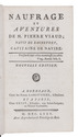
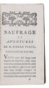
VIAUD, Pierre (and Jean Garpard DUBOIS-FONTANELLE). Naufrage et aventures de M. Pierre Viaud; natif de Rochefort, capitaine de navire.
Bordeaux, the Labottiere brothers; Paris, Lejay, 1780.
With: (2) [POIVRE, Pierre]. Voyage d'un philosophe, ou observations sur les moers & les arts des peuples de l'Afrique, de l'Asie et de l'Amerique.
Yverdon, 1768. 2 works in 1 volume. 8vo. Contemporary gold-tooled tree calf, richly gold-tooled spine; very subtly rebacked, preserving original backstrip. XXIV, 307, [4], [1 blank]; 140, [2] pp. Full description
€ 1,950
Order Inquire Terms of sale

Hand-coloured map of Africa, with an especially accurate southern coastline

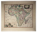
[MAP - AFRICA]. VISSCHER, Nicolaas. Africae accurata tabula.
[Amsterdam], Nicolas Visscher, [ca. 1690?]. Engraved double-page map (image size: 43.5 x 54 cm; leaf size: 51 x 60 cm), coloured by a contemporary hand. With title in a decorated cartouche on the top right flanked by two Africans and two putti and dedication to Gerardus Schaap in a decorated cartouche on the bottom left, with Schaap's coat of arms on top and flanked by mythical figures. Further illustrated with small ships and African animals (including lions, monkeys, rhinoceros and ostriches). In passepartout (56 x 66 cm). Full description
€ 2,500
Order Inquire Terms of sale

23 rare official VOC publications, giving insights into daily life on and around the ships

[VOC]. [Collection of printed VOC orders, resolutions, instructions and other documents, assembled and published with a printed contents list.]
Amsterdam and possibly elsewhere, Nicolaas Byl, Adriaan Wor and others, 1747-1790. Folio. With 2 woodcut illustrations in item 20, 1 leaf inserted in item 23 printed in red, and several items with a woodcut ship on the title page and/or one or more woodcut decorated initials. Contemporary (ca. 1790) sheepskin parchment. Full description
€ 9,500
Order Inquire Terms of sale
91 books found / Show all