Categories
Shopping cart (0 items € 0)
Advanced search

Cartography, Exploration & Voyages / Drawings & Manuscripts

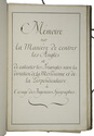
Cartographic manuscript to teach engineer-geographers to "centrer" (bisect?) angles and triangulate,
based on the work of two important French 18th-century cartographers

[MANUSCRIPT - CARTOGRAPHY]. Memoire sur la manière de centrer les angles et de calculer les triangles selon la direction de la méridienne et de la perpendiculaire à l 'usage des ingenieurs-géographes.
[France, ca. 1750/99]. Folio. Manuscript in French on thick paper, written in a neat 18th-century cursive hand. With 5 manuscript plates, showing 14 geometrical figures. Sewn in quires and stored loose in a portfolio covered with grey paper, grey cloth ties, paper label on the front board. [2 blank], [1], [1 blank], 61, [3 blank] pp. Full description
€ 2,750
Order Inquire Terms of sale

Travelling through Germany and Russia in the 19th century

[MANUSCRIPT - DUTCH]. TROMP, C.H. [Collection of an illustrated manuscript diary, and travel journals, including some views and photographs of Russia and Germany].
[The Netherlands, 1824-1911]. Manuscript on paper in Dutch. Preserved in a card-board box (27 x 23.5 x 7 cm), covered with marbled paper. Full description
€ 3,500
Order Inquire Terms of sale

Traversing Qajar Persia with a manuscript guide

[PERSIA - TRAVEL GUIDE]. [Manuscript travel guide].
[Qajar Iran, ca. 1850s]. 8vo (12.5 x 22 cm). Persian manuscript on polished paper. Black nasta'liq script in 15 lines per page, ruled in green and blue, with rubricated chapter headings and marginal medallions. Contemporary limp leather and woven floral-patterned cloth. 26 ll. Full description
€ 8,500
Order Inquire Terms of sale

Attractive coloured views of the Pyrenees, including several panoramas

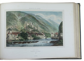
PETIT, Victor Jean-Baptiste. Bagneres de Luchon et ses environs.
Paris, Charles Boivin; Pau, Auguste Bassy, [ca. 1850]. Oblong folio (26.5 x 37.5 cm). With a lithographed title-page with a hand-coloured vignette, and 29 numbered lithographed plates, all coloured by hand and some double-page (including 1 folding out vertically) or folding panoramas. All plates mounted on thick wove paper with letterpress captions. Contemporary gold- and blind-blocked dark green cloth, gilt edges. Full description
€ 1,250
Order Inquire Terms of sale

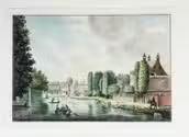
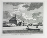
Pendant of a drawing in the Amsterdam city archives, together with two engravings after the drawing

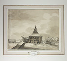
[AMSTERDAM]. PHILIPS, Caspar Jacobsz. Afbeelding van de Oostzijde der Muijder Poort te Amsterdam, na dat dezelve tussen den 29 en 30 Januarij 1769 bij na 16 voeten diep in de grond gezakt was.
[Netherlands], 1772. (23 x 29 cm). Original pen drawing.
With:
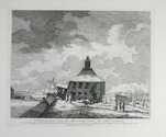
(2) KEUN, Hendrik. Afbeelding van de Muyderpoort te Amsterdam, zo als die zig vertoonde, na dat dezelve tussen den 29 en 30 Jannuary 1769 by de 16 voeten in de grond gezakt was.
Amsterdam, F.W. Greebe, [1769]. (22 x 28.7 cm)
(3) KEUN, Hendrik. Afbeelding van de Muyderpoort te Amsterdam, zoo als die ingezakt synde, van buiten af te zien zig vertoond.
Amsterdam, F.W. Greebe, [1769]. (21.7 x 28.2 cm.
Two engraved views with captions below the image, both signed "H. Keun Fecit" in the plate. Full description
€ 2,500
Order Inquire Terms of sale

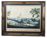
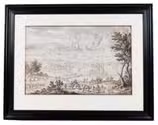
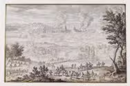
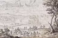
Panoramic landscape of the Siege of Besançon, a refined drawing attributed to Pierre Puget

[PUGET, Pierre Paul]. The Siege of Besançon.
[France, late 17th century]. 46 x 58 cm. Brown and black ink and grey wash on vellum mounted on a wooden panel, heightened with gold. In a passepartout behind glass in a modern black wooden frame. Full description
€ 8,500
Order Inquire Terms of sale

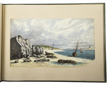
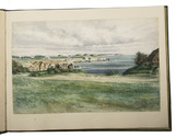
22 excellent watercolour views of rocky sea-coasts in New Caledonia & Peru

ROMIEUX, Osmond. [Watercolour views of sea-coasts in New Caledonia and Peru].
[New Caledonia & Peru], [1855/60?]. Album: full-sheet leaves (oblong 1mo) (39.5 × 52.5); drawings: oblong folio and oblong 4to. An album with 21 watercolour drawings on paper with views of sea coasts from the shore (24 × 31 cm to 29.5 × 46.5 cm), one with a 22nd watercolour drawing on the back with a similar view, and one with about 15 human figure drawings in graphite pencil on the back. All bear the artists stamp on the front (Lugt 3703) and 4 are signed or initialled by the artist. Richly gold- and blind-tooled green goatskin morocco, white watered silk endleaves. 21 album ll. with 1 drawing mounted on each recto. Full description
€ 18,000
Order Inquire Terms of sale

Finely executed Royal Naval Academy exercises by the teenage future Admiral,
Charles Sotheby 493 pages including nautical charts, fortification plans,
astronomical diagrams, topographic views, etc.

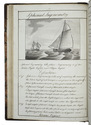
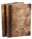
SOTHEBY, Charles. [Engraved title page:] A plan of mathematical learning taught in the Royal Academy Portsmouth performed by [in pencil: Charles Sotheby] a student there.
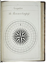
[Portsmouth], "177 " [recté 1795-1798]. 2 volumes. Imperial 4to (37.5 x 27 cm). Manuscript school exercises with a pre-printed engraved title-page with a blank space for the student to add his name, with 4 full-page and 1 larger folding nautical charts (some partly in colour), 7 full-page fortification plans (in black ink with 1 to 3 colours), 4 full-page astronomical diagrams (2 also with yellow), a full-page compass rose, 23 pen and ink wash views in the text (9 x 15 cm to 12.5 x 22 cm, 1 also with blue washes), and numerous other diagrams (including maps in the surveying section) and some illustrations in the text. Near contemporary (ca. 1803) blind- and gold-tooled half calf, blue sprinkled edges. Engraved title page + “229” [= 228]; 230-493, [2 blank] pp., with pp. 229 and 493 blank excepting the page numbers. Full description
€ 25,000
Order Inquire Terms of sale
19 books found / Show all