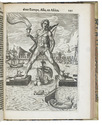

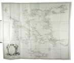
A valuable account of the Greek islands, with a large folding chart
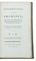
[KINSBERGEN, Jan Hendrik van].
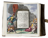
Beschryvinge van den archipel, tot nut van den krygsman, zeevaarenden en handeldryvenden.
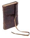
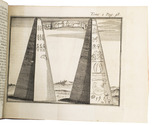
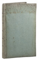
Amsterdam, 1792. 8vo. With a large folding engraved sea chart (57.5 x 68.5 cm). Publisher's original flexible boards covered with blue paper, with the title and decoration printed letterpress on the spine. [8], 190, [2 blank] pp. Full description
€ 1,850
Amsterdam, 1792. 8vo. With a large folding engraved sea chart (57.5 x 68.5 cm). Publisher's original flexible boards covered with blue paper, with the title and decoration printed letterpress on the spine. [8], 190, [2 blank] pp. Full description