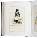

Extremely rare Dutch poem celebrating life on the country house Moffenschans
and hinting at the upcoming tulip craze

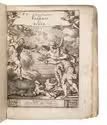
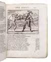
HONDIUS, Petrus.
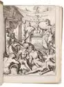
Dapes inemptae, oft de Mouffe Schans, dat is de soeticheyt des buyten-levens, vergeselschapt met de boecken.
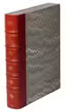
[Netherlands, 1619(?) (not after 1621)]. 12mo. Recased in 17th-century vellum. 64 pp. Full description
€ 8,500
[Netherlands, 1619(?) (not after 1621)]. 12mo. Recased in 17th-century vellum. 64 pp. Full description