Categories
Shopping cart (0 items € 0)
Advanced search

Maritime History

Extensive directory providing essential information for navigating
in the Southern and Eastern Hemispheres

HORSBURGH, James. The India directory, or, directions for sailing to and from the East Indies, China, Australia, and the interjacent ports of Africa and South America ... Sixth edition.
London, Wm. H. Allen & Co. (back of title-pages: printed by Cox and Wyman), 1852. 2 volumes. Large 4to (29.5 x 23 cm). Contemporary green cloth, title in gold on spine. XIV, XXXIV, [2], 650; VIII, "890" [=880] pp. Full description
€ 7,500
Order Inquire Terms of sale

Massive navigational directory, with sections on the Arabian Sea, the Red Sea and the Gulf

HORSBURGH, James, Gerrit KUIJPER and D. BOES LUTJENS. Zeemans-gids, naar, in en uit Oost-Indiën, China, Japan, Australiën, de Kaap de Goede Hoop, Braziliën en tusschenliggende havens, volgens de vierde Engelsche uitgave van James Horsburgh, ...
Amsterdam, C.F. Stemler, (back of half-title: printed in Haarlem by H. Bakels), 1841. 4to. Contemporary half calf, spine lettered in gold, marbled sides. I-XII, [2], XIII-XXIV, XXVIII, 1376 pp. Full description
€ 3,750
Order Inquire Terms of sale

Updated edition of a massive directory providing essential information
for navigating in the Southern and Eastern hemispheres

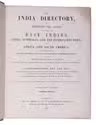
HORSBURGH, James. The India directory, or, directions for sailing to and from the East Indies, China, Australia, and the interjacent ports of Africa and South America ... Seventh edition.
London, Wm. H. Allen & Co. (back of the title pages: printed by Cox and Wyman), 1855. 2 volumes. Large 4to (28 x 23 cm). Contemporary half calf, re-backed with the original backstrips laid down. XII, XXXIV, [2], “681” [= 683], [1 blank]; VIII, 978 pp. Full description
€ 18,000
Order Inquire Terms of sale

Important guide to navigating the seas to the far reaches of Asia

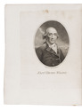
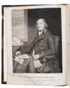
HUDDART, Joseph. The oriental navigator; or, new directions for sailing to and from the East Indies, China, New Holland, &c. &c. &c. Also for the use of the country ships, trading in the Indian and China seas, Pacific Ocean, &c. &c. &c...
London, printed and published by Robert Laurie and James Whittle, map, chart, and printsellers, 1801. 4to. With an engraved frontispiece portrait of Huddart by James Stow after John Hoppner and small woodcut coastal views in the text. Contemporary tree calf. [2], XII, 656 pp. Full description
€ 7,500
Order Inquire Terms of sale

A Dutch commander's description of Japan, with a large lithographed map

HUYSSEN VAN KATTENDYKE, Willem Johan Cornelis. Uittreksel uit het dagboek van W.J.C. Ridder Huyssen van Kattendyke, Kapitein-Luit. ter zee, gedurende zijn verblijf in Japan in 1857, 1858 en 1859.
The Hague, W.P. van Stockum (printed by Giunta d'Albani), 1860. 8vo. With a large folding lithographed map (67 x 54.5 cm) depicting the west coast of Japan and Kiusiu. Original printed publisher's boards. [2 blank], [10], 236 pp. Full description
€ 4,000
Order Inquire Terms of sale

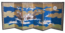
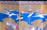
An exquisite example of a "Nanban Byobu" (or "Southern Barbarian screen");
a beautiful visual record of the encounter between the Japanese and the Portuguese

[JAPANESE FOLDING SCREEN - NANBAN BYOBU - THE PORTUGUESE IN JAPAN]. [A Japanese folding screen, specifically a nanban byôbu, depicting the arrival of a Portuguese ship in Japan].
[Japan, late Edo period (1615-1868)]. 104 x 272 cm (each illustrated panel: ca. 90.5 x 44.5 cm). Ink, watercolours, gold paint, and gold leaf on paper. The image is surrounded by a frame of silk brocade (a narrow frame in burgundy and gold and a wider frame in yellow, gold, and black, with a clear floral pattern; together the frame is 5 cm wide), the whole is mounted on six roiro (black) lacquered wood panels, with gilt metal fittings on the outer corners of the outer panels. The panels are backed with decorative paper. [6 panels]. Full description
€ 85,000
Order Inquire Terms of sale

Captivating account of the life in the Carribean of one of the most influential Dutch naval writers
of the late eighteenth century

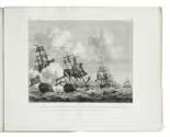
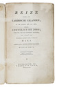
JONG, Cornelis de. Reize naar de Caribische Eilanden, in de jaren 1780 en 1781; door Cornelius de Jong, toen ter tijd als luitenant dienende, aan boord van s'Lands schip van oorlog Mars onder bevel van den schout bij nacht Willem Krul
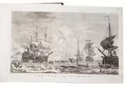
Haarlem, François Bohn, 1807. 8vo. Two engravings, one portrait of Willem Krul (14 x 8.7 cm), the other engraving depicting Dutch and English battleships (14,5 x 18,5 cm) by Gerrit Groenewegen. Contemporary pasteboard binding. X, 326 pp. Full description
€ 1,250
Order Inquire Terms of sale

Whales, herring, and the Dutch Artic: illustrated maritime classic

[JONG, Dirk de]. De walvischvangst, met veele byzonderheden daartoe betrekkelyk.
Including: Beschryving der haringvisschery.
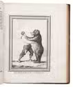
Amsterdam, Petrus Conradi, and Harlingen, Volkert van der Plaats, 1784-1786. 4 parts bound as 1. 4to. With 6 folding engraved maps and 2 folding engraved plates by H. Kobell and M. Sallieth, 3 additional folding and 10 full-page engraved plates. Every title page features a small woodcut illustration, and several woodcut tailpieces throughout. Contemporary half marbled calf and marbled paper sides. VII, [1], 96; [4], 116; [4], 116; [4], 116 pp. Full description
€ 4,500
Order Inquire Terms of sale

The main source of early knowledge of the Pelew or Palau Islands in Micronesia, in Dutch translation

KEATE, George. Beschryving van de Pelew Eilanden ...
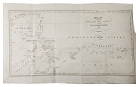
Rotterdam, Gerard Abraham Arrenberg, 1789. 4to. With 8 plates: 4 mixed technique (partly stipple-engraved) portraits, 1 large folding engraved map of the Palau Islands and western equatorial Pacific, and 3 folding engraved views. Contemporary boards. XXXII, 365, [1] pp. Full description
€ 2,500
Order Inquire Terms of sale
322 books found / Show all