Categories
Shopping cart (0 items € 0)
Advanced search

Middle East & Islamic World

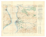
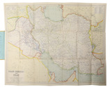
The Gallipoli Campaign, depicted in an extremely detailed map drawn in Cairo under the direction of Lawrence of Arabia

[INTELLIGENCE OFFICE - ARAB BUREAU - CAIRO]. Chanak.
Cairo, Survey Department Egypt, 1915 Colour-lithographed map (79 x 62.5 cm), printed in black, brown, red, blue and green. Mounted on contemporary cloth, with the key on the back (printed on or printed and pasted onto). Folded. Full description
€ 3,500
Order Inquire Terms of sale

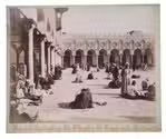
The Stangen tour of the Levant in 1898, accompanying Kaiser Wilhelm II's imperial journey

IRANIAN, Mihran; Maison BONFILS; ZANGAKI BROTHERS & AMERICAN COLONY PHOTOGRAPHY DEPARTMENT. [Portfolio with photographic prints of landmarks in Turkey, Palestine, and Egypt].
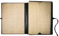
1898. With 32 albumen prints (ca. 18.5 x 25.7 cm and ca. 23.5 x 27.7 cm) mounted on cardstock, most signed and captioned in French the negative, a German manuscript caption in red ink below. Contemporary portfolio, half green morocco and dark blue pebble-grained cloth sides, with "Orient-Reise 1898" and "H. B." stamped in gold on the front board, lined with floral paper, green closing ties. Full description
€ 5,000
Order Inquire Terms of sale

British colour-printed aerial maps of Iraq for use in the Persian war

[MAPS - IRAQ]. [Reconnaissance maps of Iraq].
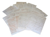
[UK Government], Survey Directorate HQ Tenth Army / Indian Field Survey Co., 1942 42 chromolithographed topographic maps of parts of Iraq, made from aerial photographs during World War II, on a scale of 1:100,000 and 1:253,440 (a quarter-inch to a mile). 68 x 50.5 cm & 60 x 47 cm. Full description
€ 6,500
Order Inquire Terms of sale

Historical narrative of a voyage to India and Persia written by a surgeon of the British Royal Navy

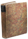
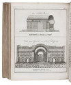
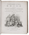
IVES, Edward. Reize naar Oost-Indië en Persië, en de daar omliggende landen. Ondernomen langs een' ongewoonen weg.
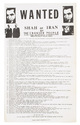
Amsterdam, De Compagnie, 1779. 2 volumes bound as 1. 4to. With 2 engraved title-pages, 2 folding engraved maps, one of India (44 x 51 cm), the other tracking Ives's journey from Basra to Latakia (ca. 42 x 56 cm), and 9 engraved plates (including 1 large folding). Early 20th-century boards. [16], 324; [1], [1 blank], [1], [1 blank], 379, [1] pp. Full description
€ 2,950
Order Inquire Terms of sale

Historical narrative of a voyage to India and Persia written by a surgeon of the British Royal Navy

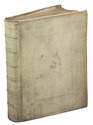
IVES, Edward. Reize naar Oost-Indië en Persië, en de daar omliggende landen. Ondernomen langs een' ongewoonen weg.
Amsterdam, De Compagnie, 1779. 2 parts in 1 volume. 4to. With 2 engraved title-pages, 2 folding engraved maps, one of India, the other tracking Ives's journey from Basra to Latakia, and 9 engraved plates (including 1 large folding). Contemporary blind-tooled vellum. [16], 324; [1], [1 blank], [1], [1 blank], 379, [1] pp. Full description
€ 3,950
Order Inquire Terms of sale

The beginning of the renewed contacts between France and Persia

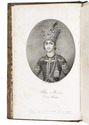
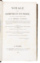
JAUBERT, Pierre Amédée Emilien Probe. Voyage en Arménie et en Perse, fait dans les années 1805 et 1806 ... accompagné d'une carte des pays compris entre Constantinople at Téhéran ... suivi d'une notice sur le Ghilan et le Mazenderan ...
Paris, Pélicier et Nepveu, 1821. 8vo. With 10 lithographed plates showing portraits, costumes, and views, most of them designed by Orlowski and lithographed by Aubry, 1 large engraved folding map showing the region between Constantinople and Teheran engraved by Flahaut. Contemporary gold-tooled marbled calf. [2], XII, 506, [2] pp. Full description
€ 1,750
Order Inquire Terms of sale
599 books found / Show all